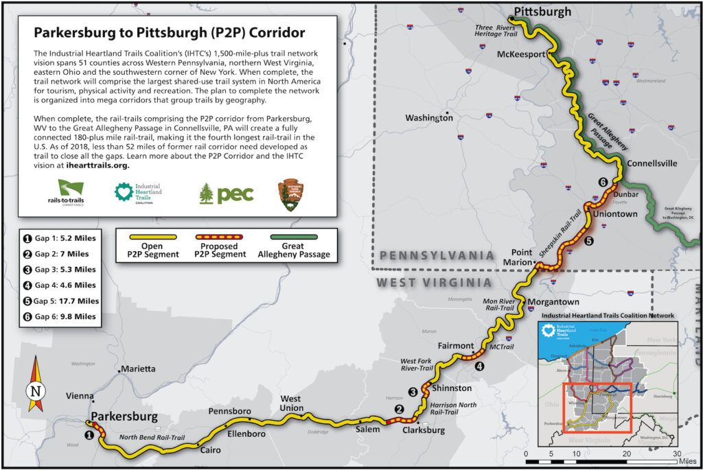
West Virginia and Pennsylvania’s Parkersburg to Pittsburgh Corridor

Trail of the Month: April 2018
“As we become a bigger trail system, we’ll become a tourist destination.”
—Ella Belling, executive director of Mon River Trails Conservancy in Morgantown, West Virginia
The P2P: It’s a small acronym that holds a world of promise. Extending from Parkersburg to Pittsburgh (P2P), the developing 238.5-mile route connecting northern West Virginia and southwestern Pennsylvania by trail would be a gamechanger for the dozens of small, rural Appalachian towns that have seen the Cinderella story of the highly successful Great Allegheny Passage so close at hand.
“Recent studies have shown that a large amount of our trail users are residents,” said Ella Belling, executive director of Mon River Trails Conservancy in Morgantown, West Virginia. “They use the trails to commute, to exercise and for events. We do have outside visitors, but as we become a bigger trail system, we’ll become a tourist destination, and more people will spend money in our trail towns and stay longer.”
Already, the Three Rivers Heritage Trail, which brings the P2P into Pittsburgh, has proven to be a draw. More than half a million people are using the riverfront pathway each year, generating an estimated $8.3 million in total annual economic impact, according to a report published by Rails-to-Trails Conservancy (RTC) in 2014.
Quick Facts
Three Rivers Heritage Trail generates an estimated $8.3 million in total annual economic impact.
Many other pieces of the P2P puzzle are also in place, and the closure of just a few gaps will complete the trail. For West Virginia native Kelly Pack, director of trail development for RTC, the thought of seeing those connections happen—which will give West Virginia one of the longest rail-trails in the country—is both professionally and personally fulfilling.
“By connecting just 22 miles of corridor in West Virginia alone, you’d have a nearly 150-mile trail,” said Pack. “It’s so achievable when you look at the map, and the impact to the state would be huge. They’re about to have the equivalent of the Great Allegheny Passage in their own backyard.”
Route to Revitalization
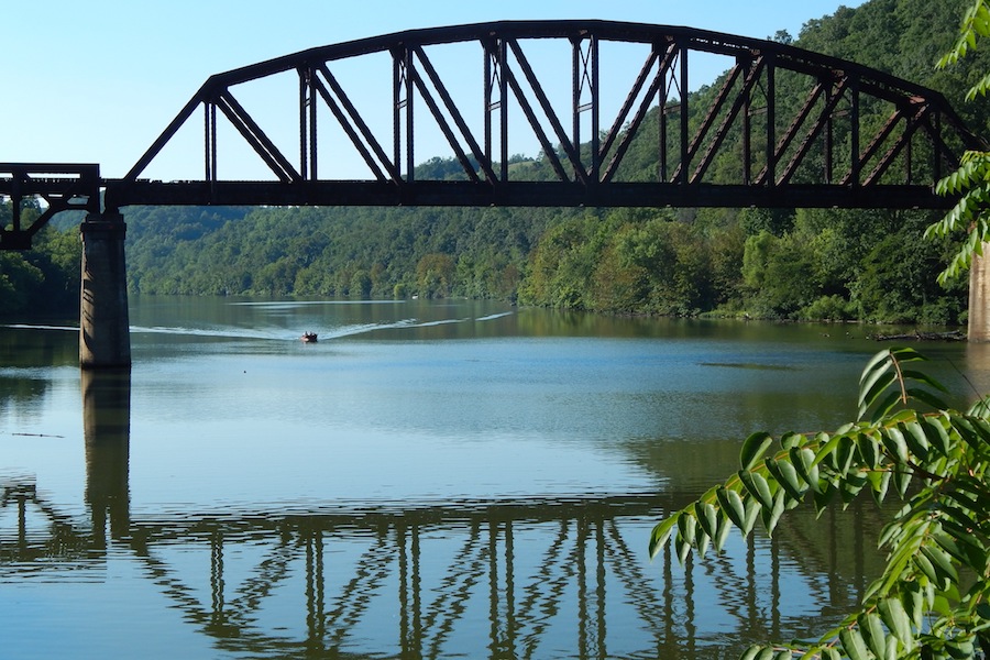
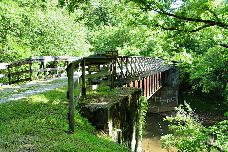
To manage such a large-scale project, RTC hired consultant Kent Spellman, who has nuts-and-bolts experience from his work getting West Virginia’s North Bend Rail Trail off the ground more than three decades ago. The 72-mile rail-trail, which begins just outside of Parkersburg, is the southern tail of the P2P. With 13 tunnels, 36 bridges and a backdrop of pristine wilderness, it’s an incredible asset to the region.
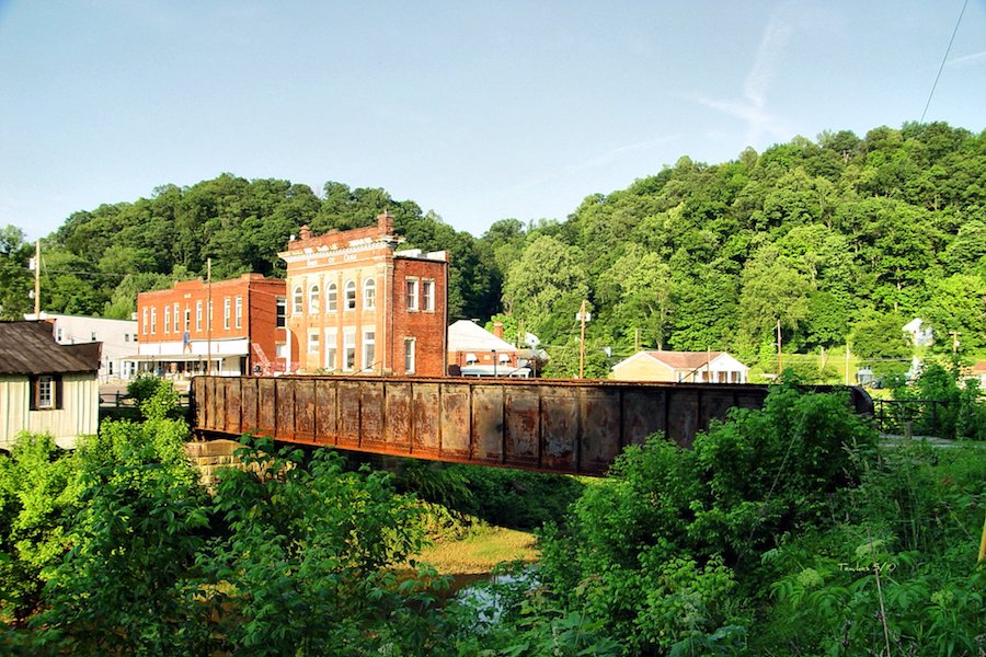
From the North Bend’s eastern end at Wolf Summit, a gap of approximately 5 miles would need to be filled to continue the P2P into Clarksburg. Swinging northeast, a series of trails—Harrison North Rail Trail, West Fork River Trail, the MCTrail and the Mon River Trail System—would then bring the route through the vibrant university community of Morgantown (one of the state’s largest cities) and continue the P2P up to the Mason-Dixon Line, which is also the border between West Virginia and Pennsylvania.
This handful of rail-trails has something in common: They all provide serene and scenic experiences through canopied river valleys rich in wildlife. When linked together, they’ll form a seamless green thread through rural Appalachia, an especially refreshing change of pace for multiday riders coming from Pittsburgh or Washington, D.C., by trail. Two philanthropy groups, the Claude Worthington Benedum Foundation and The George Gund Foundation, are supporting the effort to stitch them together.
“It’s exciting after all these years to see these gaps that have been sitting there for 25 years get closed,” said Spellman. “Because of RTC’s involvement in the P2P, people are thinking in terms of a trail system; it’s built a more collaborative approach instead of competitive.”
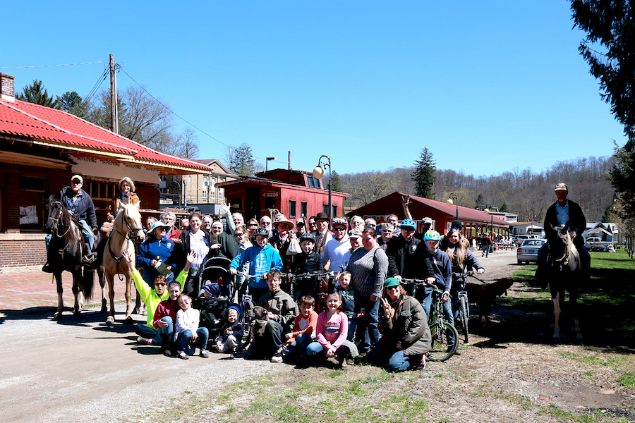
Within the past two years, RTC has helped community teams in West Virginia’s Wood, Harrison and Marion counties to begin negotiations for the acquisition of 11 CSX-owned parcels to close the gaps in the P2P alignment. Harrison County, in particular, has become a hub of grassroots support with the formation of a new trail group, Harrison Rail Trails (HRT), in 2015.
“About 20 to 25 people were initially part of the group: community members, business owners, politicians, county officials, parks and recreation people,” said Diana Druga, HRT president. “People came out of the woodwork to be involved.”
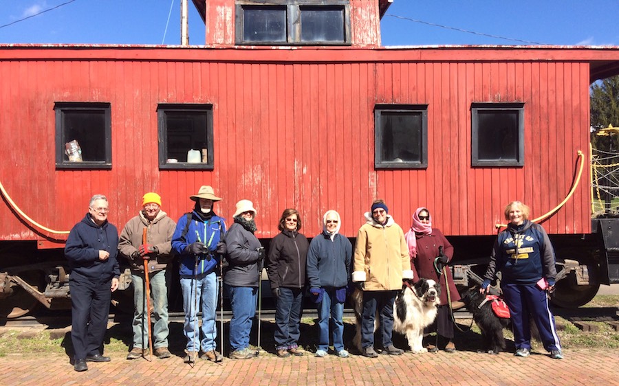
To raise awareness and use of the county’s growing trail system, the small nonprofit hosts trail walks every other week, as well as events that draw larger crowds, like 200 attendees at the Opening Day for Trails celebration last spring and 400 at the Spooky Tales on the Rail Trails in October.
For these developing trails, the popular Mon River Trail System, spanning 50 miles in and around Morgantown, provides an aspirational beacon of success and tangible proof that these trails improve the quality of life for residents. Median property values along its route have increased a whopping 173 percent since 2004, according to an economic impact study by the West Virginia University School of Public Health.
Flocking to the Sheepskin Rail-Trail
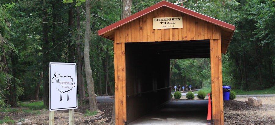
Over the state line, the planned 34-mile Sheepskin Rail-Trail plays a critical role in the Pennsylvania portion of the P2P. Already, the Sheepskin has two short segments on the ground in Dunbar and South Union Township, totaling just over 4 miles, and another segment on the way.
“Hopefully, we’ll have a shovel in the ground by the end of March or early April,” said Donna Holdorf, executive director of the National Road Heritage Corridor and facilitator for the Sheepskin Rail-Trail, who expects the much-anticipated 1.7-mile section through Point Marion, Pennsylvania, to be completed in 2018. “People living in Point Marion are already riding their bikes to work on it. There’s a lot of activity for it not being a trail yet.”
Once complete, this short but critical piece of trail will tie into Morgantown’s trail system, connecting the West Virginia and Pennsylvania halves of the P2P together. “‘When will it open?’ I get that question at least once a week,” said Belling, noting that the project has been on the wish list for a long time.
Another milestone for the P2P came this spring, when RTC released a feasibility study on the project, which effectively “put a price tag on everything, so the counties and cities can understand the costs,” explained Pack. Although the P2P is currently 78 percent complete, it will take several more years to close those gaps, and the report is a critical next step for moving the project forward.
“For local trail groups to be part of something much bigger, that’s a powerful message,” said Spellman. “It helps them see the value and potential of the trail going through their community.”
Already a massive project, the P2P is part of an even larger trail network, the Industrial Heartland Trails Coalition (IHTC), spanning 1,500+ miles within Pennsylvania, West Virginia and two other states: Ohio and New York. The group is comprised of more than 100 organizations and led by the Pennsylvania Environmental Council, the National Park Service and RTC.
“We weren’t a united force before,” said Belling, who credits the coalition with spurring momentum for trails in the region. “The IHTC brought us together to make it happen.”
Related Links
Industrial Heartland Trails Coalition (IHTC)
Harrison Rail Trails
Mon River Trails Conservancy
North Bend Rails to Trails Foundation
West Virginia Rails-to-Trails Council
Trail Facts
Name: Parkersburg to Pittsburgh Corridor (P2P)
Used railroad corridor: Much of the P2P route follows the historical Baltimore and Ohio Railroad; today, RTC and local trail advocates are working with CSX to acquire the rail corridors for the trail.
Trail website: IHTC Mega Corridors and Major Trails
Length: 238.5 miles
County: The P2P touches six counties in West Virginia (Wood, Ritchie, Doddridge, Harrison, Marion and Monongalia) and three in Pennsylvania (Fayette, Westmoreland and Allegheny).
Start point/end point: The P2P trail will extend from Parkersburg in northern West Virginia into the southwestern corner of Pennsylvania and up to Pittsburgh.
Surface type: The extensive network will have a varied surface, though it will largely be a crushed-stone trail with some paved sections, especially in city centers.
Uses: Biking, walking, inline skating (on the paved sections) and cross-country skiing; wheelchair accessible. For the North Bend Rail Trail and Harrison North Rail Trail sections, riders will feel most comfortable on hybrid or mountain bikes; horseback riding is also an option on these two rail-trails.
Difficulty: The MCTrail, Mon River Rail-Trail network, Sheepskin Rail-Trail and Three Rivers Heritage Trail make for easy riding. The varied surfaces and conditions of some of the other trails in the P2P corridor offer an experience of more moderate intensity, with the most challenging areas located in the remote sections far outside of city centers.
Getting there: On the west end of the P2P, the North Central West Virginia Airport is located in Bridgeport, about 8 miles east of the Wolf Summit trailhead of the North Bend Rail Trail. On the east end of the P2P, Pittsburgh International Airport (1000 Airport Blvd.) is an option. For those who want to travel by rail, an Amtrak station is available in Pittsburgh (1100 Liberty Ave.).
To navigate the area with an interactive GIS map, and to see more photos, user reviews and ratings, plus loads of other trip-planning information, visit TrailLink.com, RTC’s free trail-finder website.
Access and parking: For the North Bend Rail Trail on the western end of the P2P, all trailhead access points are accessible from US 50, which parallels the trail for its length. In Morgantown, a hub of the P2P, parking is available in local parks, like the Edith Barill Riverfront Park and the Hazel Ruby McQuain Riverfront Park. On the east end of the P2P in Pittsburgh, on-street meter parking is available throughout the city, as well as paid parking garages.
Rentals: On the western leg of the P2P, bike rentals are available in North Bend State Park and Prickett’s Fort State Park. Near the center of the P2P in Morgantown, Wamsley Cycles (709 Beechurst Ave., Suite 3; 304.296.2447) is an option. On the east end of the P2P, Golden Triangle Bike (600 First Ave., Pittsburgh; 412.600.0675) is available in Pittsburgh.


Donate
Everyone deserves access to safe ways to walk, bike, and be active outdoors.


