Georgia’s Augusta Canal Trail
Trail of the Month: August 2018
“On the trail, you get the sense that you’re out in this nature preserve.”
—Rebecca Rogers, marketing and public relations director for the Augusta Canal Authority
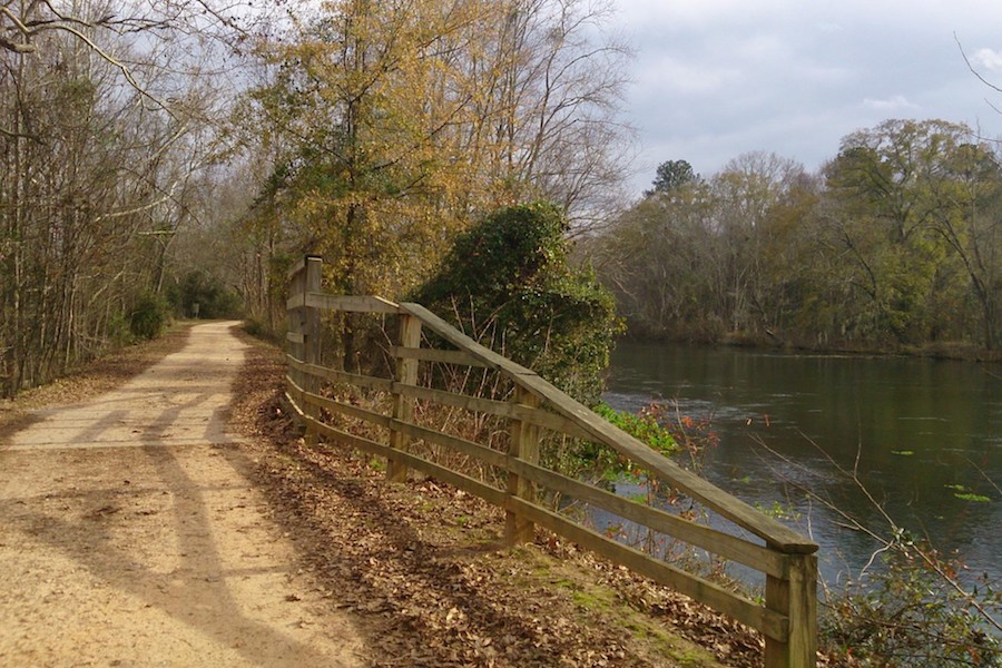
Like the fabled yellow brick road, Georgia’s Augusta Canal Trail unfolds with a soft orange hue and unexpected delights with every footstep or turn of the wheel. The packed-dirt trail, spanning just shy of 8 miles, follows an old towpath that is enveloped in history, paralleling the oldest continuously operating hydropower canal in the United States. Nestled into the state’s first National Heritage Area, wanderers will find textile mills dating back to the late 1800s, the house of George Walton (a signer of the Declaration of Independence) and a towering brick chimney once used in the manufacture of gunpowder during the Civil War.
“That sense of connection to our history makes this place very special,” said Rebecca Rogers, marketing and public relations director for the Augusta Canal Authority, which manages the Augusta Canal National Heritage Area.
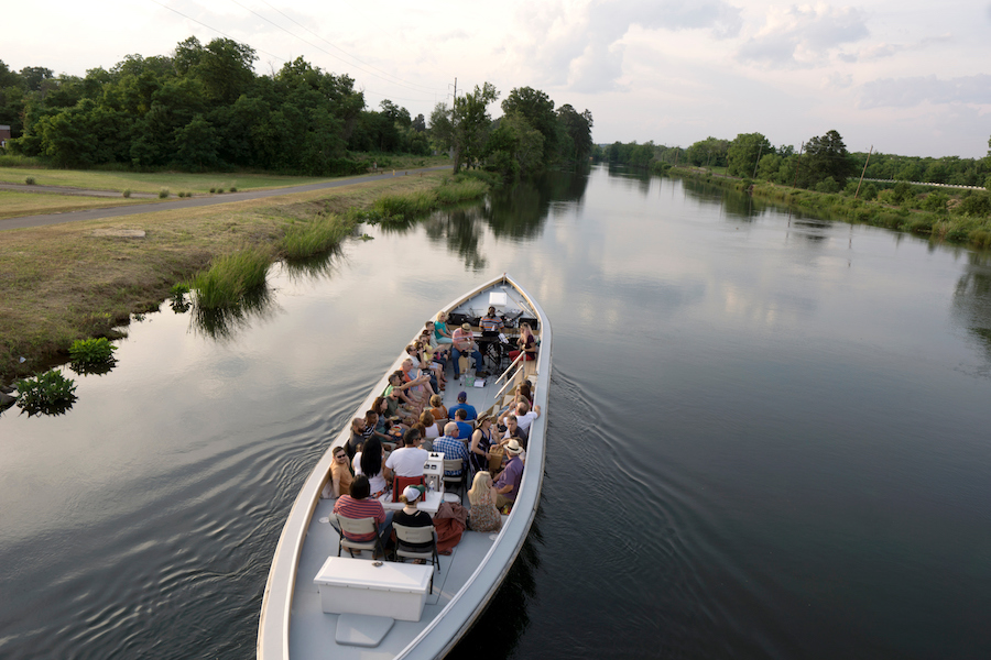
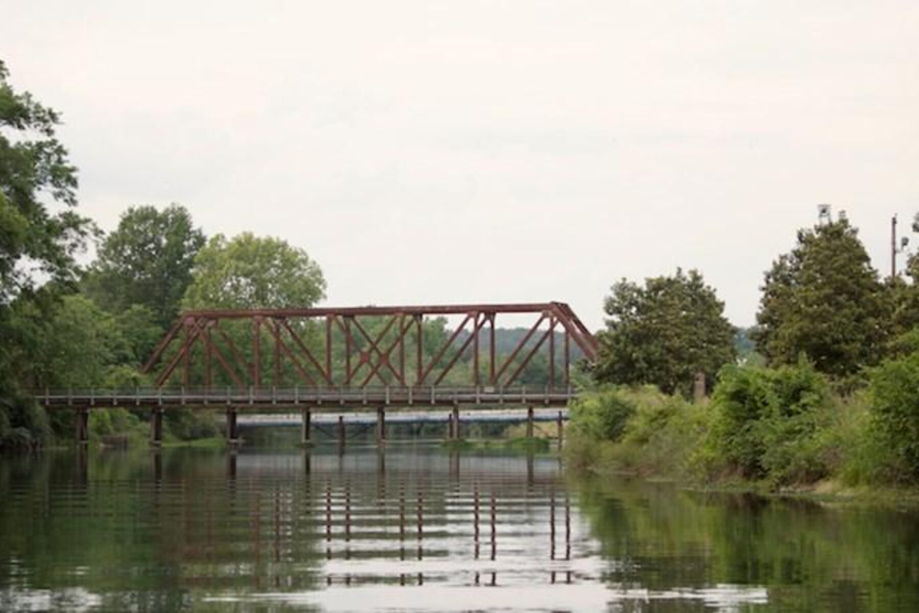
Tucked between the Augusta Canal and the Savannah River, the towpath sits in a green oasis, where the recreational opportunities seem almost boundless. Guided boat tours are a great way to learn about the 19th-century canal, and the waterway also offers fishing opportunities and an easy, family-friendly paddle with canoes and kayaks. The connecting River Levee Trail’s suspension bridge provides a spectacular view of downtown, or travelers can hop on a mountain-biking loop to mix in a more challenging adventure.
“On the trail, you get the sense that you’re out in this nature preserve,” said Rogers, noting that lucky trail goers might see king fishers, snowy egrets, herons and many other types of birds along the trail. Its northern half is especially well shaded with trees arching over the pathway.
“We have all the modern conveniences of a town, but I can get out on the river and it is still wild,” said Hazel Cook, executive director for Central Savannah River Land Trust (CSRLT), a nonprofit land conservation organization that also works to connect people to the natural environment.
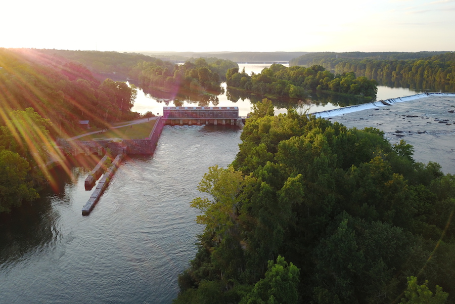
One of Cook’s favorite local spots is the Augusta Canal Headgates, where the towpath begins. It’s a place so pretty that she even held her wedding there. “If you start at the headgates, you’re on a bluff overlooking the river. The view upstream is a placid, clear-as-glass river with islands in it.”
From there, the scenic pathway ambles southeast, ending in downtown Augusta, where travelers are rewarded with a plethora of restaurants, craft breweries, shops and other amenities to choose from. Located only a two-to-three-hour drive from several major cities, including Atlanta, Georgia; Charlotte, North Carolina; and Charleston, South Carolina, the charming city of Augusta shines as a ready-made trail vacation for the region.
“Augusta is very much a Southern city in the best sense of the word,” said Rogers. “People here are extremely friendly. You could call it the world’s smallest big city.”
Lindsay Fruchtl, marketing vice president for the Augusta Convention and Visitors Bureau, agrees, adding, “It’s an interesting juxtaposition. You have these historical homes with classic Southern architecture, but the vibe downtown is a little different. There are new developments going on and a young art scene. It feels funky, eclectic and creative. It’s a really great time to be in Augusta with all these different elements coming together.”
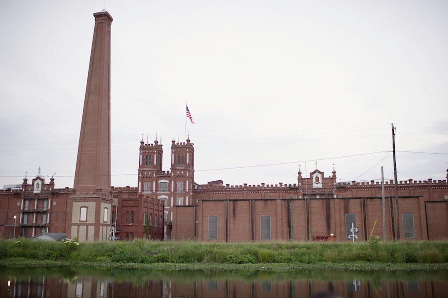
Even today, the hardworking Augusta Canal—which is fed by the Savannah River—supplies the city with drinking water and hydroelectric power, a task it’s undertaken since its construction in 1845. Visitors can see the process in action through large plexiglass windows at the Augusta Canal Discovery Center housed inside the beautiful Enterprise Mill, a three-story red-brick building on the southern end of the trail.
“The canal has three hydropower stations in these historical textile mills that we operate,” said Rogers. “We’re located in Enterprise Mill and we make the electricity that powers the whole building. We use about half the power and sell the rest to Georgia Power. It’s an important source of income for us to use for trail building and other activities.”
Augusta’s nickname is the Garden City, and here, trails are blooming. In addition to the towpath, which serves as a central spine, more than 20 miles of trail can be found throughout the city.
“On the weekends, you’ll see a ton of people on the trails,” said Fruchtl. “It’s a wonderful amenity for residents to have. Everyone appreciates having them right out their back door.”
Rogers chuckles that people in town have caught trail fever. “In the last six to seven years, we’ve seen a build-out of the trail system here. As we accumulate funds, we build more trail. The Augusta Canal Authority has had these trail ideas for 20-plus years. Like the Little Engine That Could, we’re chipping away at them.”
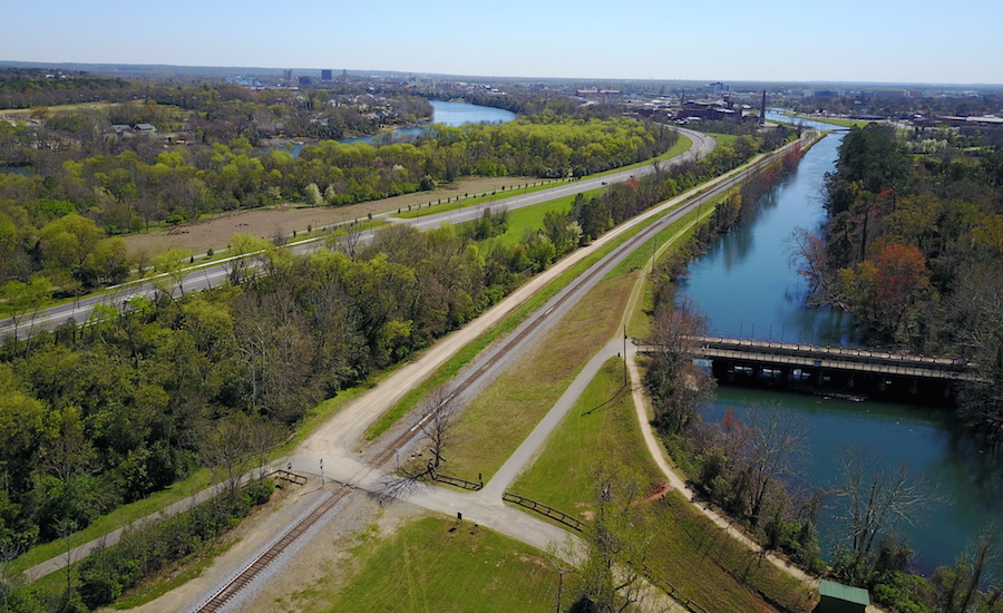
The Augusta Canal Trail is also playing a role in a larger regional network underway, which will connect 150 miles of trail across three counties—Aiken, Columbia and Richmond—in Georgia and neighboring South Carolina, which lies just on the other side of the Savannah River. The effort, called the Savannah River Greenway, is being spearheaded by CSRLT in partnership with local municipalities, county governments and other trail advocates. Cook estimates that about a quarter of the greenway’s planned mileage is complete, and the group hopes to begin placing branded signage on the trails by late next year or 2020.
“All these different places have their own stand-alone trails, and now what we’re doing is plugging them into each other,” said Cook. “These 150 miles of trail will provide a beautiful necklace around the city.”
Related Links
Augusta Canal National Heritage Area
Augusta Convention and Visitors Bureau
Central Savannah River Land Trust
Trail Facts
Name: Augusta Canal Trail
Trail website: Augusta Canal National Heritage Area
Length: 7.85 miles
County: Richmond
Start point/end point: On its north end, the trail begins at the Augusta Canal Headgates & Lock, just outside the Savannah Rapids Park; the trail heads south to end at 13th Street and Walton Way in downtown Augusta.
Surface type: The towpath consists of a hard-packed, sand-clay mixture.
Grade: The trail itself is wide and flat. The only steep sections travelers may face is if they head down the slope from the canal to the paralleling Savannah River to access the waterway.
Uses: The trail is enjoyed by walkers, runners and bicyclists. Although unpaved, the towpath’s surface is firm enough for road bikes and wheelchairs, except after a rain when the trail can get muddy.
Difficulty: Easy; the trail’s connection to downtown, parks and trailheads with amenities makes the journey pleasant and convenient.
Getting there: The Augusta Regional Airport (1501 Aviation Way, Augusta), located on the southeast end of town, is served by Delta and American Airlines. Another option is Atlanta’s airport, Hartsfield–Jackson Atlanta International Airport (6000 N. Terminal Pkwy., Atlanta), about a 2.5-hour drive from Augusta.
Access and parking: A good place to begin a journey on the towpath is at its north end at Savannah Rapids Park (3300 Evans to Locks Road, Martinez), where parking and other park amenities are available. Closer to the southern end of the trail, another popular starting or stopping point is the Lake Olmstead Trailhead (1 Milledge Road), as it offers parking, restrooms, drinking fountains and a picnic pavilion.
To navigate the area with an interactive GIS map, and to see more photos, user reviews and ratings, plus loads of other trip-planning information, visit TrailLink.com, RTC’s free trail-finder website.
Rentals: Hourly and daily bike rentals for adults and children are available on the north end of the trail at The Bicycle Peddler (#5 Savannah Rapids Pavillion Drive, Evans) in Savannah Rapids Park; the bike shop has seasonal hours, so call ahead at 706.373.4519 to confirm availability.


Donate
Everyone deserves access to safe ways to walk, bike, and be active outdoors.


