Indiana’s Cardinal Greenway
Trail of the Month: September 2018
“The Cardinal Greenway is listed time and time again as one of the best assets of each of our communities.”
—Angie Pool, CEO, Cardinal Greenways
Decades ago, a disused railroad line found new life, becoming the Cardinal Greenway, Indiana’s longest rail-trail. But with some ambitious new projects planned, the newest member of the Rail-Trail Hall of Fame—which is also celebrating its 25th anniversary as a trail in 2018—is about to experience yet another rebirth.
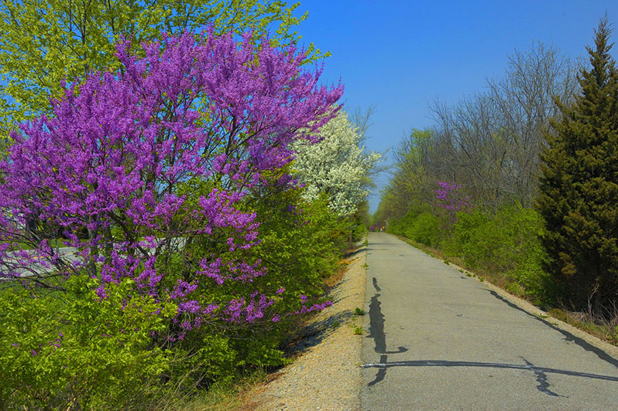
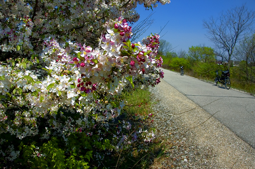
The old Chesapeake and Ohio (C&O) rail line was about transportation, but the Cardinal Greenway is more than that today; it’s about escape; an opportunity to retreat into nature. The paved trail stretches out 61.2 miles on a northwest-southeast trajectory connecting the mid-size cities of Marion, Muncie and Richmond—the rise of the trail having coincided with the revitalization of Muncie’s downtown and the surrounding areas. Supporting these efforts as a recreational and cultural amenity, the trail seems to have helped generate an expanded sense of civic pride as well as an enhanced quality of life.
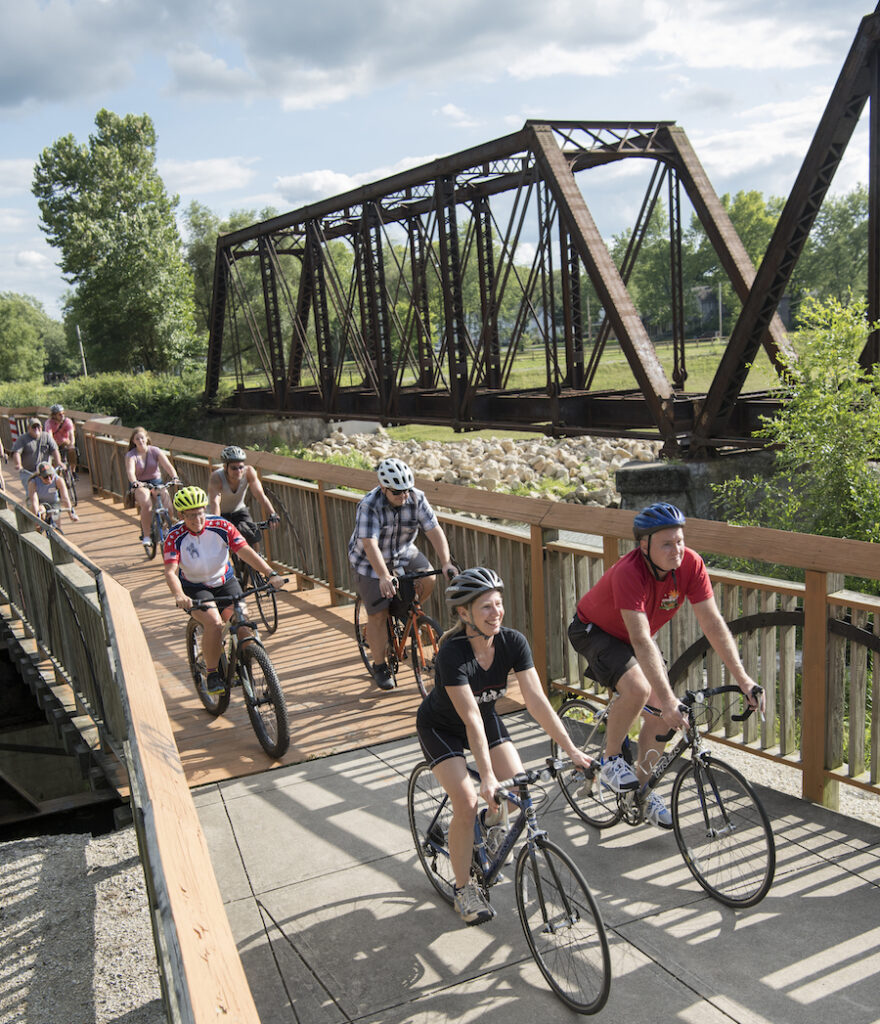
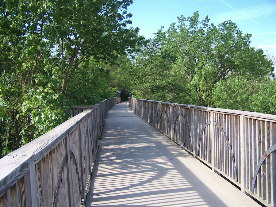
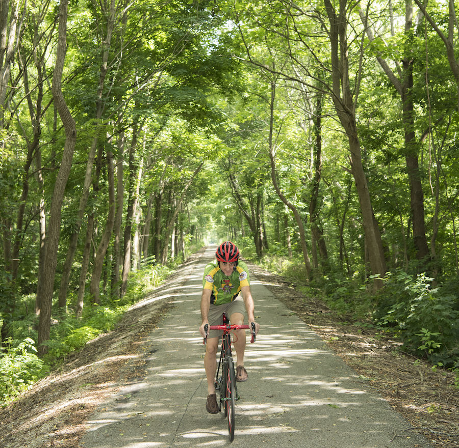
Urban tract homes give way to pastoral farmland, while the bustle of automobile traffic disappears in favor of sweetly singing robins and catbirds (and yes, even cardinals). A canopy of oak, tulip and sycamore trees offers a shady respite from the afternoon sun throughout much of the route. Joggers share the trail with seniors kitted out in Lycra and aerodynamic helmets, while Ball State students in less “typical” cycling attire ride their Schwinn cruiser bikes down to Prairie Creek Reservoir to splash around in the water and blow off steam.
Although Indiana is notoriously flat, the trail grade even steepens slightly around Losantville, where the surrounding hills become a little more rolling. Years ago, a second set of tracks carried a secondary locomotive that helped push less-powerful or fully loaded trains up the grade, but cyclists rarely need that same extra boost up the hills.
From Rail Days to Trail Days
The locomotives on the line ran less than 100 years. At the turn of the last century, the C&O Railroad built the Cincinnati, Richmond, Muncie (CRM) line, which shuttled passengers, Appalachian coal, merchandise and other goods from Cincinnati to Chicago, with stops in Richmond, Muncie and Marion.
Passenger service on the CRM line declined steadily though the 1940s, ending in 1949, said Tom Dixon, chief historian of the C&O Historical Society. The C&O would eventually merge with the Baltimore & Ohio Railroad in 1963, starting a series of mergers and acquisitions that would ultimately lead to the formation of CSX. The line ceased to operate in 1986, and freight service rerouted through Indianapolis.
Beginning in 1993 as a volunteer effort—a phenomenon that continues to play heavily into the trail’s existence—the first section was laid in 1998, with the Cardinal’s current configuration completed 14 years later. The Wysor Street Depot in Muncie now serves as the Cardinal Greenways headquarters. Where passengers used to buy a ticket to ride the rails, visitors can drop in to borrow one of nearly two-dozen loaner bikes to explore the rail-trail.
“I remember my first months at the Cardinal Greenway and hearing that the trail was the best-kept secret in town,” said Angie Pool, CEO of Cardinal Greenways. “We’ve worked hard to break out of this mold, so everyone knows about and enjoys all the Cardinal Greenway has to offer.
In fact, the Cardinal Greenway served as “an inspiration” for other rural rail-trails such as the Nickel Plate Trail and Panhandle Pathway, “paving the way, pardon the pun,” for the nonprofit model in Indiana, said Amy Marisavljevic, streams and trails section chief for the Indiana Department of Natural Resources.
“A couple of decades ago, rail-trails were controversial and got a lot of resistance in their proposed communities,” Marisavljevic explained. “But the Cardinal Greenway showed how they could become a great asset.”
Pool says that the decision to form a nonprofit Cardinal Greenways organization was more of an expedience issue than an attempt to be groundbreaking. “We couldn’t make the deadline for filing for the abandoned right-of-way if we were a governmental group due to the need to cross so many jurisdictions,” Pool said. “We also felt we could raise money for the match quickly and efficiently if we had a locally controlled 501(c)(3)” [nonprofit], adding that while the Cardinal Greenway continues to be a popular amenity for the locals, raising money to maintain it hasn’t always been easy.
In addition to the major municipalities along the route, the Ball Brothers Foundation and Lilly Foundation have been huge supporters of the trail since the beginning. But they aren’t able to foot the bill for everything. The nonprofit relies heavily on a network of 450 volunteers to handle litter removal and minor repairs. Apart from those patch jobs, the trail hasn’t been repaved since it was originally built.
“We’re trying to prioritize repaving during the upcoming fundraising campaigns,” Pool says. “Some of this pavement has been around for 20 years! The trail (as it is now) isn’t going to last forever. … (But) we have strived to keep the trail in the best shape we can and use resources wisely to extend the life of the asphalt—keeping it safe and smooth for all to enjoy.”
Another New Start: A Bridge and a Brownfield
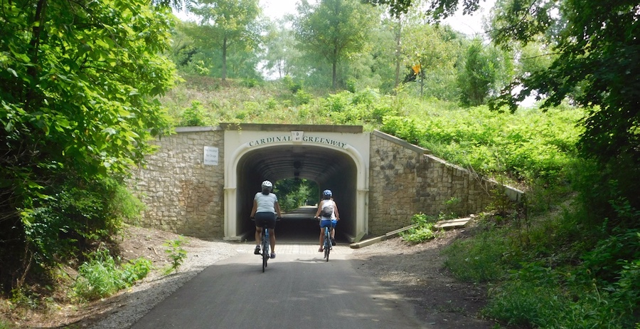
Because the rail line was built relatively late in the development of the region, it was difficult to lay track through heavily trafficked areas; that may be the reason why the trail comes close to, but doesn’t pass directly through, the cities’ downtowns. But more than a century after the first iron rail was laid, and 25 years after the Cardinal Greenway was first established, development is coming to the trail.
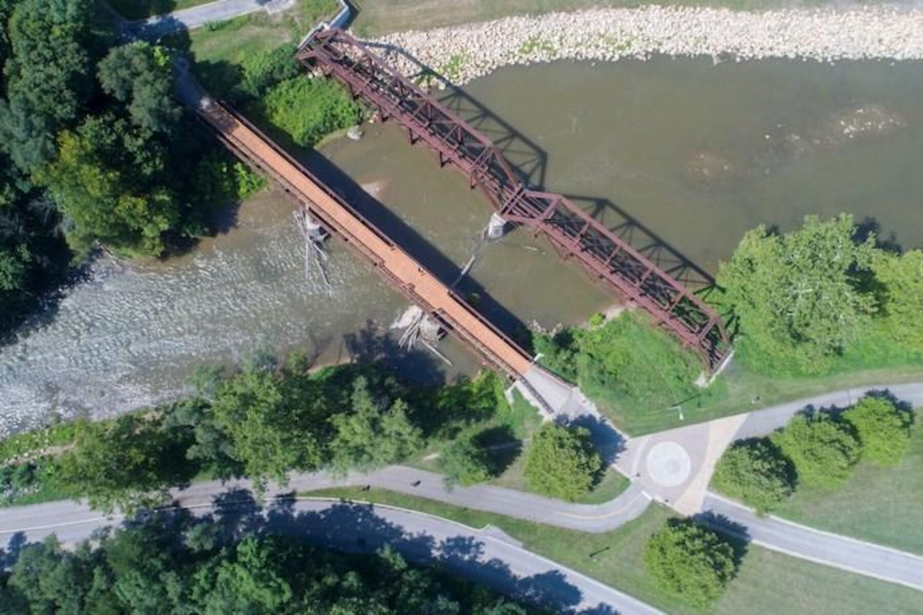
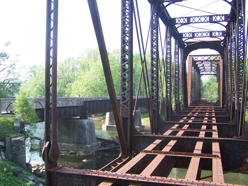
Just as the Cardinal Greenway revitalized an abandoned and unsightly rail line, two new projects promise rebirth. A new “Kitselman” Trailhead will connect the Cardinal Greenway to the White River Greenway (managed by Cardinal Greenways) via a bridge built more than a century ago by Muncie’s own Indiana Bridge Company. The 5.6-mile White River Greenway follows its namesake from the west side of Muncie to the John Craddock Wetland Nature Preserve, ending at Bunch Boulevard near North Gavin Street. The bridge, now being refurbished, will link the two trails as a pedestrian-only span across the White River and south of Phillips Lake, meeting the Cardinal Greenway just north of East Jackson Street. In time, additional green space, boat launches, a loop trail and more will be added.

Bordering this trail segment will be a separate $60 million project called Kitselman Pure Energy Park, a mixed-use development featuring a five-megawatt solar power plant; a community center with classrooms; the headquarters building for electric-vehicle manufacturer DD DANNAR; and a mid-size hotel. The PEP complex, as it is known, is being built on the site of the former Indiana Steel and Wire Company factory, which was shuttered more than a decade ago. (The factory was built by the Kitselman brothers more than a century ago, hence the name of the two projects.)
The PEP plan transforms a blighted brownfield “that once polluted and almost killed the White River, into a pedestrian-friendly trail and river-centric greenfield landscape surrounded by green technology businesses,” wrote David Rubin, who created the project’s master plan. The goal, he wrote, is to transform “Muncie’s industrial heritage to an alternative energy revolution by celebrating art, nature, history, and recreation and the embrace of new technologies. Quality of place is the future trademark of a vibrant and thriving city.”
“Muncie has lost about 17,000 manufacturing jobs over the years. How do you keep young professionals in town? How do you attract tech businesses?” posed John Craddock, a member of the Cardinal Greenway and Community Enhancement Projects (CEP) board. “Years ago, businesses asked for tax breaks and good relations with labor upfront. Now companies are more interested in education options for their staff and families, as well as trails and recreational opportunities. These two projects will really benefit each other and the community.”
Forging Links—to Health and Recreation
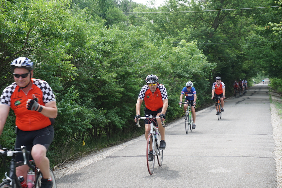
According to a recent study conducted by Indiana University’s (IU’s) Eppley Institute for Parks and Public Lands, nearly a third of users travel more than 7 miles to use the greenway, about double the state average of 15 percent for trail use. Conversely, nearly 30 percent travel less than a mile to use the Cardinal. Once there, Cardinal users spent 77 minutes traveling 11.5 miles on the greenway 4.5 times a week, all numbers that are higher than the state averages for trails.
Nearly 70 percent say they’re exercising more because of the trail.
About 64 percent of Cardinal users are looking to get fit or stay in shape, while another 15 percent say they’re just having fun outside. Nearly 70 percent say they’re exercising more because of the trail, and 37 percent say they’re at least twice as active as before they began using the greenway. Led by IU Health Ball Memorial Hospital, the 115 businesses and community organizations making up the Healthy Community Alliance of Delaware and Blackford Counties use the Cardinal Greenway as a lynchpin for their fitness initiatives.
“The ability to bicycle or walk in a scenic environment mostly free of motor vehicles allows you to set your mind free for awhile, putting your body into motion,” says John D. Disher, community outreach manager for IU Health Ball Memorial Hospital Foundation. “The Cardinal Greenway has no cost to use, it has a 61-mile length that cuts an angle through the middle of Delaware County, and it’s within 2 miles or less of a majority of homes in the area. It also serves as a transportation link, enabling community members to walk or bike to destinations, further supporting an active lifestyle.”
Greenway Means Greenbacks
Because the Cardinal Greenway stretches so far, users tend to spend more time—and more money—on it.
Despite most restaurants and other amenities along the route being a few blocks off the trail, the average Cardinal Greenway user spends $41.50 per visit at surrounding businesses and about $4,528 annually. That compares well to the statewide average of $47.30 per visit and $3,564 annually. While only a few businesses are located just off the greenway, some recent signs indicate that this might begin to change. In addition to the Kitselman projects, the supermarket Fresh Thyme earlier this year requested a spur trail running about a city block from the store to the greenway. Locals say there have been rumblings of other businesses relocating to prime trail spots.
“The Cardinal Greenway is listed time and time again as one of the best assets of each of our communities,” said Pool. “Businesses promote themselves by saying they’re ‘located beside the beautiful Cardinal Greenway,’ realtors brag homes are ‘just 1 mile from the Cardinal Greenway.’ The Chamber of Commerce and Economic Development staff use it to bring new businesses to town and to keep employees here.
“She continued, “We promote what the trail can do for all of our communities, form partnerships and collaborations to boost local pride, and increase tourism and economic value to each.”
Rolling Ahead
With the recent news that the Cardinal Greenway would become the newest member of the Rail-Trail Hall of Fame, Pool predicts even brighter days for the trail.
“The staff, volunteers, and trail users have all contributed to the trail gaining popularity each year,” said Pool. “We remain dedicated to continuing this and keeping the trail wonderful for the next generation of users.”
This article was originally published in the Fall 2018 issue of Rails to trails magazine. It has been reposted here in an edited format.
Related Links
Cardinal Greenways
Indiana Department of Natural Resources
Trail Facts
Name: Cardinal Greenway
Used railroad corridor: Originally the Chesapeake and Ohio Railway, which subsequently became part of the CSX railroad network.
Trail website: Cardinal Greenways
Length: 61.2 miles
Counties: Grant, Delaware, Henry, Randolph and Wayne
Start point/end point: County Road 400 W. just south of W. Delphi Pike/US 18 (Marion) and E. 10th St. (Jonesboro); W. County Road 850 N. (Gaston) to Test Road and River Road (Richmond)
Surface type: Asphalt
Grade: The trail’s grade doesn’t exceed 3 percent. From Muncie’s Wysor Street Depot, a popular starting point, travelers will have a slightly uphill climb heading south to Losantville (the trail’s highest point), but, from there, it’s easy sailing down to Richmond, the trail’s lowest point.
Uses: The paved pathway is suitable for walking, biking, inline skating and cross-country skiing (the trail is not plowed in winter); it’s also wheel-chair accessible.
At the Medford trailhead (County Road 500 South), equestrians can access the 3.5-mile Cardinal Greenway Horse Trail that parallels the paved Cardinal Greenway and extends to South County Road 534 East. The Medford trailhead features a circular gravel lot with hitching rails and room for horse trailers.
Difficulty: Easy
Getting there: The nearest commercial airport is the Fort Wayne International Airport (3801 W. Ferguson Road, Fort Wayne), about 50 miles from the trail’s northern end in Marion. Another option is the Indianapolis International Airport (7800 Col. H. Weir Cook Memorial Dr., Indianapolis), about 80 miles from the southern end of the trail in Richmond.
Access and parking: To access the northernmost trailhead just outside of Marion: From I-69, take Exit 264 for IN 18. Head west on IN 18, and go 10.8 miles. Turn left onto County Road 400 W. The trailhead and parking lot for the Sweetser Switch Trail (which serves both the Sweetser Switch Trail and the Cardinal Greenway) will be on your right. Cross the railroad tracks to access the Cardinal Greenway on the opposite side of the street.
To reach the trailhead in Gaston, take I-69 to Exit 255 for IN 26 toward Hartford. Head east on IN 26, and travel 1.5 miles. Turn right onto S. Wheeling Pike. In 3 miles, turn right onto S. CR 900 E, which becomes N. CR 600 W. In 4.9 miles, turn right onto CR 850 N/W. Elm St. In 0.3 mile turn left onto Broad St. to find the trailhead.
To access the southernmost trailhead near Veterans Memorial Park: From I-70, take Exit 149 or 149A, and head south on Williamsburg Pike. In 2.4 miles, turn left onto Richmond Ave. In 0.6 mile, cross the East Fork Whitewater River, and Richmond Ave. becomes N. D St. Go 0.1 mile after crossing the river, and turn right onto N. Fifth St. Immediately turn right onto N. D St. The parking lot is 0.1 mile straight ahead. The trailhead will be on your right and is located just under the Richmond Ave. Bridge.
To navigate the area with an interactive GIS map, and to see more photos, user reviews and ratings, plus loads of other trip-planning information, visit RTC’s free trail-finder website, TrailLink.com.
Rentals: Free bike rentals are available at the Historic Wysor Street Depot (700 E. Wysor Street, Muncie; 765.287.0399) by depositing your driver’s license.


Donate
Everyone deserves access to safe ways to walk, bike, and be active outdoors.


