Top 10 Trails in Wyoming
Split between the Rocky Mountains and the High Plains, Wyoming captures the wild spirit and rich history of the American West. The least populous state in the contiguous United States, Big Wyoming offers some of the most scenic views in the country, many of which can be found in the state’s two beloved national parks: Grand Teton and Yellowstone.
Learn more about cycling through the towering Tetons, walking along the Big Horn River, and watching herds of elk graze in the sagebrush valley in this list of top trails in Wyoming.
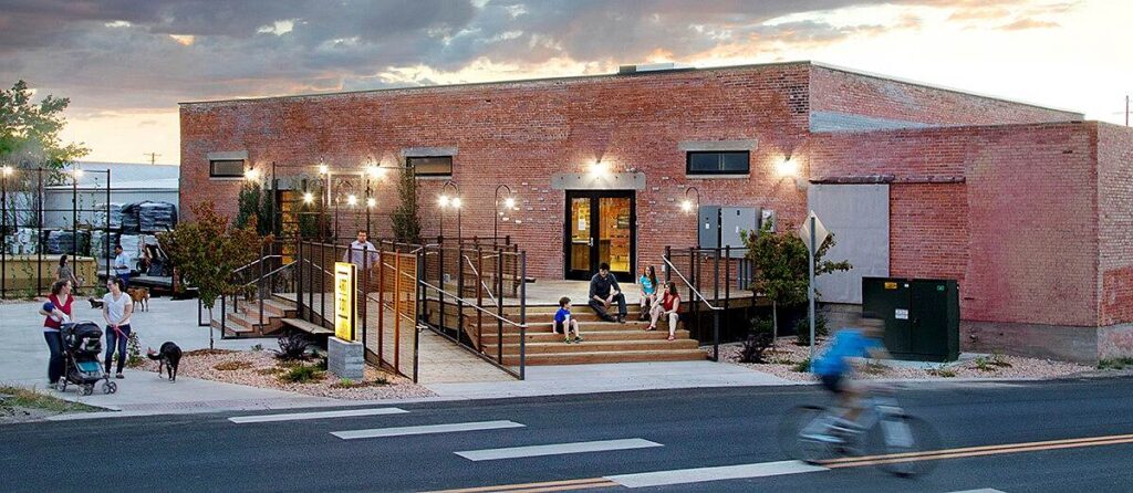
Jackson Hole Community Pathway System
County: Teton
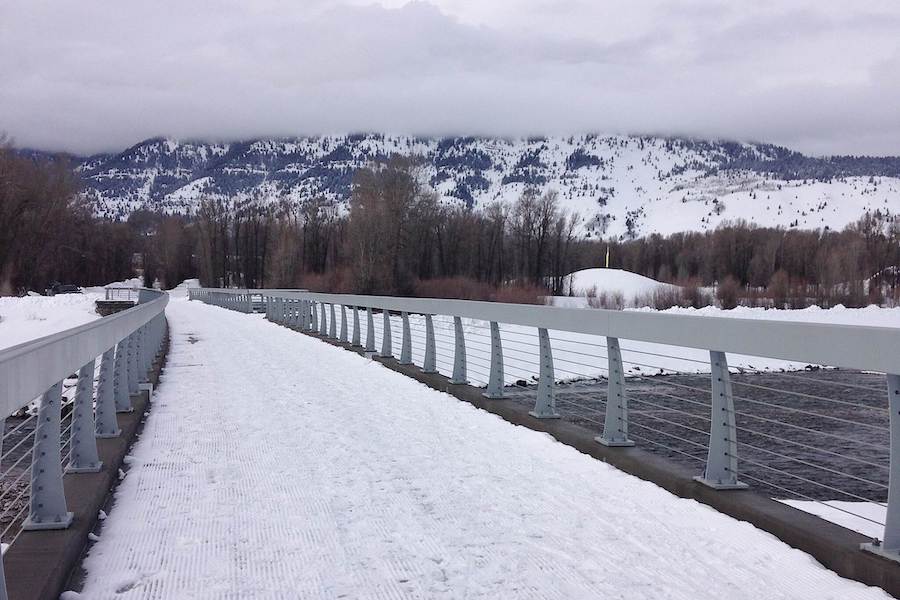
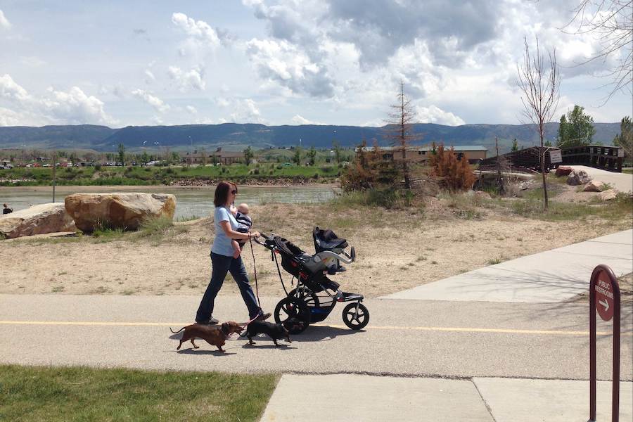
Winding 65 miles through the sagebrush valley, the Jackson Hole Community Pathway System is a cornerstone of the town. The system is not just limited to the town, but traverses through Grand Teton National Park and leads to 130 miles of dirt trails in Bridger-Teton National Forest. While Grand Teton National Park has constructed 16 miles of pathway, there are plans to expand to 40 miles. The pathway system offers year-round opportunities for families and individuals alike to recreate safely in the crisp mountain air. During the summer months, these pristine pathways welcome runners, walkers, cyclists, e-bikes and horseback riders; once the temperatures drop and the snow begins to accumulate, stretches of the pathway are groomed for winter activities such as nordic skiing, fat tire biking, walking and snowshoeing.
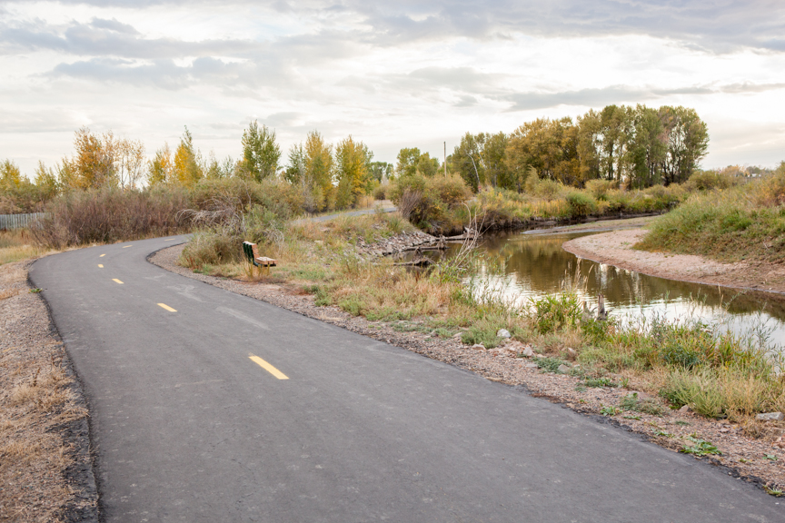
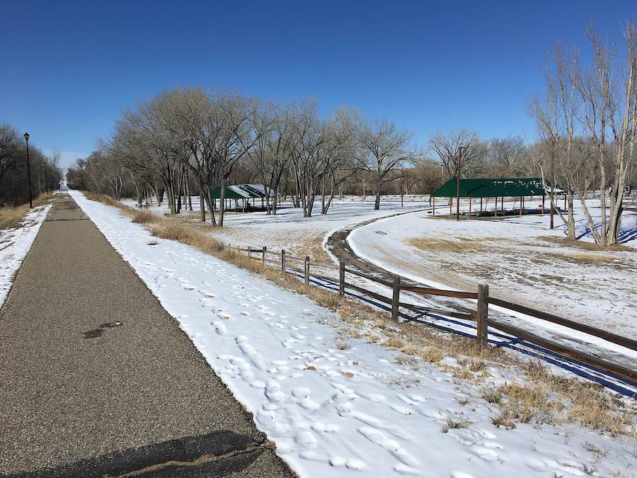
Platte River Trail
County: Natrona
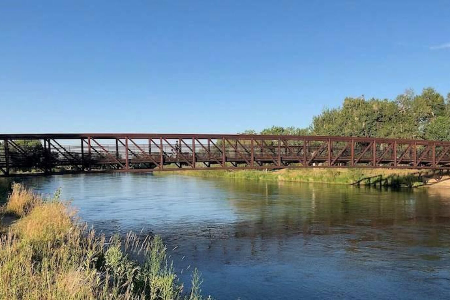
Hugging its namesake river, the Platte River Trail weaves 10 miles through city parks and scenic recreation areas in Wyoming’s second-largest city. Along the trail, visitors will find highlights such as the Fort Caspar Museum, which houses 6,000+ artifacts from Casper’s early days; Amoco Park, which features a glow-in-the-dark labyrinth; outdoor yoga and tai chi classes in the riverside parks; and loaner stations with life jackets for watersports. Whitewater rafters, paddleboarders, and fishermen have the Clean Rivers Act of 1972 to thank for the sparkling waterway that was once a dumping zone.
In the next five years, trail advocates hope to build a connection between the Platte River Trail and the Casper River Trail. This would not only bridge a connection between downtown and recreational amenities in Casper, but also close a gap in Wyoming’s segment of the Great American Rail-Trail™, a 3,700-mile route stretching from Washington, D.C., to Washington State.
TRAIL OF THE MONTH: Wyoming’s Platte River Trail (May 2019)
Medicine Bow Rail Trail
County: Albany
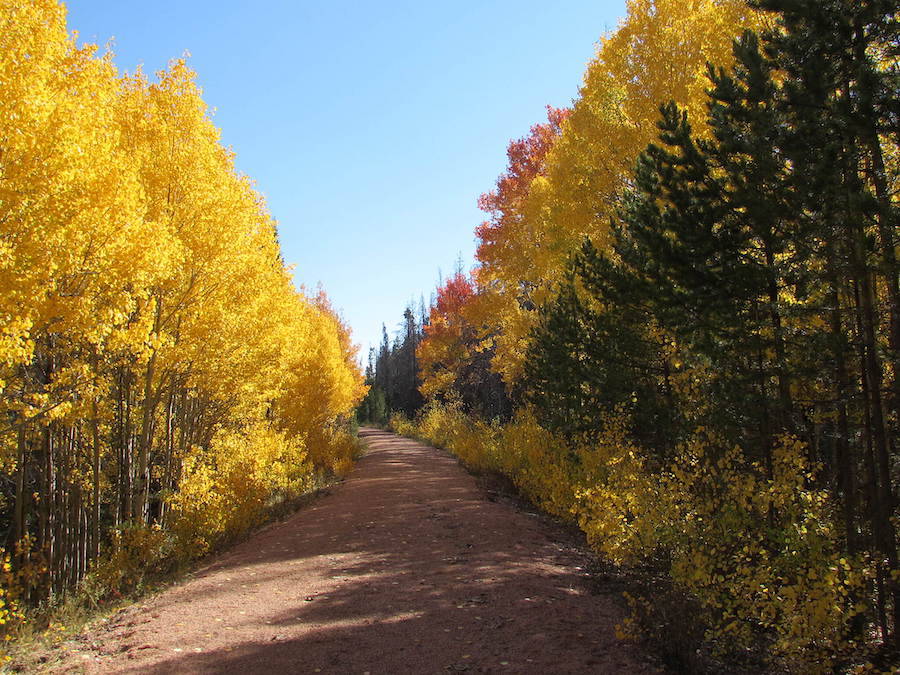
The 21-mile Medicine Bow Rail Trail in Albany County has a history that goes back more than 100 years, to the days when the Arapahoe, Cheyenne and other Native American tribes traveled to the area for ceremonies to prevent illnesses. The tribes also utilized trees in the area to make hunting bows. European settlers combined these facts together to form the area’s name, “Medicine Bow.” Among the relics you’ll find along the route are remains of former tie-hacker camps and mining communities, and an old caboose parked near its northern end. Interpretive signs help elucidate this history.
The trail passes through large stands of lodgepole, spruce, fir and aspen; traverses meadows of grass and sagebrush; crosses numerous streams; and skirts dozens of swamps, bogs, ponds and lakes. The solitude of the trail is one of its biggest drawing points, as the closest city, Laramie, is 30 miles away. Because of its seclusion, the trail is teeming with wildlife, including beavers, moose, elk, pronghorn and bears.
Read about the trail’s central involvement in a 2014 Supreme Court case: Marvin M. Brandt Revocable Trust et al. v. United States.
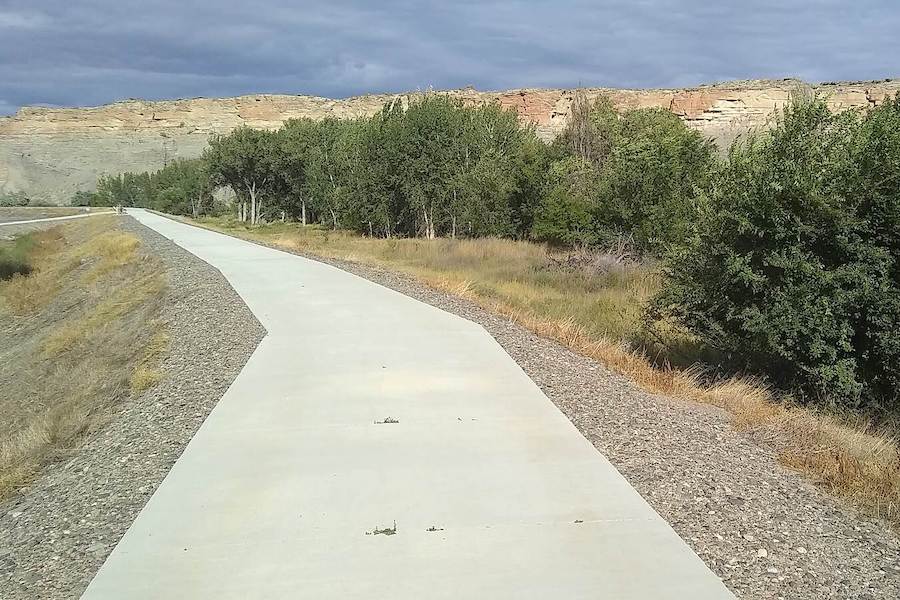
Casper Rail Trail
County: Natrona
Partially following the former route of the Chicago and North Western Railway, the Casper Rail Trail runs for 6.2 miles throughout its namesake community and serves as a gateway to the Great American Rail-Trail. Along the trail, visitors can explore attractions such as the Science Zone and Nicolaysen Art Museum, which features contemporary art from artists of the central Rockies and high plains. Just two blocks north of the trail’s western end, you can pursue local shops and stop for a bite to eat. The future of the Casper Rail Trail looks bright as the Platte River Trails Trust (PRTT) has made plans to begin extending the trail to Edness Kimball Wilkins State Park on the east side this spring.
RELATED: 16 Historic Highlights Along the Route of the Great American Rail-Trail
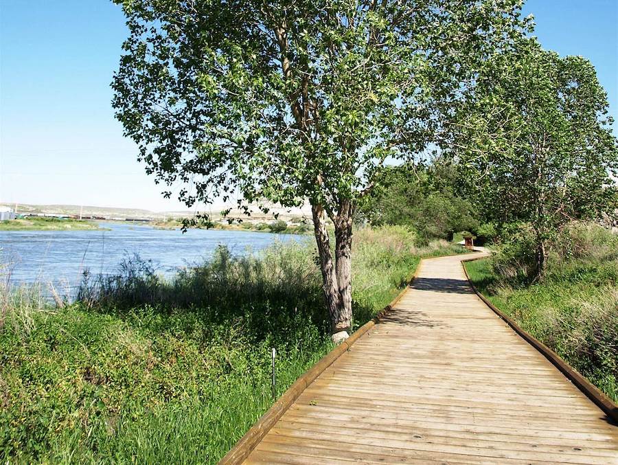
Laramie River Greenbelt Trail
County: Albany
Running north to south, the Laramie River Greenbelt Trail is an almost identical, mirror image of its namesake river. The trail deviates from the river near its southern end with a 1.5-mile loop, known as the Union Pacific loop. Just west of the trail is the Wyoming Territorial Prison Historic Site and Museum—the former prison that once housed the infamous train and bank robber, Butch Cassidy. For nearly 6 miles, this trail offers amazing views of the river and surrounding environment, in part thanks to a restoration project undertaken by the Laramie Rivers Conservation District during the summers of 2009–2011. To prevent further erosion, large rocks and root wads were strategically placed along the banks. This not only supplied fish with a healthier habitat, but also improved the ecosystem for beavers, hawks, frogs and deer found along the river.
Greater Cheyenne Greenway
County: Laramie
In the heart of Wyoming’s capital is an ever-expanding trail system known as the Greater Cheyenne Greenway. The idea began in 1990 when a grassroots group of private citizens brought forth the proposal at an Earth Day meeting. The group became the Crow Creek Greenway Committee, now the Cheyenne Greenway Foundation, and built the first segment in Martin Luther King Jr. Park the following year. More than 30 years later, the system is 45 miles long and runs throughout the city and urbanized areas of the county.
North Pathway
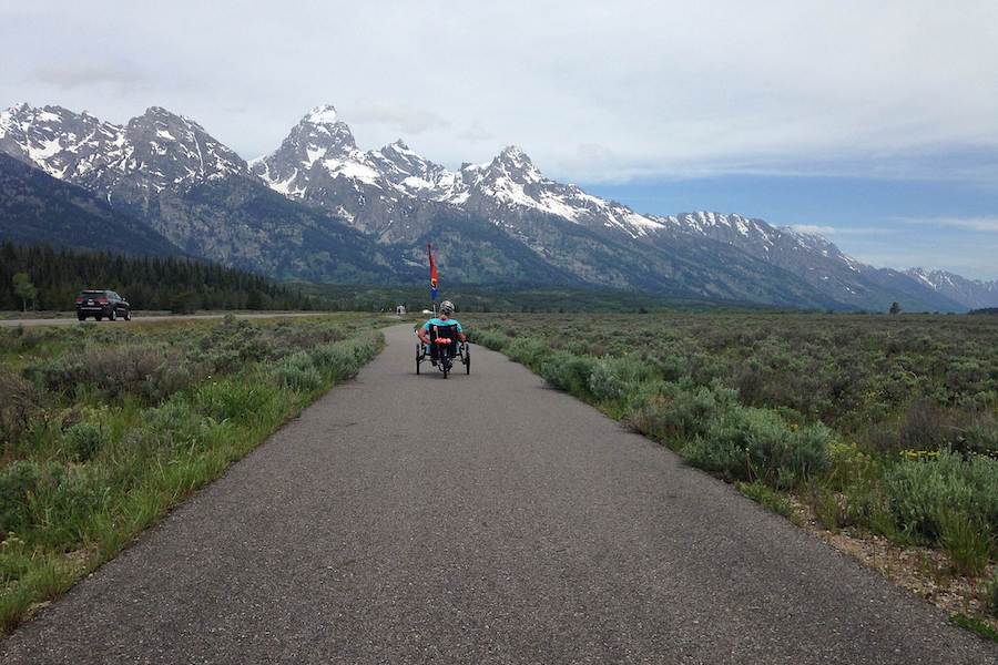
County: Teton
Starting in the town of Jackson and running north through Grand Teton National Park to Jenny Lake Visitor Center, the North Pathway offers breathtaking views along its 20.3 miles. At the visitor’s center, you can see exhibits on the geology and ecology of the area or continue your adventure by connecting to the Jenny Lake Trail to ride along the eastern shoreline. At the opposite end, the trail passes through the National Elk Refuge—a nearly 25,000-acre refuge established in 1912 to give the 11,000 Jackson Elk Herd a winter habitat. The North Pathway is part of a larger project called the Greater Yellowstone Trail, a seamless, 180-mile trail under development from Grand Teton National Park to Yellowstone National Park.
TRAIL OF THE MONTH: Wyoming’s North Pathway (July 2018)
Al’s Way
County: Converse
Just 25 miles south of Casper sits the town of Glenrock—home to a small trail with a big role. Al’s Way, a 2.1-mile trail, is named after Al Finch, a local high school coach. Finch, who coached track for more than 30 years, created the high school’s cross-country program and often took his runners to train along the old, abandoned railroad tracks bordering the high school. The Herders went on to win two state championships and the community began referring to the trail as Al’s Way. While the trail holds sentimental value for the Glenrock community, the trail will soon hold value for the larger trail community as it is also a link in the 3,700-mile Great American Rail-Trail.
Green River Greenbelt Pathway
County: Sweetwater
The Greenbelt Pathway follows the banks of the Green River for the entirety of its 3.5-mile route. Part of the larger Green River Pathway System, which boasts over 12 miles of trails, the Greenbelt Pathway offers visitors access to multiple local parks, picnic areas, scenic overlooks and fishing holes. Just north of the trail’s southern terminus, bike enthusiasts can exit via Scott’s Bottom Road and hop on the Wilkins Peak Trail System, where over 20 miles of varied-level trails await. At the southern end of the trail, visitors can enjoy a 1-mile nature walk at Scott’s Bottom Nature Area.
Greybull Riverwalk
County: Big Horn
This 1.9-mile trail is a staple among locals of Greybull, running north on a slightly curving north–south route between the town to the west and the banks of the Big Horn River to the east. Of note: Access to the trail is available almost every five blocks throughout the community.
Within the town, visitors can explore attractions like the Greybull Museum, which features rocks, fossils, artifacts and antiques from the region, and the Big Horn Basin Geoscience Center, which is dedicated to an exploration of the region’s geological and paleontological history. The community of Greybull is also located less than 45 minutes from a handful of scenic side-trips such as Red Gulch Dinosaur Tracksite, Shell Falls and Paintrock Mine Area.
RELATED: Five Rail-Trails in America’s National Parks
Special acknowledgments: Laura Stark, Rails to Trails magazine; Sam Petri, Friends of Pathways; Jeanie Vetter, Greater Cheyenne Greenway


Donate
Everyone deserves access to safe ways to walk, bike, and be active outdoors.


