Top 10 Trails in Hawaii
With its picturesque beaches, lush tropics, diverse wildlife, and dramatic mountains and volcanos, it’s no wonder Hawaii is considered to be “like no place on Earth.” More than 1,500 years ago, Polynesians sailed to and first began settling on this breathtaking archipelago of more than 130 islands in the Pacific Ocean. Today, the six main Hawaiian Islands—Hawaii, Maui, Lanai, Molokai, Oahu and Kauai—offer trails and parks that allow you to explore the state’s variety of landscapes, history and rich culture.
Grouped by island, here is an assortment of greenways and rail-trails that you’ll want to say “hi!” (but not “bye”) to in the Aloha State.
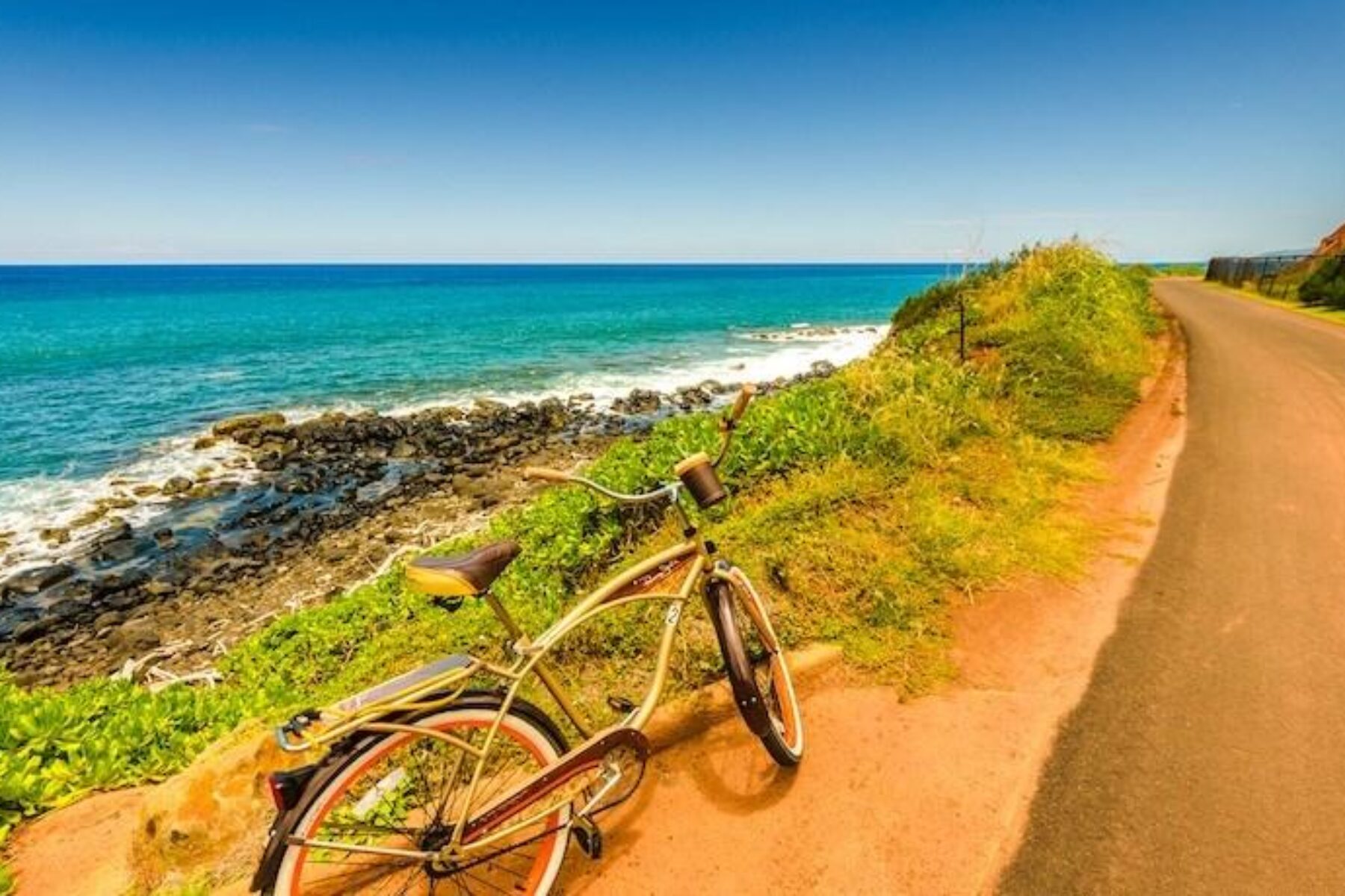
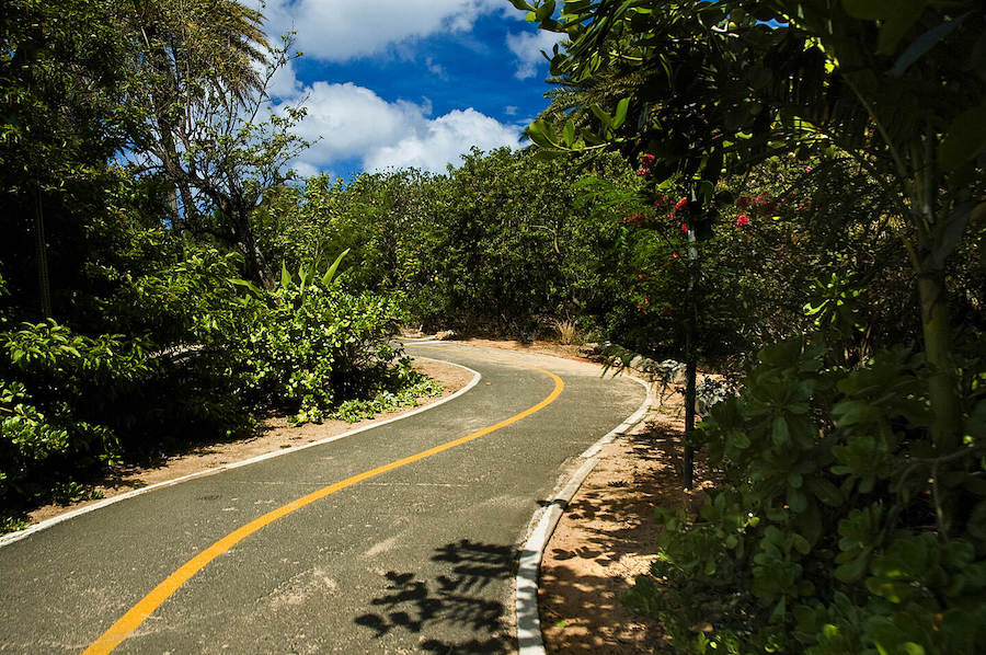
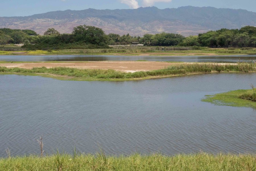
Ke Ala Hele Makalae
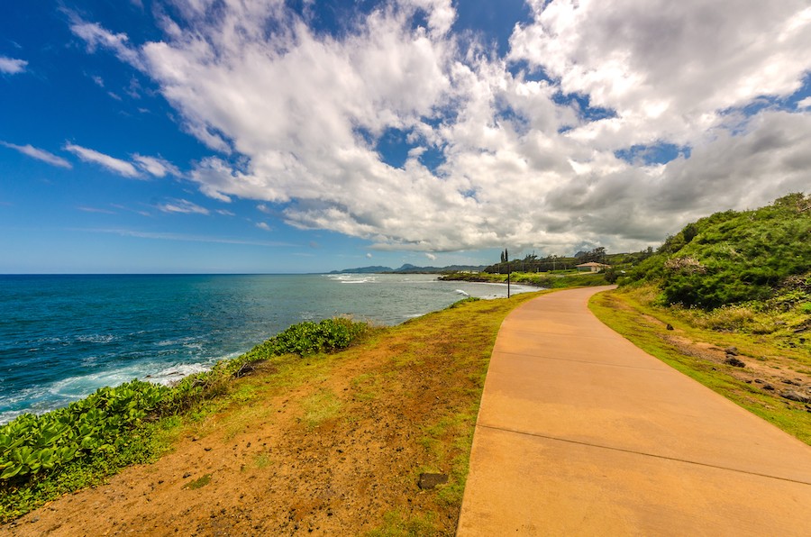
County: Kauai
Among the many outdoor activities to do on Hawaii’s oldest and fourth-largest island, you won’t want to miss the Ke Ala Hele Makalae trail, which means “The Path that Goes by Coast.” True to its name, this trail travels more than 7 miles—over two disconnected segments—along the Royal Coconut Coast of Kauai. Visitors can expect phenomenal beach views; plenty of signage to guide the way and share information about the area’s past and present; lush greenery; and occasional glimpses of seabirds, monk seals and whales.
Already one of the state’s longest rail-trails, there are plans to extend the paved pathway until it covers 17 miles of the “Garden Island’s” scenic eastern coast—further helping to connect communities, offer commuting options and provide spectacular recreational opportunities.
TRAIL OF THE MONTH: Hawaii’s Ke Ala Hele Makalae (August 2016)
Ka’ena Point Trail
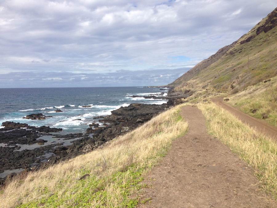
County: Honolulu
Referred to as the “Heart of Hawaii,” Oahu has some extraordinary trails that you’re sure to love, including the Ka’ena Point Trail. Located in the northwest corner of the island is the Ka’ena Point State Park, where this 4.75-mile trail leads to the Ka’ena Point Natural Reserve Area, “a remote and scenic protected area harboring some of the last vestiges of coastal sand dune habitat on the island.” To reach the reserve, this V-shaped dirt trail treks along the coast via a former railroad bed belonging to the O’ahu Railway and Land Company.
Although the views may be easy on the eyes, the ocean waves can be rough, and the sun along this mostly unshaded pathway can feel intense. In addition to being watchful of turbulent waves and any potential washing-out of the trail, visitors should look out for whales and other wildlife that call the reserve home.
Waialua Beach Road Bike Path
County: Honolulu
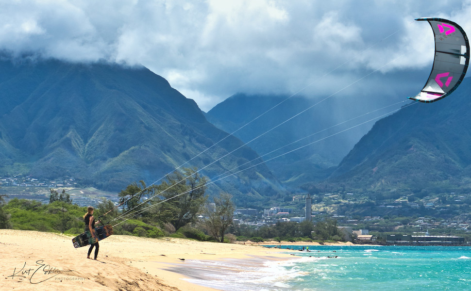
Known for its legendary 30-foot swells, Oahu’s North Shore is sure to delight surfers and land-based explorers alike. Between its eastern and western boundaries, the area has 11 miles of coastline with around 50 eye-catching beaches, which even made an appearance in the television series “Lost.” Waialua is a charming and more rural part of the North Shore, where you can expect to find a quieter scene; room to spread out on the beach; and the historic Waialua Sugar Mill, a former sugar plantation that was established in 1865 and then became home to a mix of shops featuring locally made products.
The Waialua Beach Road Bike Path runs right by the mill as this smooth, 2.5-mile route makes its way through the community, providing recreation and transportation opportunities. Plans exist to connect the trail with other active transportation routes, further improving connectivity in and around Waialua.
Ke Ala Pupukea Bike Path
County: Honolulu
Another North Shore gem, the Ke Ala Pupukea Bike Path is a 2.8-mile trail that parallels the Kamehameha Highway on the “Makai”—ocean—side. The trail is paved with a gentle grade, making it a smooth way to explore the Pupukea community and some of the North Shore’s beaches.
The trail is framed by two stop-worthy spots: Shark’s Cove, which is a reef-protected cove in the 100-acre Pūpūkea Marine Life Conservation District that’s very popular with divers due to its diverse marine life, and Sunset Beach, a 200-foot-wide stretch of beach that’s considered to be one of the most famous surfing spots in the world. The sites along the way make it an excellent way to walk, run, roll or ride through the community—plus, you can skip the car traffic during surf competitions!
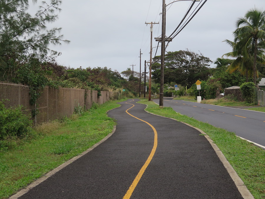
Malaekahana Bike and Pedestrian Path
County: Honolulu
Toward the eastern section of the North Shore, between the towns of Kahuku and Laie, is the Malaekahana Bike and Pedestrian Path. The opening of the 1.2-mile pathway was made possible by the collective effort of volunteers, community groups, the landowners, businesses and residents, as well as the pearls of wisdom from the team behind the nearby Ke Ala Pupukea Bike Path. The paved 8-foot-wide trail runs alongside the Kamehameha Highway and is well used by locals for exercise and car-free commuting between the towns. The route also takes its travelers near the beach; a ranch that offers horseback riding and eco-tours; and the Malaekahana State Recreation Area, which has camping.
Not far from the trail, about a 2-mile trip on the highway, is the Polynesian Cultural Center. Voted the No. 1 paid attraction in Hawaii, the center comprises “42 acres of tropical splendor” and provides a way to experience the culture and heritage of six different Pacific Island Nations through arts, storytelling, performances and food.
Ala Wai Canal Promenade
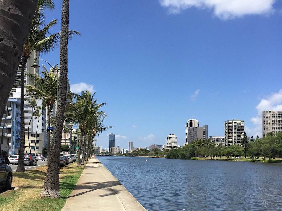
County: Honolulu
In 2019, Oahu had 211 miles of bikeways, including nearly 60 miles of shared-use paths, and developed a plan to expand their bikeway network to add another 575 miles. The Ala Wai Canal Promenade, which sits in a bustling area near Waikiki Beach in Honolulu, would be lengthened and enhanced via new pedestrian crossings thanks to this proposed expansion. What’s more, the trail is part of the Lei of Parks, a developing network of interconnected trails and bicycling routes along Oahu’s southern shore.
The trail is paved and currently traces the 2-mile Ala Wai Canal, which was built in 1928 to drain the wetlands and build up the land for development. Currently, the trail is near schools, shops, parks, an aquarium, a zoo, a golf course and popular beaches; ultimately, the proposed plans intend to make it easier and safer for pedestrians and bicyclists to get around and access the area’s many destinations.
Ala Moana Park Path
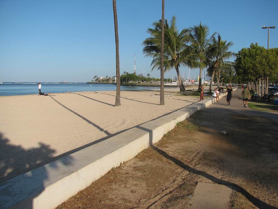
County: Honolulu
As the state’s capital and its largest city, Honolulu provides a wealth of experiences, from outdoor oases to business centers and cultural attractions. This city is where the majority of people in Oahu live, and it was named a bronze-level Bicycle Friendly Community as well as ranked 12th among the country’s largest cities for bicycle commuting. For bicyclists and pedestrians who love sunlight as much as the limelight, Ala Moana Park Path grants its users access to nature and the city’s lively downtown.
The path is also part of the Lei of Parks network and wanders approximately 2 miles through Ala Moana Beach Park, which is fittingly called “the People’s Park” and translates to “path [to the] sea.” This popular park was dedicated by President Franklin Delano Roosevelt in 1934 and has received recent upgrades and enhancements. In addition to the expansive beaches and the enchanting Magic Island, trail users can expect to come across bikeshare stations, green areas, a pond, picnic areas, game courts and shopping.
Pearl Harbor Bike Path
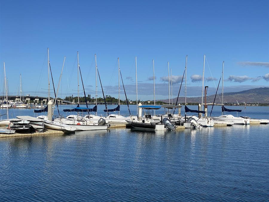
County: Honolulu
Located near downtown Honolulu, this rail-trail traces the shoreline of Pearl Harbor, the most visited site in Oahu. The 5.2-mile trail offers a recreational space for strolls, runs and rides, and an opportunity to reflect on a place that will forever be a part of our nation’s history. A short distance from the trail is the Pearl Harbor National Memorial, where visitors can learn about the attack on Pearl Harbor in 1941, the U.S. entry into World War II and its effects on Hawaii, as well as honor those who died.
Although much of the trail wanders through an industrial area, it also passes by parks and other green spaces. Community groups have helped lend a hand with trail clean-up and maintenance, and plans have been considered to expand and enhance the trail and sections of its surrounding area.
West Loch Bike Path
County: Honolulu
Following the sections of the West Loch shoreline in Pearl Harbor, the 1.7-mile West Loch Bike Path is a close neighbor of the Pearl Harbor Bike Path. Eventually, there are plans to connect the two as part of the Leeward Bikeway using the former Oahu Railroad & Land Company right-of-way.
Currently, the paved West Loch Bike Path treats its visitors to water views, quiet residential neighborhoods and green areas. Along the rail-trail’s route are Kapapapuhi Point and Asing Community parks (West Loch Community Shoreline Park); the West Loch Golf Course; and the Pearl Harbor National Wildlife Refuge, which provides a wetland oasis for Hawaii’s endangered waterbirds and other rare species.
North Shore Greenway
County: Maui
The aptly named North Shore Greenway is a favorite of families and anyone seeking a gentle ride along the north shore of the “Valley Isle.” The second largest of the main islands, Maui features 120 miles of coastline and the iconic Haleakalā National Park, which holds the most endangered species of all national parks. The park’s namesake—meaning “House of the Sun”—is a dormant volcano with a crater standing 10,023 feet above sea level, making it a famous setting to watch the sunrise as well as an iconic landmark visible from nearly every point on the island.
Beyond showcasing the island’s natural beauty, the 2.2-mile trail also offers its users—walkers, strollers, riders and rollers alike—a way to exercise and get around. The paved pathway, which has been a decades-long effort by the county, local groups and the community, was envisioned to provide a 7-mile link between Kahului Airport, parks and surrounding communities as well as serve as a model for other safe, car-free pathways.
Honorable Mention
For more trail adventures, we hope you’ll check out these recommendations from our friend, Cindy Barks, on TravelAwaits.
If you decide to take your exploration beyond the virtual world and head to Hawaii in real life, please remember to #RecreateResponsibly and be respectful of the people and places you visit. Caring for the islands and all their inhabitants is central to Hawaiian values; to help tourists embrace this spirit, the state launched the Malama—“to care for” Hawaii Program, which helps you plan trips that give back through outdoor stewardship projects and more.
Special acknowledgments: Torsha Bhattacharya, RTC’s director of research


Donate
Everyone deserves access to safe ways to walk, bike, and be active outdoors.


