Top 10 Trails in Alaska
With rugged peaks, sparkling seas and verdant forests, Alaska is unparalleled in natural beauty. Holding more than half of America’s national park land by area, as well as numerous wildlife refuges, national forests, state parks and other outdoor assets, opportunities to recreate in the state are nearly boundless.
A growing effort is the development of multiuse pathways that enable trail users of all types and abilities to connect to the many treasured natural areas, cultural sites and recreation areas that abound in the Last Frontier state, as well as travel through and between communities. One successful model in the state is Anchorage’s Moose Loop, a developing 32-mile trail system that, when viewed on a map, appears to be in the shape of one of Alaska’s most famed mammals—from its ears and dewlap to its humped back. A few of the trails in this loop are listed below, as well as several other exciting multiuse pathways.
(Since Alaska does not have counties, but instead is divided into boroughs, we’ve listed the relevant boroughs below for each trail.)
Tony Knowles Coastal Trail
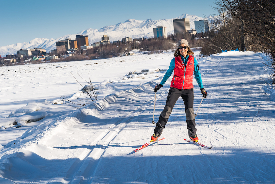
Borough: Anchorage
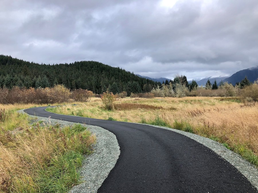
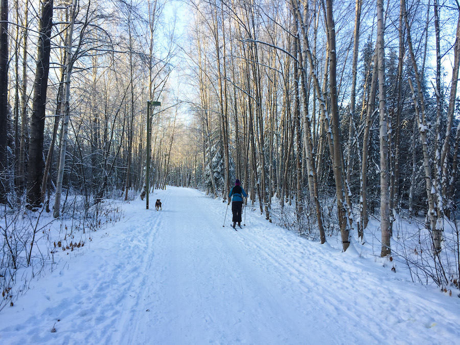
With views of the Chugach Mountains and tidal inlets, Anchorage’s Tony Knowles Coastal Trail offers breathtaking beauty coupled with a good chance of seeing black bears, bald eagles or other wildlife within the wooded fringes of Alaska’s largest city. Hugging the coastline, the 11-mile paved pathway—named for the Alaskan mayor and (later) governor who championed it—connects several unique parks and plays a key role in the Moose Loop.
A few miles into the journey, Earthquake Park shares the heartbreaking story of the natural disaster that rocked the region in 1964. With a magnitude of 9.2, it was the most powerful earthquake to strike North America and the second-largest earthquake ever recorded worldwide. Farther on, Point Woronzof Park offers cliffside views overlooking the ocean, where—during the summer—you can look for flocks of cliff swallows, the aerial acrobats who come back year after year to nest on the steep bluffs overlooking the entrance to the Knik Arm to devour their favorite food, mosquitos. At trail’s end, Kincaid Park provides a plethora of recreational amenities, including a fishing lake, archery range and Nordic ski center.
TRAIL OF THE MONTH: Tony Knowles Coastal Trail (January 2019)
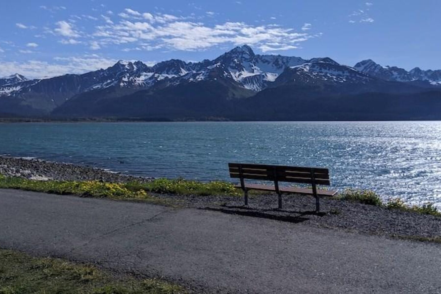
Homer Spit Trail
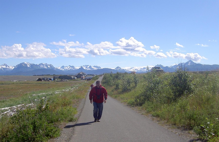
Borough: Kenai Peninsula
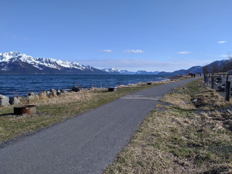
The small community of Homer—the “Halibut Fishing Capital of the World”—is located on the Kenai Peninsula of southcentral Alaska. Its Homer Spit Trail rolls down the narrow 4.5-mile strip of land jutting out from the city into Kachemak Bay. This backdrop means gorgeous views of the sea, sky and mountains all along the paved pathway, as well as great birding opportunities.
Recreational activities abound here; outfitters along the “Spit” offer fishing, kayaking, camping and other fun outdoor adventures. You can also enjoy fresh seafood and refreshments at one of the restaurants at trail’s end.
Bird to Gird Pathway
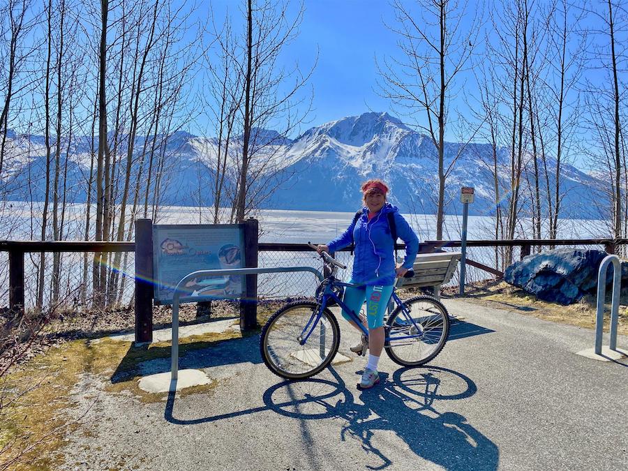
Borough: Anchorage
Tracing the Turnagain Arm, the Bird to Gird Pathway offers expansive views of the shoreline and snow-covered mountains across its 13 paved miles. Dotting the trail, interpretive signage provides the opportunity to learn about these surrounding geologic features, as well as the area’s history and wildlife. Keep a lookout for Dall sheep and mountain goats, especially, which are common along the craggy cliffs. You may even see the bright white flashes of beluga whales among the Cook Inlet waves.
Also known as the Indian to Girdwood Bike Path, the route was formerly the Seward Highway and connects the communities of Girdwood, Bird and Indian along Seward Highway (AK-1). The trail also skirts the southern end of Chugach State Park, which—at a whopping 495,000 acres—is one of the largest state parks in the country. Here, adventurers will have access to campgrounds and 280 miles of trails for hiking, biking, horseback riding, snowmobiling and other outdoor pursuits.
Kaxdigoowu Heen Dei
Borough: Juneau
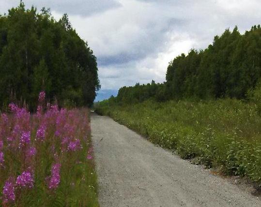
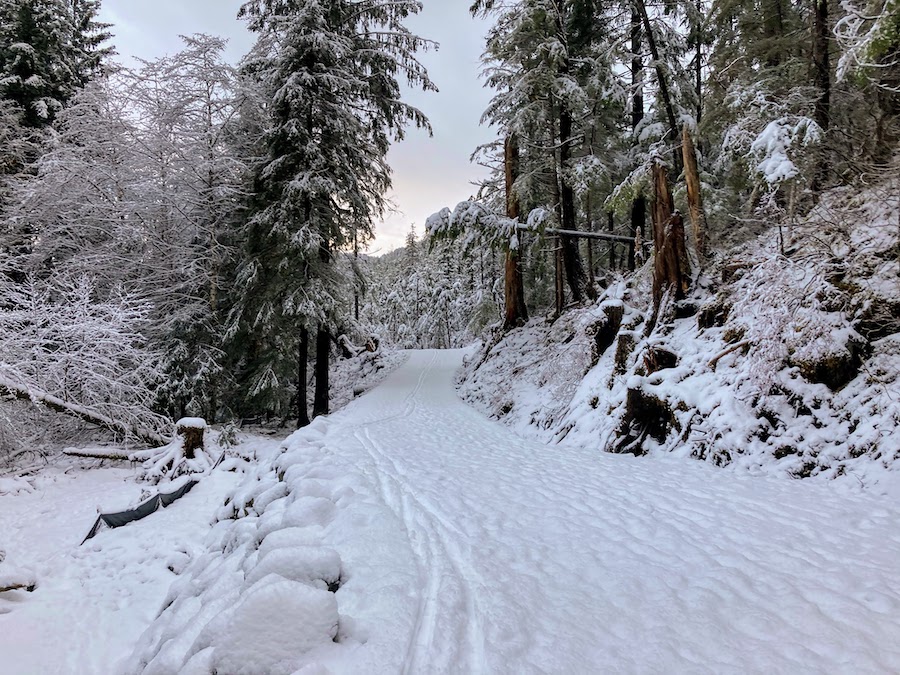
The Kaxdigoowu Heen Dei is nestled in the pine-filled Mendenhall River valley about 9 miles northwest of downtown Juneau and just north of Juneau International Airport. Also known as the Brotherhood Bridge Trail, its Tlingit name is believed to mean “going back clearwater trail.” The 2-mile route is the city’s longest paved pathway and will get even better with scheduled repaving in 2024.
The route starts off with a bang with views of snow-capped peaks and a glacier from the trailhead parking lot at its southern end on the aptly named Glacier Highway. In season, you may also be greeted with a field of purple-pink wildflowers. The trail winds north with an option (0.5 miles in) to cross a bike/pedestrian bridge over the river to reach Dimond Park, home to an aquatic center, ballfields and other athletic facilities. The pathway ends at trailhead parking at the end of River Road.
For more adventure, there are hiking trails around the striking Mendenhall Glacier nearby, or you could head to downtown Juneau to pick up the 3-mile Perseverance Trail, a backcountry route favored by hikers and mountain bikers that offers a gentle climb steeped in history.
Chase Trail
Borough: Matanuska-Susitna
The scenic Chase Trail begins at the northern end of charming Talkeetna, founded as the district headquarters for the Alaska Railroad in 1916. The trail today still parallels the active railroad tracks. From town, head north along the largely flat, gravel pathway, crossing the massive railroad bridge (circa 1923) that allows for both train and trail traffic over the confluence of three major rivers: the Susitna, Chulitna and Talkeetna. After the river, you’ll enter the sparsely populated community of Chase (home to fewer than two dozen people) for which the trail is named. Much of the route continues through dense spruce–birch forest, ending abruptly at the end of its 14-mile stretch.
Before or after your journey, be sure to explore downtown’s Talkeetna Historic District, just south of the trail, as well as the National Park Service’s Walter Harper Talkeetna Ranger Station, which offers visitor information and an orientation to the area’s mountaineering opportunities. You can also pick up the Alaska Railroad at the Talkeetna Depot and ride south to Anchorage and Seward, or north to Denali National Park and Fairbanks.
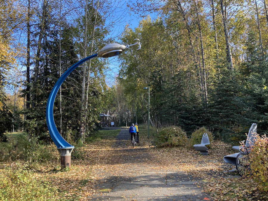
Campbell Creek Greenbelt
Borough: Anchorage
Winding 7.5 miles through the heart of Anchorage, the Campbell Creek Greenbelt follows its namesake, tree-lined waterway through quiet neighborhoods and beloved city parks, crossing the serpentine creek a few times along the way. You may see salmon making their way up the creek in late summer or early autumn to spawn; at the end of Piper Street, there’s a viewing platform that overlooks the confluence of the north and south forks of Campbell Creek.
On its southern end, the paved pathway begins off Dimond Boulevard near Campbell Lake; it ends at Tudor Road, just south of the University of Alaska–Anchorage campus. On the northern end of the trail, Campbell Park offers a playground, picnic tables and a popular put-in point for inner tubing on the creek. The pathway is also part of the Moose Loop connecting trails across the region.
Chena Riverwalk
Borough: Fairbanks North Star
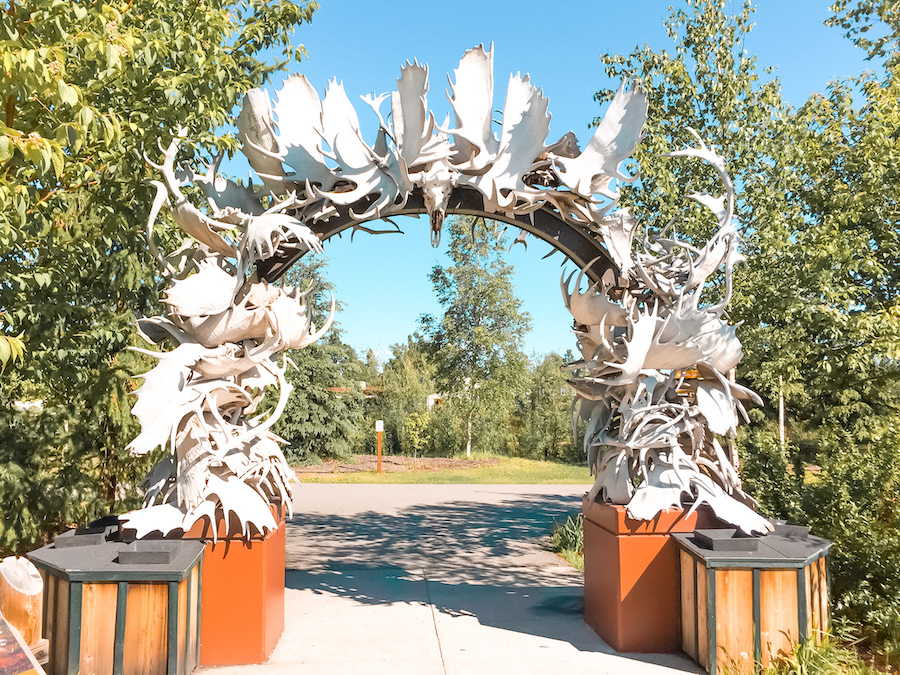
The Chena Riverwalk offers a great way to check out the parks, plazas and historic downtown along Fairbanks’ riverfront. The paved 3.5-mile pathway follows the Chena River from Pioneer Park (dotted with historical buildings and museums) on its east end to Airport Way, a major thoroughfare, on its western tip.
Although somewhat short, the trail is lined with attractions, including Golden Heart Plaza (featuring an 18-foot statue of an Alaskan family and a buried time capsule slated to be opened in 2059 for Alaska’s centennial) and the Morris Thompson Cultural and Visitors Center with exhibits on Alaska Native culture and history, as well as regional information on landscapes and wildlife. A popular photo-op here is the arch made of moose and caribou antlers.
Lanie Fleischer Chester Creek Trail
Borough: Anchorage
Anchorage’s Lanie Fleischer Chester Creek Trail follows the course of Chester Creek between Goose Lake Park and Westchester Lagoon with views of the pristine Chugach Mountains along the way. As the route crosses the city, it connects a handful of parks, including Margaret Eagan Sullivan Park and Valley of the Moon Park (which features a rocket-ship-themed playground). It’s also part of the Moose Loop and provides links to other trails, such as the Goose Lake Park Trails and Tony Knowles Coastal Trail for further exploring.
The trail is named for Lanie Fleischer, who—shortly after moving to Anchorage in 1971—co-chaired a newly formed bike committee and galvanized grassroots support for making the city more bike friendly. Surprised by the lack of trails in Anchorage, Fleischer’s work with the group culminated in a master plan for trails that could be used for bike commuting, recreational riding and safe routes to school. In 1973, the group was successful in getting a bond issue passed to finance the development of the Chester Creek Trail, the city’s first paved pathway.
TRAIL OF THE MONTH: Lanie Fleischer Chester Creek Trail (May 2021)
Waterfront Path
Borough: Kenai Peninsula
Tucked between the mountains and Resurrection Bay on Alaska’s southern coast, Seward is a beautiful port town and the southern terminus of the Alaska Railroad. Its paved, milelong Waterfront Path, traversing Seward Waterfront Park, provides easy access to those enticing views as well as interpretative signage, historical landmarks, the chance to see wildlife (watch for bald eagles, seabirds, sea otters, sea lions and harbor seals) and a handful of campgrounds right on the shoreline.
The trail’s southern end is a mere block from the Alaska SeaLife Center, which serves as a public aquarium, research institution and marine mammal rehabilitation facility. Adjacent to the building is the historical Seward Depot (circa 1917), once considered the “Gateway to Alaska.” Tracing the shoreline, you will soon arrive at the original starting point (mile 0) of the famed Iditarod Trail (now a National Historic Trail), the route of a 1,049-mile sled dog race across the state. Heading north, Waterfront Playground offers a fun stop for families as well as picnic tables and restrooms. The trail ends just south of the picturesque Seward Boat Harbor and the Kenai Fjords National Park Visitor Center, plus is only blocks from several restaurant options for a rewarding meal after your excursion.
Cross Trail
Borough: Sitka
Encompassing a series of islands, the City and Borough of Sitka in southeast Alaska is accessible from the mainland only by boat or plane. The community is also noteworthy for being Alaska’s first official Bike-Friendly Community (before the much more populated cities of Anchorage and Juneau) and abounds in riding opportunities, including numerous bike lanes, mountain-biking trails and multiuse pathways.
As its name implies, Sitka’s Cross Trail allows bikers, walkers and others the opportunity to travel across town—skirting its northern, mountainous edge—in a pleasantly forested corridor (there’s even a waterfall) with minimal encounters with vehicle traffic. The 3.8-mile gravel route, running between Kramer Avenue to the west and Indian River Road to the east, connects into city neighborhoods, parks and schools along the way. It also links to the Indian River Trail, a 4.6-mile hiking route through Tongass National Forest. By early 2022, an extension to the Cross Trail will reach Sitka’s ferry and cruise terminals, enhancing the pathway’s utility.
Special thanks to two Rails-to-Trails Conservancy staff members—and former Alaskan residents—who assisted with this article: Willie Karidis, Route of the Badger project manager, and Eric Oberg, Midwest regional director


Donate
Everyone deserves access to safe ways to walk, bike, and be active outdoors.


