Top 10 Trails in Missouri
From key steamboat ports to railroad hubs, Missouri has long been at the literal center of transportation in America. This rich railroad history has led to more than 450 miles of rail-trail in the state today, and its powerhouse rivers—like the Missouri and Mississippi—sport miles of scenic greenways. We highlight some of those beloved rail-trails here as well as a few of Missouri’s other multiuse gems.
Katy Trail State Park
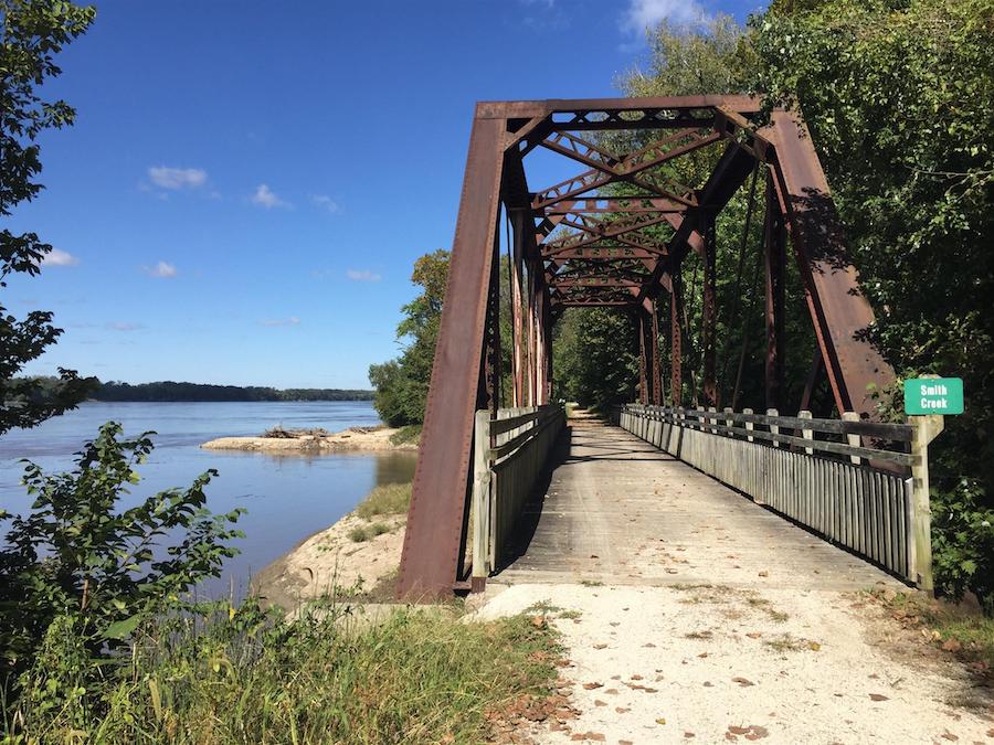
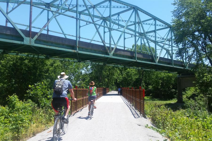
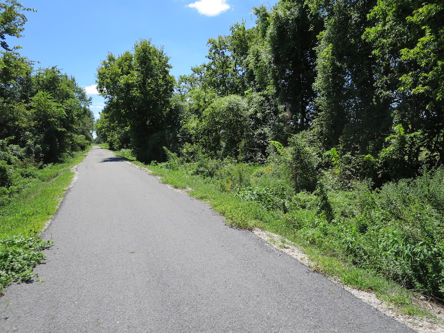
Traversing almost the entire state of Missouri, the 240-mile Katy Trail State Park is the longest rail-trail in the country. Largely paralleling the majestic Missouri River—with limestone bluffs to one side and the river to the other—the crushed-stone path features some of the most striking natural areas of the state as it travels through dense forests, wetlands, prairies and rolling hills, in addition to weaving through more than 40 towns. The Katy Trail begins northwest of St. Louis in Machens and heads west to Clinton, passing through the state capital of Jefferson City. At Windsor, on the west end of the trail, travelers can connect to the Rock Island Spur of Katy Trail State Park, which totals more than 50 miles and offers a northwestern trajectory to Kansas City.
Counties: Boone, Callaway, Cole, Cooper, Henry, Howard, Montgomery, Pettis, St. Charles, Warren
Related: Pathway to Prosperity: Missouri’s Katy Trail Is a Beautiful Model for Commerce
Trail advocates and supporters in Missouri are working to connect the Katy Trail to the developing 144-mile Rock Island Trail in an effort to create a seamless 450-mile trail loop connecting Kansas City and St. Louis. Learn more about the Rock Island Trail.
Rock Island Spur of Katy Trail State Park
Nestled in the foothills of the Ozarks, the Rock Island Spur of Katy Trail State Park winds through the picturesque countryside of western Missouri. A 46-mile section of the trail begins in Windsor, where trail-goers will find a railroad caboose and a connection to the extensive Katy Trail. The crushed-limestone pathway continues to Pleasant Hill, a suburb of Kansas City, which offers a Downtown Historic District that’s listed on the National Register of Historic Places, as well as colorful murals depicting the area’s history and culture. A second section of the trail in Jackson County stretches 6.5 miles from Lee’s Summit to Kansas City. A highlight of this segment is the 453-foot-long Vale Tunnel, originally completed in 1904.
Counties: Cass, Henry, Jackson, Johnson
RELATED: The Rock Island Trail Is a 144-Mile Would Be Game-Changer for Missouri
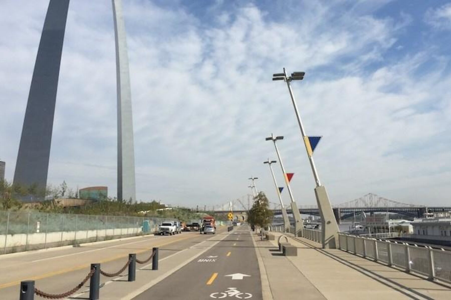
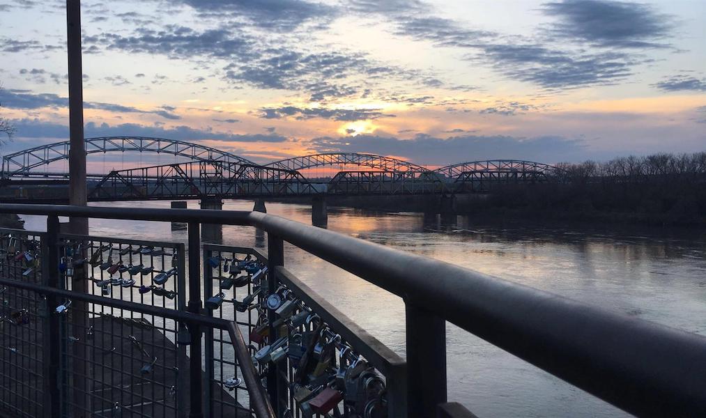
St. Louis Riverfront Trail
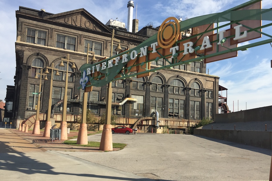
Starting just south of the iconic Gateway Arch downtown and flanking the west bank of the Mississippi River, the St. Louis Riverfront Trail is a must-visit. For history buffs, the adjacent Lewis and Clark statue is worth a stop, and the 12-mile trail is also dotted with interpretive signage to learn about the area’s heritage. At different points in time, travelers will find themselves atop the river levee or rolling along the large concrete flood walls lined in artwork. The Old Chain of Rocks Bridge marks the northern end of the trail; part of the historical Route 66, the mile-long bike and pedestrian crossing of the Mississippi River reaches Illinois on the other side.
County: St. Louis
Project Spotlight: St. Louis Regional River Ring Initiatives
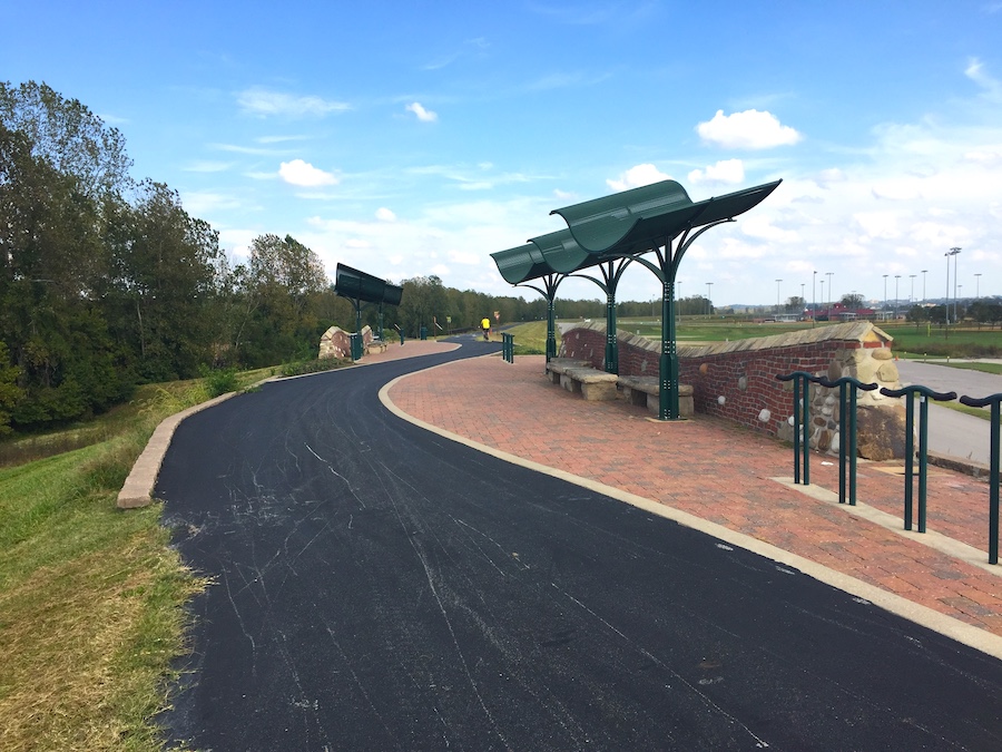
Riverfront Heritage Trail
Kansas City—Missouri’s largest city—was founded in the early 1800s as a port for the Missouri River; exploration of its Riverfront Heritage Trail enables a special connection to both the river and that legacy. The paved pathway rolls along the waterfront through the Richard L. Berkley Riverfront Park, provides access to several other downtown parks, and continues west, snaking across the border into Kansas. A noteworthy stop is the trailhead at W. 8th Street and Madison Avenue, which features a Santa Fe railcar and a poignant set of sculptures, made by a local artist, depicting an enslaved family fleeing bondage and journeying to the free state of Kansas.
Counties: Clay, Jackson, Wyandotte
Monarch-Chesterfield Levee Trail
West of St. Louis, the 11-mile Monarch-Chesterfield Levee Trail provides an interesting way to see the Missouri River and explore the growing suburb of Chesterfield. Beginning at Centaur Road on the western end of the paved pathway, travelers are high above the surrounding landscape atop a river levee. Views include farm fields, woodlands along the river and planes overhead—with the Spirit of St. Louis Airport so close at hand. The east end of the trail provides access to River’s Edge Park, which features a beautiful lake at its center and two boardwalks.
County: St. Louis
Little Blue Trace Trail
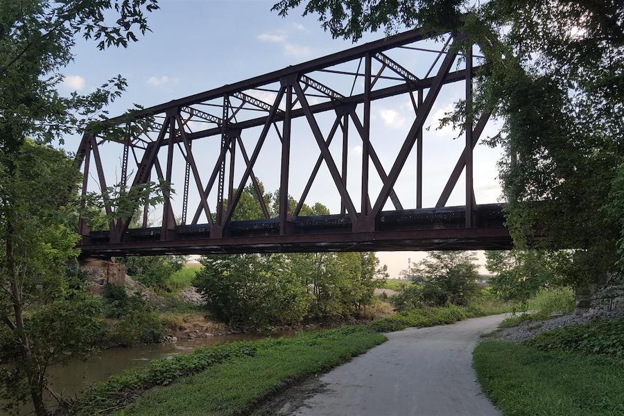
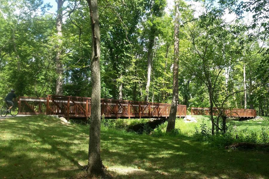
Hugging its namesake river and lined with wildflowers in the summer, the beautiful Little Blue Trace Trail is a favorite for locals and visitors alike. Skirting the suburban eastern edge of Kansas City, the scenic 15-mile route traverses woodlands and pastoral landscapes, and includes a handful of charming bridge crossings and passage beneath several old train trestles.
County: Jackson
Grant’s Trail
Grant’s Trail, winding through the southern outskirts of St. Louis, offers many unique sights along its 10 miles, including Grant’s Farm, named for the 18th president of the United States, Civil War hero Ulysses S. Grant, who farmed in the area in the 1850s. Today, Grant’s Farm—the former estate of the Busch family of Anheuser-Busch brewing company fame—is an animal park featuring bison, elephants, camels, peacocks and more than 100 other species, including its most iconic residents, the Budweiser Clydesdales. The town of Kirkwood, where Grant’s Trail ends, was established when a branch of the Missouri Pacific Railroad, upon which the trail is now built, reached the area in 1853.
County: St. Louis
Frisco Highline Trail
In southwestern Missouri, the 37.6-mile, partially paved Frisco Highline Trail provides a pleasant route between Bolivar and Springfield, the state’s third largest city. From its northern end, the trails unfurls through bucolic countryside sprinkled with wildflowers and dotted with cows and horses. Sections of the trail are tucked under the tress with pretty crossings over babbling creeks and larger streams. Approaching trail’s end through the town of Willard, the surroundings become more bustling with trailside shops, homes and schools.
Counties: Greene, Polk
Prairie Creek Greenway
Northwest of Kansas City, Platte County’s Prairie Creek Greenway offers a natural escape from suburban life. Just shy of 7 miles, the paved trail is set in a tranquil backdrop of forests, prairie and the lush corridor of its titular creek. Travelers may expect to find wildlife along the way, a rock waterfall, limestone outcroppings and several bridges. In addition to the main loop, a short spur on the trail’s northern end connects travelers to residential neighborhoods and Platte Valley Park.
County: Platte
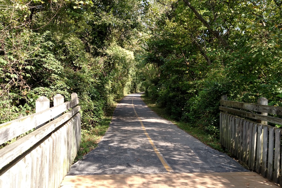
MKT Nature and Fitness Trail
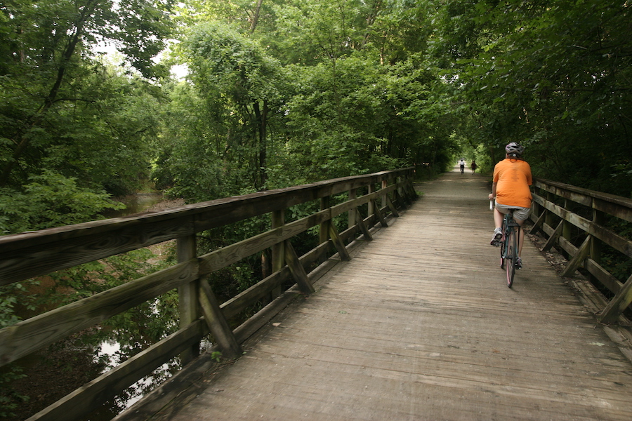
Within minutes, travelers on the MKT Nature and Fitness Trail are spirited away from lively downtown Columbia and taken into the forest. The trail—just a tad over 9 miles—is serene, with the soft crunch of crushed stone, the rustle of leaves overhead and the gentle gurgle of its many creek crossings. Before its dive into nature, the trail hugs the west end of the University of Missouri. Of note, the rail line on which the MKT Trail was built—a spur of the Missouri-Kansas-Texas Railroad—was created in part to service students and faculty of the school, established in 1839. At Hindman Junction, on the southern end of the trail, it meets Katy Trail State Park, the longest contiguous rail-trail in the country.
When you subscribe to Rails to Trails magazine, you’ll have access to many other features like this one. Our magazine is a premium of Rails to Trails membership. Join today to start receiving the magazine!


Donate
Everyone deserves access to safe ways to walk, bike, and be active outdoors.


