Top 10 Trails in Idaho
From the forested and lake-laden north to the Snake River plain in the south, Idaho offers a variety of exceptional trails for walking, jogging, bicycling, trailside fishing, snowshoeing and Nordic skiing. Urban, rural, or a bit on the wild side, Idaho has trails that are as diverse as the state’s topography. Here are a few of our favorites.
Especially notable is the Trail of the Coeur d’Alenes, a key part of the Great American Rail-Trail™, a signature project of Rails-to-Trails Conservancy that crosses the United States from Washington D.C. to the state of Washington. The 3,700-mile route will connect people and communities by creating a nationwide network of public trails traveling through natural environments, and linking cultural and historical resources.
Trail of the Coeur d’Alenes
Counties: Benewah, Kootenai, Shoshone
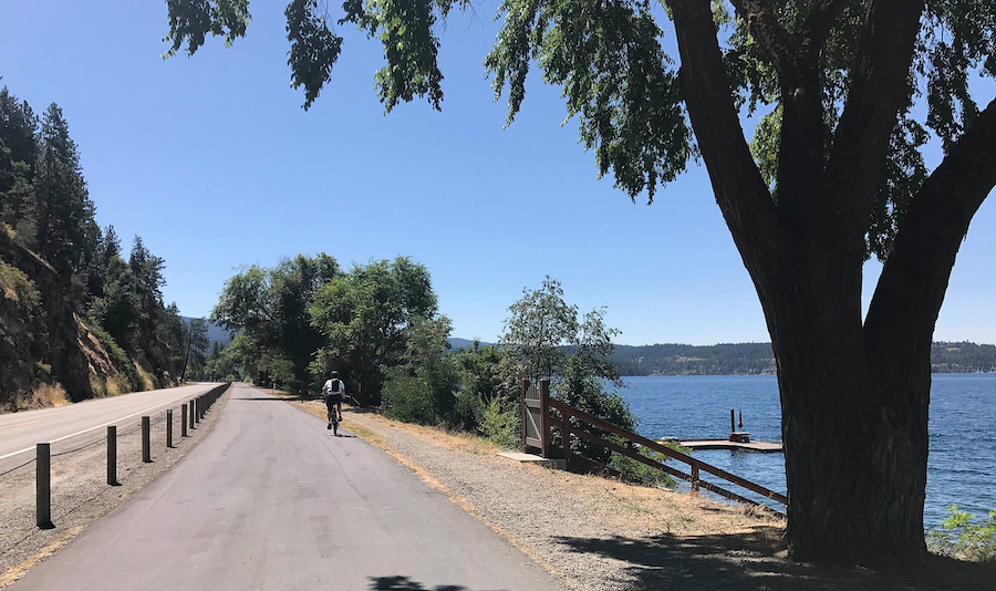
One of the most popular trails in the state, the Trail of the Coeur d’Alenes offers a paved 73-mile route across the panhandle from Plummer to Mullan. Nineteen trailheads distributed along its length provide multiple access sites. The incredibly scenic pathway—a Hall of Fame Rail-Trail and a part of the nation-spanning Great American Rail-Trail—travels through wooded canyons, next to Lake Coeur d’Alene, along the Coeur d’Alene River and into the Silver Valley, connecting several small towns with interesting silver mining histories. There is also abundant wildlife along the way and the route is part of the Idaho Birding Trail.
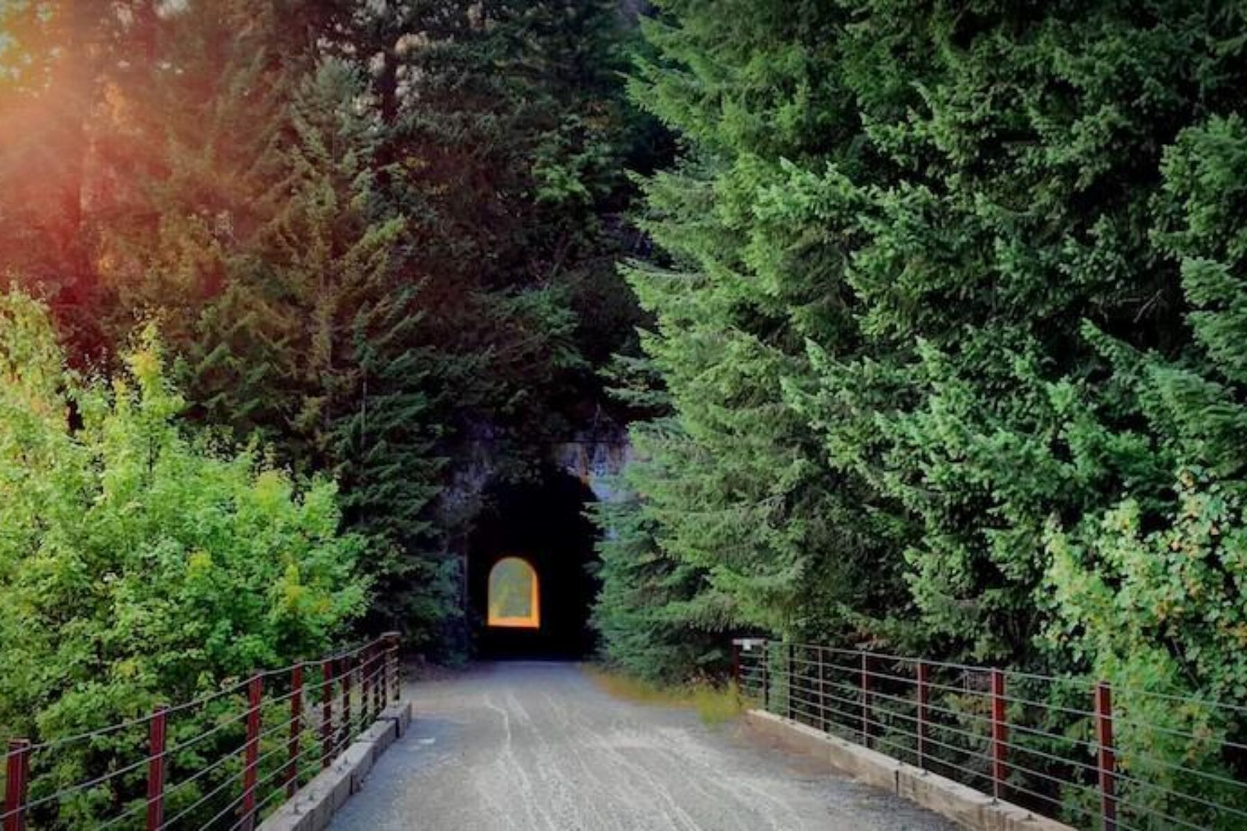
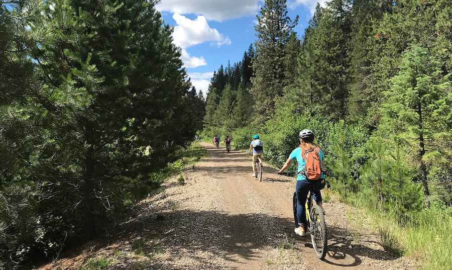
Route of the Hiawatha
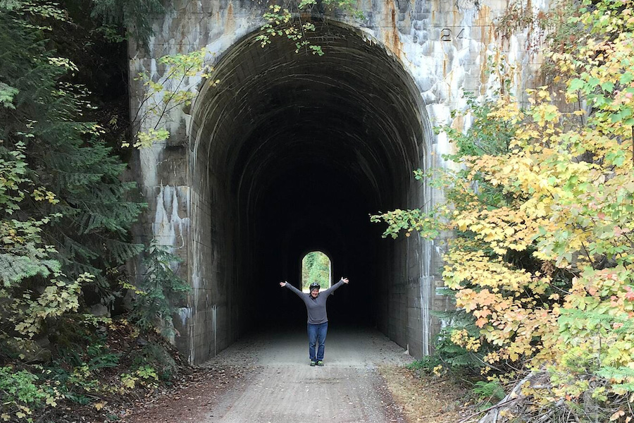
County: Shoshone
The Route of the Hiawatha is a 15-mile, gentle downhill (1.6% grade), gravel trail that is surrounded by dense forest. Trail users cross seven historical wooden rail trestles, which provide great views, and travel through 10 tunnels, including the 1.66-mile-long St. Paul Tunnel (aka Taft Tunnel) at the East Portal trailhead, the eastern terminus of this trail. For the return trip, trail users have the option of taking a shuttle bus back up to the Roland trailhead on the west side of the St. Paul Tunnel.
Trail passes, shuttle tickets and bike rentals are available at Lookout Pass Ski Area on I-90 (Exit 0) on the Idaho-Montana border. East Portal is a 7-mile drive from Lookout Pass—shuttles are not provided.
At the Lookout Pass Ski Area, you can connect with the NorPac Trail, another component of the Great American Rail-Trail, which offers spectacular views of the forested Rocky Mountains.
Bill Chipman Palouse Trail
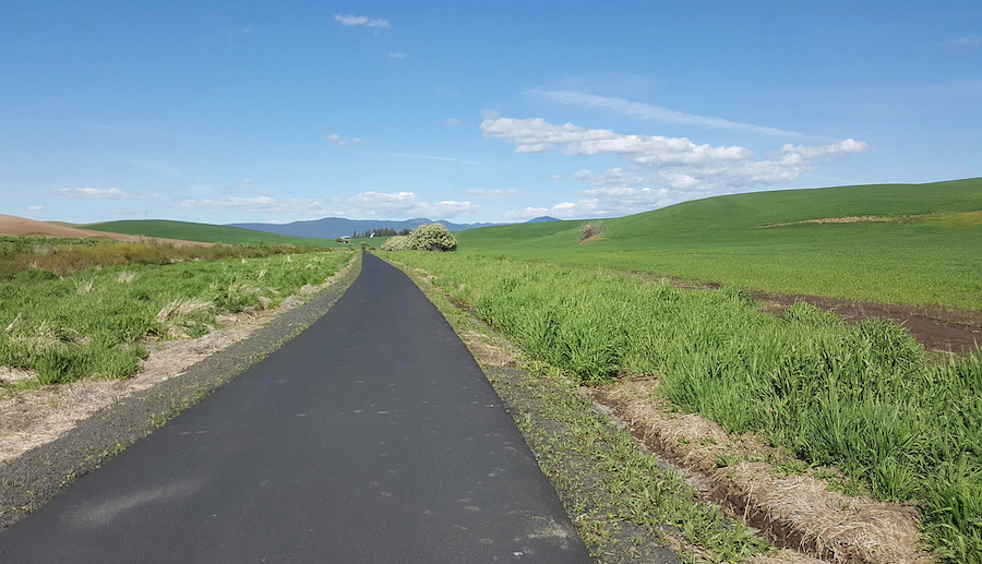
Counties: Latah (Idaho), Whitman (Washington)
The paved 7-mile Bill Chipman Palouse Trail, connecting Washington State University in Pullman and the University of Idaho in Moscow, rolls through the agricultural fields of the Palouse. Although the Palouse is known for its gentle hills, this trail is mostly flat as it follows Paradise Creek, crossing the stream 13 times on the original railroad bridges. In spring, the hills are especially beautiful when covered with bright yellow canola flowers.
The trail connects with the 2-mile Paradise Path on the University of Idaho campus. It travels through town connecting with the Latah Trail on the east side of Moscow. In Pullman, the Pullman Riverwalk Loop Trail, which loops around the city, connects with the Bill Chipman Palouse Trail.
North Idaho Centennial Trail
County: Kootenai
North Idaho Centennial Trail is a fabulous paved trail that traverses 24 miles from Higgins Point on beautiful Lake Coeur d’Alene and along the Spokane River to the Idaho/Washington state line where it connects with the Spokane River Centennial State Park Trail. In November and December, trail users make their way to Higgins Point to view and photograph hundreds of bald eagles arriving from the north to feast on spawning kokanee salmon.
The 4-mile Prairie Trail connects with this trail near Riverstone Park on the west side of Coeur d’Alene.
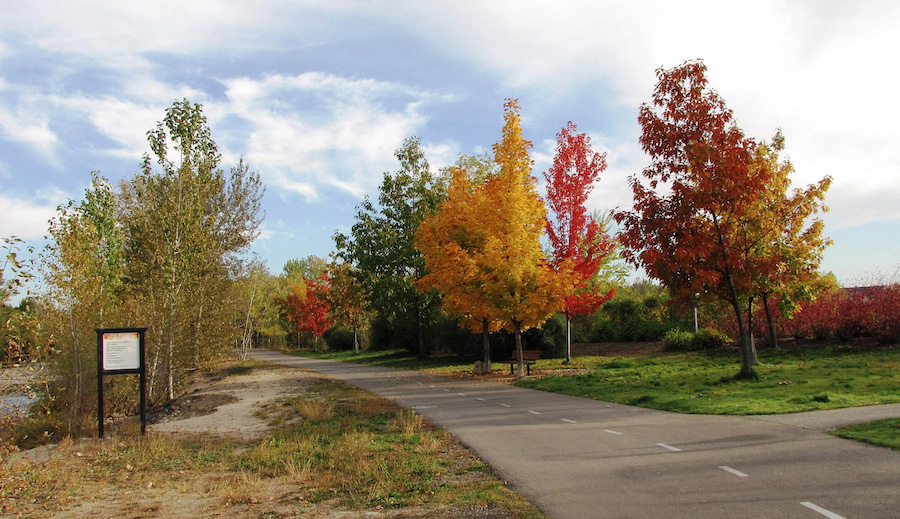
Boise River Greenbelt
County: Ada
The Boise River flows through the heart of the city and the Boise River Greenbelt follows this beautiful riparian corridor, often on both sides of the river. The pathway provides an alternative urban travel route to businesses and recreation areas throughout the city. Anglers regularly use the trail to access favorite fishing spots. Bookended on the east side by Lucky Peak State Park (Lucky Peak Dam) and on the west by State Highway 55, this 46-mile paved trail connects several city parks and numerous other city amenities such as Zoo Boise, Anne Frank Memorial and MK Nature Center.
Weiser River National Recreation Trail
Counties: Adams, Washington
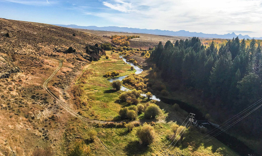
At 84 miles, stretching from the farming community of Weiser to Rubicon (near New Meadows), the Weiser River National Recreation Trail is the longest rail-trail in the state. Many trail users ride the whole trail in two or more days, but most are day trippers taking in a section at a time. The trail passes through the towns of Midvale, Cambridge and Council, which provide nice rest stops, stores, lodging options and trail access points. Paralleling the Weiser River, trail users experience desert, forest, riparian and alpine meadow habitats that support a variety of wildlife. The autumn colors are exceptional from the rolling hills of farmland in the south into forested mountains in the north.
Wood River Trail
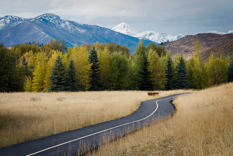
County: Blaine
So many options! The former Sun Valley line of the Union Pacific Railroad, which at one time brought skiers to Sun Valley, connects the communities of Bellevue, Hailey, Ketchum and Sun Valley via the Wood River Trail. Between the trail’s 20-mile spine and connecting spurs, the paved route provides a combined 36 miles to get around and play in the picturesque region.
Mountain and river views are your companions as the trail travels through the Wood River Valley. When the white stuff starts falling in the winter, the Blaine County Recreation District grooms the trail for Nordic skiing and snowshoeing.
Numerous trails connect to the Wood River Trail, including the Elkhorn-Ketchum Loop, Warm Springs Pathway and Broadford-River Street Loop, just to name a few. Check the Blaine County Recreation District map for links and maps to all of the trail options.
Aston-Tetonia Trail
Counties: Freemont, Teton
Trail users have a fantastic view of the majestic Teton Mountains for the full 29.6 miles of this gravel and dirt trail. The Ashton-Tetonia Trail crosses three historical train trestles and three smaller bridges while ambling through agricultural fields dotted with quiet farms and antique grain elevators. Aspen groves scattered along the trail are a beautiful golden-yellow in the autumn and, with the Teton Mountains as a backdrop, you’ve got many splendid photo opportunities.
The Idaho Department of Parks and Recreation provides maps of the trail noting trailheads, additional parking areas, bridge and trestle locations, and restrooms.
The Ashton-Tetonia Trail is also part of a developing trail network called the Greater Yellowstone Trail, a 180-mile route that will connect Jackson Hole, Wyoming, to West Yellowstone, Montana, via a handful of small towns in eastern Idaho.
Portneuf Greenway
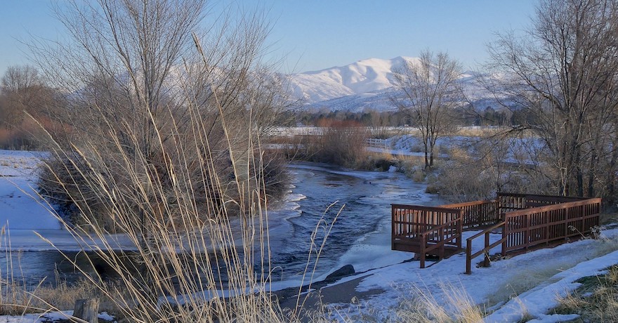
County: Bannock
The Portneuf Greenway is a 17-mile collection of paved trails connecting residential neighborhoods, commercial areas and natural habitats throughout Pocatello. One trail section parallels the Portneuf River and offers trailside benches where trail users can relax and admire the view. The pathways connect a handful of city parks, which offer convenient access points for the trails with parking lots, picnic areas and restrooms.
Trail system highlights include the 29-acre Edson Fichter Nature Area, which provides an excellent opportunity for viewing wildlife and fishing; Zoo Idaho; and the Bannock County Historical Museum, which includes a replica of Fort Hall and a re-creation of an 1800s fur trading post.
TRAIL OF THE MONTH: Idaho’s Portneuf Greenway (February 2021)
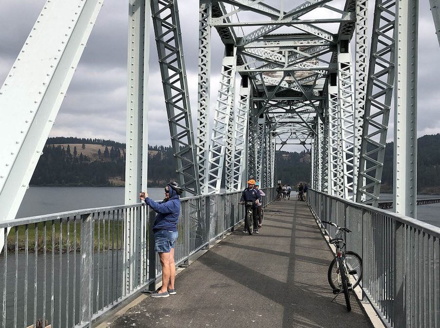
Lewiston Levee Parkway Trail
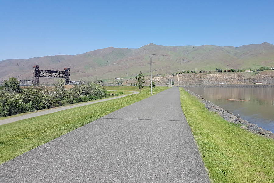
County: Nez Perce
The Lewiston Levee Parkway Trail is a 12.3-mile asphalt trail that extends from Hells Gate State Park on the Snake River, to Locomotive Park on the north side of Lewiston, and then travels across Memorial Bridge to Lower Goose Pasture on the north shore of the Clearwater River. Lewis and Clark’s historic journey through this area on their way to the Pacific Ocean is highlighted on several interpretive signs along the trail. The river corridors offer suitable habitat for several species of waterfowl, including herons, swans and pelicans, and a few mammalian species, such as marmots.
Special acknowledgments: RTC staffers Laura Stark, senior editor; Kevin Belle, Great American Rail-Trail project manager; Marianne Fowler, vice president of policy advocacy
When you subscribe to Rails to Trails magazine, you’ll have access to many other features like this one. Our magazine is a premium of Rails to Trails membership. Join today to start receiving the magazine!


Donate
Everyone deserves access to safe ways to walk, bike, and be active outdoors.


