Top 10 Trails in Maryland
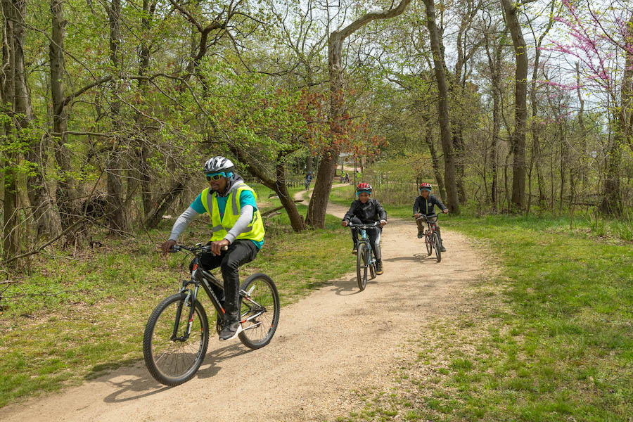
If you’ve been on Maryland’s trails, then you know there’s much more to the state than just crabs, Old Bay and Baltimore Orioles baseball. The Free State offers a host of trail offerings for nearly every user, and its mild winters allow those riders and hikers to make the most of them year-round.
Here are just 10 of our favorite pathways.
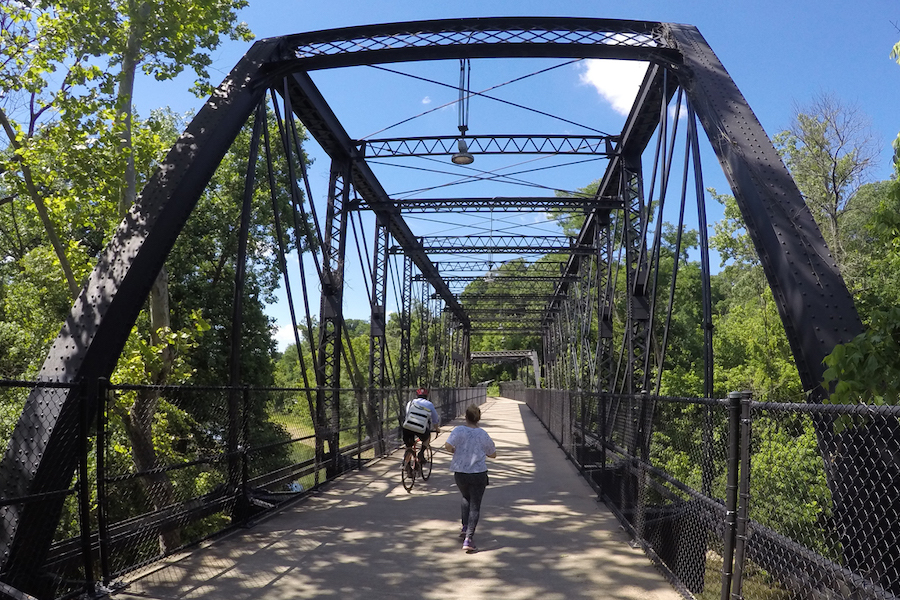
Jones Falls Trail
County: Baltimore City
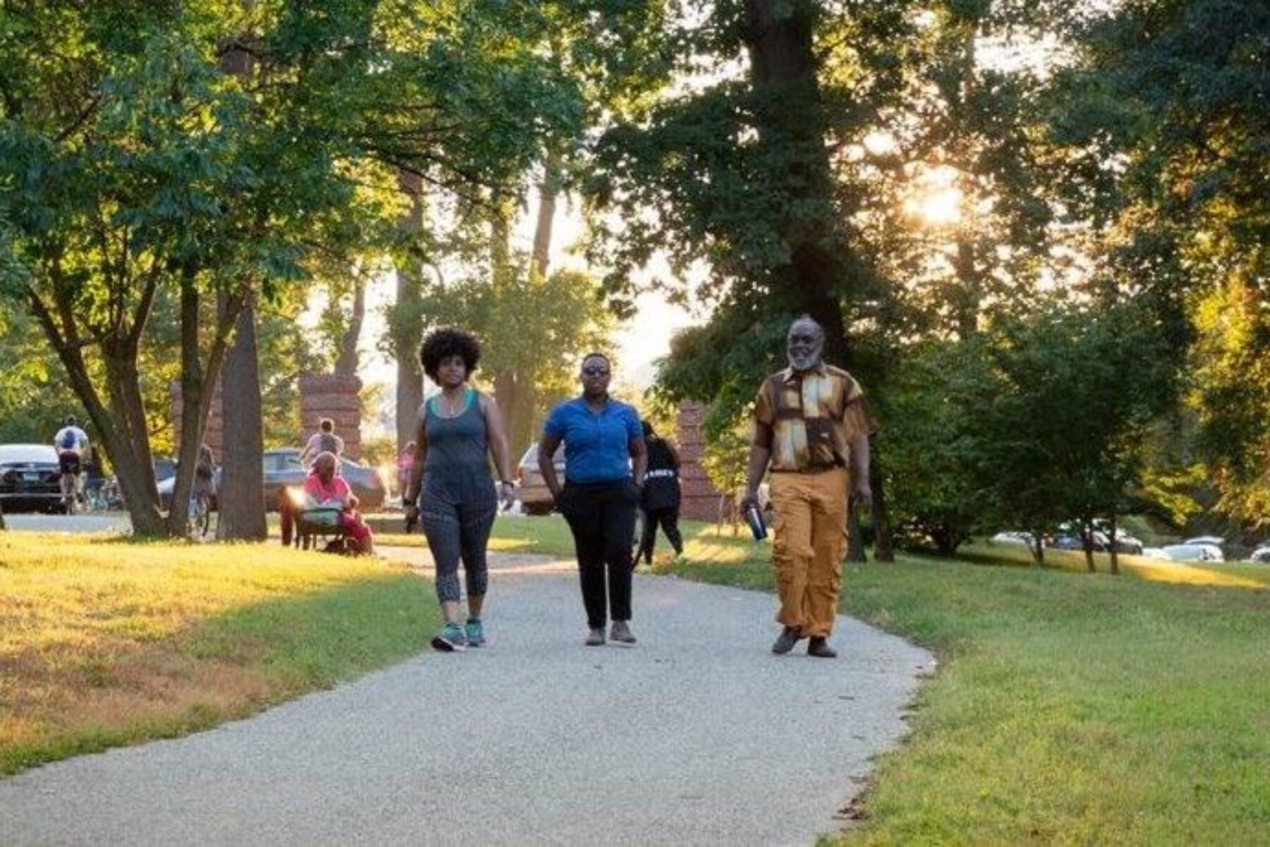
Running mostly along the length of its namesake Jones Falls in Baltimore City, this scenic trail passes through both urban centers and idyllic natural escapes. It can be a challenging journey—specifically for those on bike—if you’re starting at Baltimore’s Inner Harbor; from there it’s a mostly uphill climb for nearly 10 miles before reaching the Mount Washington Light Rail Station. (Luckily, that makes for an easy, quick return to the trailhead!) Most of the route is a dedicated walking and bicycling path, but there are a few spots where people must navigate bike lanes.
A segment of the developing 35-mile Baltimore Greenway Trails Network, the Jones Falls Trail connects with the Gwynns Falls Trail and is also part of the 3,000-mile East Coast Greenway, a growing network of multiuse trails across 15 states and the District of Columbia. The trail passes through Druid Hill Park, which features several fun diversions for families, including the Baltimore Zoo and the Botanic Gardens at Rawlings Conservatory. The park also hosts a few notable festivals: the annual Charm City Bluegrass & Folk Festival, AFRAM (a celebration of African American life, music and culture) and PRIDE.
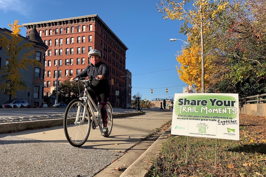
Learn more about our Trail Moments campaign at trailmoments.org and #TrailMoments on social media. Share your story or view a collection of trail moments stories.
Baltimore and Annapolis (B&A) Trail
County: Anne Arundel
Built on the remnants of the Annapolis and Baltimore Short Line built in 1880, the 13-mile B&A Trail is now trafficked by walkers and cyclists instead of freight-filled steam trains. Trail users can exercise their mind as well as their body, thanks to a host of historical markers, the newly refurbished Earleigh Heights Ranger Station (originally built in 1889!), and the Planet Walk, a linear museum about our solar system. Distances between the planets are true to scale, making it fun to hop between them like a bike-ped-powered USS Enterprise. In between astronomy lessons, the trail traverses some relatively mild elevation changes and winds through several suburban parks and neighborhoods. Upon reaching the trail’s end at Glen Burnie, riders wanting to extend their afternoon can hit the John Overstreet Connector to the BWI Trail loop for an additional 12.5 miles around Baltimore-Washington International Airport. The trail’s southern endpoint takes you to the outskirts of Annapolis and all that the historic state capital, situated on the Chesapeake Bay, has to offer. Want to go even further? The trail is part of the massive East Coast Greenway.
Torrey C. Brown Rail Trail
County: Baltimore
Beginning in Cockeysville, Maryland, the Torrey C. Brown Rail Trail ends just over the state line in New Freedom, Pennsylvania, the northern border of the Mason-Dixon Line. From there it becomes the York County Heritage Trail; the two were inducted into the Rail-Trail Hall of Fame in 2015. Perhaps better known locally as the Northern Central Railroad Trail (NCR), reminders of its rail past line the crushed-stone greenway. The nearly 20-mile trail passes by the ruins of Pleasant Valley, a long-abandoned mining village once served by the railroad, and reuses several old bridges that pass over Little Gunpowder Falls, which parallels the southern end of the trail. Anglers and paddlers often use the trail to reach the creek. The canopy of oak and birch trees offer a pleasant respite from the sun during hot summer days.
HALL OF FAME: Maryland’s Torrey C. Brown Rail Trail
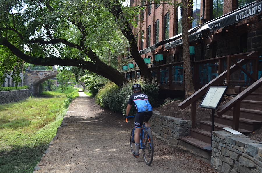
Capital Crescent Trail
Counties: Montgomery, Washington
One of the most heavily used trails in the nation’s capital, the Capital Crescent Trail offers city dwellers an 11-mile sliver of nature. Beginning in the historic Georgetown neighborhood, the trail follows a former freight route of the Baltimore and Ohio Railroad through Bethesda and Washington, D.C., before ending in Silver Spring. The history goes deeper than just the rail line; the Confederate army traveled along much of the route during the Civil War before the Union forced them back down South. A 3-mile section between Bethesda and Silver Spring is temporarily off limits due to a massive infrastructure project (more trails!), but a few detours allow trail users to quickly return to the greenway. When crossing Rock Creek, be sure to stop at one of the bump-outs along the bridge for a nice view. Hitting the connecting Rock Creek Trail will double your mileage for the afternoon.
The Capital Trails Coalition seeks to create a world-class network of multiuse trails that are equitably distributed throughout the Washington, D.C. metropolitan region.
Indian Head Rail Trail
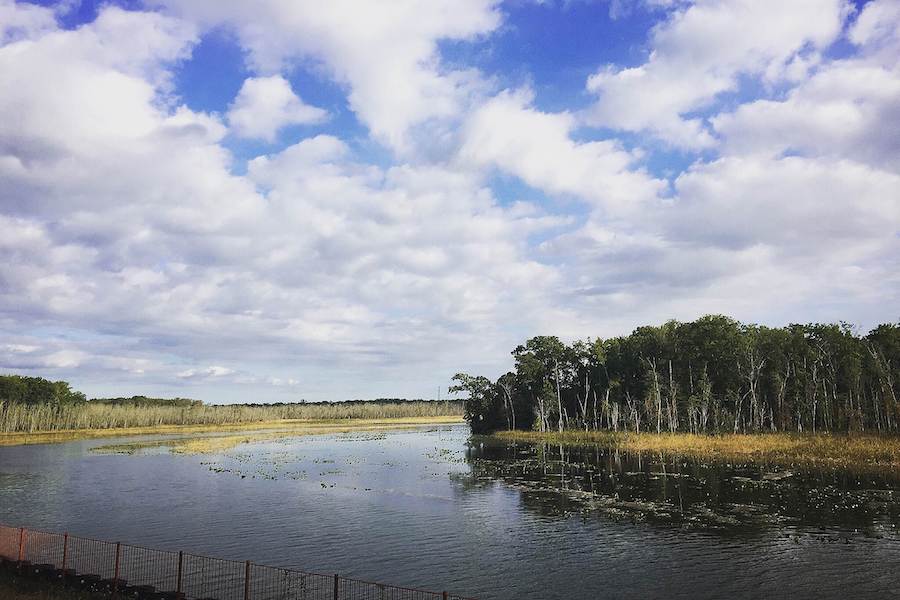
County: Charles
Fans of this tranquil trail south of Washington, D.C. consider it an asphalt time machine, a place where they can experience Maryland as the state was years ago—with plenty of forests, wetlands, creeks and the occasional farm. Near the Mattawoman Creek, trail users can expect to see herons, egrets and, appropriately enough given its location, bald eagles. The 13-mile trail itself is built on an abandoned railroad corridor that used to transport supplies for the Navy’s now-defunct Indian Head Powder Factory.
Ben Cardin C&D Trail
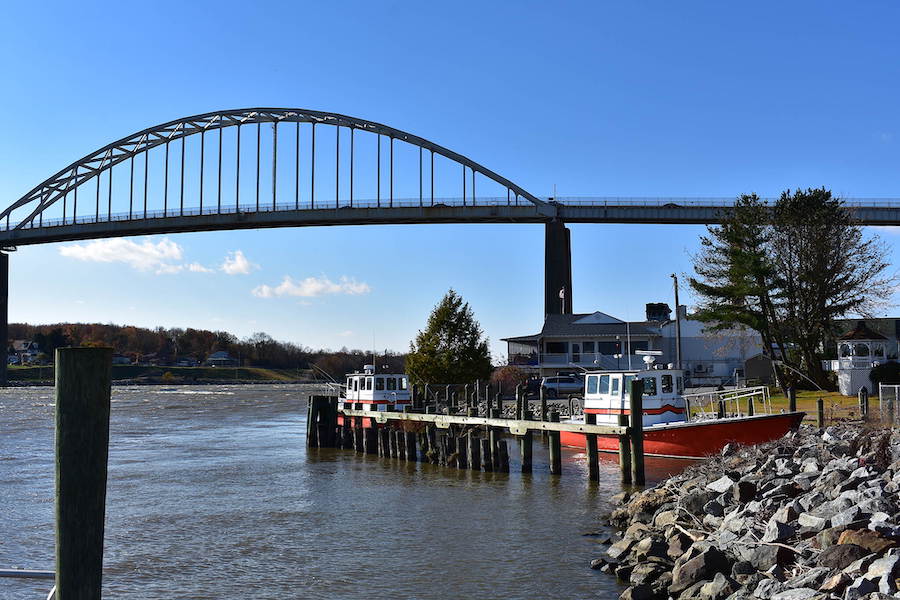
County: Cecil
The Ben Cardin C&D Trail is less than 2 miles long, but it seems like a much longer trail. That’s because it connects to Delaware’s Michael Castle Trail, which adds another dozen miles. Unlike many of the other trails on this list, it’s not built on an abandoned rail line. Its history runs a bit deeper, back to the Chesapeake and Delaware (C&D) Canal built in the early 1800s. But unlike most canals, this one is still in use, making commercial freighters a common site. As you might expect, the trail is mostly flat, with three short hills to keep things interesting. The trail does venture off the canal in a couple of spots in Delaware; locals say those particular spots are great for bird watching. Both the starting point in Chesapeake City, Maryland, and Delaware City, Delaware, have multiple post-ride food-and-drink options.
Assateague Island Bike Path
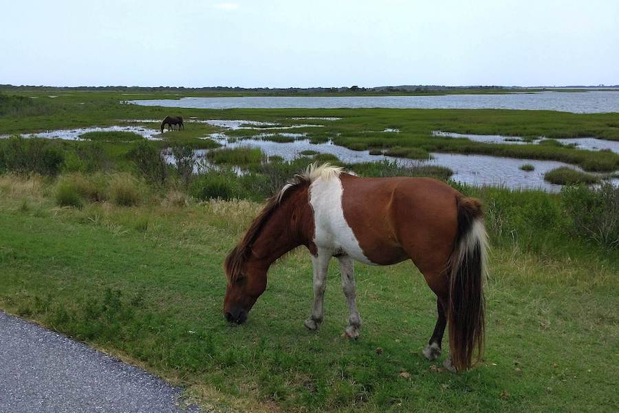
County: Worcester
What this trail lacks in mileage, it more than makes up for in gorgeous views of the surrounding bay, Atlantic Ocean, sandy beaches and island. The 4-mile paved trail starts on the mainland at the Assateague State Park Visitor Center and continues over a bridge onto the island. Maryland controls the northern half of the island, while Virginia technically controls the southern half. On the Virginia side, greenway users can connect to nearly 7 miles of additional trails, one of which is unpaved. The entire island is considered a wildlife refuge thanks to the herd of wild horses that call it home. You may be tempted to pet or feed the horses, but don’t! Remember, they are still wild animals and can react unpredictably. Just enjoy their majestic presence, and keep a safe distance when taking pictures.
BWI Trail
County: Anne Arundel
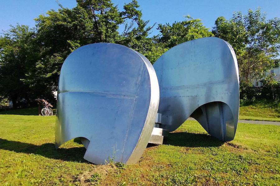
Almost no one enjoys going to the airport, but BWI Trail users might be the exception. The 12.5-mile paved loop surrounds Baltimore Washington International Airport, and you don’t need to be a frequent flier to enjoy the trail. While there is the expected noise coming from jumbo jets landing or straining to take flight, riders and hikers can find a bit more peace and quiet in the section passing through Friendship Park’s pine forest. The Thomas A. Dixon Observation Area, at the north end of the airport near the general aviation runway, is a popular viewing spot for aviation aficionados young and old. Keep an eye out for the modern-art metal sculpture and fenced-in ostrich along the route. Locals often hop onto the connecting Baltimore & Annapolis (B&A) Trail to more than double their afternoon ride.
Anacostia River Trail
County: Prince Georges
This 20-mile route along its eponymous river leads trail users through neighborhoods and nature from Washington, D.C., to Bladensburg, Maryland. One of the highlights is the Kenilworth Park and Aquatic Gardens that offers trail users a spot to take a breather and take in the colorful waterlilies and lotuses. Trail surfaces range from perfectly paved to wooden boardwalks to crushed limestone, so bring along slightly wider tires. Part of a proposed 800-mile network of trails in and around Washington D.C., Maryland, and Virginia spearheaded by the Capital Trails Coalition, the trail splits off at its official terminus and connects to several others in the appropriately named Anacostia Tributary Trail System.
TRAIL OF THE MONTH: Washington, D.C. and Maryland’s Anacostia River Trail (Aug. 2020)
Chesapeake & Ohio Canal Towpath
Counties: Allegany, Frederick, Montgomery, Washington
Nearly every long-distance cyclist has this trail on their bucket list. One of the most popular and heavily trafficked trails in the country, this 184-mile behemoth traverses nearly the entire length of Maryland and is considered a National Park Service National Historic Park, with remnants of the trail’s namesake canal—which has a history going back to the days of George Washington—still visible along the route. Connecting to the Great Allegheny Passage (gaptrail.org), trail users can hike or bike a seamless 334 miles from Pittsburgh to Washington, D.C.—an iconic bucket-list journey for outdoor adventure seekers. Luckily there are plenty of places to eat, drink, and rest just off the trail.
Cumberland—the “meeting place” for the GAP and C&O Canal Towpath, which has Amtrak and a connection to the National Road—is a historic bike-friendly community with signage for trail users, a full-service bike shop, and attractions including a distillery and a brewery.
- Rails to Trails Magazine: Preserving an American Legacy: Chesapeake & Ohio Canal National Historical Park
- Rails to Trails Magazine: How the Great Allegheny Passage Transformed a Region
Special acknowledgments: Jim Brown, former RTC director of trail development; Ethan Abbott, former Baltimore Greenway Trails Coalition project manager
The Baltimore Greenway Trails Coalition seeks to create a 35-mile world-class network of urban trails that link together the diverse neighborhoods, cultural amenities and outdoor resources that make up the landscape of Baltimore City.
When you subscribe to Rails to Trails magazine, you’ll have access to many other features like this one. Our magazine is a premium of Rails to Trails membership. Join today to start receiving the magazine!


Donate
Everyone deserves access to safe ways to walk, bike, and be active outdoors.


