Top 10 Trails in Montana
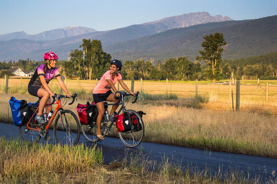
Montana has plenty of room to roam. With roughly 30 million acres of state and federal lands, choosing the path less traveled is a distinct possibility. Wide open spaces take you through rolling grasslands and bucolic farmland, and past peaceful waterways within sight of, if not surrounded by, spectacular mountains. And the trails within towns, such as the former Milwaukee Road that is now part of the Riverfront Trail in Missoula, give users opportunities to explore the nuances of neighborhoods and natural areas within these more populated, but rarely crowded, regions.
With continual improvements on the trail systems throughout the state every year, here is a handful of our current favorites.
Headwaters Trail System
County: Gallatin
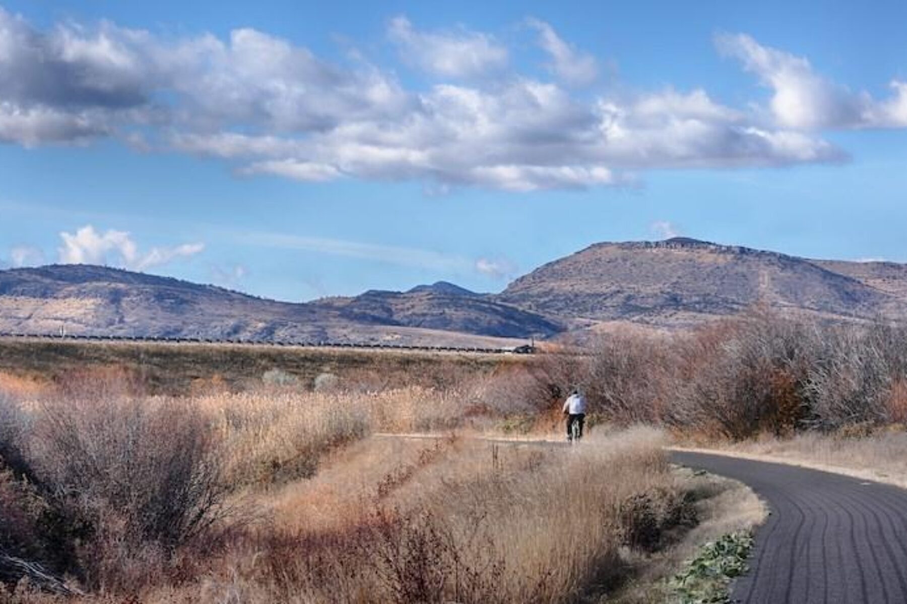
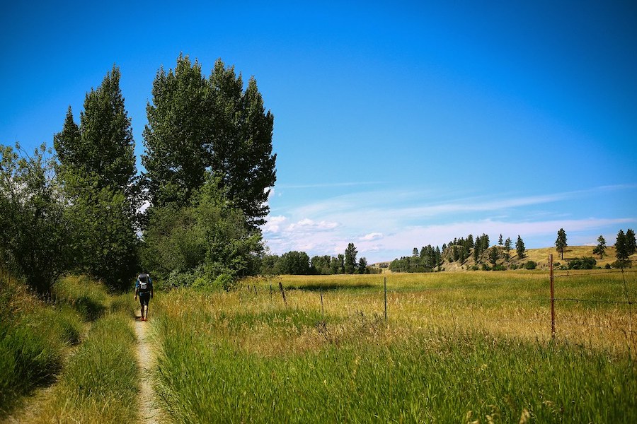
Located in Southwestern Montana, the 11.8-mile Headwaters Trail System connects the Three Forks to the historical and strikingly beautiful Missouri Headwaters State Park. Utilizing the former railbed of the Milwaukee Railroad, the asphalt trail passes through the City of Three Forks, named as such because the Jefferson, Gallatin and Madison rivers converge in this location to form the 2,341-mile-long Missouri River. This area is also one of the campground sites where the Lewis and Clark Expedition camped during their epic journey in July 1806 while mapping the Missouri River.
The route passes through grasslands, ponds and mature cottonwood stands that abound with birds and wildlife, eventually entering the state park and paralleling the Jefferson River with views of the Tobacco Root Mountains to the southeast. Plans are in the works to extend the trail to the Gallatin Valley as part of the developing 3,700-mile Great American Rail-Trail connecting Washington, D.C., and Washington State.
RELATED: Five Top Trails That Make the Case for America’s Recreational Trails Program
Bozeman to Bridger Mountains Trail
County: Gallatin
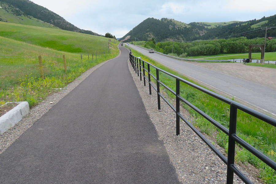
The Gallatin Valley is already a pedestrian- and bicyclist-friendly region, and the 2.1-mile Bozeman to Bridger Mountains Trail, which is also part of the Great American Rail-Trail and the local “Main Street to the Mountains” vision, pieces together the section from the popular “College M” parking area to the Story Mill Community Park. The 40-acre park features a nature sanctuary along the East Gallatin River, including a bird blind, along with fishing ponds, a labyrinth garden, teaching gardens and plenty of areas for children to climb and play. The short ride over smooth, new pavement is a gradual uphill climb traveling from west to east. It travels past homes in a sub-division at one point, and crosses MT 86 at roughly the half-way point, but offers gorgeous views of the Gallatin Mountains.
Old Yellowstone Trail
County: Powell
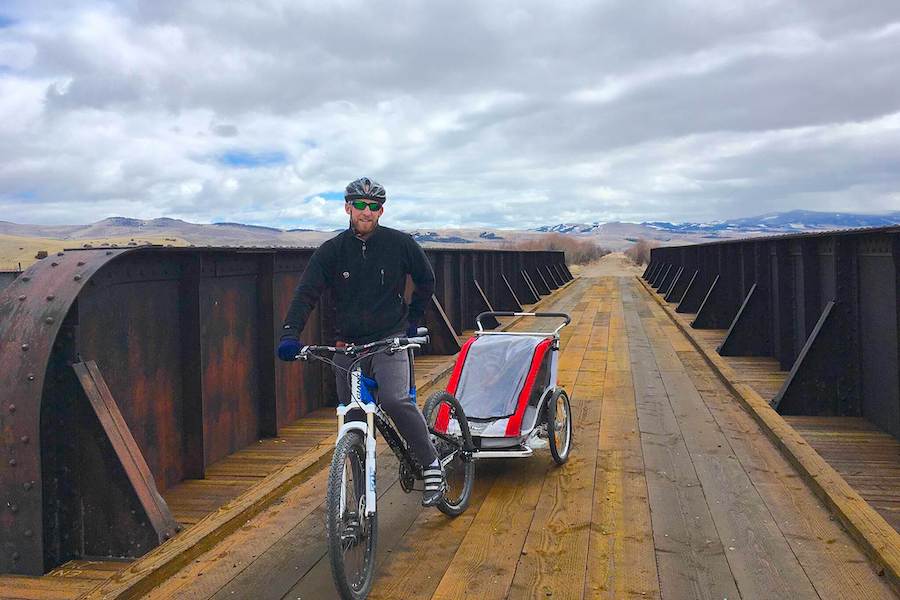
There is plenty to see while traveling the dirt and crushed-gravel path of the historic Milwaukee Road, which stretched from the Pacific to the Midwestern states from 1908 until the mid-1980s. Beginning south of Garrison, with views of the Flint Creek Range, the 7.5-mile Old Yellowstone Trail crosses three refurbished bridges over the Clark Fork River where beavers and birds call home, and the entire area is a haven for wildlife, including elk, deer and moose. With welcomed conveniences, including vault toilets at the end points, as well as benches and picnic tables along the way, it’s an excellent opportunity for walkers, runners and bicyclists to stretch their legs and soak in the scenery. Phase two—which will extend the trail another 4 miles to connect it to the Grant-Kohrs Ranch National Historic Site, a historic working ranch, and the city of Deer Lodge—is slated for completion in 2021.
Riverfront Trail
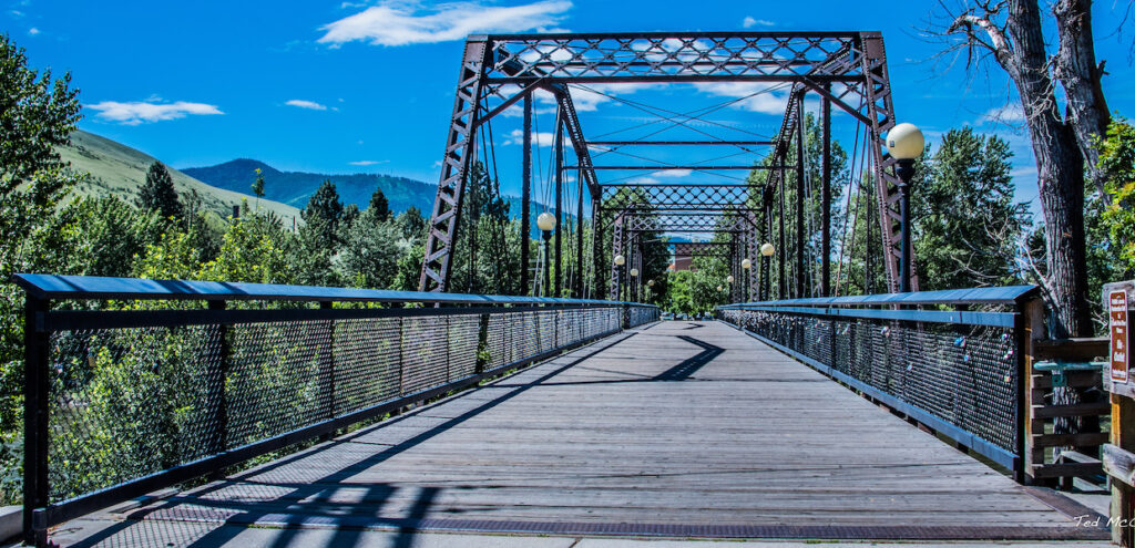
County: Missoula
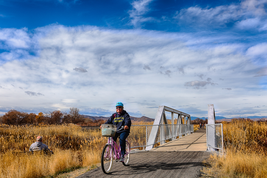
Another section of the Milwaukee Road, the 3.5-mile River Front Trail winds through the heart of Missoula. The partly paved and packed gravel route is relatively flat along both the north and south shores of the Clark Fork River. The trail along the north side passes Caras Park near the Higgins Street Bridge, which is home to the Carousel for Missoula and Dragon Hollow, a favorite children’s park, as well as a location for one of Missoula’s Farmers’ Markets. Crossing the Orange Street Bridge to the south shore, the Clark Fork Natural Area, a haven for birds and wildlife, is an oasis in the middle of town. Also along this route, McCormick Park offers recreational activities and a children’s fishing pond. Just a couple of miles west of McCormick Park, pick up the 1.8-mile long Milwaukee Trail, or at the eastern edge of the trail, connect to the 4.2-mile Kim Williams Nature Trail.
Bitterroot Trail
Counties: Missoula, Ravalli
Between downtown Missoula to Angler’s Roost south of Hamilton, the paved Bitterroot Trail gains a mere 400 feet over 51-miles, making it an ideal route for nonmotorized users. Traveling through the Bitterroot Valley south of out Missoula, this scenic route runs between the Bitterroot Mountains along the west and the Sapphires to the east as it follows MT 93 through the small towns of Lolo, Florence, Stevensville and Victor.
History buffs will enjoy a stop near Lolo at Travelers’ Rest State Park, a well-known campsite of the Lewis and Clark Expedition in 1805 and 1806. In Stevensville, the St. Mary’s Mission, founded in 1841, is touted as the site “Where Montana Began,” and is a beautiful place for a picnic. For a quick side trip, the Lee Metcalf National Wildlife Refuge, a birder’s paradise, is only 2.5-miles outside of Stevensville. Wrapping up in Hamilton, the largest town outside of Missoula in the area, there are plenty of places to find good food or grab a cold drink. It’s also an excellent opportunity to visit the Daly Mansion, home of Marcus Daly, one of the renowned—or rather, notorious—“Copper Kings” of Montana history.
RELATED: Big Bike Country: Experiencing Montana’s Bitterroot and Milwaukee Trails
Great Northern Historical Trail
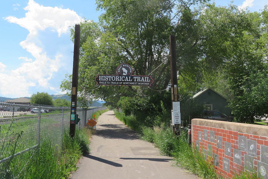
County: Flathead
A nod to the Great Northern Railway in Northwestern Montana, the Great Northern Historical Trail is a tour through a mostly remote, beautiful collection of backdrops, including forests, agricultural fields and historical structures along a 22-mile paved route. The shining mountains of the Swan, Mission, Salish and Whitefish Mountain ranges provide an ever-changing landscape along the way.
Stretching from Kila, the trail passes the Smith Lake Waterfowl Production Area and crosses Ashley Creek as it parallels U.S. Highway 2, into Kalispell ultimately reaching the quaint town of Somers at the shore of Flathead Lake. In Somers, in July and August, roadside stands of freshly picked Flathead cherries make the perfect trail snack. During the winter, the trail, particularly closer to Kila, is popular with snowshoeing and Nordic skiing enthusiasts.
Gateway to Glacier Trail
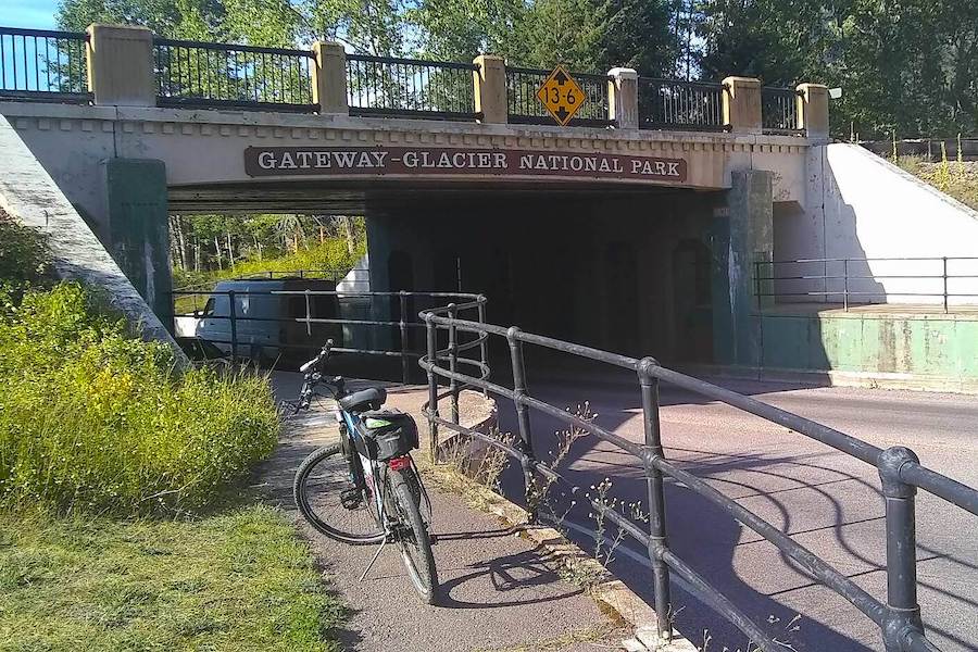
County: Flathead
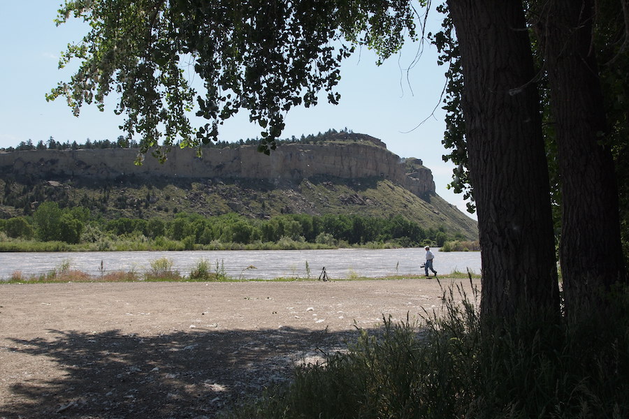
Paralleling US 2, this 10.5-mile asphalt trail isn’t the most idyllic, but the beautiful views of the mountains, including Desert Mountain between Coram and West Glacier, along with the opportunity to see wildlife make the Gateway to Glacier Trail a very worthwhile adventure. The route’s southern trailhead in Hungry Horse also serves as a jumping off point for other local sites in the Flathead National Forest, including the 564-foot-tall Hungry Horse Dam, the locally popular Hungry Horse Reservoir and the Bob Marshall Wilderness Complex.
Heading north, the trail—which has gradual hills—eventually crosses to the north side of US 2 in Coram, and follows a section of “Old Hwy 2,” which is a nice departure from the busier US 2. For the most peaceful experience, an early morning or evening ride is particularly serene. This is also home to black bears and grizzlies, and while run-ins are rare, it is possible to spot them alongside the road.
Tobacco River Memorial Trail
County: Lincoln
The 7.4-mile Tobacco River Memorial Trail follows the Tobacco River and part of the shore of Lake Koocanusa between Riverside Park in Eureka and Rexford, the original “dam town” during the construction of the nearby Libby Dam. This gravel surfaced route is flat and relatively easy for everyone, plus offers multiple benches along the way on which to rest in this wooded setting teaming with wildlife. It’s not unusual to see bears (mostly black bears, but there are grizzlies in the area), deer, moose and bald eagles. Whether starting or ending in Eureka, an engaging side trip is the Tobacco Valley Historical Village, which shares the colorful, living history, ranging from 1880 to the 1920s, of this rugged area.
River’s Edge Trail
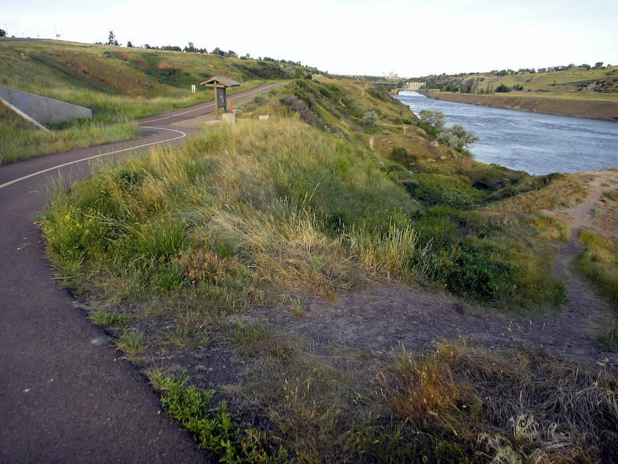
County: Cascade
There is something for everyone along the 55-mile long (and growing) River’s Edge Trail in Great Falls, the largest town in Central Montana. Twenty miles of paved trails accommodate families and those who wish to stick to a hard surface as it travels around city parks and along the Missouri River.
Intermediate mountain bikers can enjoy a ride through the prairie on the South Shore Trail starting at the Lewis and Clark Overlook parking area near Rainbow Dam, while those who seek a challenge can opt for the “Chaos” and “Mayhem” cliff-hugging routes, and travel as far as the Lost Fork Loop. There is plenty of single track on the North Shore, as well, passing eye-catching hoodoos and cruising through the prairie landscape as the trail travels from the Rainbow to the Ryan and Morony Dams.
RELATED: Meet the Newest National Recreation Trails
Jim Dutcher Trail
County: Yellowstone
Beginning on the former rail bed located at Mary Street in Billings Heights, the 6.5-mile Jim Dutcher Trail is a park-plentiful path through several neighborhoods, ultimately leading to a route along the Yellowstone River. A popular start is the heavily wooded Two Moon Park, named for the last Chief of the Northern Cheyenne, toward the northern end of the trail. The path soon parallels the Yellowstone River, offering bird and wildlife sightings, and there is a connection to Alkali Creek Trail near MetraPark just north of Earl Guss Park, which is known for its manmade, yet very natural looking, waterfall and plenty of excellent picnic areas. Continuing south, the trail meets up with the currently 13-acre Coulson Park where the riverboat town of Coulson thrived in the late 1800s, and ends at Mystic Park.
Special acknowledgments: Kevin Belle, Great American Rail-Trail project manager; Marianne Fowler, RTC vice president of policy advocacy; Bob Walker, Montana Trails Coalition; John Juras, Great Falls Bicycle Club; Saara Snow, Adventure Cycling Association
RELATED: Eight Scenic State Parks for RV Camping Along the Great American Rail-Trail
Honorable Mentions
With such a wide variety of terrain in Montana, it is difficult to pick favorites, particularly when some trails are closely connected with others on the list. A perfect example is the Kim Williams Nature Trail in Missoula, which is named after a beloved local naturalist. Connecting to the eastern end of the Riverfront Trail, the Kim Williams Trail is a beautiful 4.2-mile walk or ride along the Clark Fork River, where it’s common to see deer, bald eagles and other wildlife.
In the heart of Montana, the centrally located town of Lewistown boasts the 20-mile Lewistown City Trail System, which meanders through neighborhoods as well as along Big Spring Creek and other natural areas. An 8-mile section of the trail parallels the former railroad bed to allow horseback riders to travel the route, as well. Trout from the Big Springs Fish Hatchery are stocked in the Frog Ponds, making it a good choice to bring along a fishing pole. There is even a small herd of bison behind the Charles M. Russell Wildlife Refuge Headquarters building!
The developing Great American Rail-trail will eventually connect Washington, D.C., and Washington State on a 3,700-mile route that connects some of the most renowned geography, revered cultural and natural treasures, and iconic landmarks in the country.
When you subscribe to Rails to Trails magazine, you’ll have access to many other features like this one. Our magazine is a premium of Rails-to-Trails Membership. Join today to start receiving the magazine!


Donate
Everyone deserves access to safe ways to walk, bike, and be active outdoors.


