California’s Napa Valley Vine Trail
Trail of the Month: April 2022
“The Vine Trail makes it so easy for people to get on the trail and go. You can go car free through the entire Napa Valley.”
—Joel King, board member of the Napa County Bicycle Coalition
It’s remarkable how a single trail brings together an entire region. As California’s Napa Valley Vine Trail grows to reach its ultimate 47-mile potential, community members and visitors realize the beauty of connectivity and accessibility.
Chuck McMinn, founder and president of the Napa Valley Vine Trail Coalition, championed the trail—a vision of practicality and aesthetics—from the beginning. When vacationing throughout the world, McMinn says he and his wife always made it a point to rent bicycles to explore the region. Living in the scenic Napa Valley, he said it struck him, “Why don’t we have a trail like these other places?”
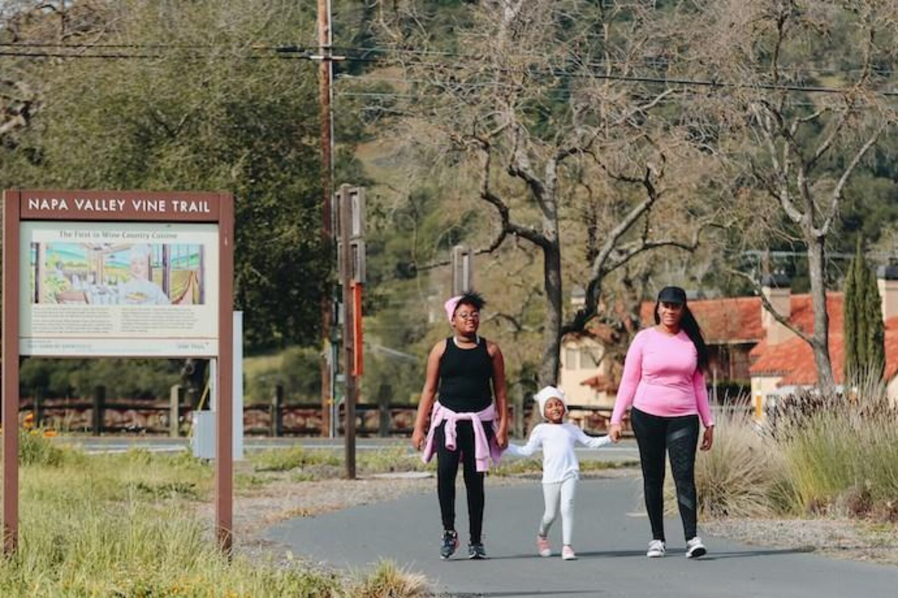
Napa Valley is synonymous with the green, rolling hillsides of classic wine country. There’s a particular appeal to walking or biking between the long-established vineyards, creating a deeper relationship between the people utilizing the trail with the grape growers and vintners who are the heart of the region.
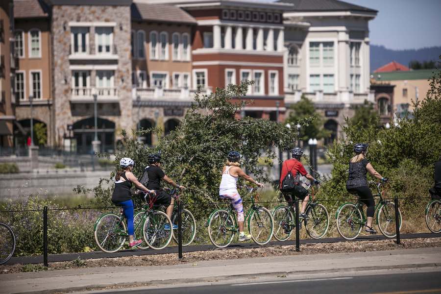
A Trail for All
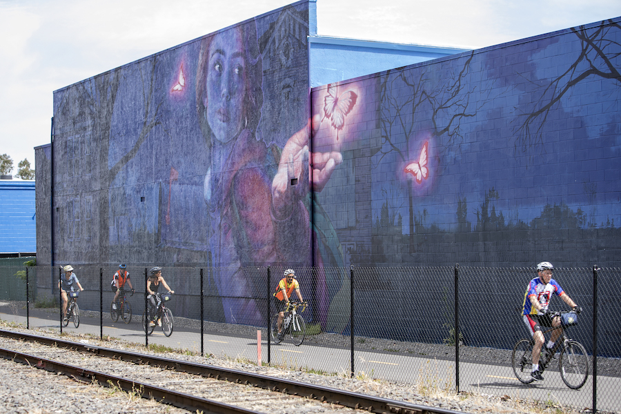
Launched in 2008, the trail currently covers nearly 20 miles, which are open in a few disconnected sections. Beginning in Vallejo, the trail travels north through the City of Napa and its Rail Arts District, an outdoor art exhibit. Lined with vineyards, the paved pathway continues to Yountville, paralleling the Napa Valley Wine Train and State Route 29, offering a safer alternative to sharing the road with vehicles.
In 2022, the gap between Vallejo and the City of American Canyon on the southern end of the route, as well as the section between St. Helena and Calistoga on the northern end, will open, adding another 12 miles. The remaining 15 miles is in the works. By the project’s completion, anticipated by 2025, the Vine Trail will connect two counties (Napa and Solano), five cities and one town, and will link to two expansive regional projects, the Bay Area Ridge Trail and the San Francisco Bay Trail.
“I can’t say enough good things about this project,” said Joel King, board member of the Napa County Bicycle Coalition and avid Vine Trail cyclist. “There are so many benefits.”
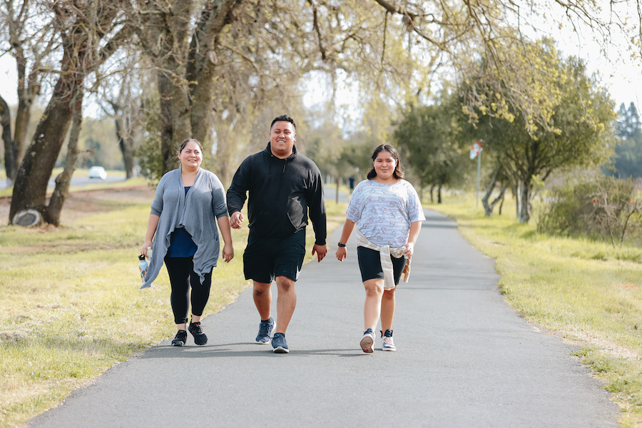
King said prior to his retirement, he bicycled daily to work, and now appreciates the opportunity to pedal into town for errands, as well as use the trail for recreation. Although King is a lifelong bicycling enthusiast, the Napa Valley Vine Trail holds an appeal for all types of trail users, particularly because many residents live within just a half-mile from the route.
“You see a lot of regular people riding on it,” commented King. “The Vine Trail makes it so easy for people to get on the trail and go. You can go car free through the entire Napa Valley.”
Part of a Bigger Picture
The Vine Trail also provides opportunities to reach beyond Napa Valley as part of the Bay Area Ridge Trail, a 550-mile route along the scenic ridges surrounding San Francisco Bay.
King said trail users can bring their bikes to the Vallejo Ferry to reach San Francisco to explore the region through the trail network envisioned by the Bay Area Trails Collaborative (BATC) and Rails-to-Trails Conservancy (RTC). This ambitious project already offers more than 1,400 miles of connected trails out of its 2,604-mile goal.
“Now, having a trail that gets you to the ferry building opens up a whole new world,” King said.
Laura Cohen, RTC’s western regional director, says the Napa Valley Vine Trail is one of BATC’s priority projects. Not only does the growing trail benefit the localities and agricultural region, it’s an important component of this larger TrailNation™ project to increase safe walking, biking and trail access for millions of Bay Area residents.
RELATED:Commuting Across and Exploring the Bay Area Will Become More Accessible to Millions of Residents Via 2,604 Miles of Connected Trails
Celebrating an Agricultural Heritage
Known for its appealing rural landscape, the true beauty of the trail is its open spaces filled with wild and cultivated blooms—particularly the gloriously yellow fields of mustard—scenes of rural life and acres upon acres of grape vines stretching out along trellises. And while tours of the vineyards and wineries have been a favorite activity for decades, there’s an intimacy to traveling under your own power.
“It’s easier when you bike or walk through something because you can get a better look,” said Marion Johnson, marketing director of the Napa Valley Vine Trail Coalition.
With roughly 300 vineyards in the region, McMinn noted that there are 115 within a mile of the trail, bringing together both the vintners and grape growers with those who love them.
“There are many bike tours going to the wineries,” said Johnson. “People want to drink the wine and still be fit. We get great support from the wineries.”
The collaboration makes sense. “We know that 70% of the [trail] users are locals; that means 30% are tourists,” said McMinn. He pointed out that visitors typically spend between $100 and $200 during their trips here, and with the anticipated 3 million annual visitors when the trail is complete, this equates to between $90- and $180-million tourist dollars per year.
The trail also provides a venue to familiarize residents and visitors alike with the agricultural heritage of the region. Since the late 1960s, forward thinking individuals created the Napa County Ag Preserve to ensure that these family farms remained within the landscape. Plus, the AG RESPECT program educates trail users about these long-held traditions and how to respectfully share the space with their neighbors.
Benefits Beyond Recreation
This initial vision of bringing visitors and residents to the heart of Napa Valley brought with it additional benefits from the Vine Trail.
“California was built for the car,” commented Johnson, but noted that many people want options. “If you can connect the communities, you can use it as an alternative transportation route.”
She explained that utilizing the trail to ride to school or work, or to run errands, provides freedom and independence because people are not tied to a vehicle. It’s often commented that people stuck in traffic watch the bicycles on the Vine Trail traveling faster, and with fuel costs rising, it is better for everyone’s budget.
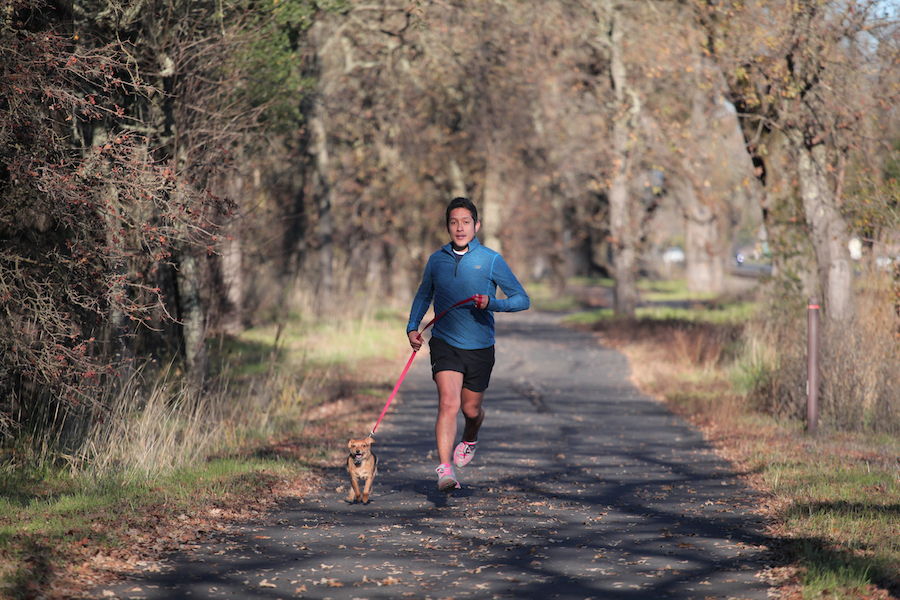
With fewer cars on the road, the reduced emissions are another positive aspect, and for those who frequently use the trail, they reap the perks of exercising outdoors. On top of it all, with 51 educational signs describing local history and ecology, even long-time residents are learning more about their community. Schools are even incorporating the trail as an outdoor classroom.
Creating the Final Pieces
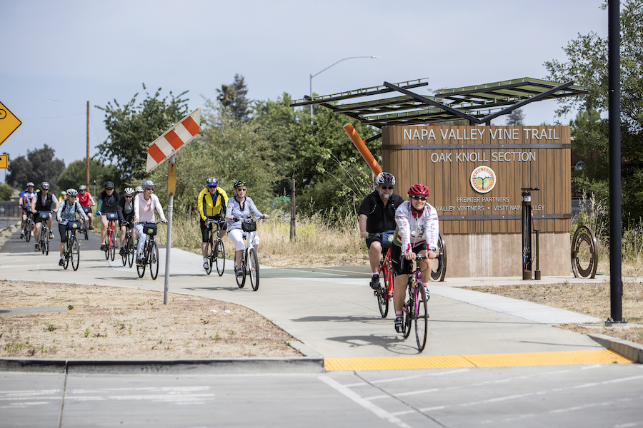
Steady progress continues for the Vine Trail with the goals of completing more sections and adding amenities, such as rest shelters with bike repair stations. Currently, there are stations in Napa and the Oak District, and three additional shelters are planned between St. Helena and Calistoga.
“It’s a big, complicated project,” said McMinn who noted that it’s a collaboration between nearly 30 public and private organizations, including the Rotary Club, Napa Valley Transportation Authority and the Winegrowers of Napa County.
The Napa Valley Vine Trail Coalition is also coming to the table with money, not just ideas. An estimated final cost of the project is $60 million, with roughly 75% coming from state, federal and local grant sources. The coalition is raising the remaining funds.
It’s rare to have the variety of public and private groups working together for the same goal of bringing together a unique region like Napa Valley. Not only can visitors and residents enjoy the immediate benefits of accessibility and connectivity, but the project will allow future generations to do the same.
“It’s a legacy project,” said Johnson. “The trail will be here 100 years.”
Related Links
- Napa Valley Vine Trail Coalition
- Napa County Transportation Authority
- Napa County Bicycle Coalition
- Bay Area Trails Collaborative
Trail Facts
Name: Napa Valley Vine Trail
Used railroad corridor: Approximately 15 miles of the trail parallel the Napa Valley Vine Train to the vineyards. Originally built in 1864 by wealthy entrepreneur Samuel Brannon, the rail line carried visitors to his spa in Calistoga. It was purchased in 1885 by the Southern Pacific Railroad to transport passengers in the region, with the Napa Valley Wine Train Inc. purchasing the line in 1984.
Trail website: Napa Valley Vine Trail Coalition
Length: Currently, 18.5 miles of the planned 47-mile route is open. By the end of 2022, 32 miles will be open.
Counties: Napa, Solano
Start point/end point: The trail is currently open in a few disconnected segments. Upon completion (slated for 2025), the trail will begin on its south end at the Vallejo Ferry Building (289 Mare Island Way, Vallejo) and finish on its northern end at Washinton Street in Calistoga.
Surface type: Asphalt and concrete
Grade: The trail has a grade of approximately 2%, rising as you travel from south to north.
Uses: Walking, biking and inline skating; wheelchair accessible
Difficulty: With a mostly level grade and entirely paved route, the established sections of the trail are ideal for nearly everyone. Difficulty may come in navigating the gaps in the trail, which are not currently signed; travelers must bike on road or drive between the completed sections.
Getting there: The closest commercial airport is Sonoma County Airport (2200 Airport Blvd., Santa Rosa), which is about 35 miles from Yountville on the northern end of the trail. Oakland International Airport (1 Airport Drive, Oakland) is about 40 miles from the trail’s southern end in Vallejo. The San Francisco/Vallejo Bay Ferry also offers a way to reach the Napa area from the San Francisco area.
Access and parking: Parking is available at several points along the Napa Valley Vine Trail, including (from south to north):
- Vallejo: Vallejo Ferry Building (289 Mare Island Way)
- American Canyon: Veterans Memorial Park (2801 Broadway St.)
- Napa: Kennedy Park (3291 Streblow Drive)
- Yountville: Yountville Park (2900 Lincoln Ave.) and Veterans Memorial Park (6465 Washington St.)
To navigate the area with an interactive GIS map, and to see more photos, user reviews and ratings, plus loads of other trip-planning information, visit TrailLink.com, RTC’s free trail-finder website.
Rentals: Bike rentals are available from Napa Valley Bike Tours, which has two locations: Yountville (6500 Washington St.) and Napa (950 Pearl St.); the phone number is the same for both shops: 707.251.8687. Additional options include: St. Helena Cyclery (1156 Main St., St. Helena; phone: 707.963.7736) and Napa Valley Velo (145 Gasser Drive, Suite D, Napa; phone: 707.927.5486).


Donate
Everyone deserves access to safe ways to walk, bike, and be active outdoors.


