20 Iconic Bike and Pedestrian Bridges in America
Special acknowledgements to: Kevin Belanger, Ken Bryan, Marianne Wesley Fowler, Ben Kaufman, Kevin Mills, Yvonne Mwangi, Eric Oberg, Anya Saretzky and Tom Sexton for their assistance with this piece.
Across the country, bridges are literally serving as gateways for communities to achieve critical strides in active transportation, conservation and economic development. Here, we take a look at 20 iconic bridges and trestles in the United States (in no particular order) that have played—or are playing—transformative connectivity roles in their regions.
For a more in-depth look at the impact of some of these hallmark connectors, check out Rails to Trails magazine’s Spring/Summer 2022 cover story, “Bridge to Everywhere.”
St. Anthony Falls Stone Arch Bridge (Minneapolis, Minnesota)

Built in 1883 for the Great Northern Railroad, the St. Anthony Falls Stone Arch Bridge in Minneapolis—a key link in the St. Anthony Falls Heritage Trail along the Mississippi River—was transformed into a pedestrian and bicycle path in the 1990s, thanks in part to a $2 million grant through Transportation Enhancements (TE, now known as Transportation Alternatives, or TA). Together with the Recreational Trails Program, TA is the nation’s legacy federal funding program for trails and active transportation. The stone arch bridge is one of the earliest examples of the impact of TE/TA, which has supported 40,000+ trails and walking and bicycling projects to date.
Of note: The bridge was built with a 6-degree curve at its west end to enable its work around St. Anthony Falls and is a National Historical Civil Engineering landmark.
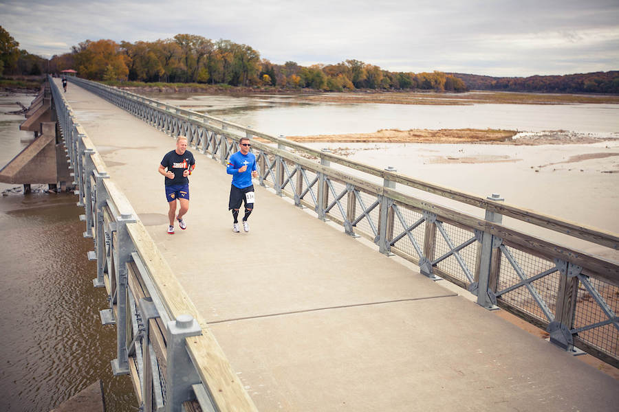
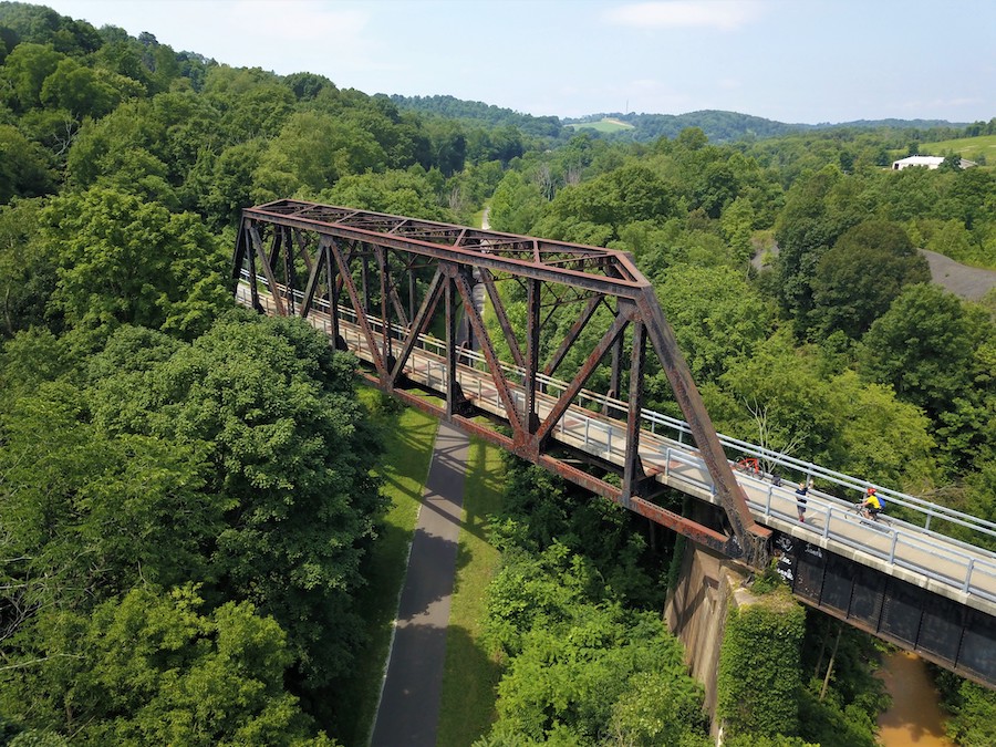
Cowboy Recreation and Nature Trail (Nebraska)
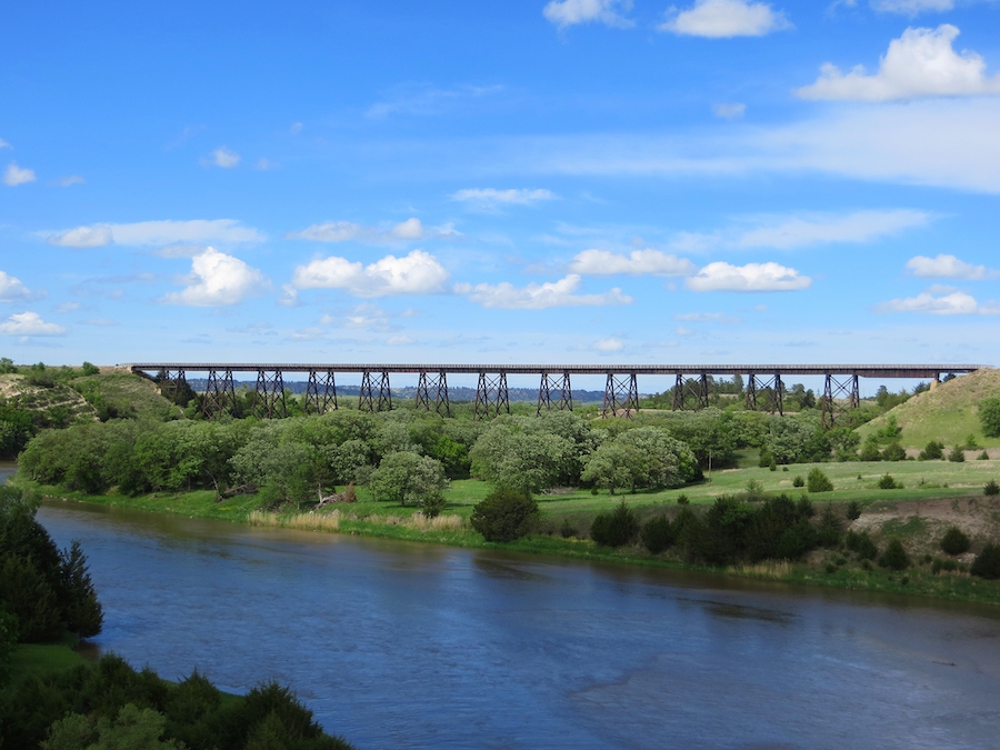
The developing 200-miles-plus Cowboy Recreation and Nature Trail is one of the country’s longest rail-trails, connecting seven counties in Nebraska and comprising 200+ bridges that provide crucial passage along the former Chicago and Northwestern Railway corridor. The trail is also a gateway of the 3,700-mile Great American Rail-Trail®, which will one day connect Washington, D.C., and Washington State.
Perhaps the most well-known trestle of the route can be found in the section that begins in Valentine and crosses over the Niobrara National Scenic River. The 148-foot-tall, 0.25-mile-long historic railroad bridge provides sweeping views of the river and the wider area, where multiple major ecological systems meet, including tall grass, mixed grass and Sandhill prairielands.
Government Bridge (Illinois and Iowa)
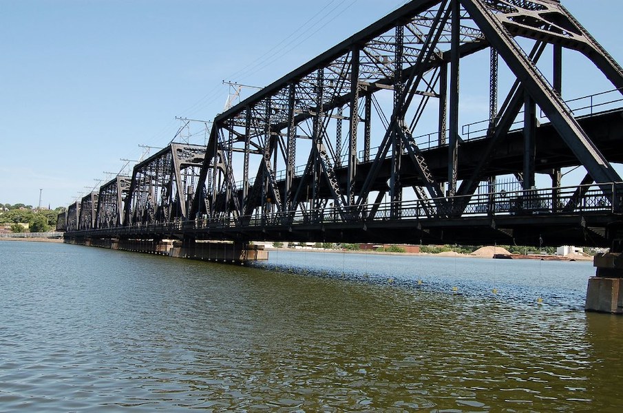
Between Rock Island, Illinois, and Davenport, Iowa, is the Government Bridge—a 1,854-foot-long structure capable of swinging a full 360 degrees to accommodate traffic on the Mississippi River. Built in 1896, it is the fourth and final iteration of the first Mississippi River crossing ever completed.
Also known as the Arsenal Bridge due to its connection to the Rock Island Arsenal, the bridge comprises two levels: an upper deck with two railway lines and a lower deck for automobiles, walkers and bicyclists. For further connectivity, the bridge connects with the Mississippi River Trail in Iowa and the Great River Trail in Illinois—and all three are hosts for the cross-country Great American Rail-Trail.
Wendy Park Bridge (Cleveland, Ohio)
Championed by Cleveland Metroparks Commissioner Dan Moore, the Wendy Park Bridge—recently completed in 2021—provides a long-anticipated critical link between the Cleveland Flats and the Lake Erie waterfront along the Cleveland Foundation Centennial Lake Link Trail.
Of note is the safe walking and bicycling access the bridge now provides, for the first time in decades, between local public housing and the lakefront by way of Whiskey Island, a premier coastal natural habitat in the region. The bridge also stands as a key piece of infrastructure along the Industrial Heartland Trails Coalition’s developing Cleveland–Pittsburgh corridor, which will eventually link the Pittsburgh riverfront and the Lake Erie shoreline via 200 miles of trails.
The bridge was named in honor of Dan Moore’s late daughter Wendy, who passed away in 1997.
Big River Crossing (Memphis, Tennessee)
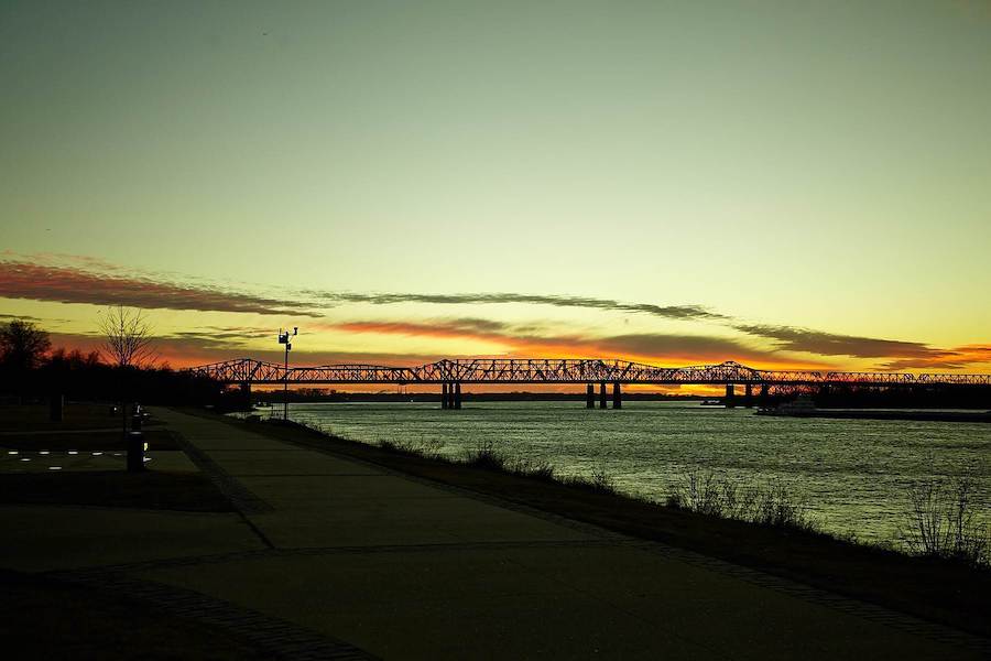
The 4,973-foot-long Big River Crossing (BRX), which opened in 2016, now serves as a key gateway over the Mississippi River for cyclists and pedestrians traveling between Main Street in Memphis and Main Street in West Memphis, Arkansas. Formerly known as the Harahan Bridge, the BRX boasts the distinction of being the longest public pedestrian bridge across the Mississippi and—as host to an active Union Pacific rail line—the longest active rail/bike/pedestrian bridge in the country.
Also serving as a trailhead for the 70-mile Big River Trail, the BRX was instrumental in inspiring further sustainability efforts in the region in the form of the Big River Strategic Initiative, which includes a 42-mile trail extension and major wetland preservation efforts via the Big River Park Conservancy project.
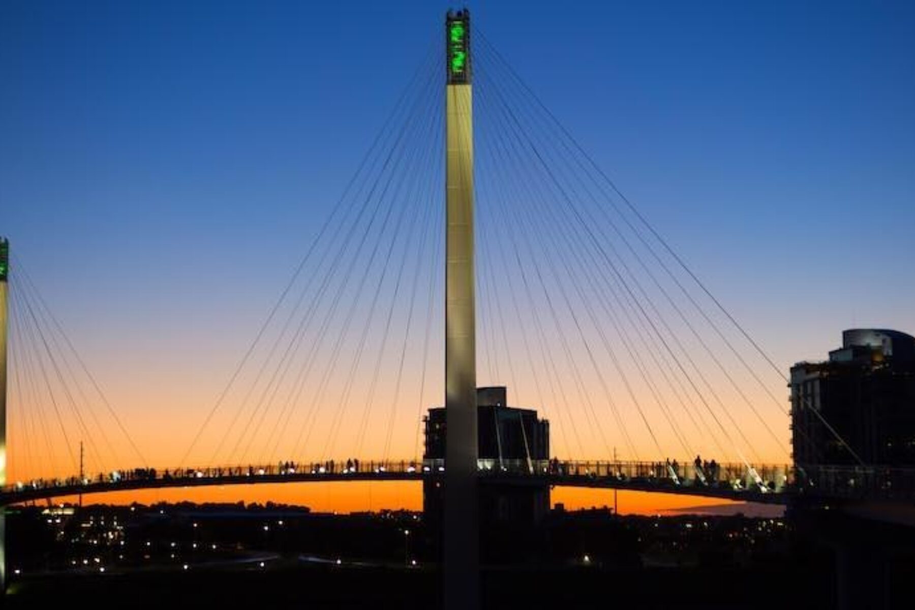
Bob Kerrey Pedestrian Bridge (Nebraska and Iowa)
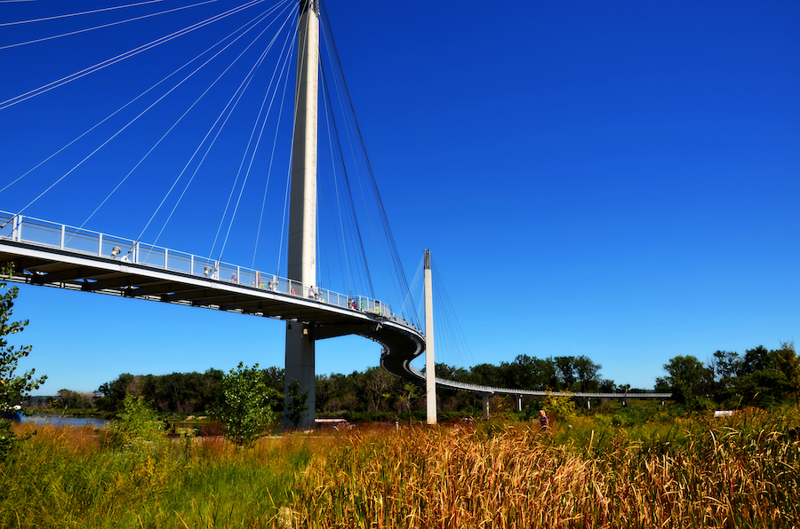
The 3,000-foot Bob Kerrey Pedestrian Bridge (or “Bob” as it’s known locally) was declared a “bridge to nowhere” by local residents when it debuted in 2008 as a gateway across the Missouri River between the Iowa Riverfront Trail in Council Bluffs, Iowa, and the Omaha Plaza in Nebraska—but with no links to downtowns. Today the architecturally stunning structure is a destination in its own right and a catalyst for other connectivity efforts.
Its demonstrated value as a bike and pedestrian route and tourism draw has helped spark new projects, including a connection into Omaha in the form of a new bridge called the “Baby Bob,” currently in development. The short (0.1-mile) but impactful connector will provide a safe crossing over railroad tracks and roads between big Bob and the North Downtown area. Big Bob also serves as a host trail in the 3,700-mile Great American Rail-Trail.
RELATED: Nebraska and Iowa’s Bob Kerrey Pedestrian Bridge
John Lewis Memorial Bridge (Seattle, Washington)
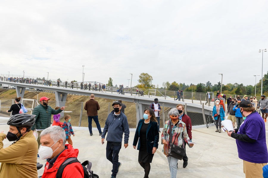
Years of planning culminated in the 2021 opening of this game-changing bike and pedestrian bridge in the Northgate area of Seattle, Washington, which had been historically divided for years by busy Interstate 5.
Funded by the Levy to Move Seattle and many local and regional partners, the 1,900-foot bridge now connects the community of Maple Leaf, the Northgate retail center and the Northgate Link light rail station on the eastern side of I-5 to Licton Springs and North Seattle College to the west. The bridge is anticipated to have a major impact on connectivity and mobility for residents, employees, commuters, students and visitors in the Northgate area. Check out this great video to learn more.
Beverly Bridge (Washington)
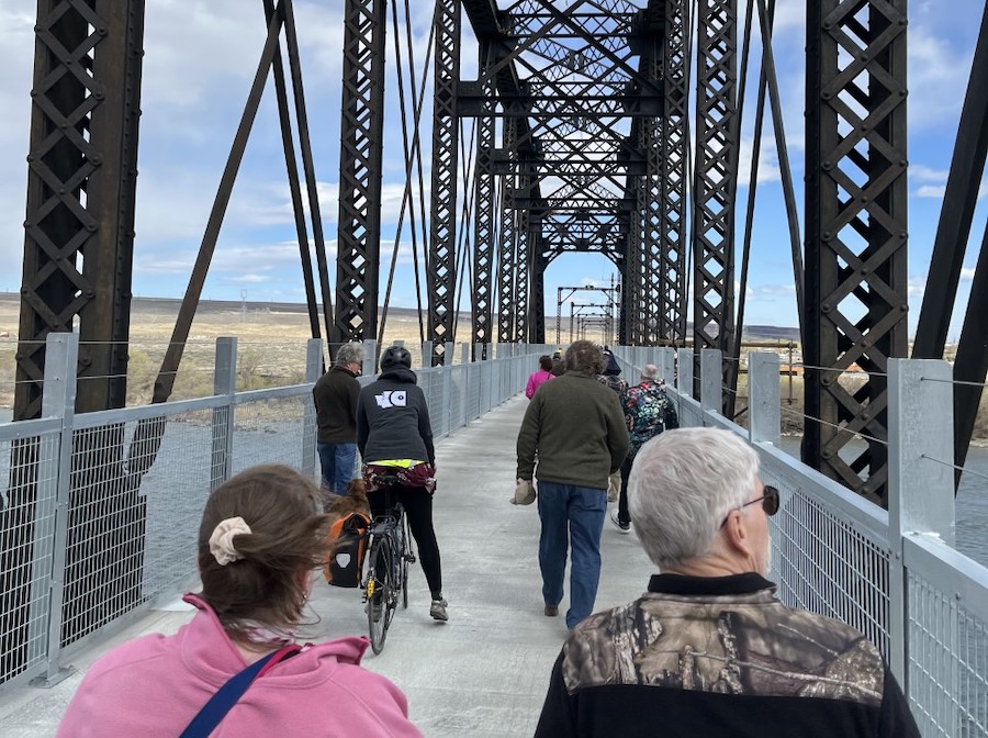
The $5.5-million retrofitting of the Beverly Bridge, located along the route of the 285-mile developing Palouse to Cascades State Park Trail, has transformed the tourism potential of the trail as a cross-state corridor. Formerly dedicated in April 2022, the bridge now serves as a critical gateway for equestrians, walkers and bicyclists on both sides of the Columbia River at a crossing that had been essentially impassable without vehicle support since the closure of the Chicago, Milwaukee and St. Paul Railroad in the 1980s.
The Palouse to Cascades trail is a host trail of the 3,700-mile Great American Rail-Trail, and the completion of the Beverly Bridge marks the filling in of a key gap in the cross-country trail route. Read about the ribbon cutting for the Beverly Bridge.
Lied Bridge (Platte River Connection) (Nebraska)
Reopened in July 2021 after incurring flood damage several years ago, the 1,714-foot-long Lied Bridge (Platte River Connection)—a converted Rock Island Railroad trestle—is a short but critical route in the region for trail connectivity.
On its north side, the bridge connects to the 13-mile MoPac Trail (Springfield). Trail managers for the 5.3-mile MoPac Trail West (which joins with the 22-mile MoPac Trail East in Lincoln) hope to eventually connect the route to the southern side of the Lied Bridge in South Bend, thus filling in a critical gap in a potential seamless off-road walking and bicycling route between Lincoln and Omaha along the Great American Rail-Trail.
Purple People Bridge (Ohio and Kentucky)
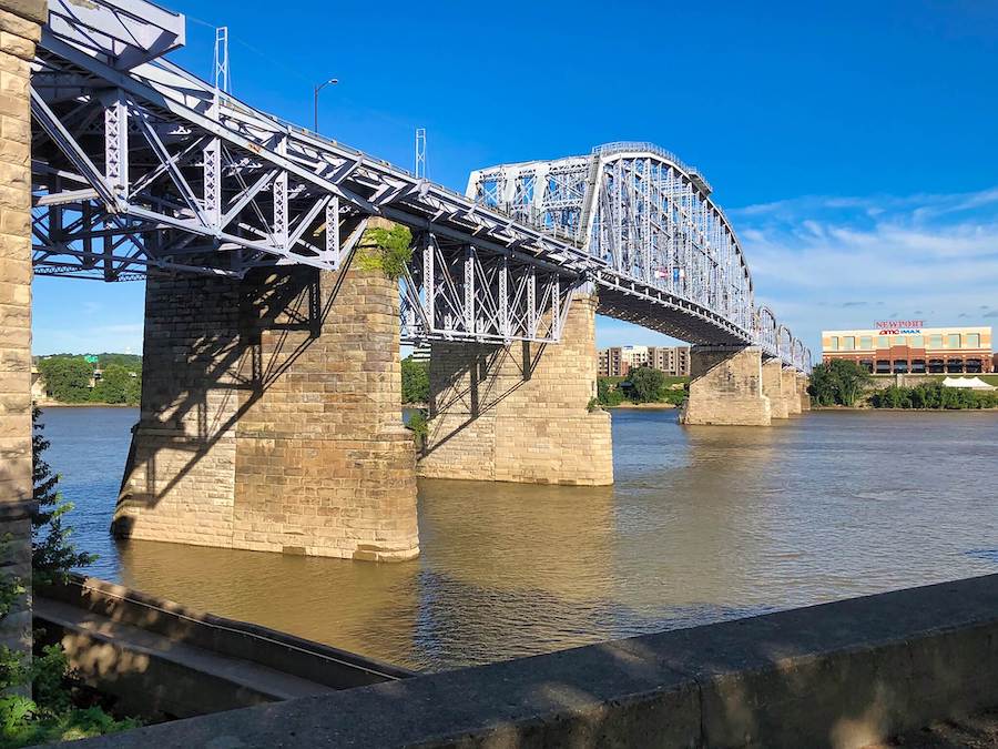
Connecting Newport, Kentucky, with Cincinnati, Ohio, the historic half-mile Purple People Bridge (or Newport Southbank Bridge)—created in 1872 as part of the Louisville and Nashville Railroad and opened as a pedestrian crossing in 2006—serves not only as a vital recreational connection, but also as a landmark, event space and economic generator featuring magnificent views of the skyline on both sides as well as some of the region’s premier cultural attractions.
Fun Fact: The color purple was a top choice by people in more than a dozen focus groups convened for residents to help choose how the bridge should look!
Scioto River Hilltop Bridge Connector (Columbus, Ohio)
Along the route of the Great American Rail-Trail, the Scioto Trail provides 12 miles of safe walking and bicycling access in Columbus along the trail’s namesake river. The trail is also a part of two larger visions, including Central Ohio Greenways efforts to connect 230 miles of trails in the region, and the in-progress 326-mile Ohio to Erie Trail, which—when complete—will provide an off-road route from the Ohio River in Cincinnati to Cleveland and Lake Erie.
The 550-foot-long Scioto River Hilltop Bridge Connector is an important link enabling safe foot and bike traffic across the river and CSX Railroad tracks—connecting the Scioto Path with the west side of Columbus and the Camp Chase Trail, which stretches a further 16 miles to London.
Bridge of Dreams (Ohio)
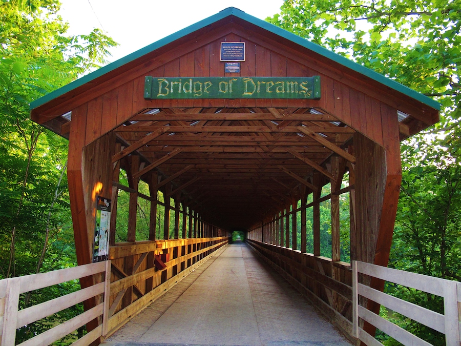
Also along the 3,700-mile Great American route, the 370-foot covered Bridge of Dreams serves as a prime attraction of the 4.8-mile Mohican Valley Trail in Knox County, Ohio. Further connections can be made locally and regionally, as the trail connects to the Kokosing Gap Trail in Danville, and both trails are part of the larger developing 326-mile Ohio to Erie Trail.
Fun Facts: The bridge got its name from skeptics who claimed proponents of covering the bridge—which was dedicated in 1999—were “dreaming.” It is also the second-longest covered bridge in Ohio and the third-longest covered bridge in the United States.
Seven-Mile Bridge, Florida Keys (Florida)
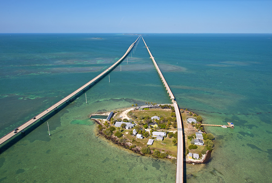
“Henry Flagler’s Florida Keys Overseas Railroad was a marvel in its day, a feat of engineering connecting mainland Florida to the country’s southernmost point 90 miles away in Key West,” wrote author Skye Sherman in a January 2022 Travel + Leisure article. This includes the stretch now known as the Old Seven Mile Bridge between Marathon and Pigeon Key.
After the old bridge closed in 1982—replaced by a new Seven Mile Bridge—it served as a recreational amenity until 2017, when it began the process of a $44 million renovation. In January 2022, it reopened to walkers and bicyclists, many of whom trek to Pigeon Key, a National Historic Landmark, to learn about the five-acre island that housed the 400 workers who constructed Flagler’s railroad.
Kinzua Bridge Skywalk (Pennsylvania)
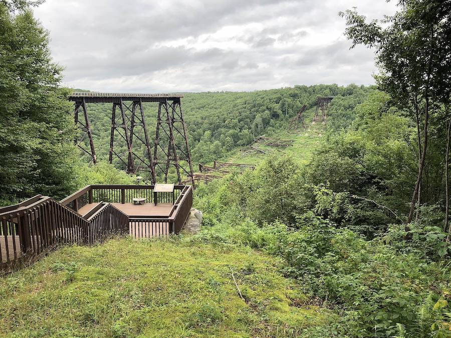
According to TrailLink™, the Kinzua Bridge—at 301 feet high and 2,053 feet long—was the tallest and longest railroad bridge in the world when it was built in 1882. First opening to foot traffic in 1970 and undergoing restoration in 2002, the stunning, historic bridge was struck by a tornado in 2003 that left part of it in ruins.
Today, pedestrians can experience the bridge’s breathtaking views via a 600-foot skywalk, constructed in 2011, as well as check out remnants of wreckage from the old bridge that still remain in the gorge below. A 3.8-mile section of the Knox Kane Rail Trail provides a seamless crushed-stone connection between Mount Jewett and Kinzua Bridge State Park.
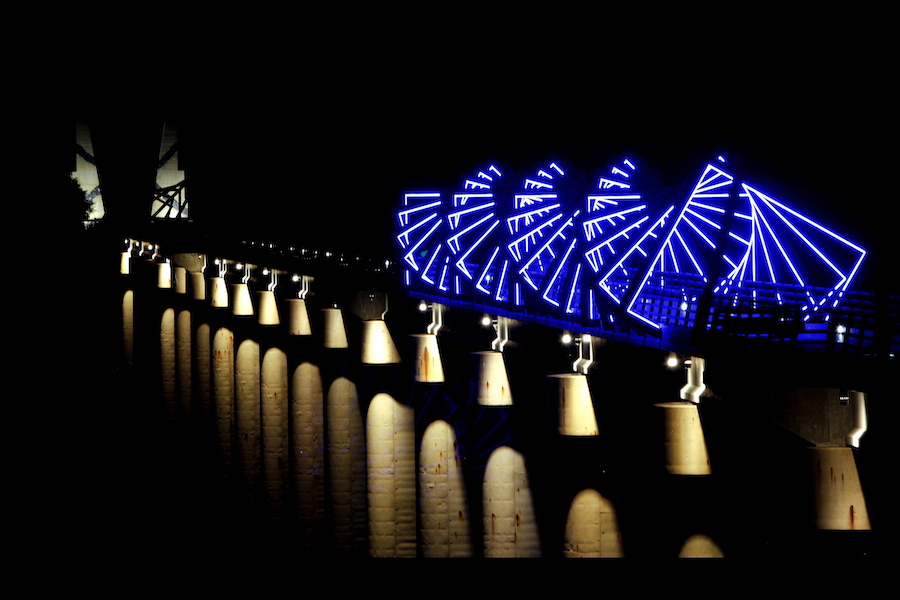
High Trestle Trail (Iowa)
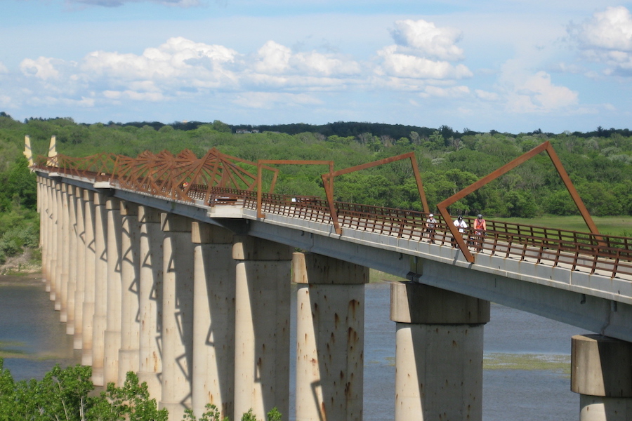
Iowa is a legacy state for trails, having been the first state ever to railbank a rail corridor for trail development—a practice that’s been responsible for making nearly 200 rail-trails possible to date. One of the brightest stars of the state’s trail system is the 30-mile High Trestle Trail, which features an iconic half-mile, 13-story-high bridge over the Des Moines River.
Situated along (and above) the bridge is a unique art installation by famed designer David Dahlquist. Magnificently lit at night by a series of blue LED lights, the installation, titled “From Here to There,” is designed to look like a coal shaft in honor of the region’s industrial past. The bridge’s appeal as a tourist attraction—and as a place for special memories—brings in approximately 250,000 users each year (as of 2018).
The High Trestle Trail also serves as a host for the Great American Rail-Trail.
Related: Trail of the Month – July 2016: Iowa’s High Trestle Trail
Big Four Bridge (Kentucky and Indiana)
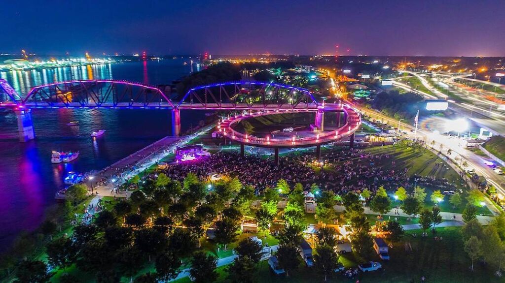
The half-mile Big Four Bridge, connecting Louisville, Kentucky, and Jeffersonville, Indiana, was reopened as a pedestrian bridge in 2013 after the former rail corridor on which it sits—the Cleveland, Cincinnati, Chicago & St. Louis Railway (hence the nickname “Big Four Railroad”)—had seen decades of disuse following its closure in the 1960s.
Wrapped in a vibrant LED lighting system, the Big Four Bridge is a popular city landmark, nighttime beacon and recreational amenity that sees some 1.5 million users annually. On the Kentucky side, the bridge connects to the Louisville Riverwalk, with further connections into downtown along the Ohio River.
McDonald Trestle (Southwest Pennsylvania)
The 61.5-mile Montour Trail is one of the longest suburban rail-trails in the United States, forming a semicircle around the Greater Pittsburgh region in Southwest Pennsylvania. It is also a key connector trail in two massive trail network projects on the regional and national scale: the 3,700-mile Great American Rail-Trail.
A signature site of the Montour Trail is the 900-foot McDonald Trestle, which features stunning viewscapes of the area’s famous foliage (green in the summer—golden in the fall) while providing safe crossing over multiple roadways, a tributary of Chartiers Creek and the 29-mile Panhandle Trail.
Benjamin “Ben” Franklin Bridge (Pennsylvania and New Jersey)
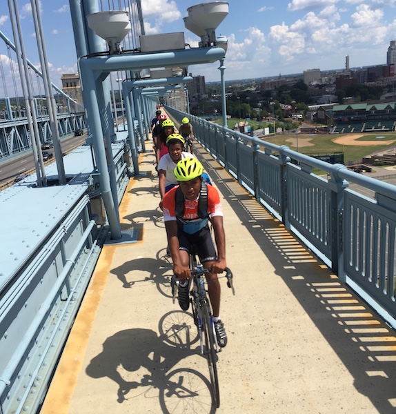
Opened in 1926 to accommodate automobiles and streetcars crossing the Delaware River between Philadelphia and Camden, New Jersey, the Ben Franklin Bridge now serves as a key river gateway for walkers and bicyclists, with separated pedestrian lanes on either side of its 1.3-mile expanse (which hosts I-676/US 30).
The structure—which was once the longest suspension bridge in the world—features sweeping views of the Philadelphia skyline and is extremely popular with both commuters and tourists. At its east bank, users can pick up the 1.2-mile Ulysses Wiggins Waterfront Park Promenade for riverfront access. Both trails are part of the Circuit Trails, an 800-mile trail system that will eventually connect the Greater Philadelphia–Camden region.
Manayunk Bridge (Philadelphia, Pennsylvania)
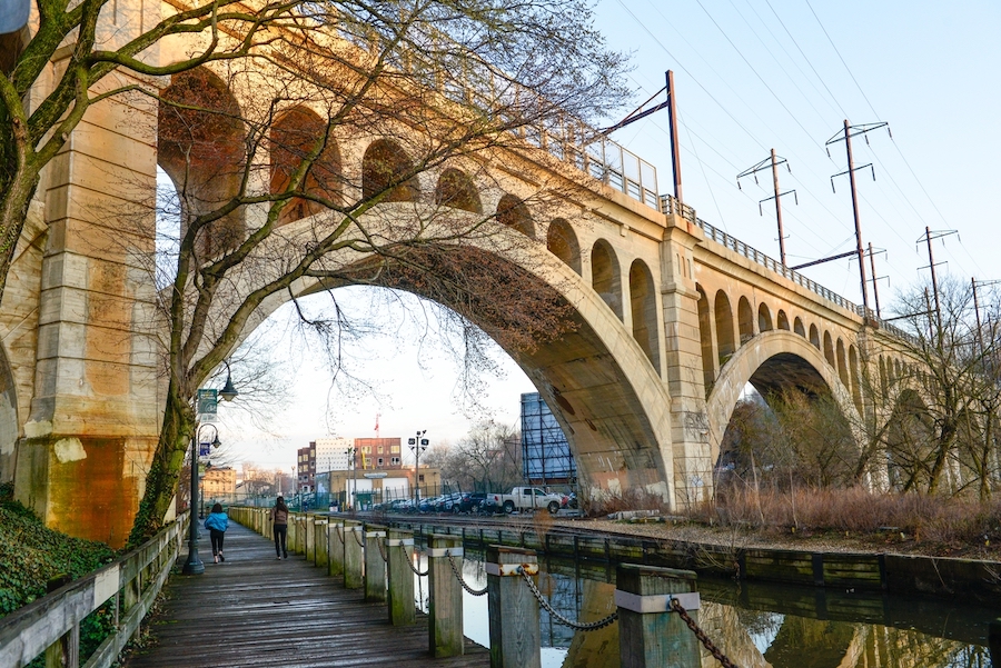
The historic Manayunk Bridge Trail, formerly part of the Pennsylvania Railroad, opened in late 2015 after decades of stagnation—providing a long-sought, safe walking and bicycling connection across the Schuylkill River and the busy Schuylkill Expressway for two Philadelphia communities and hundreds of thousands of trail users.
Locally, the bridge provides a direct connection between Manayunk and Bala Cynwyd, where one can take a further 1.8-mile trail leading to the Cynwyd SEPTA station. The Manayunk Bridge Trail is also part of the developing Circuit Trails network, which will eventually traverse 800 continuous miles in Greater Philadelphia and Camden, New Jersey.
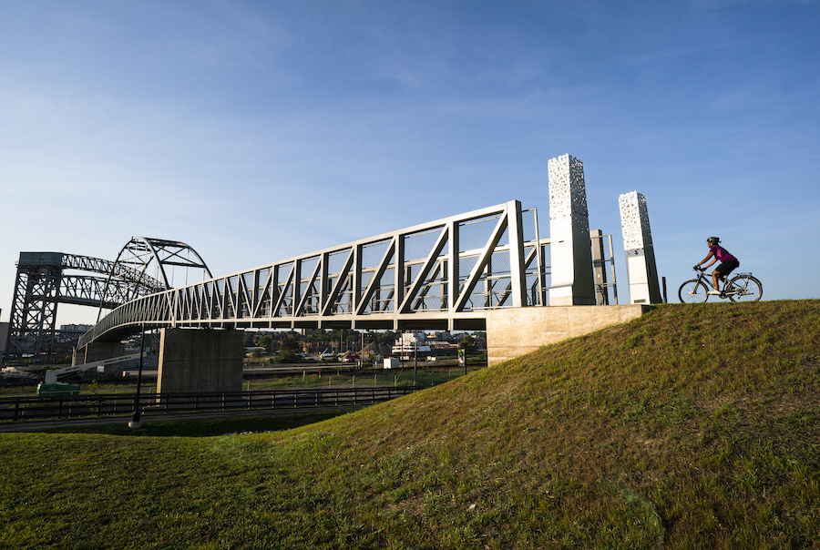
Old Chain of Rocks Bridge (Former Route 66 Bridge) (Missouri to Illinois)
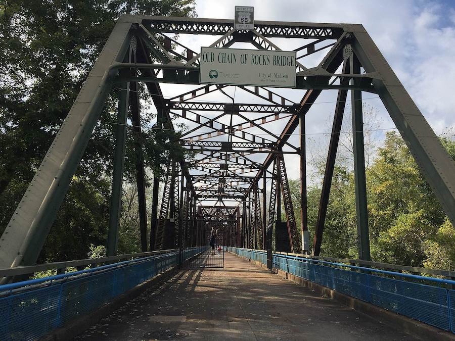
“Today you might say that the Chain of Rocks Bridge has completed a historic cycle. Built at the beginning of America’s love affair with the automobile, it is now a reflection of America’s desire not to ride in cars so often,” writes the National Park Service of this 1-mile historic structure that used to be part of the legendary Route 66.
The bridge provides a direct connection on its western side in St. Louis, Missouri, to the St. Louis Riverfront Trail leading 12 miles into downtown. Both the bridge and trail are critical components of the developing “River Ring”—a 600-mile trail system project of the Great Rivers Greenway to connect rivers, parks and communities across the St. Louis region.
RELATED: America’s Most Unique Trailside Attractions


Donate
Everyone deserves access to safe ways to walk, bike, and be active outdoors.


