California’s Monterey Bay Coastal Recreation Trail
Trail of the Month: May 2017
“It makes us feel connected to our community and the natural beauty. It reminds us of why we live here and why we love it.”
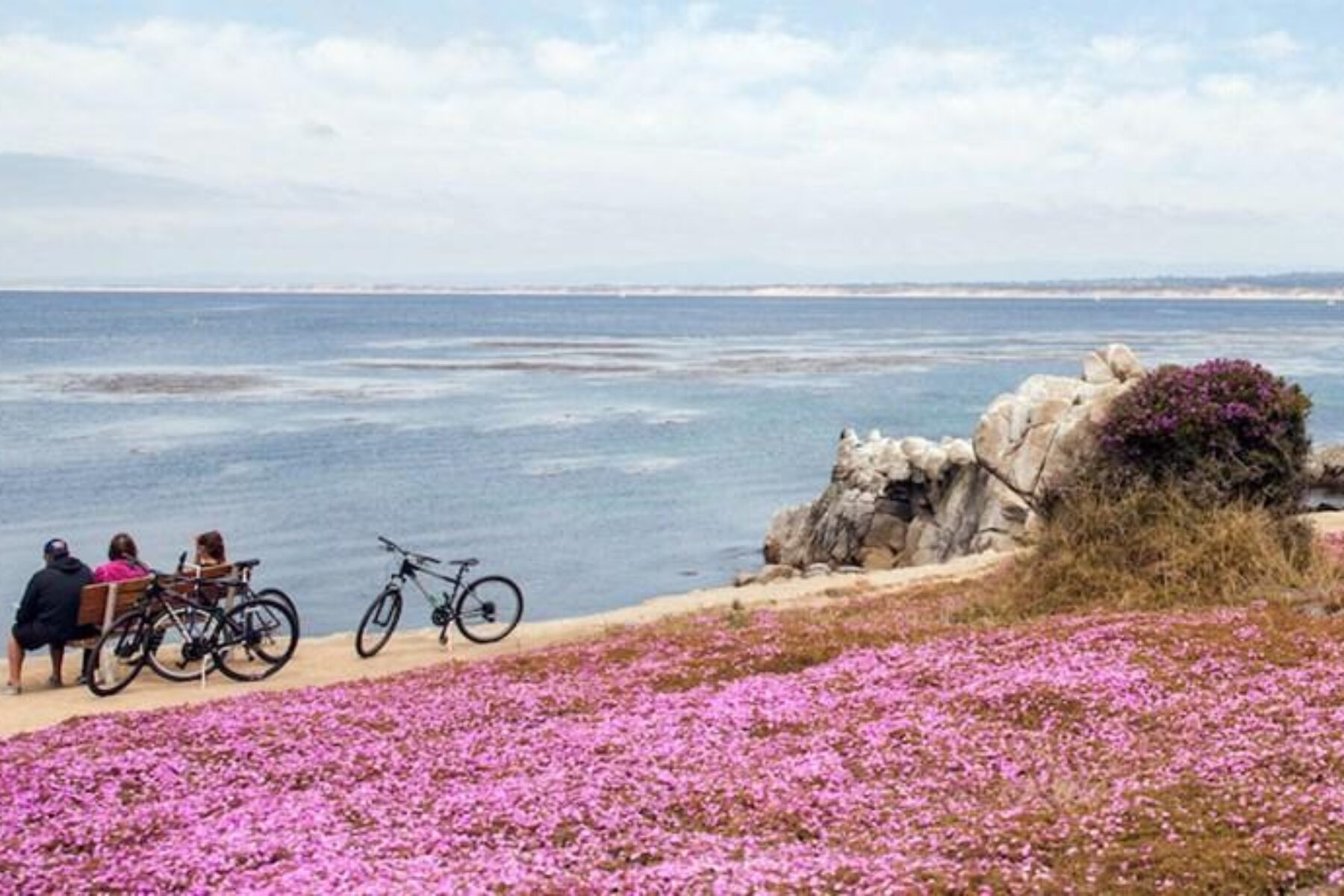
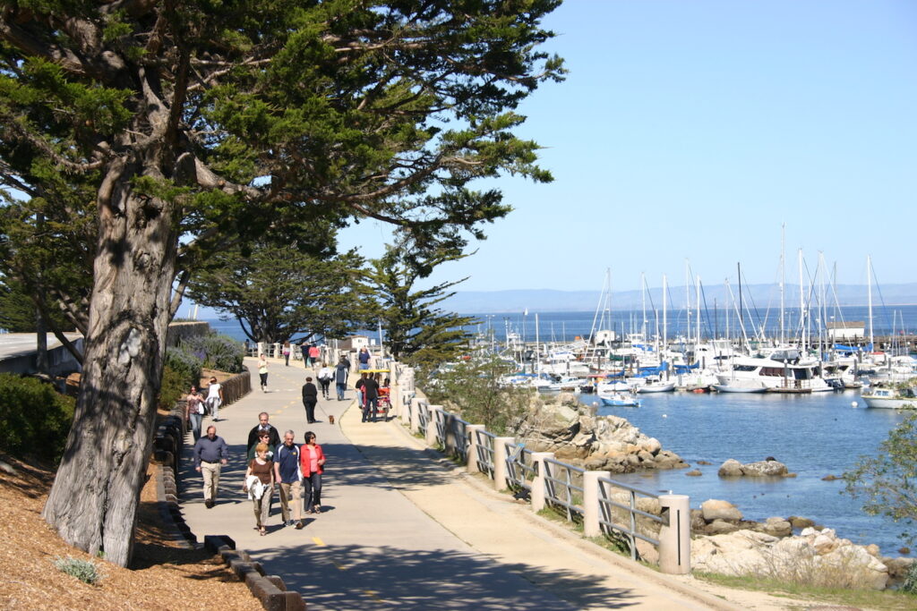
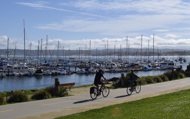
Summer excursions don’t come much better than this: 18 miles of smooth, paved trail ringside to California’s stunning Monterey Bay, in some places so close to water’s edge that waves occasionally wash over it. The Monterey Bay Coastal Recreation Trail is truly immersed in its seaside environment, providing access to sandy beaches, fishing piers and marinas bustling with small boats bright white against the deep blue water. Don’t be surprised to see kayak crossings in the pathway, whales splashing in the distance or sea lions basking on the rocky shoreline. This rail-trail is what California dreams are made of.
“That expansive view of the coastline was really striking,” says Barry Bergman, trail development manager for RTC’s Western Regional Office, who toured the trail last month as part of the California Trails and Greenways conference. “Then, as you get into town, it really integrates into the community with businesses fronting onto it, and it gets you right down into the attractions.”
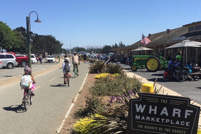
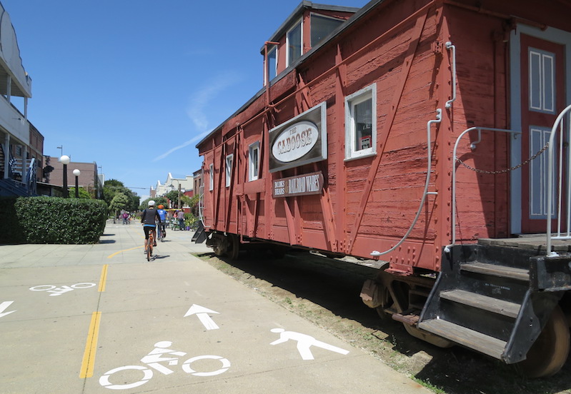
Most will start their adventure on the trail’s southern end, in the communities of Pacific Grove and Monterey. In the span of just a few short miles, travelers will find popular shops and restaurants lining Fisherman’s Wharf, the world-renowned Monterey Bay Aquarium and the historical Cannery Row, where the fishing and canning industries thrived in the early 1900s. The former Southern Pacific Railroad on which the rail-trail is built once carried canned fish from here north to markets in the San Francisco Bay area.
“I love the trail, but I’m not alone in loving the trail,” chuckles Virginia Murillo, a transportation planner for the Transportation Agency for Monterey County. “It gets pretty crowded.”
On a weekend, upwards of 2,000 people a day will use the trail—so many that the City of Monterey’s updated parks and recreation master plan, published just last year, outlines upcoming efforts to widen the pathway in its busiest spots.
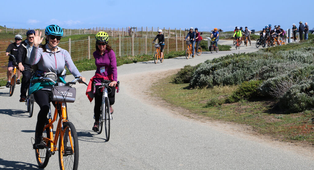
“The trail is our most used recreational amenity,” says Kim Bui Burton, Community Services Director for the City of Monterey. During the development of the city’s master plan, residents were surveyed on their recreational activities, and a whopping 70 percent indicated that they use the trail at least once a week.
North of this tourist hotspot, the trail veers inland, traversing sand dunes and a eucalyptus grove before skirting the boundary of Fort Ord Dunes State Park, a former military base that now offers miles of shoreline and pristine natural areas. The trail traffic is lessened here as the trail rolls through the smaller communities of Seaside, Sand City, Marina and Castroville.
Thrumming with life today, it’s hard to envision the railroad corridor that had become empty, overgrown and rundown by the 1970s. Back then, the canneries were derelict buildings and the aquarium, now an anchor in the community, had not yet made its debut (and would not until 1984). The cities of Monterey and Pacific Grove, working with the Monterey Peninsula Regional Park District, began acquiring pieces of the corridor in 1976, and the trail’s first section opened in 1980. From there, the pathway grew slowly north through the 1990s and 2000s.
Now a well-regarded, well-loved success, the trail serves as a catalyst for the region’s next generation of trails. Farther north, the existing Monterey Bay trail is planned to connect with a proposed 32-mile pathway that will continue along the bay in neighboring Santa Cruz County. Together, the two trails will provide 50 seamless, paved miles of scenic coastal trail.
Another project underway is the Fort Ord Rec Trail and Greenway, a grassroots effort spearheaded by two local professors. With the Monterey Bay trail as its coastal spine, the FORTAG network will add paved looping pathways to connect the coast to inland communities. The movement to create this 30-mile trail system received a boost last November when a sales tax measure to provide $20 million in funding for the project was approved by Monterey County voters.
It’s no doubt the Monterey Bay Coastal Recreation Trail is considered an asset not only on this grand, regional scale, but on a personal level for residents, too. Kim Bui Burton, who lives in Pacific Grove, enjoys walking the trail into Monterey with her husband every week. “It makes us feel connected to our community and the natural beauty,” she says. “It reminds us of why we live here and why we love it.”
Related Links
City of Monterey
City of Pacific Grove
Transportation Agency for Monterey County
Trail Facts
Name: Monterey Bay Coastal Recreation Trail
Used railroad corridor: Southern Pacific Railroad
Trail website: City of Monterey
Length: 18 miles
County: Monterey
Start point/end point: Jewell Avenue and Ocean View Boulevard (Pacific Grove) to Haro Street and Merritt Street/SR 183 (Castroville)
Surface type: Asphalt, concrete
Grade: The rail-trail is relatively flat with the exception of a steep climb over the sand dunes at the border between Monterey and Seaside.
Uses: Biking, walking, inline skating and fishing; wheelchair accessible.
Difficulty: Easy
Getting there: The closest major airport is the Norman Y. Mineta San Jose International Airport (1701 Airport Blvd., San Jose), which lies about 70 miles north of the trail. If you’re coming from San Francisco, San Diego, Los Angeles, Phoenix or Las Vegas, another option is to fly into Monterey Regional Airport (200 Fred Kane Drive, Monterey), which is only 10 minutes from Monterey.
Access and parking: In Monterey, free parking is available on Del Monte Avenue between Camino Aguajito and Camino El Estero, on Pacific Street above Fisherman’s Wharf and on Lighthouse Avenue several blocks above Cannery Row. Longer-term paid parking is available at the City of Monterey’s Downtown East Garage on Del Monte Avenue, Waterfront Lot at Figueroa Street and Del Monte Avenue, and the Cannery Row Parking Garage at Wave Street. For more parking information, visit the City of Monterey’s website.
To navigate the area with an interactive GIS map, and to see more photos, user reviews and ratings, plus loads of other trip-planning information, visit TrailLink.com, RTC’s free trail-finder website.
Rentals: Bicycle rentals are available at multiple locations along the trail in Monterey at Adventures by the Sea (831.372.1807, sales@adventuresbythesea.com).


Donate
Everyone deserves access to safe ways to walk, bike, and be active outdoors.


