Colorado’s Mineral Belt Trail
Trail of the Month: October 2018
“I felt like Luke Skywalker zipping through the forests of Endor on a speeder.”
—TrailLink user Kevin Yen
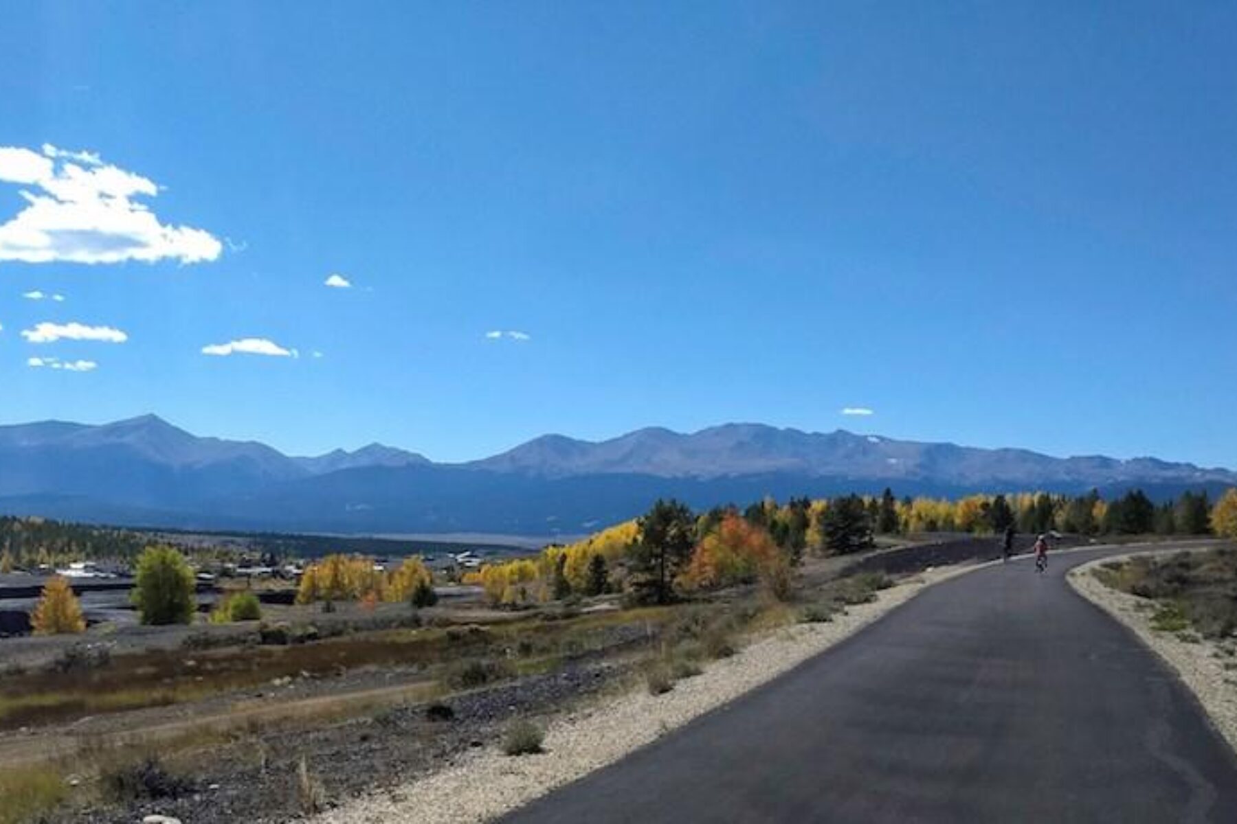
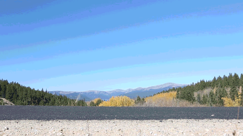
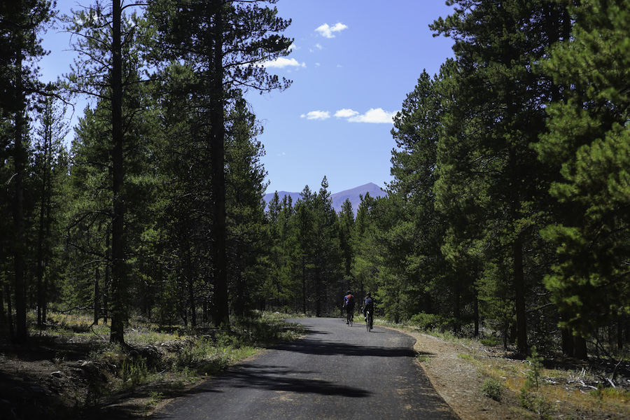
Leadville residents jokingly refer to Denverites as “low landers.” Colorado’s two-mile-high city, nicknamed Cloud City, certainly has a heavenly rail-trail. Forming a nearly 12-mile paved loop around the city, the Mineral Belt Trail offers spectacular views around every bend: the dramatic Rocky Mountains, meadows of sagebrush and passage through the Historic Mining District on the east side of the city.
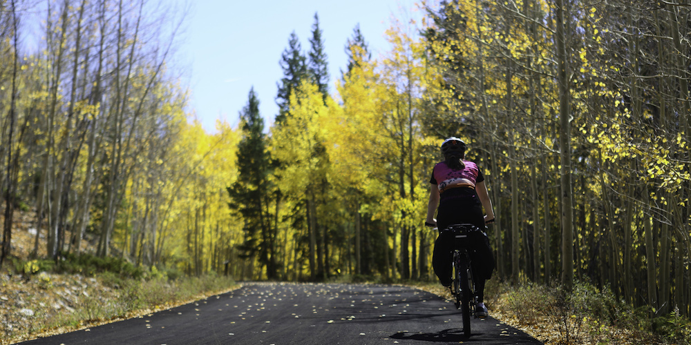
Beginning north of downtown, a clockwise circuit quickly spirits travelers into the evergreens on a gentle climb to 10,600 feet around mile marker 5, before dropping down to 9,900 feet by trail’s end. The sinuous, downhill grade on the southwest arc of the loop—after mile marker 8—is the most fun this writer has ever had on a trail. A review of the trail by TrailLink.com user Kevin Yen perhaps puts it best: “On my recumbent, I felt like Luke Skywalker zipping through the forests of Endor on a speeder bike.”
Because not all of the route follows former railroad lines, Mike Conlin, the planning consultant who originally designed the trail, said he was able to be more “playful” with some sections, adding that the trail’s sweeping curves provide “a sense of exploration.”
A Local Treasure
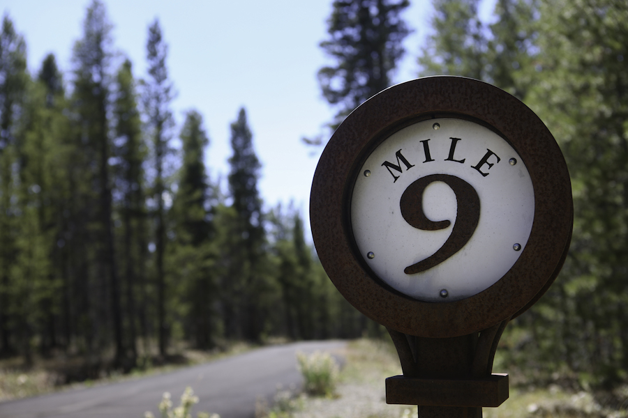
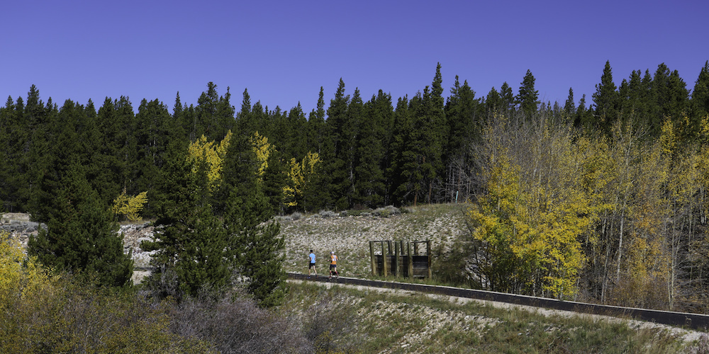
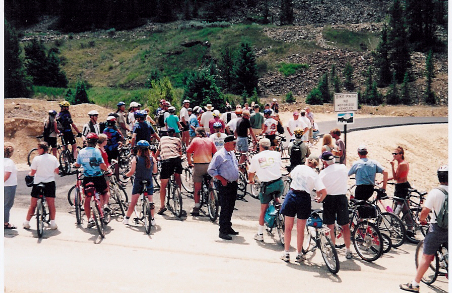
This scenic pathway not only draws tourists, but is also a beloved asset for residents, connecting the local hospital, schools, neighborhoods and businesses. On a late September weekend, pockets of bright, golden aspen decorated the trail, and many types of trail users were out enjoying the experience: dog walkers, groups of bicyclists, hiking pairs, families with young children, and moms with strollers. (Parent-to-parent tip: Have youngsters look for the Bigfoot cutouts peeping out of the trees around mile markers 3 and 9.)
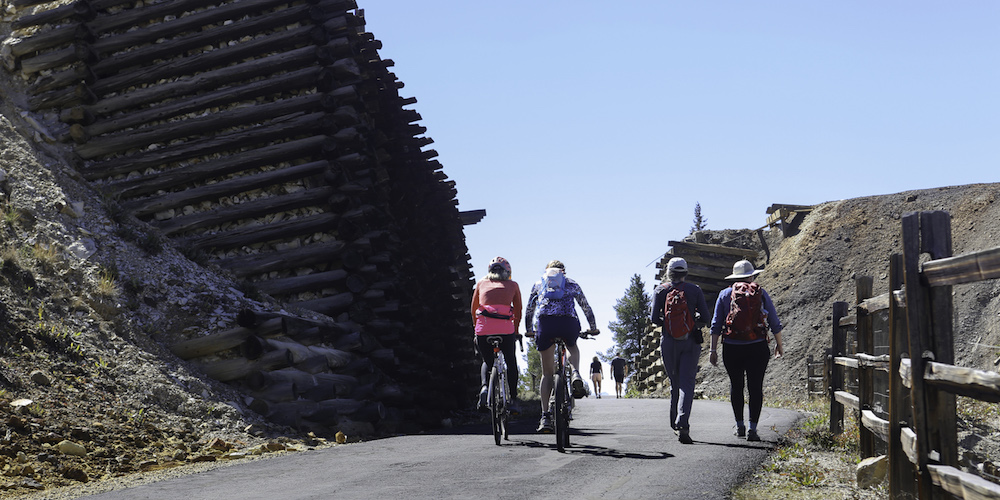
The pathway, even from its conception in the 1990s, has been embraced by residents. Leadville, as one might deduce from its name, was once a mining boomtown, beginning with the discovery of gold here in 1859. The three former railroads on which portions of the Mineral Belt Trail were built, served these mines, including the trail’s namesake Mineral Belt Line. Many historical relics from this era—such as an old mining tower, ore carts, a mine shoot and other aged equipment—have been placed along the route to serve as an outdoor mining museum. All of these items were donated by locals to honor their community’s heritage.
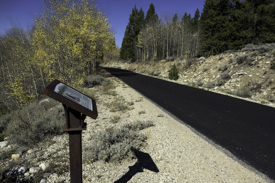
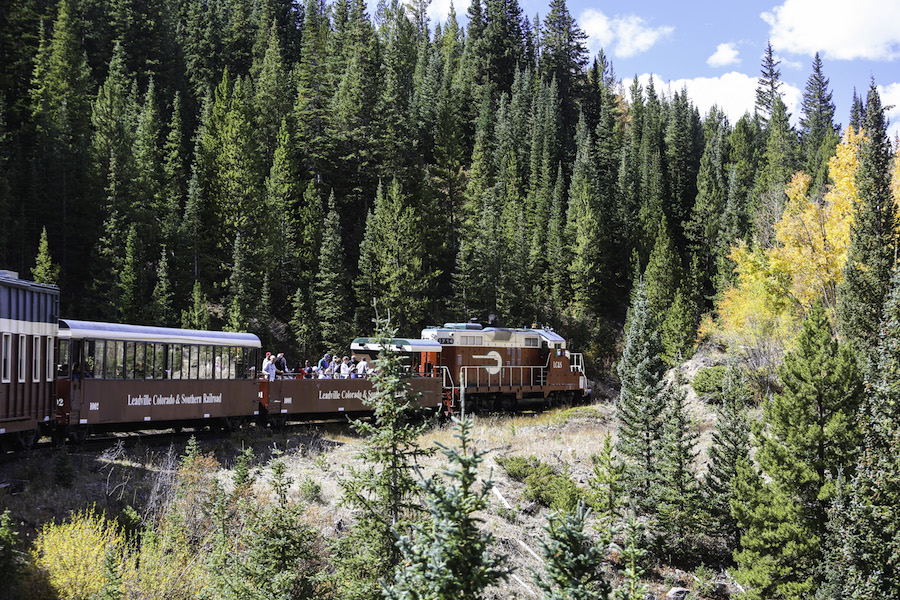
Interpretative signage, placed every quarter-mile along the trail, details the riches and risks of the mining industry, shares stories about the city’s most memorable inhabitants and expounds on other interesting historical tidbits. History buffs will also want to check out the National Mining Hall of Fame and Museum downtown and take a ride on the Leadville, Colorado & Southern Railroad, a sight-seeing train which departs from the depot in town and journeys into the wilderness while the conductor spins tales about the town’s colorful history.
“After the gold rush, silver was discovered, and this resulted in a bigger bonanza than the gold,” said Howard Tritz, an original member of the Mineral Belt Trail Committee, a volunteer group formed in the early 1990s, which operates the trail’s website and maintains the trail. “In addition to silver and gold, other metals such as copper, zinc and lead were mined. During a 100-year time span, nearly a billion dollars-worth of these metals came out of the hills east of Leadville. In today’s dollars, this amounts to $29 billion. Absolutely astounding.”
Reclamation and Renewal
During the 1980s, however, mining became a prohibitively expensive endeavor, and the mines began to close. With the loss of this lifeblood industry, Leadville’s economy went bust.
“In 1971, when I first came to this community, it was a blue-collar mining town,” Conlin said. “But in 1982, all that crashed. When Climax Mine closed, we lost over 3,000 jobs. You couldn’t drive anywhere in town without seeing ‘For Sale’ signs on two-thirds of the houses.”
On top of this—due to contamination from the area’s years of mining and smelting— the California Gulch and the surrounding area, including Leadville itself, were listed as a Superfund Site by the Environmental Protection Agency (EPA) in 1983.
“During the great mining days, the population grew to an estimated 30,000 or more people,” said Tritz. “All of these people in a small area, and the hundreds of mines operating east of town, contributed to an environmental disaster. Within a few decades, forests were decimated, native wild animals were slaughtered and the waterways were badly polluted with acidic mine water drainage.”
This left Leadville with two problems to solve: how to turn the economy around and how to remediate the environment. In 1991, a citizens group called the Lake County Liaison Committee brainstormed several ideas, including building a bicycle trail, saving the historical mining district, creating a bobsled run off the Mosquito Range and constructing a high-altitude training center, among others. The committee placed poll-collection receptacles (dubbed “wishing wells”) in strategic locations throughout the city to gather input from the community and also published surveys in the local newspaper for residents to vote on. It was a tie-breaker between the trail and the mining district, so the concept of building a bicycle trail through the mining district was born. Adds Tritz, “Little did we know at the time what a wonderful idea this was.”
Environmental Catalyst + Economic Asset
The trail would not only serve to cap contaminated soil under layers of gravel and asphalt, but also sparkled with the possibility of economic revitalization from tourism. A diverse team of stakeholders— including a mining company called Asarco (which was liable for some of the contamination), the EPA, government officials from the City of Leadville and Lake County, and community advocates—set to work on the project in 1993.
“One of the most important things that it did over time was create partnerships,” said Conlin, who now serves as director of the Lake County Open Space Initiative. “It opened up a dialogue about what we could do together, which has extended beyond the trail.”
The most challenging aspect of the project was the fact that more than 120 landowners had property overlapping the proposed trail route, including individuals, public entities and railroad companies. Although it was a daunting task to research and notify all the affected landowners—with some of the land claims even going back to the 1800s—Leadville residents stepped up. All of the land for the trail was either donated, or provided in exchange for an amicable land-swap agreement.
Construction began in 1995, and the entire trail was opened in the summer of 2000 with a festive ribbon-cutting ceremony and a group bike ride. Today, nearly 20 years later, the Mineral Belt Trail continues to be widely used in all seasons with the Colorado Mountain College grooming the trail in winter for cross-country skiing, snowshoeing and riding on snow with fat tire bikes.
“Leadville has four seasons: summer, early winter, mid-winter and late winter,” chuckles Conlin. “And the trail gets as much winter use as summer use.”
The people of Leadville have struck gold with the rail-trail, and its future continues to shine brightly. In 2015, Gov. Hickenlooper announced his “Colorado the Beautiful” initiative, a grand idea that aims, within one generation, to provide all Coloradoans with access to a park, trail or open-space area within a 10-minute walk of their home. Two of the priority trail projects within that program will connect to the Mineral Belt Trail: the Fremont Pass Trail, which will provide a link to neighboring Summit County’s trail system, and the Arkansas River Stage and Rail Trail, which will extend south from Leadville more than 60 miles to Salida.
“The trail has surpassed our original expectations,” said Conlin. “We had people in the beginning who were skeptical, but now they’re proprietary about this trail. They protect it, defend it, and promote it.”
Related: Colorado the Beautiful
Related Links
Trail Facts
Name: Mineral Belt Trail
Used railroad corridor: The Mineral Belt Trail uses sections of three former rail lines: Colorado Midland Railway, Denver & Rio Grande Western Railroad and the Colorado & Southern Railway.
Trail website: Mineral Belt Trail website
Length: 11.6 miles
County: Lake
Start point/end point: The Mineral Belt Trail is a loop; begin and end your journey at Ice Palace Park at Harrison Avenue and W. 10th Street, north of downtown Leadville.
Surface type: Asphalt
Grade: The Mineral Belt Trail has an average grade of 3 percent with a maximum grade of 5 percent. If you begin your journey at Ice Palace Park, which is between Mile Marker 1 and 2, and travel in a clockwise direction, you will have a gentle but steady climb to Mile Marker 5, and then enjoy a rewarding downhill ride to trail’s end.
Uses: Walking, bicycling, inline skating and cross-country skiing; wheelchair accessible
Difficulty: The Mineral Belt Trail offers an easy, paved walk or ride with gentle climbs suitable for most abilities. The only challenging aspect to the trail is that there are few restrooms and water fountains along the way, so plan accordingly.
Getting there: Leadville can be reached by flying into Eagle County Regional Airport (217 Eldon Wilson Road, Gypsum), which is approximately 60 miles away, or Denver International Airport (8500 Peña Blvd, Denver), approximately 125 miles away. By car, Leadville is easily accessible via US Highway 24.
Access and parking: The best place to begin your journey is just north of downtown at Ice Palace Park (Harrison Ave. and W. 10th St.), where parking, restrooms and drinking water are available. On the west side of town, another option is the parking lot at Washington St. and W. 6th St. A mile farther south, there is also an unpaved parking lot at the Dutch Henry Trailhead off US Highway 24, west of College Road.
To navigate the area with an interactive GIS map, and to see more photos, user reviews and ratings, plus loads of other trip-planning information, visit RTC’s free trail-finder website, TrailLink.com.
Rentals: Both adult and children’s bike rentals are available from Cycles of Life (309 Harrison Ave.; 719.486.5533) in downtown Leadville.


Donate
Everyone deserves access to safe ways to walk, bike, and be active outdoors.


