Top 10 Trails in Mississippi
Mississippi trails beckon bicyclists and walkers year ‘round—even in January and February when an extra jacket might be needed—and every walk or ride is a new experience with the ever-changing leaves, flowers and wildlife discovered along the way. Flat terrain or rolling hills make up most of the landscape, with thick pine or hardwood forests keeping even the hot days more bearable. Lush wetlands enhance the Southern feel. Whether traveling through trail-friendly towns, or stretching your legs on longer excursions, these well-established trails are the perfect ways to take advantage of these idyllic areas.
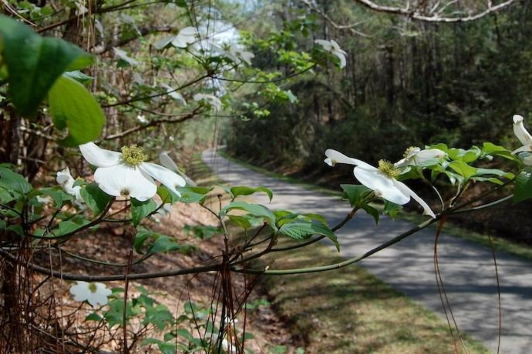
Longleaf Trace
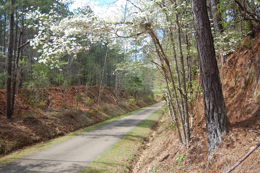
County: Forrest, Jefferson Davis, Lamar
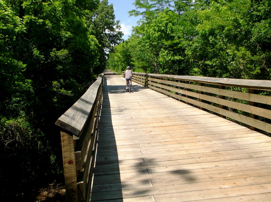
With 44 hard-surfaced miles to explore between Hattiesburg and Prentice, the Longleaf Trace deserves every bit of its recognition in the Rail-Trail Hall of Fame. Encompassing the former route of the Mississippi Central Railroad, the path winds through small towns, shaded pine forests and wetlands, making the experience a combination of Southern charm and outstanding natural beauty. With numerous rest areas and shelters, this clean and well-maintained trail is ideal for families recreating for an afternoon or a longer adventure for more ambitious bicyclists and hikers.
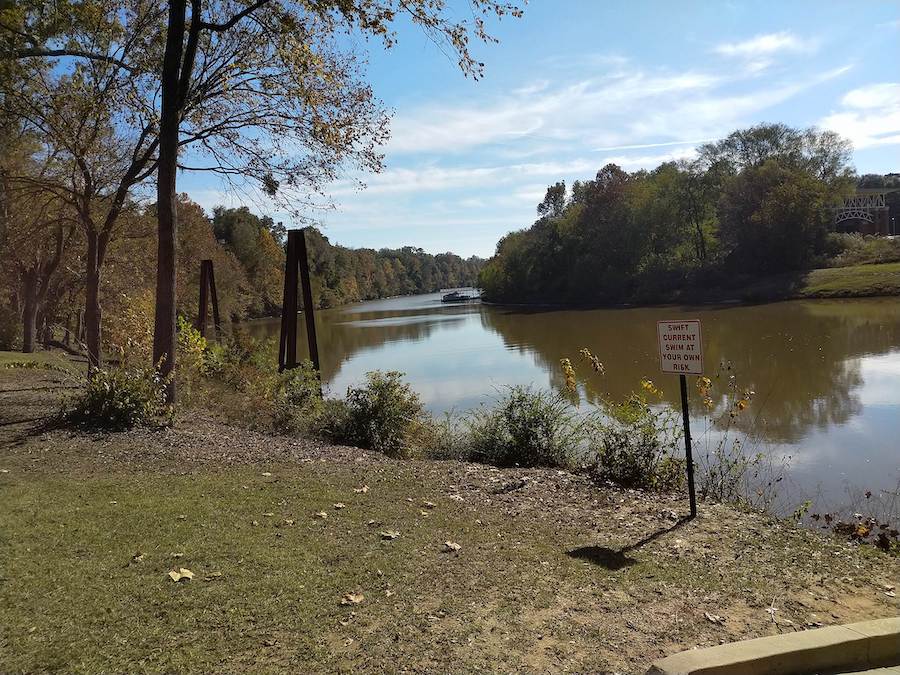
Tuxachanie National Recreation Trail
Counties: Harrison, Stone
Following the former railroad bed that served a sawmill over a century ago, the Tuxachanie National Recreation Trail winds 12.1 miles through the heart of the DeSoto National Forest and the P.O.W. Lake Recreation Area where war prisoners were held during WWII. This dog-friendly walking trail is perfect for casual strolls or those desiring a solid workout. Winding past live oaks and lush forests, the path leads over bridges or planks placed across streams and swampy areas where palmetto trees and wildflowers abound. It’s worth packing a fishing pole to cast a line at Airey Lake or the P.OW. Lake Recreation Area.
South Campus Rail Trail
County: Lafayette
Part of the effort to link numerous trails throughout Oxford, the South Campus Rail Trail, formerly known as the Thacker Mountain Trail, is a popular trail starting at Ole Miss. The main, graveled trail is 20 feet wide and is a popular spot for walking and biking the 5.6 mile out-and-back trip to Thacker Mountain Road. This dog-friendly (as long as they’re leashed) path is well shaded and flat with numerous single-track side trails. This includes over 30 miles of trails within the town that offer additional options to explore.
Tanglefoot Trail
Counties: Chickasaw, Pontotoc, Union
The route of what we now call the Tanglefoot Trail was once used by the Chickasaw tribe and called the “King’s Highway” in honor of the last Chickasaw king, Ishtehotopah. Later, world explorers and the Union Army also followed. In 1871, the Gulf and Sheep Island Railroad was created as part of post-Civil War reconstruction efforts. Today the 43.6-mile Rail-Trail Hall of Fame inductee welcomes all experience levels to enjoy the hardwood forests, trees draped in kudzu, multiple wetlands and quaint small towns. With three main entrance points and four “whistle stops” equipped with amenities, it’s easy to make a journey on the Tanglefoot either a short outing or a multiday hiking or biking trip.
RELATED: Mississippi’s Tanglefoot Trail | August 2019 Trail of the Month
Chisha Foku Multi-Use Trail

County: Madison
Paralleling the Natchez Trace Parkway, the Chisha Foku Multi-Use Trail is a touchstone to the history of the Choctaw Nation. The most popular starting point is on the east end of the route at the Ross R. Barnett Reservoir overlook. Leaving the shoreline, the gently rolling trail leads into the hardwood and pine tree forests where birds and wildlife abound. The wheelchair-accessible path has benches spaced throughout the trail for places to rest. At mile marker 104.5, the Old Natchez Trace intersects the Chisha Foka with the nearby William Lowe “Bill” Waller Craft Center, offering a creative diversion.
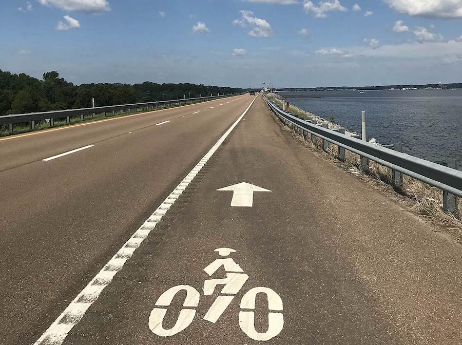
Spillway Multi-Use Trail
County: Rankin
The Spillway Multi-Use Trail might be short, but it is an important piece joining communities paralleling the Spillway Road, as well as providing an opportunity of connecting with the North Shore Parkway Multi-Use Trail to create a loop almost the entire way around Pelahatchie Bay of the Ross R. Barnett Reservoir. Made up of three trail segments transitioning into bike lanes on quiet neighborhood roads, the trail features exceptional views of the water as well as wooded areas before traveling past the Reservoir Gardens and Botanical Trail near the Reservoir Public Library.
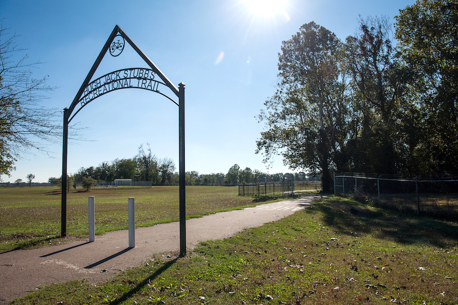
Hugh Jack Stubbs Recreational Trail
County: Coahoma
The lovely 5-mile roundtrip Hugh Jack Stubbs Recreational Trail is a perfect welcome to the beautiful state of Mississippi. Beginning at the Senator Delma Furniss Hospitality Station near the Mississippi/Arkansas border, the wheelchair-accessible pathway encourages visitors and locals to spend time outdoors along this relaxing route. There are multiple picnic areas to enjoy a bite to eat along with four exercises stations for those looking for more of a workout. At the end of the route, the 2,300-acre Moon Lake off of the Mississippi River offers opportunities to fish off the dock or launch a canoe/kayak to paddle the calm waters.
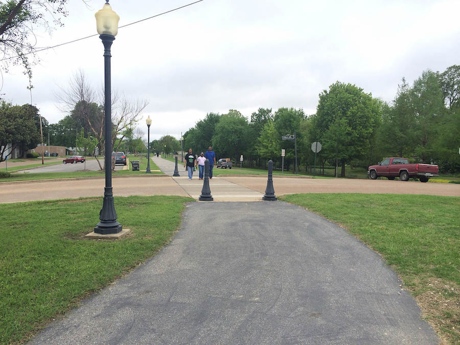
Crosstie Walk
County: Bolivar
Born from the route of four previous railroads, the final being the Columbus and Greenville Railway, which removed the tracks in 1999, the Crosstie Walk now winds through Cleveland’s historic downtown. The paved trail is well lit at night, bringing visitors to the shops and restaurants, and connects to other trails, such as the Hollandale Rail-Trail. At roughly mid-way through the path, the Martin & Sue King Railroad Heritage Museum shares the stories of the railroad in this region, with the largest model train layout in Mississippi—plus a caboose to tour!
Columbus Riverwalk
County: Lowndes
Following the Tombigbee Waterway, the Columbus Riverwalk is the perfect opportunity to step into nature just outside of Columbus. In the roughly 4.5-mile out-and-back excursion, visitors travel through wooded areas and along the water, which are perfect spots to look for birds and wildlife, as well as butterflies, which can be seen at the garden created by the Lowndes County Master Gardeners. Even in this short distance, there are plenty of amenities, including an exercise station, water fountains, restrooms and benches. The route is also well lit for evening strolls. Adjacent to the path, there is an historic swinging bridge that crosses a channel over the river to an island.
Kitty Bryan Dill Memorial Parkway National Recreation Trail

County: Clay
What was originally the route of the Mobile and Ohio Railroad’s “Gulf Coast Special” in the mid-1800s and the “Delta Route” of the Columbus and Greenville Railway, the Kitty Bryan Dill Memorial Parkway was one of the first 500 rail-trails developed in the country. Looping 3.8 miles through the hardwood forests surrounding the town of West Point, the trail flows through five city parks with picnic areas and gazebos. The Sally Kate Winters Park is closest to the downtown area and features fountains and gazebos, along with a bandstand and playground for the kids. There’s also a windmill along the trail that is the unofficial symbol of West Point, plus the center for an annual arts festival.
Special acknowledgments: Mark Alexander, City of Columbus; Sue Griffin and Kinchen “Bubba” O’Keefe, Visit Clarksdale; Whitney Hancock, City of West Point; Wes Smith, Oxford Bicycling Company
When you subscribe to Rails to Trails magazine, you’ll have access to many other features like this one. Our magazine is a premium of Rails-to-Trails Membership. Join today to start receiving the magazine!


Donate
Everyone deserves access to safe ways to walk, bike, and be active outdoors.


