Great American
Rail-Trail
Historical Marker Program
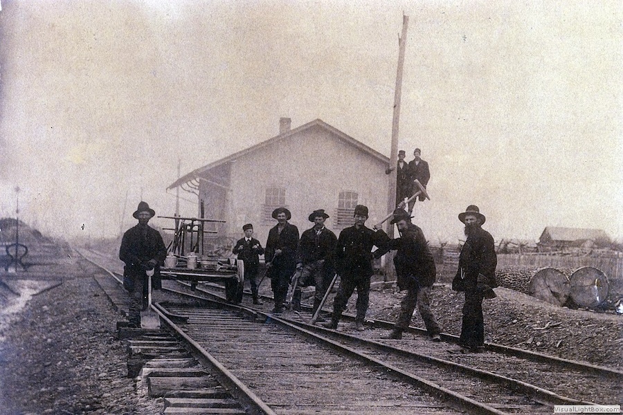
Train arriving at the Centerburg CA&C depot, 1908 | Courtesy Gloria Parsisson
Rails to Trails Conservancy has partnered with the Pomeroy Foundation on a marker program designed to highlight historically significant people, places and events along the 3,700-mile Great American Rail-Trail®. Through this exciting program, we seek to engage trail users in the diverse cultural histories of communities along the developing route, while helping communities achieve their goals for trailside tourism and economic development.
In 2023 and 2024, we collaborated with trail managers and historians to identify and research 12 historic points of interest located on Great American host trails and commemorate them with permanent trailside markers.
Learn more about the unique histories of these sites and the markers that are in the process of popping up this year in 12 communities on the Great American route.
Great American Rail-Trail Historical Markers
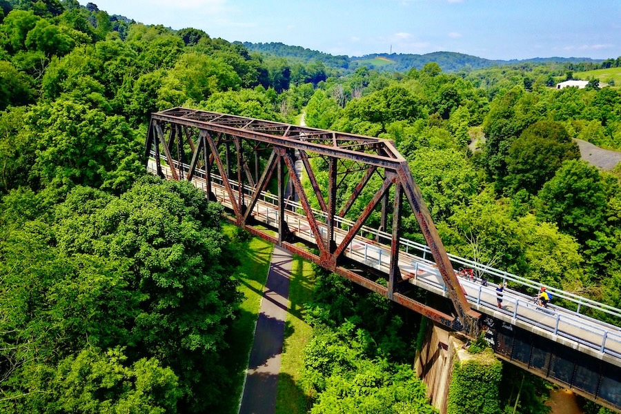
- Cedar Valley Nature Trail – Brandon Bridge
- Cedar Valley Nature Trail – Center Point Depot
- Cowboy Recreation and Nature Trail – Edward Day Cohota
- FIRST AVE Trail – Gateway to West
- Headwaters Trail System – Trident Depot
- Heart of Ohio Trail – Feed & Grain Mill
- Heartland Trail – Rare Unconformity
- Nickel Plate Trail – “Circus City”
- Oak Street Trail – Bozeman Cannery
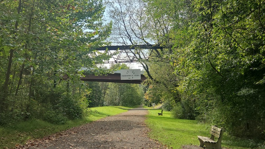
- Panhandle Trail – Coal Mining
- Panhandle Trail – Oil Well Fire
- Story Mill Spur – Story Mill
Rails to Trails Conservancy expresses its deepest gratitude to all the individuals and organizations who helped make the markers possible.
Additional thanks to Susan Hughes, Historian & Archivist, William G. Pomeroy Foundation, and Dr. Avigail Oren, Historian.
Cedar Valley Nature Trail – Brandon Bridge
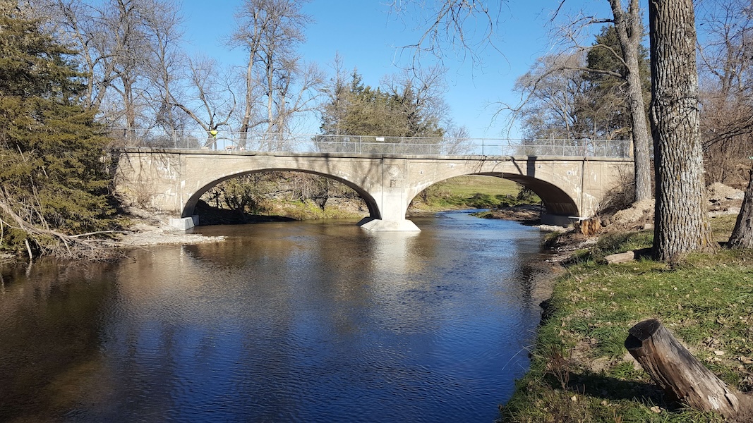
Marker Location: Near Finley Ave. and 330th St. in Brandon, IA
After a catastrophic flood in 2008 destroyed two historic bridges on Iowa’s Cedar Valley Nature Trail, only one functional double-arched span bridge over the Cedar River—created over a century ago—remained. Built just east of Brandon, Iowa, in 1913 for the Waterloo, Cedar Falls & Northern Railway, the bridge was considered an early highlight among people in the town who were thrilled to gain rail access. Today, the bridge serves as a legacy of Brandon’s growth in the early 1900s.
Learn more about this double-arch bridge on the TrailBlog.

Acknowledgments:
- Black Hawk County Conservation
- Cedar Valley Nature Trail (Black Hawk County)
- Tallgrass Historians L.C.
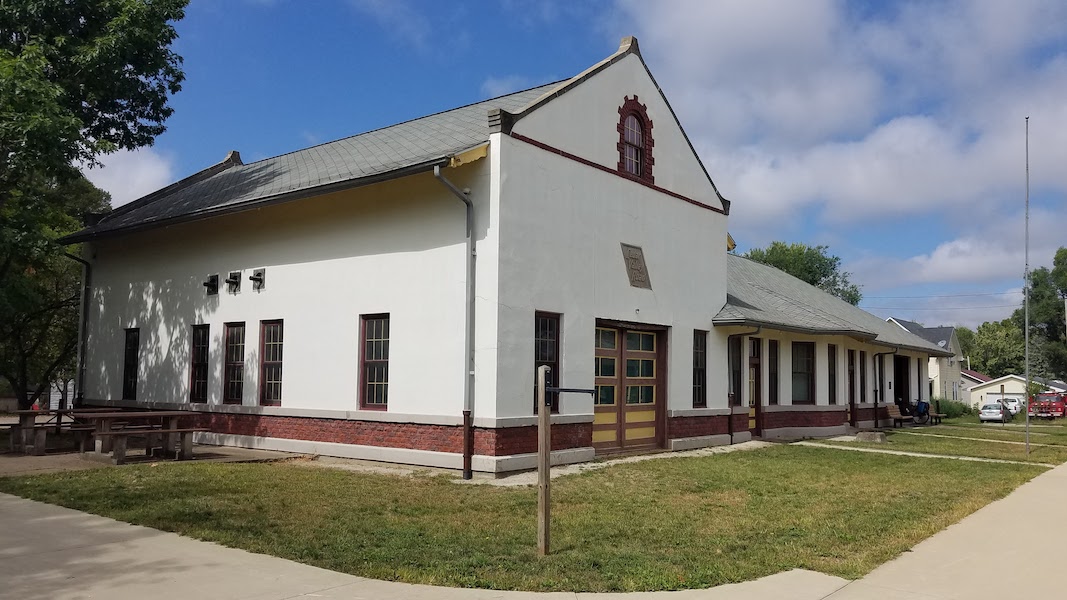
Cedar Valley Nature Trail – Center Point Depot

Marker Location: 700 E. Washington St., Center Point, IA
Now home to a museum that preserves the stories of the eastern Iowa town for which it is named, the Center Point Depot is a key piece of area history. Added to the National Register of Historic Places in 2018, it was one of eight depots along the Waterloo, Cedar Falls & Northern Railway (WCF&N), which did much to energize and “wake up” the town of Center Point. It now offers people on the Cedar Valley Nature Trail a rest stop with a world of information inside.
Learn more about Center Point Depot on the TrailBlog:
Acknowledgments:
- Cedar Valley Nature Trail (Linn County)
- Linn County Conservation (Iowa)
Edward Day Cohota – Cowboy Recreation and Nature Trail

Marker Location: Cowboy Trail and Meadow Lake Road (near S. Green Road) in Valentine, NE
It is likely that Edward Day Cohota was born in Shanghai, and was brought to Gloucester, Massachusetts, by a ship captain named Sargent S. Day when he was around 4 years old. Raised by the Days alongside their biological children, Cohota enlisted in the Union army as a teenager, making him one of 58 known men of Chinese descent to fight in the U.S. Civil War. The enlistment would spark a military career that spanned three decades. In 1902, Cohota—then a husband, father and restaurant owner—applied for a land grant, only to discover that he was not an American citizen, and the Chinese Exclusion Act of 1882 made it impossible to become one. Cohota spent years unsuccessfully petitioning Congress to intervene.
Today, Nebraska’s Cowboy Recreation and Nature Trail, one of the country’s longest rail-trails, passes by Mt. Hope Cemetery in Valentine, where Cohota was laid to rest in 1935.
Learn more about Cohota’s life and military service on TrailLink™.
Acknowledgements
Special thanks to Dr. Avigail Oren, Historian.
FIRST AVE Trail – Gateway to West
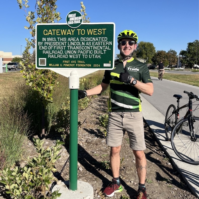
Marker Location: 99 S. 25th St., Council Bluffs, IA
In 1862, Congress passed the Pacific Railway Act, which created the Union Pacific Railroad Company and authorized it “to construct a single line of railroad from a point on the western boundary of the State of Iowa to be fixed by the President of the United States ….” President Lincoln would designate Council Bluffs as Mile 0, and two presidential orders later in 1864, that designation was realized by Congress, making Council Bluffs the eastern terminus for the first transcontinental railroad. Today, the FIRST AVE Trail preserves this history.
Learn more about Mile 0 on the TrailBlog.

Acknowledgments:
Special thanks to Patricia LaBounty, Curator, Union Pacific Railroad Museum.
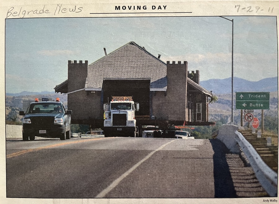
Headwaters Trail System – Trident Depot

Marker Location: 112 N. Main St., Three Forks, MT
Following a major effort by historic preservationists and Montana residents to save it in 2011, the historic Trident Depot now serves as the Railroad and Trident Heritage Center in neighboring Three Forks, Montana. Located in John Q. Adams Milwaukee Railroad Park along the Headwaters Trail System, the depot was built by cement created from the region’s limestone deposits—identified by Lewis and Clark during their Corps of Discovery Expedition in 1805.
Learn more about the depot, and the community that saved it, on the TrailBlog.
Acknowledgments:
Special thanks to Patrick Finnegan, Treasurer, and Pat O’Brien Townsend, President, Three Forks Area Historical Society.
Heart of Ohio Trail – Feed & Grain Mill
Marker Location: 108 N. Hartford Ave., Centerburg, OH
The arrival of the Cleveland, Akron and Columbus (CA&C) Railroad in Centerburg, Ohio, in 1873 brought many opportunities for the fledgling community—as new manufacturing businesses developed, and hotels, restaurants, hack services and liveries prepared for travelers and freight. The building that stands at 108 N. Hartford Ave. was built in 1899 for the Alsdorf–Pearson Company and hosted agricultural concerns for 100+ years. Today, it stands as a legacy of Centerburg’s farming heritage along the Heart of Ohio Trail.
Learn more about the feed and grain mill on the TrailBlog.

Acknowledgments:
- Heart of Ohio Trail Inc.
- Knox County Commissioners
- Knox County Historical Society
- Knox County Park District
Special thanks to Gloria Parsisson, Knox County Historical Society/Park District.
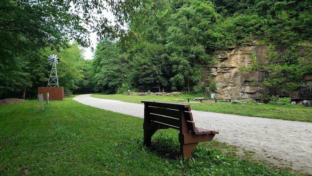
Heartland Trail – Rare Unconformity

Marker Location: 0.7 mile north of E. Market St., Marshallville, OH
Traveling on the Heartland Trail in Marshallville, approximately 0.7 mile north of E. Market St. … (40.9084, -81.7153), trail users might notice the continuous flat, parallel strata, or layers, of rock. Along the way, these layers change from interbedded shales and thin sandstones to massive sandstones and even thicker shales and sandstones. These sedimentary rocks are Mississippian and Pennsylvanian subperiod strata, deposited during the Carboniferous Period (360–299 million years ago).
Learn more about this geological unconformity and its discovery on the TrailBlog.
Acknowledgments:
Special thanks to Frank Fugitt.
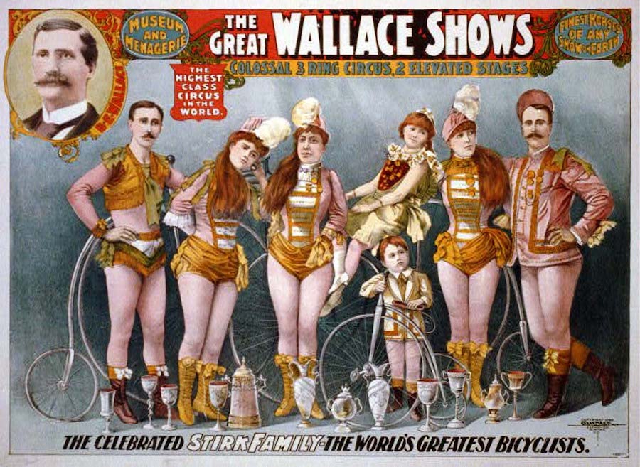
Nickel Plate Trail – “Circus City”
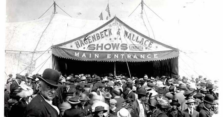
Marker Location: 886 W. Main St., Peru, IN
The convenience of railroad travel induced Ben Wallace to take his traveling horse and wagon show out of his farm in Peru, Indiana, and across the country in the 1880s. But it was his winter circus headquarters, built in 1892, that helped put Peru on the map as America’s “Circus City.” Today, the property—not far from the Nickel Plate Trail—is a National Historic Landmark and home of the International Circus Hall of Fame.
Learn more about Peru’s circus legacy on the TrailBlog.
Acknowledgements:
- Friends of the Nickel Plate
- International Circus Hall of Fame
- Nickel Plate Trail Inc.
Special thanks to President John Wright and Historian/Treasurer Bob Cline of the International Circus Hall of Fame.
Oak Street Trail – Bozeman Cannery
Marker Location: 117 E. Oak St., Bozeman, MT
Montana’s Gallatin Valley has a rich history of agriculture supporting a variety of industries, including canning. A century ago, the Bozeman Canning Company, which operated between 1918 and 1958, produced more than 75% of the nation’s pea supply, at one time producing over 300,000 cans daily to be shipped around the country. Today, the original cannery, which now hosts a variety of businesses, and original water tower, remind us of when the Gallatin Valley was known as the “pea capital of the nation.”
Learn more about Bozeman’s canning days.
Acknowledgments:
Special thanks to Sarah Rosenberg, Historic Preservation Officer, City of Bozeman
Panhandle Trail – Coal Mining
Marker Location: 713 N. Main St., Burgettstown, PA
Like many areas of Pennsylvania, Burgettstown was a large coal producer—and the railyard along the Pittsburgh, Cincinnati, Chicagao & St. Louis Railway, also known as the Panhandle Railroad—now the Panhandle Trail—was a major shipping center in the early 20th century. In fact, it was thought to be largest for coal in the United States during the 1920s. According to The Evening Review published on March 16, 1921, the daily shipments from town the previous year reached 250 to 300 cars per day, with an annual output of 3.5 million tons.
Learn more about the Panhandle Trail and its industrial history on the Trailblog.
Acknowledgments:
- Fort Vance Historical Society
- Panhandle Trail (Pennsylvania)
Panhandle Trail – Oil Well Fire
Marker Location: Just southwest of 105 Railroad St., McDonald, PA
The Oil Fields in McDonald, Pennsylvania—located along the “Panhandle” Railroad—were once the most productive in the world, yielding the highest levels of oil globally in the early 1890s. On Aug. 20, 1891, the S.H. Cook Well famously exploded and burned for six days, threatening the town. Today, a community greenspace named Heritage Park inhabits most of the former oil field location along the Panhandle Trail in McDonald.
Learn more about the Panhandle Trail and its industrial history on the TrailBlog.
Acknowledgments:
- Citizens Library & District Center/Washington County Library System
- McDonald Area Historical Center
- Panhandle Trail (Pennsylvania)
- Washington County Parks & Recreation
Special thanks to Tim Thomassy, Coordinator, McDonald Area Historical Center
Story Mill Spur – Story Mill

Marker Location: Story Mill Road and Hillside Lane, Bozeman, MT
The Story Mill Spur Line, built upon land sold by Nelson Story Sr. to the Northern Pacific, ensured that the cattle rancher, miner and industrialist’s flour mill was Bozeman’s first business directly serviced by the railroad—and eventually the region’s largest employer. Today, the historic mill is a centerpiece viewscape of Story Mill Community Park and its surrounding trails and restored wetlands in Bozeman.
Learn more about the historic Story Mill on the TrailBlog soon.
Acknowledgments:
- City of Bozeman
- City of Bozeman Parks and Recreation Department
- Montana State Historic Preservation Office
Special thanks to Sarah Rosenberg, Historic Preservation Officer, City of Bozeman
Since its inception in 2005, the Pomeroy Foundation has funding more than 2,000 signs and roadside markers across the United States, all the way to Alaska. Learn more about its partner programs.