Pennsylvania and West Virginia’s Panhandle Trail
Trail of the Month: September 2023
“The trail serves as a gateway for Pennsylvania for anyone coming from the west.”
—Ned Williams, President, Montour Trail Council
Stretching 29.2 miles through small towns and the countryside of West Virginia and western Pennsylvania, the Panhandle Trail is a key piece in connecting several longer routes, including the Great American Rail-Trail®, yet this important—and much loved path—is the trail that almost never happened.
“It is a bit of a strange story,” said Andy Baechle, director of county parks for Pennsylvania’s Allegheny County, who explained that when he worked as the park director in neighboring Washington County, the opportunity arose to secure the railroad corridor for recreational use, but there were multiple hurdles.
Since the mid-1970s, Conrail had operated this historical route of the Pennsylvania Railroad but, as the business environment changed, its demise was eminent.
“I worked with Conrail for five years,” Baechle said, but time became short when they needed to settle on a deal before Conrail went out of business.
One challenge was that Conrail required all three of the involved entities—which included the State of West Virginia, plus Washington and Allegheny Counties—to agree on the project. While West Virginia and Allegheny County were firmly on board, two out of three commissioners in Washington County did not support the project. Things changed when one of those commissioners quit unexpectedly, and his replacement voted to approve the acquisition. After a little political maneuvering, a deal was struck in 1999 and the corridor was secured mere days before Conrail went defunct. The trail’s first mile opened to the public a year later.
“The Panhandle Trail is now the fourth county park in Washington County,” said Baechle. “They’re proud of it and love it. This would never have happened if it wasn’t for all of the volunteers.”
Great American Rail-Trail
The 3,700-mile developing Great American Rail-Trail® is 53% complete to date. Learn more about this epic cross-country route.
Highlights of the Route
From Weirton, West Virginia, to the Pittsburgh suburbs, the pathway opens up a world of hiking, bicycling and other outdoor pursuits for recreationists and active transportation opportunities for the communities along the route.
“The trail serves as a gateway for Pennsylvania for anyone coming from the west,” said Ned Williams, president of the Montour Trail Council who also works extensively with the Panhandle Trail.
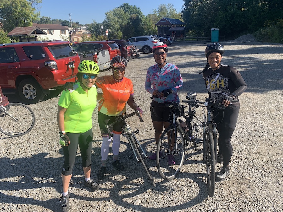
Robin Woods, an avid member of the Western Pennsylvania Bicycle Club and president of Women@Work Cycling Club who teaches people of all skill levels the nuances of biking, often rides the Panhandle Trail because it is close to her home in Pittsburgh and offers a long relaxing ride.
“It is very well maintained, and I like the little towns, too,” said Woods. “It’s very peaceful and offers just about everything you’d want. It’s a great place to take a person to practice the gears.”
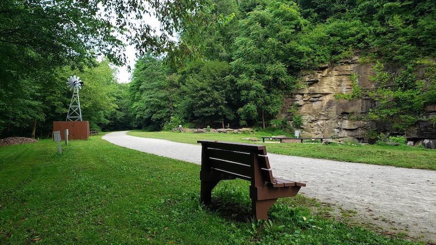
Along the way, numerous attractions can be visited to enhance the experience. Near the Gregg Station Road trail entrance, worthwhile side trips include the Pittsburgh Botanic Garden and Settlers Cabin Park. And in Rennerdale, trail users can also explore Fossils Cliff, which holds the remnants of ferns and other plants from up to 360 million years ago.
History Along the Panhandle Trail
In the early 1800s, natural resources drew people and industries to the Panhandle region of West Virginia and western Pennsylvania. And by the middle of the century, the Pittsburgh, Cincinnati, Chicago and St. Louis Railroad (PCC & StL) was essential to the movement of the region’s prosperous oil and coal assets.
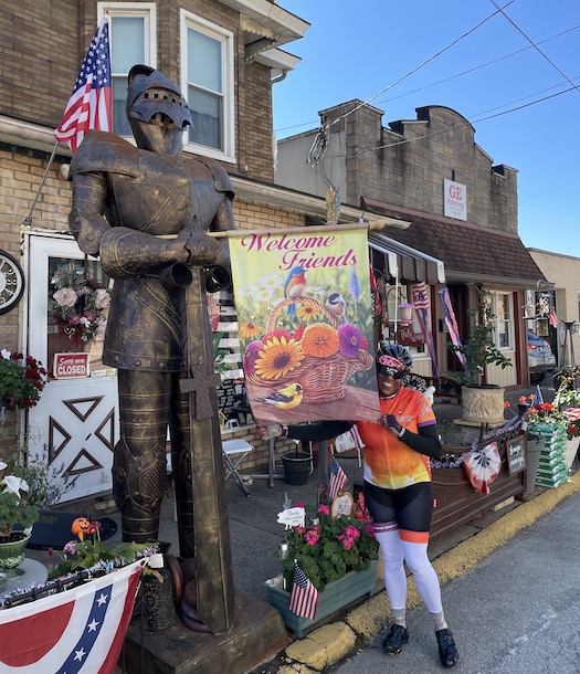
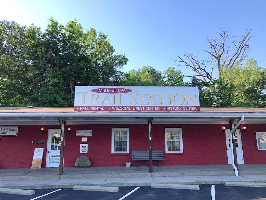
“The railroad and coal and oil were the initial things that provided the wealth,” explained Tim Thomassy, longtime resident of McDonald, Pennsylvania, who operates the McDonald Trail Station Meeting House, a landmark along the trail. Open weekends April–October, the station serves as a history center for the trail and the region.
In 1891 and 1892, Pennsylvania was the leading oil producer in the country, and its McDonald Oil Field, one of the most productive oil fields. This success was not without risks, however. On August 21, 1891, the S.H. Cook oil well ignited, exploded and burned for six days, jeopardizing the safety of the town.
“It happened right on [what is now] the trail,” said Thomassy who provided information for a new trailside historical marker about the fire, which will be located in Heritage Park on the former oil field.
A second historical marker will be placed along the trail in Burgettstown, Pennsylvania, as the borough once produced an extensive amount of coal. In the 1920s, its rail yard was a major shipping center, and specifically the largest for coal in the U.S. Even when other areas of the country took center stage in oil production, coal still reigned in this region for well over half a century.
Both markers are part of a program to highlight historically significant people, places and events along the Great American Rail-Trail—3,700-mile route stretching between Washington State and Washington, D.C.—through signage created in partnership with the William G. Pomeroy Foundation.
In 1921, the Pennsylvania Railroad leased the operation from PCC & StL and was considered one of the most productive lines in the country by World War II. But the post-war days were not as kind, with Conrail ultimately acquiring the failing line.
Part of Community Life
Even after the railroad disappeared from the region, this route—that had provided a livelihood for generations—continued to bring something special to the small towns along its path.
“The small communities recognized the economic value, and they wanted [the trail],” said Baechle. After acquiring the corridor from Conrail, volunteers affiliated with private groups, along with the dedicated staff within the surrounding municipalities, stepped up to make the trail a top-notch experience.
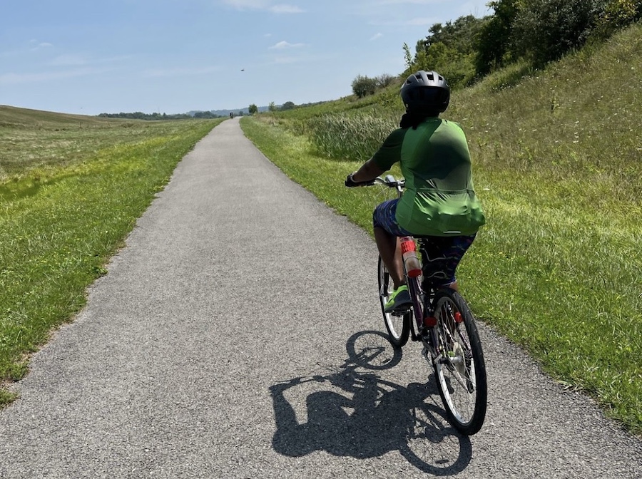
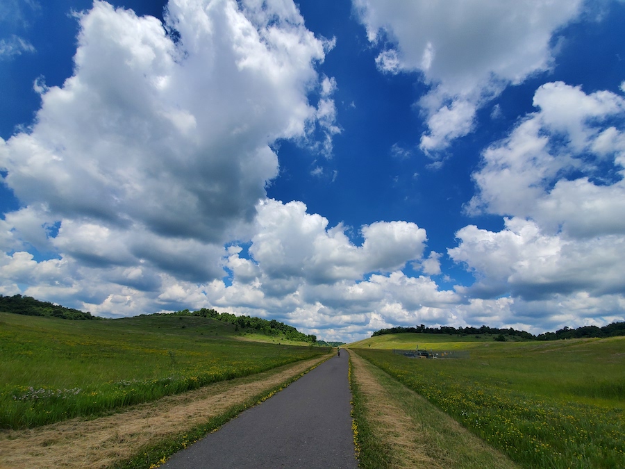
The roughly 4-mile section in West Virginia, managed by the Weirton Parks Board, is largely crushed limestone, but there are some paved areas to prevent erosion along Harmon Creek, a tributary of the Ohio River that runs along the trail. Beyond the West Virginia border, Thomassy noted that the 18 miles in Washington County are paved blacktop.
“It’s a phenomenally well-maintained trail,” said Eric Oberg, the Midwest regional director for Rails-to-Trails Conservancy. “This is gorgeous country, and it says something when you don’t notice anything but the scenery.”
The Panhandle Trail is also incorporated into community life with fun annual events, like the Night Walk around Halloween, where kids carve over 100 jack-o-lanterns to line the trail and families can enjoy ghost stories, hayrides and a bonfire.
It’s All About Connections
With its continued popularity, plans to extend the trail on its eastern end in the Greater Pittsburgh area are gaining momentum with Carnegie Borough receiving an Active Allegheny grant to conduct a feasibility study for the potential route.
“They’re trying to connect the Carnegie section to Walkers Mill [in Collier Township],” said Colleen Downey Mitchell, who is co-president of the Collier Friends of the Panhandle Trail, the group that maintains and improves the 2.9-mile portion between Gregg Station and Walkers Mill.
This new addition would not only add another scenic 2 miles to the overall trail (traveling through hardwood forests while paralleling Robinson Run) and connect more residents to the route, but would also provide important access to Carnegie’s West Main Street and transit stations, increasing its viability as a transportation option.
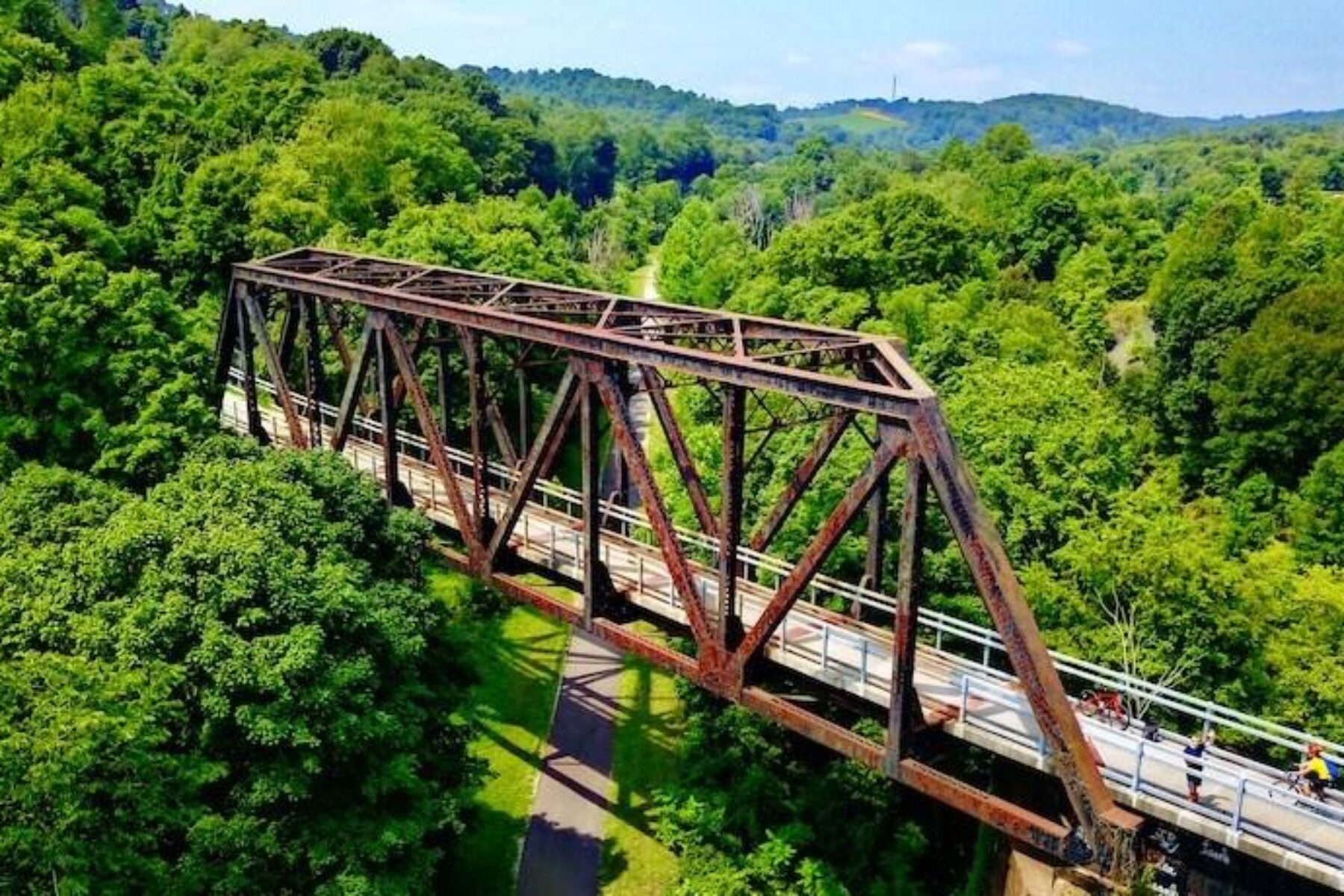
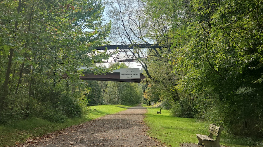
Adding to its value, the Panhandle Trail provides options to link up to several long-distance routes, including the Montour Trail, which partly encircles Pittsburgh. The Panhandle crosses under a 1913 railroad trestle that carries the Montour Trail, which in turn has connections to the famed Great Allegheny Passage (gaptrail.org) spanning 150 miles.
Efforts are also underway to develop connections with the Industrial Heartland Trails Coalition network, a Rails-to-Trails Conservancy TrailNation™ project that will ultimately establish over 1,500 miles of multiuse trail through Ohio, West Virginia, Pennsylvania and New York.
“The trail has a lot of usage, and everyone is very happy with it,” enthused Williams. “And it makes it easier and easier for those traveling by having all sorts of connections.”
The vision of the Industrial Heartland Trails Coalition (IHTC) is to establish the Industrial Heartland as a premier destination offering a 1,500-miles-plus multiuse trail network experience.
Related Links
- Collier Friends of the Panhandle Trail
- Washington County Parks & Recreation
- Visit Washington County
- Weirton Parks & Recreation
Trail Facts
Name: Panhandle Trail
Used railroad corridor: Pittsburgh, Cincinnati, Chicago and St. Louis Railroad (PCC & StL); Pennsylvania Railroad
Trail website: panhandletrail.org
Length: 29.2 miles
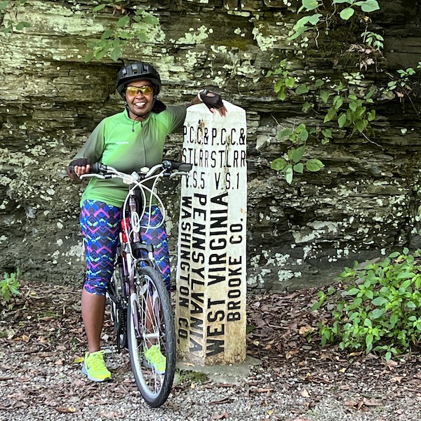
County: Allegheny and Washington (Pennsylvania); Brooke and Hancock (West Virginia)
Start point/end point: Walkers Mill Road/SR 3028 (Collier Township, PA) to 0.8 mile northwest of the McColl Road trail parking area (Colliers, WV)
Surface type: Asphalt, crushed stone
Grade: Following the railroad corridor, the trail offers a gentle grade between 1–3%.
Uses: Walking, bicycling, inline skating, cross-country skiing and fishing (in Harmon Creek and Robinson Run); wheelchair accessible
Difficulty: The trail offers an easy experience with occasional gradual slopes.
Getting there: The closest airport, Pittsburgh International Airport (1000 Airport Blvd., Pittsburgh), is about 16 miles from the trail’s eastern end.
Access and parking: Select parking lots for the trail are listed below from west to east; additional parking areas are detailed on TrailLink™.
- Colliers, WV: McColl Road, 0.2 mile from Harmon Creek Road (40.3940, -80.5687)
- McDonald, PA: McDonald Trail Station Meeting House at 151 S. McDonald St. (40.3668, -80.2346)
- Collier Township: Walkers Mill Entrance at Walkers Mill Road/SR 3028, 0.1 mile south of Noblestown Road (40.3960, -80.1317)
Rentals: Closest to the east end of the trail, Golden Triangle Bike Rental (600 First Ave., Pittsburgh; phone: 412.600.0675) offers bike rentals.


Donate
Everyone deserves access to safe ways to walk, bike, and be active outdoors.


