Top 10 Trails in Nevada
It doesn’t take long to realize that Nevada is more than glittering lights. Exploring its trails opens up a world that exists in a land many view solely as an arid, harsh environment. While the unique beauty of the desert dominates much of the landscape, there is still so much more to see, including forests, rivers and stunning lakes. Many routes provide opportunities to easily navigate through the urban footprint ultimately finding peace in the wide-open spaces.
Here are 10 of our favorites.
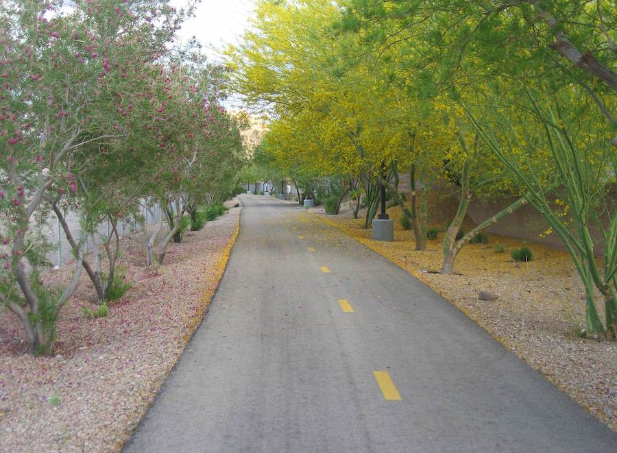
Lower Las Vegas Wash Trail
County: Clark
As part of the City of North Las Vegas’ plan to create a 70-mile Vegas Valley Rim network encompassing the entire city, the 13.4-mile Lower Las Vegas Wash Trail is one piece of the vision. Following the Lower Las Vegas Wash, a 12-mile-long channel that carries stormwater to Lake Mead, the 10-foot-wide paved trail shows off the green spaces within this urban footprint. Although there is a slight elevation gain, it is wheelchair accessible and offers shaded picnic areas, water fountains and parks. The trail connects with the shorter Upper Las Vegas Wash Trail at Alexander Road, as well as the River Mountains Loop Trail towards the southern end.
River Mountains Loop Trail
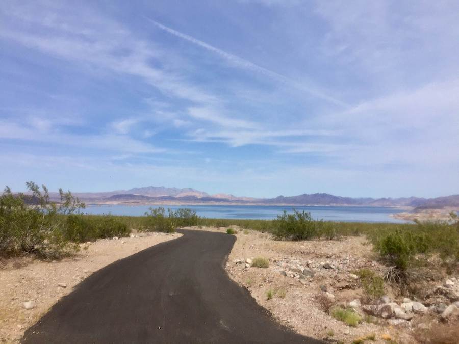
County: Clark
The 35-mile River Mountains Loop Trail provides the perfect opportunity to step away from the city lights and enjoy the quiet beauty of the desert landscape. The 12-foot-wide paved path welcomes pedestrians, bicyclists and inline skaters, and a second 15-mile trail for horseback riders parallels much of the path along the western side. Encircling the River Mountains, which are rich in volcanic geology, the trail passes through the Lake Mead National Recreation Area where it shares a trailhead with the Historic Railroad Trail. Even being so close to urban areas, look for the rare desert tortoise, as well as bighorn sheep and an array of lizards.
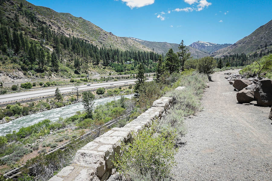
Historic Virginia and Truckee Trail
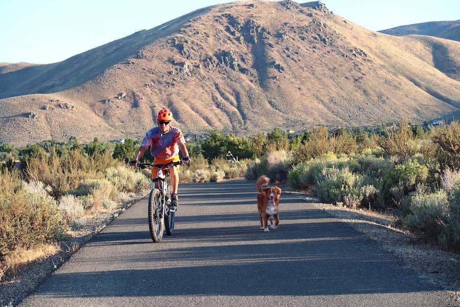
Counties: Washoe and Carson City
Following a section of the original route of the Virginia and Truckee Railroad (V&T), the Historic Virginia and Truckee Trail steps back into the time of the regional mining boon. Beginning in 1868, the V&T was integral in silver mining, initially hauling ore and lumber for the mines and then eventually transitioning to agricultural goods once the mines played out. Currently covering roughly 30 miles, from the Carson River to the Truckee River, the route encompasses a 2-mile rail-trail, 16 miles of other multiuse pathways and approximately a dozen miles of on-road riding. The plan is to eventually connect five counties and seven communities, with the trail ultimately linking to the Tahoe-Pyramid Bikeway and the 1,800-mile-long Pony Express Trail.
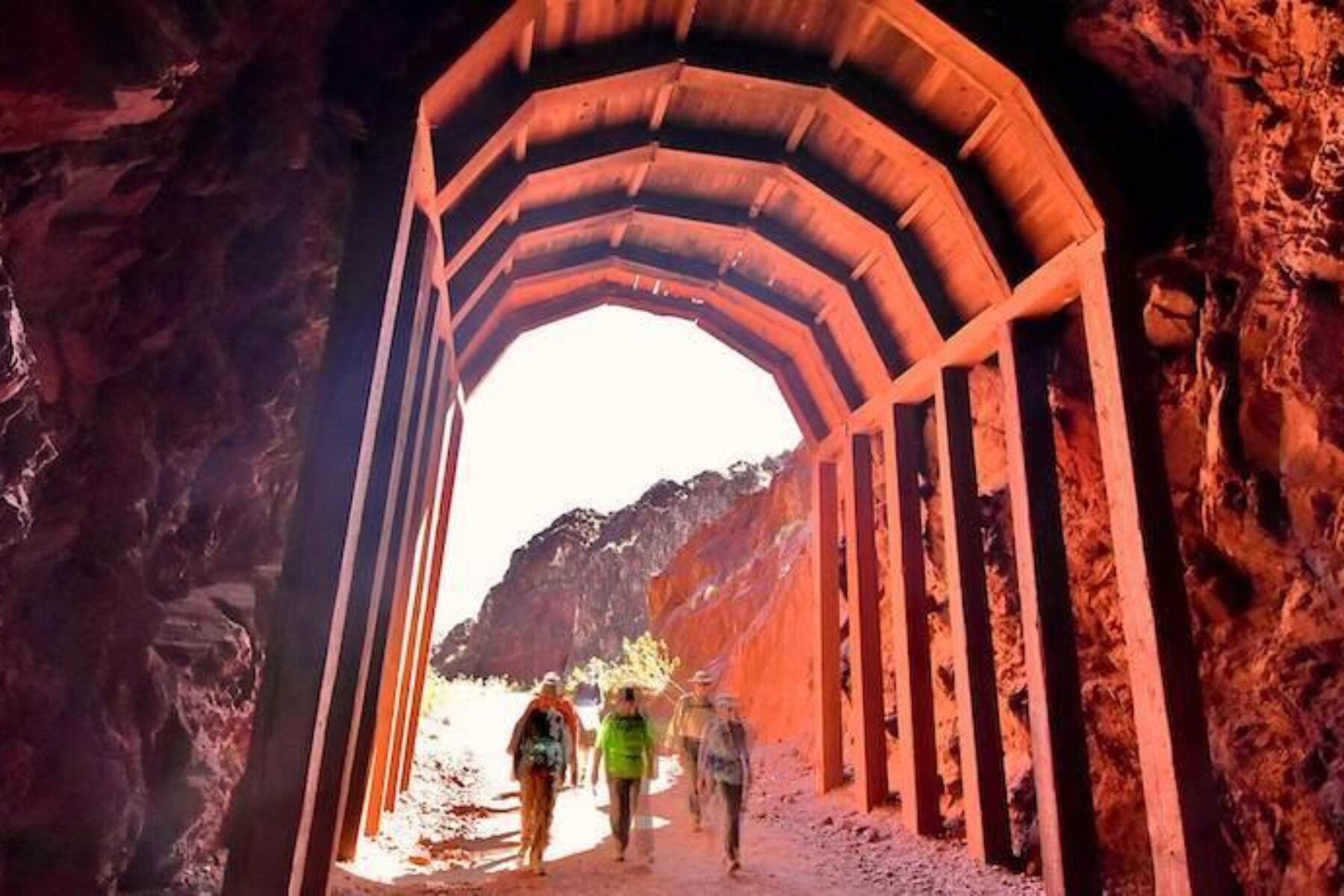
Historic Railroad Trail
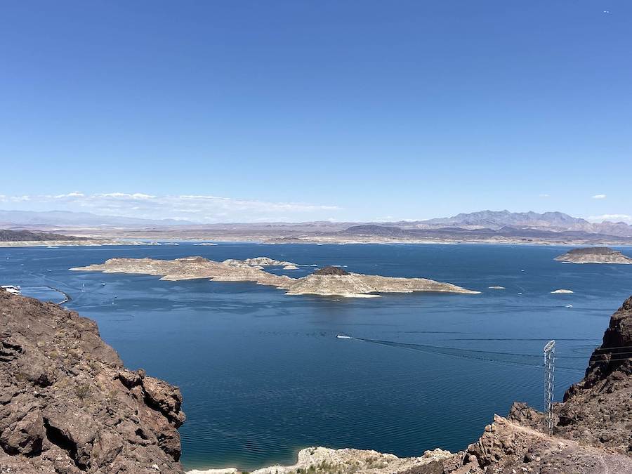
County: Clark
After filling Lake Mead upon the completion of the Hoover Dam in 1935, the 3.7-mile-long Historic Railroad Trail is the only section of the once 30-mile Hoover Dam Railroad tracks that are accessible and not underwater. The dirt and crushed-gravel trail remains relatively flat as it winds through gullies and above the shore of Lake Mead, offering jaw-dropping views of the deep blue water and the surrounding mountains. Along the entire route—which is wheelchair accessible—visitors pass through five tunnels—each of which are 300 feet long and 25 feet in diameter and were built to accommodate the enormous equipment used to construct the dam.
RELATED: A View From … Nevada’s Historic Railroad Trail
Tahoe-Pyramid Bikeway
County: Washoe
With three sections open to trail users, the 93-mile Tahoe-Pyramid Bikeway is within reach to connecting the full 114 miles of its intended plan following the Truckee River. Once completed, this multi-surfaced trail—ranging from hard-packed dirt to paved sections to bike lanes through towns—will descend over 2,000-feet from the 6,225-foot elevation of Lake Tahoe to the desert terrain leading to Pyramid Lake. The landscape transitions from forested areas along the river to expansive desertscapes, and the route also includes several towns that are perfect for meeting points or to grab a bite and recharge.
Anthem East Trail
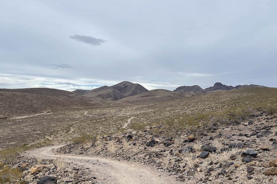
County: Clark
The first half-mile of the Anthem East Trail, beginning at Anthem Hills Park outside of Henderson, is relatively flat, but beyond this section, hills ranging from a gentle slope to a short, uphill grind make it a more challenging course. Utilizing a combination of utility roads and single tracks, the 7-mile one-way trail is surfaced with a combination of asphalt and packed dirt that is well suited for hiking and mountain biking. With vast desert surrounding the trail, keep in mind that there is no shade for most of the journey, and be sure to bring plenty of water.
Duck Creek Trail
County: Clark
Just over 3 miles long, the Duck Creek Trail links residents and visitors to services within East Las Vegas as well as Clark County Wetlands Park, which serves as a major educational resource for nature and recreational amenity in the Vegas Valley. Following the Duck Creek drainage canal on an east–west trajectory, the wide, paved trailhead is popular with pedestrians, bicyclists and inline skaters. The nature preserve within the Wetlands Park does not permit dogs or bicycles, but it is an oasis for waterfowl, which are found among the six ponds, and there is a connection at the other end of the park to the Flaming Arroyo Trail for a longer excursion.
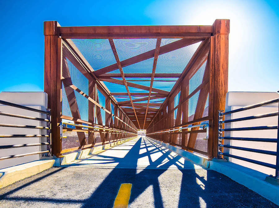
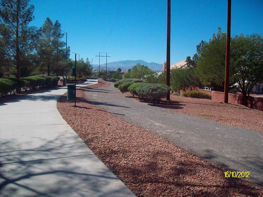
Union Pacific Railroad Trail
County: Clark
Officially named the Harry Reid Union Pacific Railroad Trail, this route through Henderson provides a mostly off-road option for trail users, including an under-crossing and pedestrian bridge. Gaining roughly 500 feet in elevation over its 11 miles, the trail connects neighborhoods with commercial areas and places for recreation. At the north end of the trail, Acacia Park has sports fields, a dog park, picnic areas and the Acacia Demonstration Gardens, which showcase native plants and water-wise landscaping techniques for Nevada’s arid climate. At the south end of the trail, recreationists can link to the River Mountains Loop Trail for a longer ride.
Goodsprings Trail
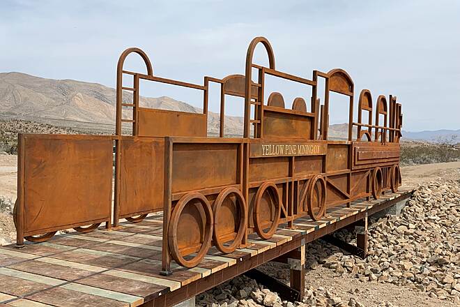
County: Clark
A visit to the historic town of Goodsprings is not complete without a stroll along the 2.2-mile Goodsprings Trail. By the early 1900s, Goodsprings was a booming mining town 40 miles south of Las Vegas where lead and zinc mining drove the prosperity of the region. The trail follows the route of the narrow-gauge Yellow Pine Mine Railroad that was used to haul out the ore from the mine, and the natural surface trail rolls along the beautiful, desert landscape while gaining enough elevation for outstanding views. Kiosks along the trail explain the history of the area and highlight the flora and fauna of the desert.
Amargosa Trail
County: Clark
The 10-mile Amargosa Trail is a mostly urban route that follows utility lines for much of its distance as it winds through neighborhoods and skirts the edge of the desert. There are beautiful views of the surrounding valley, but recreationists never quite lose sight of civilization. Even so, it’s possible to spot jack rabbits, desert tortoises, quail and other wildlife. And for those who take the time to stop, the native plants tell a story of a harsh life in this arid climate. With over 1,000-feet of elevation gain, there are good opportunities for pedestrians and bicyclists to bump up their heart rate on the hills, and ample benches for those on a more leisurely schedule to pause and relax.
Honorable Mention
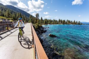
Tahoe East Shore Trail
What the 3-mile long Tahoe East Shore Trail lacks in distance, it makes up for in its “wow-factor.” Beginning at the trailhead toward the southeast side of Incline Village, the paved, 10-foot-wide trail starts with phenomenal views of Lake Tahoe, then gradually winds its way to the lake shore, terminating at Sand Harbor State Park. In this short distance, there are 16 vista points for trail users to pause and take a photo or just soak in the scenery of the largest reservoir in the United States. The Tahoe East Shore Trail also accesses the Incline Village Bike Path, including the popular 2.5-mile “jogger’s trail” along the lake shoreline.
Special acknowledgments: Donna Inversin, Historic Virginia and Truckee Trail; Janet Phillips, Tahoe-Pyramid Trail; Alemendra Johnson, Get Outdoors Nevada; Jaime Hayden, Augustine Agency/Incline Village Crystal Bay Visitors Bureau; Stephen Fleming, Goodsprings Historical Society; Amy Wojtech, City of Henderson


Donate
Everyone deserves access to safe ways to walk, bike, and be active outdoors.


