Top 10 Trails in Oregon
From the majestic coastline through the rugged mountains and into the high desert landscape, Oregon is rich in diverse natural beauty—and there’s no better way to experience the state than on a trail.
Here’s our take on some of the best trails in the Beaver State.
Historic Columbia River Highway State Trail
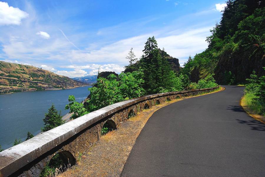
Counties: Hood River, Wasco
Without a doubt, the Historic Columbia River Highway State Trail is considered by many to be one of the best trails in the state. This magnificent multiuse pathway was created using parts of the scenic byway that are now closed to cars. Along its 13-miles-plus route, the trail features stunning river views along rugged cliffs, forested canopies of old-growth fir and wide grassland meadows. It’s the perfect marriage of nature and artistry.
With several segments throughout the Columbia Gorge National Scenic Area, you can explore the majestic natural beauty of the region along a meticulously crafted and fully restored roadway. You’ll marvel at the craftsmanship of the historic tunnels and arched walls, which can be enjoyed at an easy pace—by foot or by bike.
Banks-Vernonia State Trail
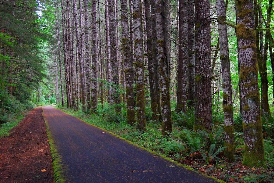
County: Columbia, Washington
Nestled in the foothills of Oregon’s Coast Range, the 22-mile Banks-Vernonia State Trail links the two towns for which it is named along a breathtaking corridor that winds through the cathedral-like coastal forests and into vast open pastoral farmland. The trail boasts 13 bridges, including the 735-foot Buxton Trestle, which takes trail users 80 feet above Mendenhall Creek and harkens back to the rail line that once transported lumber to nearby Portland.
The beloved trail—Oregon’s first rail-trail conversion—has become a major tourism draw for the towns of Banks and Vernonia. And with a connection to the future Salmonberry Trail, trail visitors will one day be able to make the trek to the Pacific Ocean.
TRAIL OF THE MONTH: Banks-Vernonia State Trail (January 2016)
Ruth Bascom Riverbank Trail System
County: Lane
This network of trails lines both banks of the Willamette River and connects the cities of Eugene and Springfield. Weaving through parks and greenspaces throughout the city, the trails are a popular circuit for local runners. Four main trails plus five bike and pedestrian bridges and several local connecting pathways ensure a variety of loops through this nearly 20-mile system.
Deschutes River Railbed Trail
County: Sherman
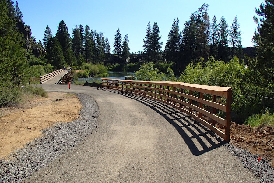
Looking to hike or ride along a nationally designated Wild and Scenic River? The Deschutes River Railbed Trail is the place for you! The pathway traces the banks of the Lower Deschutes River, where watersport enthusiasts and anglers can be seen with horseback riders, hikers and mountain bikers. Along the way, the trail shows off what makes this place so special, leading through a remote river canyon with abundant wildlife and scenic beauty.
Note: You should expect intense heat in the canyon; snacks, liters of insulated water and hats are recommended.
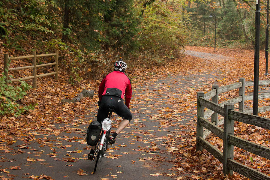
Springwater Corridor
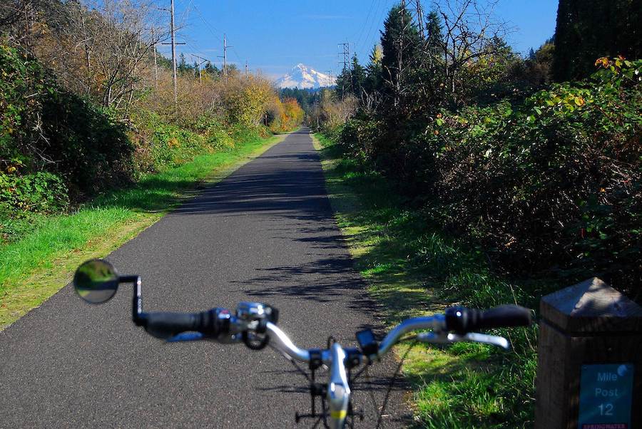
Counties: Clackamas, Multnomah
Following the banks of the Willamette River, from Portland to the town of Boring, this family-friendly 21.5-mile trail is anything but mundane. The trail is not only a recreational hotspot, but with its connections to the region’s light rail and bus system, the Springwater Corridor provides a vital active-transportation route for commuters. Although the trail currently ends in the foothills of the Cascades, there are plans to extend the trail all the way to Mount Hood’s iconic Timberline Lodge.
From the bustling downtown of Oregon’s most populous city, through the suburbs and into the natural and agricultural countryside, this pathway has a bit of everything for the trail lover—and stunning views of Mount Hood are always close at hand.
TRAIL OF THE MONTH: Oregon’s Springwater Corridor (September 2011)
Row River Trail
County: Lane
Lane County boasts the most covered bridges west of the Mississippi, and a great place to see some of them is nearby the Row River Trail. This 14-mile paved trail follows its namesake waterway from the heart of charming Cottage Grove through forests, native prairies and farmland in the foot of the Cascades.
Traverse a movie-star trestle—at Harms Park—that was featured in films like “Stand By Me,” “Emperor of the North” and Buster Keaton’s “The General” (another famous trestle in Oregon that was also featured in “Stand By Me” is along the Great Shasta Rail-Trail). And just off the trail, you can explore the historic covered bridges, including the stunning 1920 bridge at Mosby Creek.
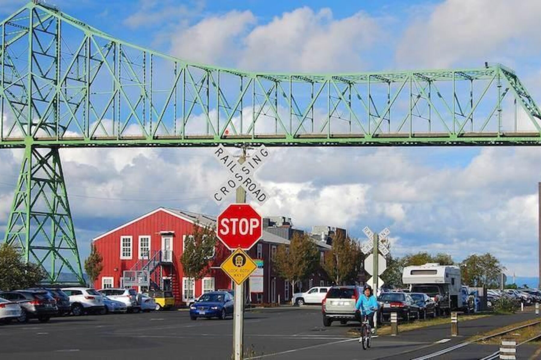
Astoria Riverwalk
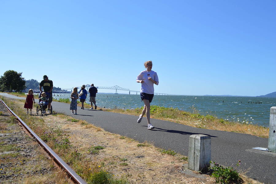
County: Clatsop
Near the mouth of the mighty Columbia River, the Astoria Riverwalk offers a terrific way to see the natural beauty and history of this coastal city—and maybe even some sites featured in the classic movie “The Goonies.”
The 6.4-mile trail allows you to get up close and personal to the maritime sights and sounds of barking sea lions and migratory birds, and then take in Astoria’s history, grab a bite to eat or sample a local brew. Watch as seagoing vessels navigate the shifting sandbars of what has long been known as the “Graveyard of the Pacific,” where the Columbia meets the sea.
Vera Katz Eastbank Esplanade (+ Tilikum Crossing)

County: Multnomah
At less than 2 miles long, the Vera Katz Eastbank Esplanade makes up for its diminutive status with splendid views of the Portland skyline along the banks of the Willamette River, and numerous connections to the downtown area and eastside neighborhoods.
The trail forms a waterfront loop by way of several bridge crossings, including the Steel Bridge Riverwalk to the north, the spectacular Tilikum Crossing to the south—Portland’s newest bridge crossing the Willamette built exclusively for transit, bike and pedestrian traffic—and several bridges in between. On the south end of the trail, enjoy breathtaking views of the city, Mount Hood and Mount St. Helens with a trip on the Portland Aerial Tram (currently restricted due to COVID-19) on the west bank of the Willamette, or connect with the Springwater Corridor just a few blocks away.
Sun-Lava Trail
County: Deschutes
Just south of Bend, the power of nature is on view as the Sun-Lava Trail takes you on a journey through the rugged volcanic landscapes and forests of Central Oregon. The trail connects the Lava Lands Visitor Center to the Deschutes River, where it continues onto the Deschutes River Trail to the northeast and the Sunriver Bike Path, which takes you through the popular resort community.
The gorgeous scenery and recreational opportunity that this trail connects to has made it a top destination for outdoor enthusiasts—and there are plans to extend the pathway toward Bend.
Minto-Brown Island Park Paved Path and the Riverfront Trail
County: Marion
Along Salem’s riverfront lies a trail twofer that winds through a natural oasis along the Willamette River. The Minto-Brown Island Park Paved Pathway takes you on a journey through the heart of the thousand-acre park, offering connections to playgrounds, wildlife viewing areas, fishing docks and other amenities.
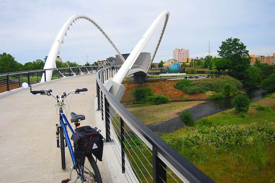
The trail connects to the Riverfront Trail by way of the 300-foot Peter Courtney Minto Island Bridge and it’s stunning arches. Continue from there to take a ride on the beautiful carved horses of the Riverfront Park Carousel and the Eco Earth Globe artwork. And don’t miss the impressive steel and timber structure of the Union Street Railroad Bridge.
These two trails are a great way to connect with nature in the heart of the state capital.


Donate
Everyone deserves access to safe ways to walk, bike, and be active outdoors.


