Great American Rail-Trail: Long-Distance Adventures
2020 may have rattled the travel industry, but one form of travel experienced an unexpected revival: trail visitation. During the COVID-19 pandemic, bicycle purchases have surged, and trail use around the country has seen a sustained uptick of more than 50% over previous years. Being outside has helped millions to cope, buoying support—and demand for—projects like the developing 3,700-mile Great American Rail-Trail™, the nation’s first cross-country multiuse trail.
Here are just a few of the long-distance outdoor adventures to be found along this unique and vital route between Washington State and Washington, D.C. (All mileages listed below are approximate.)
For more Great American long-distance rides, like the famed Great Allegheny Passage (gaptrail.org) and C&O Canal Trail route, check out our story, “Four Long-Distance Rides Along the Great American Rail-Trail.”
INDIANA
Richmond to Gaston
LENGTH: 51 miles
WHAT TO SEE: The Cardinal Greenway—the longest rail-trail in Indiana—totals 62 miles from Richmond, near the Ohio border, up to Marion in the state’s picturesque eastern countryside. Although there’s a break in the trail on its northern end, riders can follow a contiguous paved pathway for 51 of those miles between Richmond and Gaston.
Beginning from Richmond, the trail offers a scenic lookout within its first mile with its passage over the east fork of the Whitewater River on a former Chesapeake & Ohio Railway bridge. Heading north, the pathway skirts the lushly wooded Springwood Park. A worthwhile excursion just south of the park is Thistlethwaite Falls, a manmade waterfall used in the 1800s to power nearby mills. Continuing on a northwest course, the surroundings become more rural and remote, though a handful of friendly small communities dot the trail about every 5 to 10 miles.
Approaching Muncie, a companion equestrian pathway stretches 3.5 miles alongside the Cardinal Greenway and provides access to the horse trails that wind through Prairie Creek Reservoir. Take time to visit the adjacent Red-tail Nature Preserve where you can stroll through native grasses and wildflowers flush with birds.
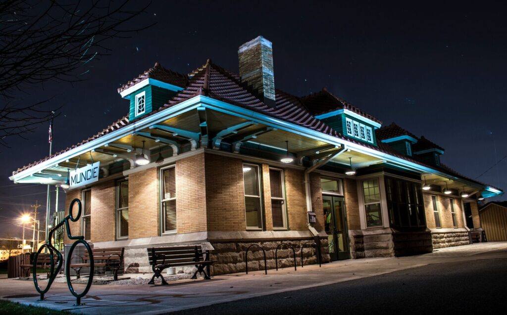
The lively college town of Muncie, home to Ball State University, offers a terrific place to spend some time with its plethora of parks, museums and other cultural attractions (including the studio of famed painter Bob Ross). In the city center, sightseers will find the charmingly restored Wysor Street Depot, listed on the National Register of Historic Places and a hallmark of the trail’s namesake, the Cardinal passenger train that once ran through the corridor. Just north of the depot, a connection can be made to the White River Greenway, which spirts visitors to the wildlife-rich habitats of the John Craddock Wetland Nature Preserve.
SURFACE: Asphalt from Richmond to Gaston; to explore the disconnected northern segment of trail between Jonesboro and Marion, travelers will need to navigate an 11-mile gap between Gaston and Jonesboro; for an on-road route, check the Cardinal Greenways website.
WHERE TO STAY: For a bevy of options available in Richmond and Muncie, check out the visitors bureau websites for Richmond/Wayne County and Muncie.
ILLINOIS
Bureau Junction to Colona
LENGTH: 63 miles
WHAT TO SEE: The Hennepin Canal Parkway totals 104 miles, but for this Great American journey, we’ve focused on the 63-mile east–west portion that extends from the village of Bureau Junction just off the Illinois River to Colona, along the Rock River. (An additional spur heads north along a feeder canal from the trail’s midpoint to Sterling.)
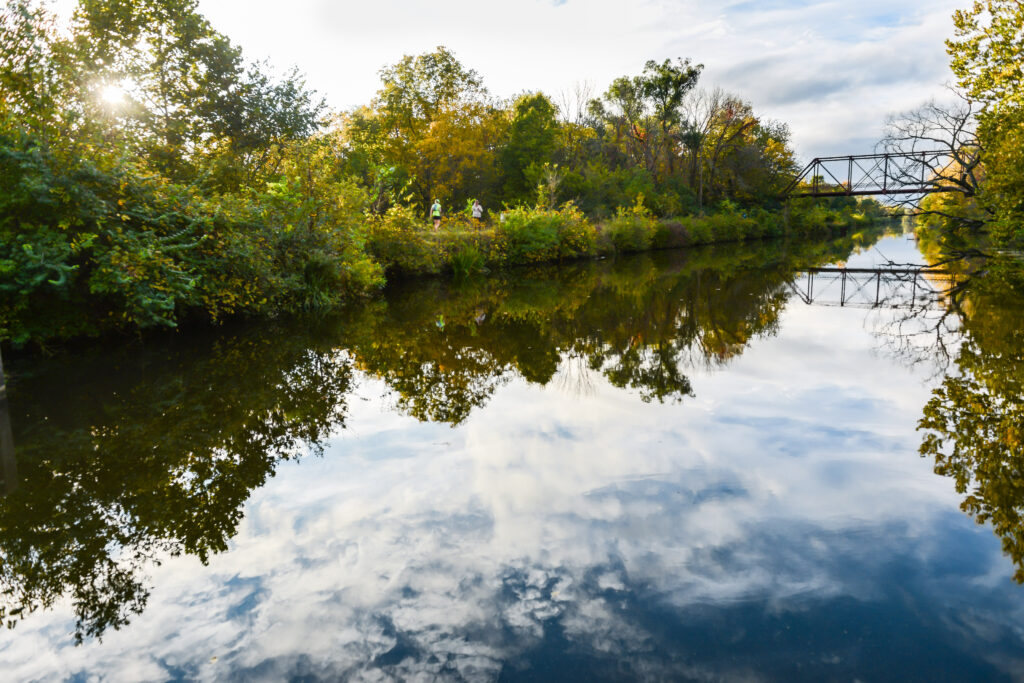
A Midwestern gem, the Hennepin Canal Parkway provides a never-dull mixture of northwestern Illinois terrain, including forest, prairie, wetlands and farm fields. This serene natural escape follows an early 20th-century canal listed on the National Register of Historic Places and dotted with numerous lift bridges, aqueducts, locks and other relics of a bygone era.
The trail serves as a state park, and a stop at the park’s visitor center near Sheffield is a must-do. There you’ll learn about the area’s natural environments and the canal’s history, including the tools used to build and operate it. Note: The pathway typically skirts the edges of the towns along the way and is generally situated about a mile from city centers, so trekkers should plan for a get-away-from-it-all experience and pack sufficient water and snacks for the trip.
In addition to the trail’s own biking, hiking and equestrian options, the canal adds to the all-around adventure with canoeing, kayaking, boating and fishing. And if birding is your passion, know that bald eagles, wild turkeys, waterfowl, woodpeckers and many other species are frequently spotted.
Mix things up a bit by visiting the Quad Cities region along the vibrant Mississippi River corridor, about 10 miles west of trail’s end in Colona.
SURFACE: Primarily gravel and best suited for hybrids and mountain bikes. Equestrians are encouraged to use the grassy edges.
WHERE TO STAY: The trail is managed by the Illinois Department of Natural Resources as a state park and includes several campsites. For more lodging options, check out the websites of Visit Quad Cities and the Henry County Tourism Bureau.
RELATED: 16 Historic Highlights Along the Route of the Great American Rail-Trail
IOWA
Solon to Hudson
LENGTH: 96 miles
WHAT TO SEE: Spanning nearly 100 miles, this route through east-central Iowa allows explorers to experience America’s Heartland up close. In Solon, the trip launches from the Solon Recreation and Nature Area along the Hoover Nature Trail, an auspicious point with plentiful amenities. Not far off the trail, Lake Macbride State Park—Iowa’s largest—offers a nice place to spend extra time enjoying the lushly wooded lake with swimming, boating and fishing.
From Solon, the trail unfurls into the quiet countryside, reaching the old railroad town of Ely after about 7 miles and a seamless connection with the Cedar Valley Nature Trail—the first rail-trail in the state and one of its longest. At times following the Cedar River, the pathway makes its way up to Cedar Rapids, Iowa’s second-largest city and a fun urban complement to the more rural aspects of the route.
Outside the city limits, the pastoral setting embraces visitors once again with agricultural fields, scenic swaths of prairie and wildflowers, and dense forests. Two not-to-miss attractions in this section include the Center Point Depot, listed on the National Register of Historic Places, and, in Brandon, Iowa’s Largest Frying Pan.
The Cedar Valley Nature Trail ends in Evansdale, but you can continue the route on a succession of shorter paved trails that are knitted together. (Navigation can get tricky; check out the TrailLink pages linked in this article for maps and details.) After skirting Meyers Lake on the Evansdale Nature Trail, you’ll ride atop a river levee on the River Forest Road Trail and soon reach the Cedar Valley Lakes Trail. You’ll pedal nearly 10 miles on this pathway, tracing Waterloo’s riverfront and winding around a handful of forested lakes. In Waterloo, the trailside “Our Freedom Story” mural is a standout attraction depicting the city’s civil rights movement in the 1950s and 60s. Spanning 3,000 feet, the powerful artwork was painted by some 300 student artists and volunteers.
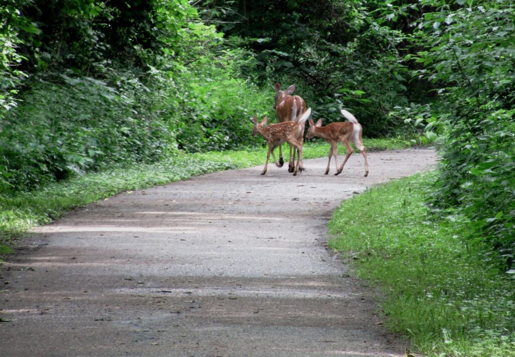
At the tail end of the trail, George Wyth State Park offers a perfect spot for birding and wildlife viewing. At its western edge, you’ll pick up the South Riverside Trail and roll into Cedar Falls across the river. Curving southward, the Cedar Prairie Trail spins through residential neighborhoods and pockets of commercial activity to a junction with the Sergeant Road Trail, which follows a straight course along US 63 to Hudson.
SURFACE: With the exception of a 20-mile compacted limestone section from Cedar Point to McFarlane Park (La Porte City), most of the route is paved.
WHERE TO STAY: For camping near either end of the route, check out Solon’s Lake Macbride State Park and Waterloo’s George Wyth State Park. Other accommodations can be found on the tourism websites for Cedar Rapids, Waterloo and Cedar Falls, as well as on the Travel Iowa website.
MONTANA/IDAHO
St. Regis to Plummer
LENGTH: 115 miles
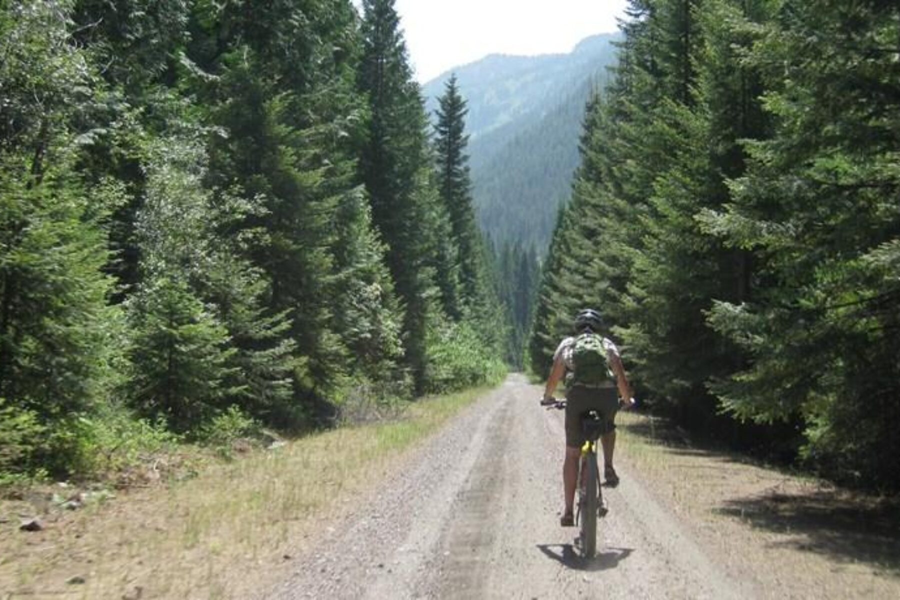
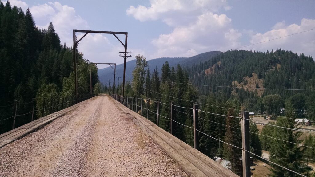
WHAT TO SEE: In the northwestern corner of Montana, you’ll begin your adventure on the outskirts of St. Regis, famed for its local fly fishing, riding 22 miles of the Route of the Olympian to the old mining and logging town of Saltese. With a backdrop of forested mountains and the clear sparkling waters of the St. Regis River at your side, trail rides don’t come much prettier. Although the western tip of the trail is not part of the Great American, it’s worthwhile to check it out to experience the jaw-dropping Dominion Trestle, which provides a bird’s-eye view of the surroundings from 70 feet up.
Ensconced in the Lolo National Forest, the connecting NorPac Trail—which gets its name from the Northern Pacific Railway—begins in Saltese and sprints about 20 miles west, climbing over Lookout Pass, a popular skiing destination. Although the pathway parallels I-90, travelers are comfortably tucked away amongst the pines. If you’re looking for scenery and solitude, this is it, though the flip side is that services and amenities are very limited.
Near Shoshone Park, adventurers will need to pedal about 4 miles on-road to reach the next part of the route, though the payoff is high: an experience on a Hall of Fame Rail-Trail. In Mullan, you’ll pick up the Trail of the Coeur d’Alenes, a 73-mile route across Idaho’s Panhandle managed by the state in partnership with the Coeur d’Alene Tribe.
When you reach Wallace after about 7 miles, be sure to stop at the beautifully restored Northern Pacific Railroad Depot Museum (open seasonally) to explore the region’s rich history. Continuing on the route, the paved pathway offers one breathtaking vista after another as it journeys through Idaho’s chain-of-lakes region, crosses the rolling foothills of the Palouse prairie and traces the shoreline of the Coeur d’Alene River. Visit in summer, when it’s prime huckleberry season, and enjoy tasty treats in the smattering of small towns that the trail connects.
Approaching its west end in Plummer (not far from the Washington border), the trail crosses the southern end of Lake Coeur d’Alene on the stunning Chatcolet Bridge. Nestled against the lake, Heyburn State Park offers a wealth of activities for water lovers, including canoeing, swimming and fishing. Founded in 1908, it’s the oldest state park in the Pacific Northwest and features buildings constructed by the Civilian Conservation Corps in the 1930s.
SURFACE: The Route of the Olympian and NorPac Trail are primarily gravel and best suited for mountain bikes. The Trail of the Coeur d’Alenes is fully paved.
WHERE TO STAY: Camping is available in Lolo National Forest and Heyburn State Park. For other lodging options, check out the websites for the North Idaho Tourism Alliance and Historic Silver Valley Chamber of Commerce.
Special thanks to RTC staffers Kevin Belanger, manager of trail planning, and Eric Oberg, Midwest regional director, who contributed to this article.
RELATED: Four Long-Distance Rides Along the Great American Rail-Trail
This article appears in the Spring-Sumer 2021 issue of Rails to Trails magazine. It has been reposted here in an edited format. Subscribe to read more articles about remarkable rail-trails and trail networks while also supporting our work.
When you subscribe to Rails to Trails magazine, you’ll have access to many other features like this one. Our magazine is a premium of Rails-to-Trails Membership. Join today to start receiving the magazine!


Donate
Everyone deserves access to safe ways to walk, bike, and be active outdoors.


