Baltimore Greenway Trails Network
Herring Run Trail | Side A Photography
Vision
Transforming the Public Realm by Providing Equitable, Healthy Trail Access for People of All Ages and Abilities in Baltimore City
The Baltimore Greenway Trails Network is a vision for a 48-mile world-class network of urban trails that will link together the diverse neighborhoods, cultural amenities and outdoor resources that make up the landscape of Baltimore City.
When complete, the trail network will connect the city’s popular institutions and destinations—including universities, hospitals, museums, parks, schools, waterfronts and employment centers—with Baltimore’s diverse communities. The trail network will transform the public realm by providing equitable, healthy, low-stress access to open space and reliable transportation and recreation for people of all ages and abilities.
The concept for this modern-day trail vision was spearheaded by Rails-to-Trails Conservancy (RTC) along with a coalition of more than 90 partner organizations and is inspired in part by the 1904 Olmsted Plan for Baltimore. Although the historical plan never came to fruition, it aimed to expand public access to the city’s vast amounts of public parkland by developing “green corridors”, envisioned as linear extensions of the city’s park systems that would connect neighborhoods and residents together. Today, we have identified new opportunities to bring this vision to reality thanks to the Baltimore Greenway Trails Network, which will link the city’s neighborhoods with its amenities and attractions to serve all Baltimore residents and visitors.
Related: What’s happening with project to connect Baltimore’s trails? (The Baltimore Banner)
Baltimore Stories
View More Blogs
A Year of Joy and Progress for Trails
This year of progress for trails underscored how trails are transforming lives and bringing joy to people and communities.
Federal RAISE Grants Illustrate Widespread Demand for Infrastructure That Makes It Safer and Easier to Walk and Bike in Communities Nationwide
RTC analysis Finds RAISE Grant Awards Address Needs of Bicyclists and Pedestrians, and Many Fill Gaps in Active Transportation Networks
Baltimore Voters Support Equitable Transportation Funding and Enhanced Trail Infrastructure
Baltimore Voters Support Equitable Transportation Funding and Enhanced Trail Infrastructure
What This Means for Baltimore
Only 10 additional miles are needed to close critical gaps through 75 neighborhoods and help reverse the urban fragmentation prevalent since the 1950s. Former rail lines, industrial coastlines and reconfigured roadways will be transformed from barriers in the built environment to community-based assets centered on trails. This will change the way Baltimore residents work, live and play—and generate myriad long-term impacts related to social equity, health, environmental conservation, active transportation and economic development.
Related: Baltimore Greenway Trails Network Aims to Connect City Neighborhoods (Baltimore Magazine)
Promoting Social Equity
Baltimore has been fragmented by busy roads and a history of housing policies since the early 20th century, as a result of a racist financial and real estate practice known as Redlining. This now illegal discriminatory practice segregated communities based on race and socio-economic status for generations while its impact on neighborhoods and families exists today. These neighborhoods are often isolated from transit, trails and greenways while more than 200,000 (nearly 1 in 3) of city residents are without access to a car. The 48-mile trail loop will connect over 75 of the city’s diverse neighborhoods to the downtown, important institutions and regional economic centers—providing safe walking and biking access to jobs, reliable public transit, schools and outdoor opportunities for physical activity and recreation.
Improving Health and Wellness
In Baltimore, opportunities for safe access to physical activity are low, while chronic health conditions are high. Creating a more equitable trail network will increase accessibility to Baltimore’s many parks and open spaces for nearby residents—providing more options to be active and connect to nature. For decades, entire neighborhoods have been segregated from public outdoor space and transportation, making it difficult to be physically active outdoors. The completed trail network and the new opportunities it creates for exercise and active transportation will lead to more healthy communities that thrive. The completed trail network is also projected to save Baltimore residents as much as $2.4 million per year in health costs, according to an Ernst & Young LLP report.
New Report Finds Trail System Can Generate Millions
The study examines the potential economic and social benefits of a $28 million plan to expand and connect existing trails in the city to complete the Baltimore Greenway Trails Network.
This report was prepared by Ernst & Young LLP in cooperation with RTC for the Greater Washington Partnership.
Related: StreetsBlog’s “Proof: Bike Paths are Good for the Local Economy”
Protecting Our Environment
The Baltimore Greenway Trails Network is partly based on a vision set forth a century ago to create a parks and greenways system in the city that naturally integrated—and was built upon—the city’s three stream valleys (Gwynns Falls, Jones Falls and Herring Run) and other unique natural features. The trail network will help preserve these cherished assets while also serving as critical green infrastructure that safely transports hundreds of thousands of people to their destinations while lowering Baltimore’s carbon footprint. The Greenway will help Baltimore City and the region reach its goals. This green infrastructure network will provide wildlife habitats and increased tree canopy; support stormwater management through trailside plantings and gardens; help clean the air; reduce the urban heat-island effect while shading neighborhoods; and creating a sense of place—for people and the ecosystem. The completed Greenway will be a model of urban sustainability demonstrating the innovation and potential for America’s cities.

Creating Active Transportation Connections
The trail network will provide active transportation connections among neighborhoods, activity centers and downtown—including to important public transit stations—while creating a new freedom of mobility for residents.
Nearly all MTA public transit systems will intersect with the Greenway, including the CityLink, LocalLink, Express BusLink, the Commuter Bus, the Light RailLink line, the Metro SubwayLink line and the MARC Train line, which provide multiple direct connections to every neighborhood in the city. For example, residents in south Baltimore will be able to use trails for increased access to transit and parks around the Middle Branch waterway for easier, safer access to downtown employment centers. The trail network will also provide a seamless off-road link between the Jones Falls Trail and the Herring Run Trail (at Lake Montebello), creating connections to two of the city’s major universities, two of the city’s large parks and more than a dozen diverse neighborhoods together.
Promoting Strong Businesses and Economies
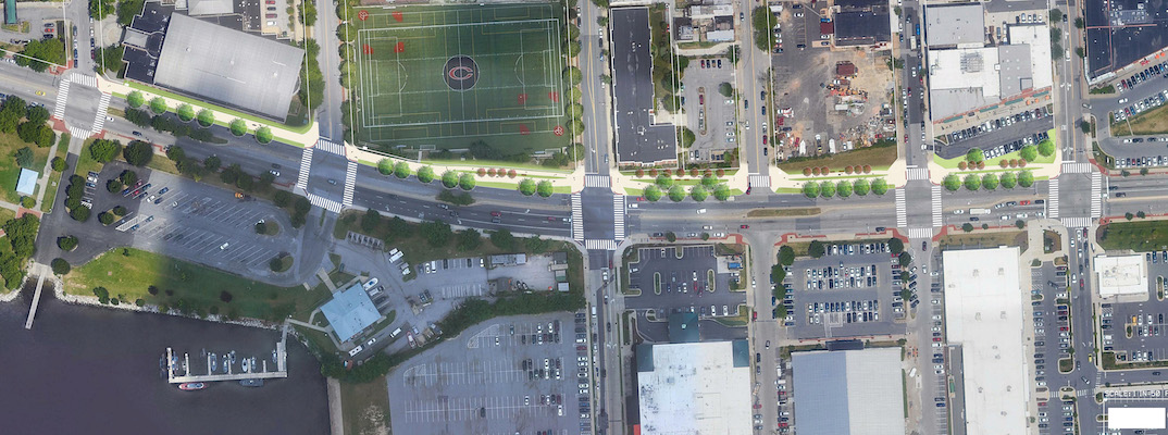
The Baltimore Greenway Trails Network will support economic development across the city—connecting employment centers to residential neighborhoods and linking trail development with community development. The trail network will bring new vitality to previously segregated areas and strengthen connections across the divided landscape. For example, a former industrial section of Baltimore’s east side is experiencing rapid population and business growth. This economic renaissance will be enhanced by transforming the area’s disused rail line into a rail-trail stretching south to the city’s popular Inner Harbor and north to residential neighborhoods—creating a host of new access points and active transportation options. When completed, the trail will weave together diverse neighborhoods that are currently cut off from each other and separated from the economic centers of southeast Baltimore. The barrier created by the unused railroad line will turn into a community connector linking residential neighborhoods to the north with the jobs and recreation opportunities in Highlandtown, Canton, Greektown and the Inner Harbor.
In multiple locations across the city, the public and private sector are working together to make sure the Greenway connects people to where they want to be. Unused industrial sites being converted into mixed-use residential, commercial and recreational uses are including connections to the Greenway and, in some cases, building sections of the Greenway as part of their construction because they know being connected to the trail will be good for business and good for Baltimore’s economy.
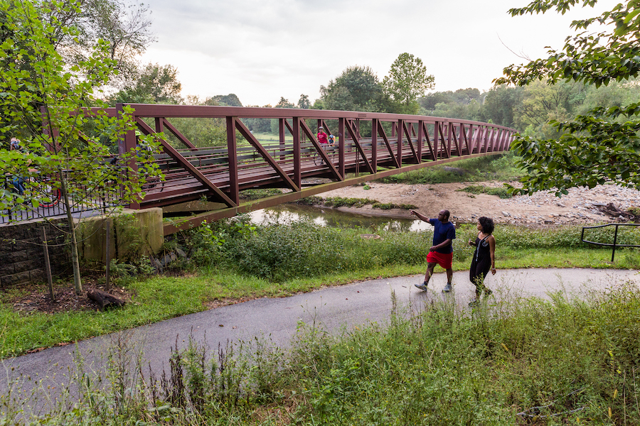
Connecting the Most Exciting Projects in Baltimore

The trail network links many of the city’s most transformative development projects and park plans in Baltimore. These exciting initiatives all play heavily into each other and have the potential to strengthen Baltimore by being connected to the Greenway. These exciting projects include:
- The Baltimore Green Network Plan: A collective vision to strengthen communities by creating an interconnected network of greenspaces throughout the City.
- The Baybrook Connector: Connecting Baybrook residents to the major redevelopment of the Middle Branch Waterfront and recreational amenities.
- BCDOT’s Lake 2 Lake Project: Increasing visibility and access to Druid Hill Park and Lake Montebello.
- Druid Park Lake Drive Complete Streets Design Effort: Designing concepts that improve access to Druid Hill Park for local residents.
- Druid Hill Park Vision Plan: Reimagining better connections, design and use of Druid Lake through community and stakeholder engagement.
- Greater Washington Partnership Blueprint for Regional Mobility: More than 30 organizations working together to advance the Capital region’s transportation system—connecting Baltimore, Washington and Richmond.
- Reimagine Middle Branch: A community-driven initiative to reconnect South Baltimore to its more than 11 miles of shoreline along the Patapsco River.
Preserving Baltimore’s Heritage

The Olmsted Brothers Landscape Architects painted a visionary picture for Baltimore in a comprehensive 1904 report, Upon the Development of Public Grounds for Greater Baltimore. The report’s blueprints for Baltimore’s park system, which focused attention on the three stream valleys (Gwynns Falls, Jones Falls and Herring Run) and other natural features unique to the city, are a shining example of successful urban planning. Read more about this vision on the Friends of Maryland’s Olmsted Parks & Landscapes website.
Partners
The Baltimore Greenway Trails Coalition is a broad-based group of diverse stakeholders that includes more than 90 active partners, spearheaded by RTC. The coalition will build on and support already emerging initiatives in the city, including Baltimore City’s emerging Green Network Plan, the updated Baltimore City Bicycle and Pedestrian Master Plan and a revitalized master plan for the Middle Branch.
How We’re Getting It Done
Working With Communities: RTC and the Baltimore Greenway Trails Coalition work with communities by co-hosting trail events, community cleanups, public art, family fun activities at farmers markets, biking and walking tours, neighborhood festivals and more.
Working with Elected Leaders: RTC and coalition partners work with elected officials to help them understand the benefits of trails to communities through trail tours, corridor gap site visits and inviting them to community meetings.
Working Groups: Coalition partners host working group meetings with public agencies, community groups and trail advocates to advance trail completion while collecting input from residents, trail users and other stakeholders.
Equitable Development Planning: RTC staff and partners continue to address longstanding equity issues in Baltimore by supporting local neighborhoods, organizations and non-profits’ community-driven work along the trail network’s footprint. In partnership with the Mayor’s office, the coalition will engage with community leaders, advocates and residents to co-design the equitable trail development plan.
Advocating for Trail Funding: Coalition partners advocate for trail and active transportation funding in Annapolis and Washington, D.C. – helping bring over $2.5 million to support Baltimore Greenway design and construction to date
Leading Trail Programming: Coalition partners, particularly Baltimore City Department of Recreation and Parks, partner with organizations such as Black People Ride Bikes, Bikemore, Bluewater Baltimore, RTC and more to have a robust and accessible schedule of programming for residents and visitors on the trail network.
Capacity Building Grants: RTC continues to support Baltimore partners through a Trail Grants program. These grants helped strengthen partnerships with local organizations to continue advocacy and community engagement, which is critical to developing the trail network. Read more about the 2021 Baltimore grantees.
Celebrating Safe Crossings at Druid Hill Park
In the greater Mondawmin neighborhood of Baltimore, a major intersection and divided highway make it nearly impossible for people to cross the street safely, essentially isolating them from Druid Hill Park and all it has to offer. On Sept. 28, 2016, the Baltimore Greenway Trails Network partnered with public artist Graham Coreil-Allen to create a demonstration crosswalk to show how safe street crossings can provide much-needed access for residents to Druid Hill Park.
Resources
Related: Vision Of Citywide Trail Network One Step Closer To Reality | WYPR
Get Involved
Stay updated on the latest Baltimore Greenway Trails Network news.