Colorado’s Rio Grande Trail
Trail of the Month: April 2016
“It’s become a destination … You see everybody using it.”
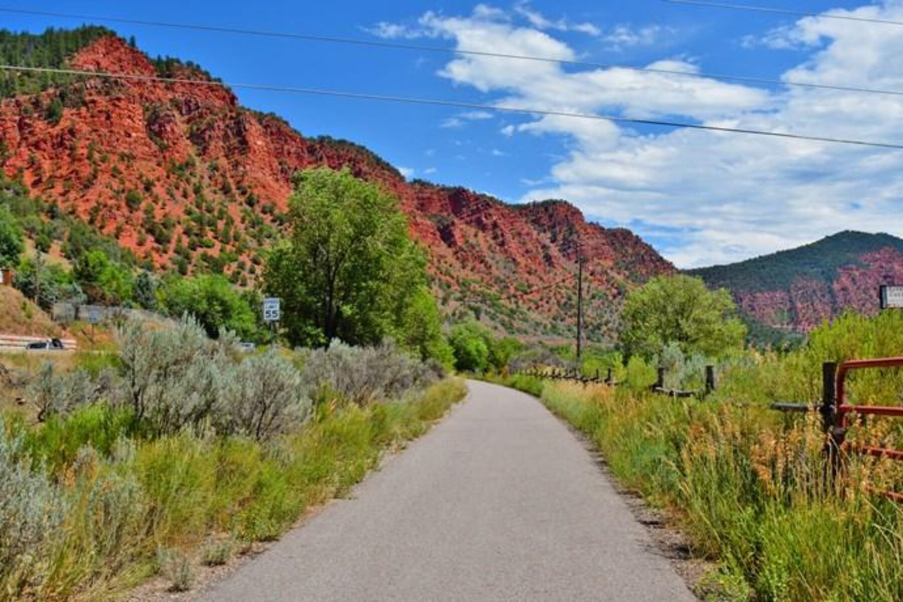
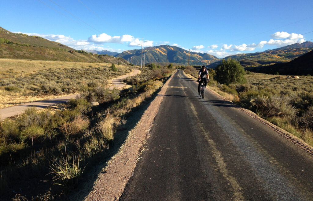
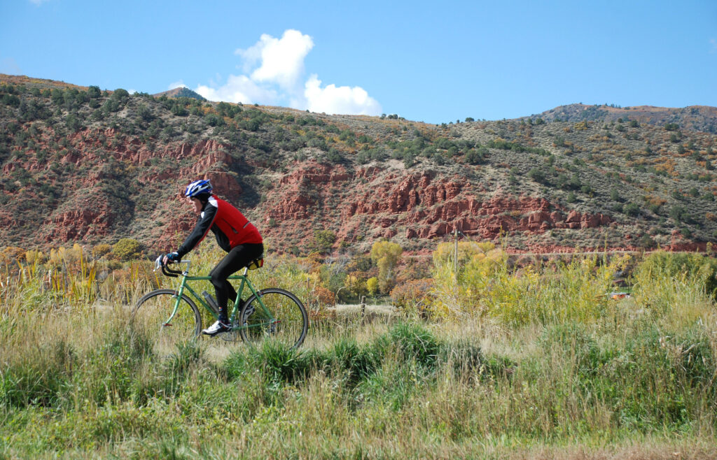
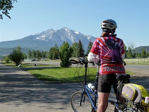
The windswept beauty of sage brush and scrub oaks, richly scented forests of ponderosa and spruce, verdant crops and ranchlands ringed in jagged mountains and crystal clear rivers: These are the visual postcards of Colorado. The beloved Rio Grande Trail traverses this rich mix of terrains along a 42-mile route (nearly all paved) winding from the famed ski town of Aspen to Glenwood Springs.
“I remind my children all of the time how lucky they were to grow up in paradise and to never forget the beauty that exists all around them,” writes Angela Henderson, assistant director of project management and facilities operations for the Roaring Fork Transportation Authority (RFTA), which manages the western half of the trail. “There is not one place on the Rio Grande that doesn’t have a stunning view of the surrounding mountains.”
For nearly the entire journey, the trail’s companion is the Roaring Fork River, beginning as boisterous whitewater in Aspen and mellowing out as it makes its way past Basalt, where the graceful arcs of fly-fishing rods can often be seen. The lucky will spot bald eagles, osprey and great blue herons also chasing the plentiful trout. The trail serves as a key access route for the river and several of its trailheads serve double duty as put-in points for kayakers and rafters.
Pedaling Down a Rocky Mountain High
For a downhill glide, many travelers begin at the eastern end in Aspen with an elevation of nearly 8,000 feet and coast toward Glenwood Springs, where the snow-capped peak of Mount Sopris dominates the skyline. A popular trip is the trail’s first 8 miles to Woody Creek, a town made famous by legendary journalist and author Hunter S. Thompson. Its lively Woody Creek Tavern is a popular hangout with locals; many pedal there for lunch and then back to Aspen. Farther west is Basalt, an old railroad town turned outdoor recreation mecca, and Carbondale with a mixture of hip, young vibrancy and Old West charm.
“As you leave Basalt, you see agriculture still happening, and you’re not hemmed in by development,” says Gary Tennenbaum, assistant director for Pitkin County Open Space and Trails, which manages the eastern half of the trail (except for a short section through Aspen that the city maintains). He adds with a chuckle: “Every once in a while, a cow or two or a herd crosses the trail. That’s the great thing about the Rio Grande Trail: It shows how open Colorado is.”
City slickers can have a tangible connection to this rural flavor at Rock Bottom Ranch, which sits trailside between Basalt and Carbondale. Goats, pigs, chickens and ponies roam the sustainable farm—part of the Aspen Center for Environmental Studies—which offers guided tours and allows picnicking on the grounds.
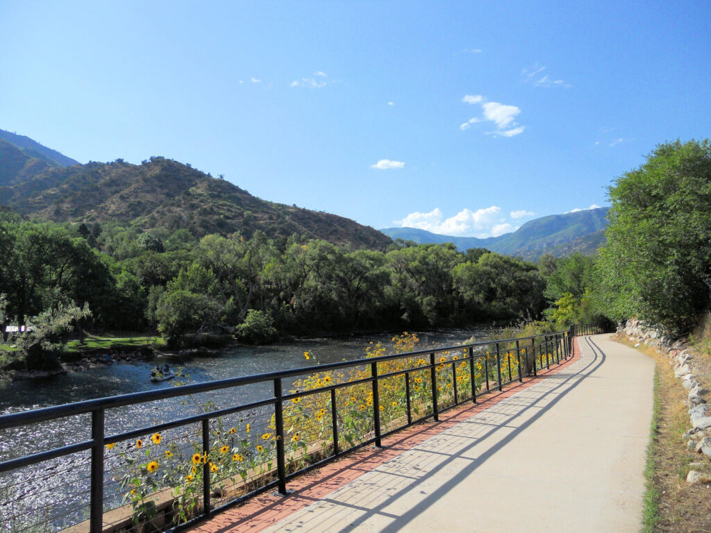
At trail’s end in Glenwood Springs, the Roaring Fork meets the Colorado River, which bisects the town. About a half mile away lies the city’s famed hot springs, a mineral-rich pool two blocks long full of cozy, bathtub-temp water. On the south bank of the Colorado, the Glenwood Railroad Museum displays the history of the Denver & Rio Grande Railroad—the corridor through which the rail-trail now runs—inside a 1904 train station serving Amtrak today.
“It’s a great experience for all ability levels to get out and enjoy the views and see the mountains,” says RFTA’s Trails and Corridor Manager Brett Meredith. “And there are lots of towns along the way to stop and rest.”
Trail Support From Up Top
The Rio Grande Trail, serving an average of 85,000 users annually, is the longest rail-trail in the state and acts as the central spine in a growing trail network.
“We couldn’t keep them off the trail as we built it,” says RFTA’s Director of Facilities Mike Hermes about the project, which was completed in 2008. “It’s become a destination, like our highway of trails, an integral part of the life in the valley. You see everybody using it.”
A short hop from the Rio’s terminus in Glenwood Springs, the Glenwood Canyon Recreation Trail winds along the Colorado River heading east 14 miles toward Dotsero. At least half a dozen other trails tie into the rail-trail, connecting more communities, attractions and natural assets in the region. Heading in the opposite direction from Glenwood Springs, the developing Lower Valley (LoVa) Trail will also follow the Colorado River, linking New Castle, Silt, Rifle and Parachute on a paved 47-mile route. The LoVa is included in the visionary “16 for 2016” plan unveiled by Gov. John Hickenlooper earlier this year as part of his Colorado the Beautiful initiative, outlining the state’s top priority trail projects.
Another of these top projects is the extension of the Crystal Valley Trail, which ties into the Rio in Carbondale. From there, the paved trail rolls south a few miles along the aptly named Crystal River, ending at the BRB Crystal River Resort, a picturesque camping spot with tent sites, an RV park and rustic log cabins. With the governor’s boost, the pathway will continue farther south, winding through Redstone with its many historical buildings (including a turn-of-the-century mansion called the Redstone Castle), on through Kebler Pass (the nation’s largest aspen grove, known for its eye-popping fall color), over McClure Pass and on into Crested Butte—a whopping distance of 74 miles.
The building out of these trails all across the northwestern corner of the state leaves locals and tourists alike with a pinch-me-I’m-dreaming feeling, and makes the already impressive Rio Grande Trail all the more so.
“Completing the Rio Grande Trail really just energized all these other trail connections,” says Tennenbaum. “As the Rio got developed, we saw this explosion of connectivity. As the ball gets rolling, magically it starts moving faster and faster.”

Donate
Everyone deserves access to safe ways to walk, bike, and be active outdoors.