Michigan’s Saginaw County to Bay County Connector
Trail of the Month: November 2016
Trail advocates believe a new pathway connecting two Michigan counties will foster a greater sense of community in the region: the Saginaw County to Bay County Connector.
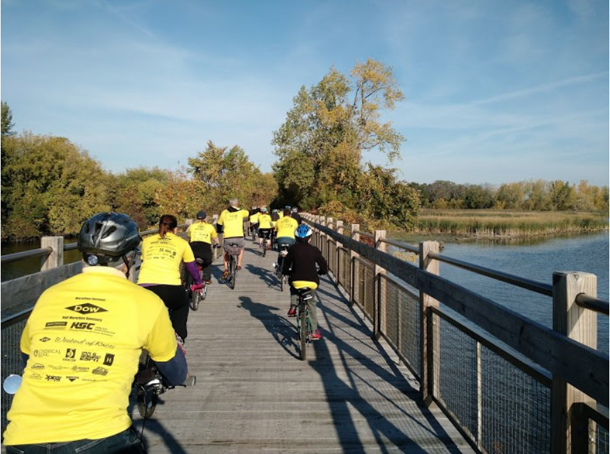
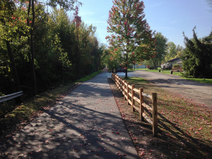
More than 200 cyclists and walkers showed up for the grand opening of the Wolverine State’s latest rail-trail last month. About 35 miles north of Flint (imagine it lying between the thumb and index finger on the mitten), the 7-mile Saginaw County to Bay County Connector joins the 17.5-mile Bay County Riverwalk to Saginaw County, where it will link up to the 2-mile Zilwaukee Pathway within the next 12-18 months. For now, people can use a combination of on- and off-road routes to go the 1-2 miles to reach the Pathway. From there, users can connect via a string of short trails to the 11-mile Saginaw Valley Rail Trail. The SCTBCC runs north via a once-abandoned rail line, from Zilwaukee to the intersection of East Hotchkiss Road and Brooks Street in Frankenlust Township, near Saginaw’s southern border.
“The trail provides unique access to areas that most people may not know about.”
A major artery in the Great Lakes Bay Regional Trail Network that links Bay and Saginaw counties to Midland County, planners anticipate more than 100 miles of interconnecting trail between the three communities upon completion. Heidi Bolger, former president of the Friends of the Great Lakes Regional Trail, estimated users can find more than 60 miles of trail spread between the three communities now, with the remaining connections completed within the next decade.
“This trail organization has a vision of physically connecting the region,” Bolger said. “It’s symbolic of the need in terms of the region’s need to become a connected whole to gain political clout and share and mutually enjoy and promote the beauty of mid-Michigan. We are only 20 to 30 minutes apart by car, so there are plenty of people enjoying all trails and many more who need to visit and experience our amazing trails. The Great Lakes and woodlands here are breathtaking.”
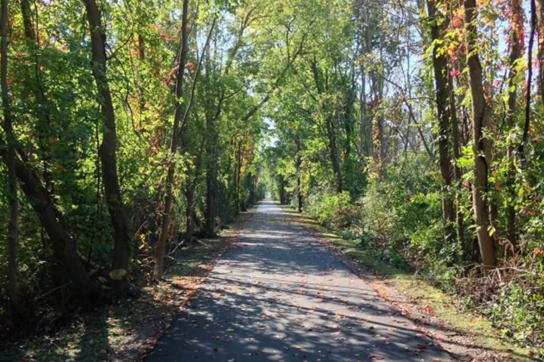
The SCTBCC is also on the Iron Belle Trail, an ambitious patchwork of trails and roads stretching more than 1,200 contiguous miles from Detroit to the Michigan/Wisconsin border. One of the major goals of the Iron Belle is to showcase the geographical diversity of the state, and the SCTBCC does an amazing job of that in its seven miles. One of the highlights is the western border of the Crow Island State Game Area, a 3,600-acre nature preserve that’s home to more than 100 different types of birds following the Mississippi Flyway migration, including the tundra swan, marsh wren and rusty blackbird. Massive trees line the trail, providing shade in the warm months and a virtual kaleidoscope of colors during the fall. Riders on cyclocross bikes will often dive onto Crow Island’s trails for a little more adventure.
The trail also passes over two pedestrian bridges and by thousands of acres of farmland, giving trail users a better appreciation for agriculture’s effect on the Michigan economy said Mike Kelly, Great Lakes Office Director of the Conservation Fund.
“The trail provides unique access to areas that most people may not know about,” Kelly said. “It really shows how unique it is.”
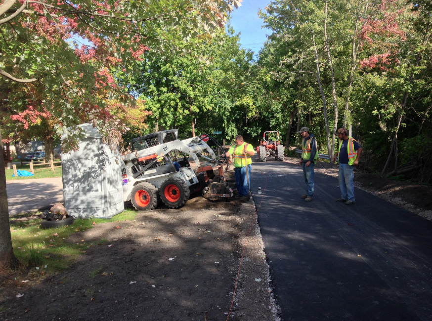
In the works for several years, the main spine of the new trail was created when the Michigan Department of Transportation bought 7 miles of dormant Detroit and Mackinac Railway line for $375,000. The line—affectionately known as the “Turtle Line” by area residents—hauled both timber and passengers during its heyday in the early half of the 20th century. It eventually was shuttered as an independent railroad in 1992, and that area of track fell into disrepair.
“It was a very unique opportunity that doesn’t come along very often,” Kelly said. “Purchasing this corridor and having only one owner to deal with made it a fairly easy proposition.”
Paving and other costs added another $2 million to the project, much of which was paid through a mixture of state and local grants. Because Governor Rick Snyder and the state of Michigan are pushing for a rapid completion of the Iron Belle trail network, local groups were able to apply for funds more easily.
“Local residents are excited about the boost to both economic development and their quality of life,” Kelly said. “People have a checklist when they’re considering moving to a new area, and recreational options, like this trail, are at or near the top of their list.”
Bolger said the trail promises to be a boon to residents who may not have easy access to other transportation lines.
“One mobility-challenged woman who uses an electric wheelchair told us these trails have given her a new lease on life,” Bolger said. “All she has to do is exit her front door to find all these new adventures on the trail.”
Trail groups were concerned that there might be some pushback against the trail by residents of the nearby South End neighborhood. After all, the neighborhood had been there for years and future plans call for a 15-car parking lot at the trailhead nearby. But Kelly said the neighbors were ecstatic about the new amenity.
“It’s bringing in a whole new group of people into the neighborhood, and the business owners are thrilled,” Kelly said. “There’s a small meat market there near the trail that sells drinks and snacks and other items. We’re looking forward to seeing just how much the trail is going to positively impact their business.”
Cory Christener, manager of nearby Ray’s Bike Shop in Bay City, said he expects to see a modest bump in sales at first, with a potential larger payoff when the Iron Belle is finally completed in 10-15 years.
In the Bay area, planners are plotting the next trail extension, from the north end of the trailhead to the southern part of the Middleground, an island in Bay City. It’s expected to cost about $18 million.
“There’s still a lot of work to do in order to get the trail network deeper into Saginaw County (and beyond),” Bolger said.
The new Saginaw County to Bay County Connector is part of the developing Iron Belle Trail, which will stretch more than 2,000 miles across Michigan. Read more about this exciting project in the upcoming Winter 2017 issue of Rails to Trails magazine to be published in January.
Related Links
Great Lakes Bay Regional TrailsIron Belle Trail
Trail Facts
Name: Saginaw County to Bay County Connector
Used railroad corridor: Detroit and Mackinac Railway
Trail website: Great Lakes Bay Regional Trail
Length: 7 miles
Counties: Saginaw and Bay
Start point/end point: The SCTBCC runs north from the Zilwaukee Pathway in Saginaw County to the intersection of East Hotchkiss Road and Brooks Street in Frankenlust Township, near Bay County’s southern border.
Surface type: Asphalt
Grade: Like most rail-trails, the route is fairly level.
Uses: Biking, walking and inline skating are all permitted. There are currently no plans to groom the trail for cross-country skiing in the winter, although that might be revisited.
Difficulty: Easy
Getting there: The trail is in mid-Michigan. Fly into MBS International Airport (Midland/BayCity/Saginaw), located at 9200 Garfield Road, Freeland, MI 48623.
Access and parking: The best place to park and ride at the moment is at the brand-new Bay-Zil Trailhead located at the north end of the trail, at the intersection of Hotchkiss Road and Brooks Street in Bay City. There’s room for 15 vehicles. Currently, the south end of the trail is a work-in-progress. Trail planners have multiple options for a trailhead there and are in the process of determining which site will work the best. After a site is picked early in 2017, construction of the trailhead will begin soon after. To navigate the area with an interactive GIS map, and to see more photos, user reviews and ratings, plus loads of other trip-planning information, visit TrailLink.com, RTC’s free trail-finder website.
Rentals: Ray’s Bike Shop (303 Salzburg Ave, Bay City) offers comfort bike rentals for $10 an hour, $40 per day and $80 for the entire week.

Donate
Everyone deserves access to safe ways to walk, bike, and be active outdoors.