New Jersey’s Cape May County Trail Network
Planned 30-mile trail network to connect major South Jersey destinations
South New Jersey’s Cape May County offers an outdoor recreation mecca within easy driving distance of Philadelphia, New York, Baltimore and Washington, D.C. Down its center, a handful of existing paved trails are planned to be patched together with new rail-trails and other multiuse trails to span nearly the whole of the county, a distance of almost 30 miles. Additional spur trails and on-road biking facilities will extend outward to reach surrounding communities, neighboring counties, the area’s famed beaches and other attractions.
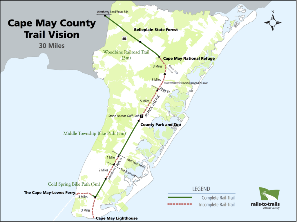
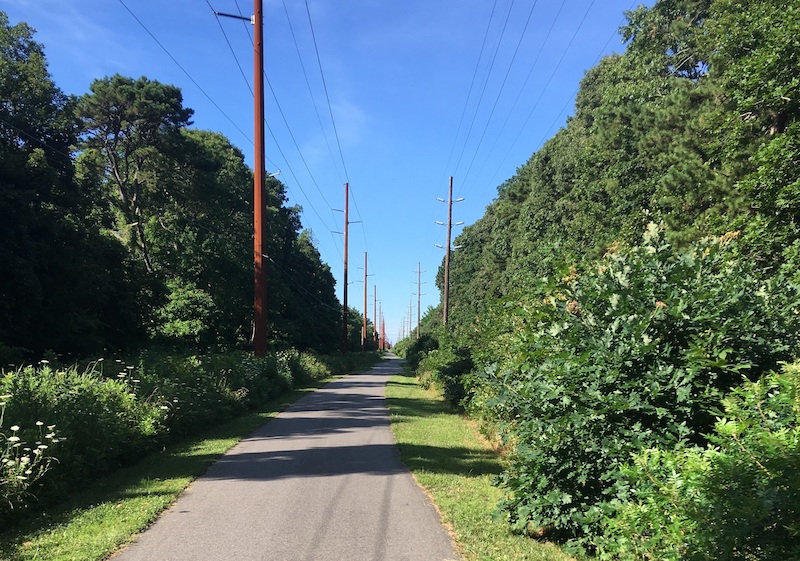
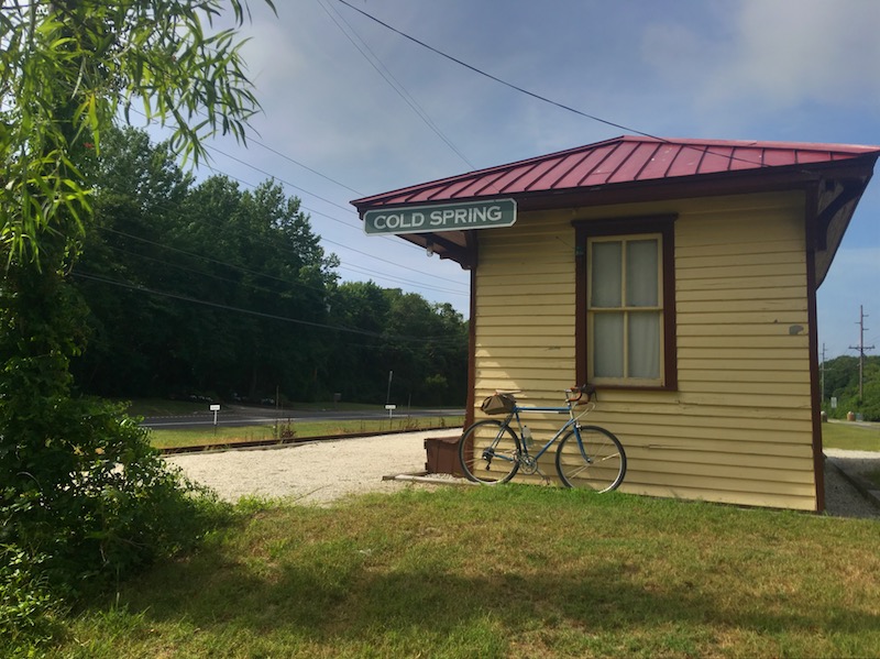
Three rail-trails in the system—the Cold Spring Bike Path, Middle Township Bike Path and Woodbine Railroad Trail—already provide safe, family-friendly routes to such popular places as the Cape May County Park and Zoo, Cape May National Wildlife Refuge and Belleplain State Forest. In the future, the trail network could extend farther north to the tourist destination of Ocean City and across the bicycle- and pedestrian-friendly Route 52 bridge to connect with Atlantic County trails.
“When you get a good example of something accomplished, others will want the same thing.” – Alan Huff, senior transportation planner with the South Jersey Transportation Planning Organization
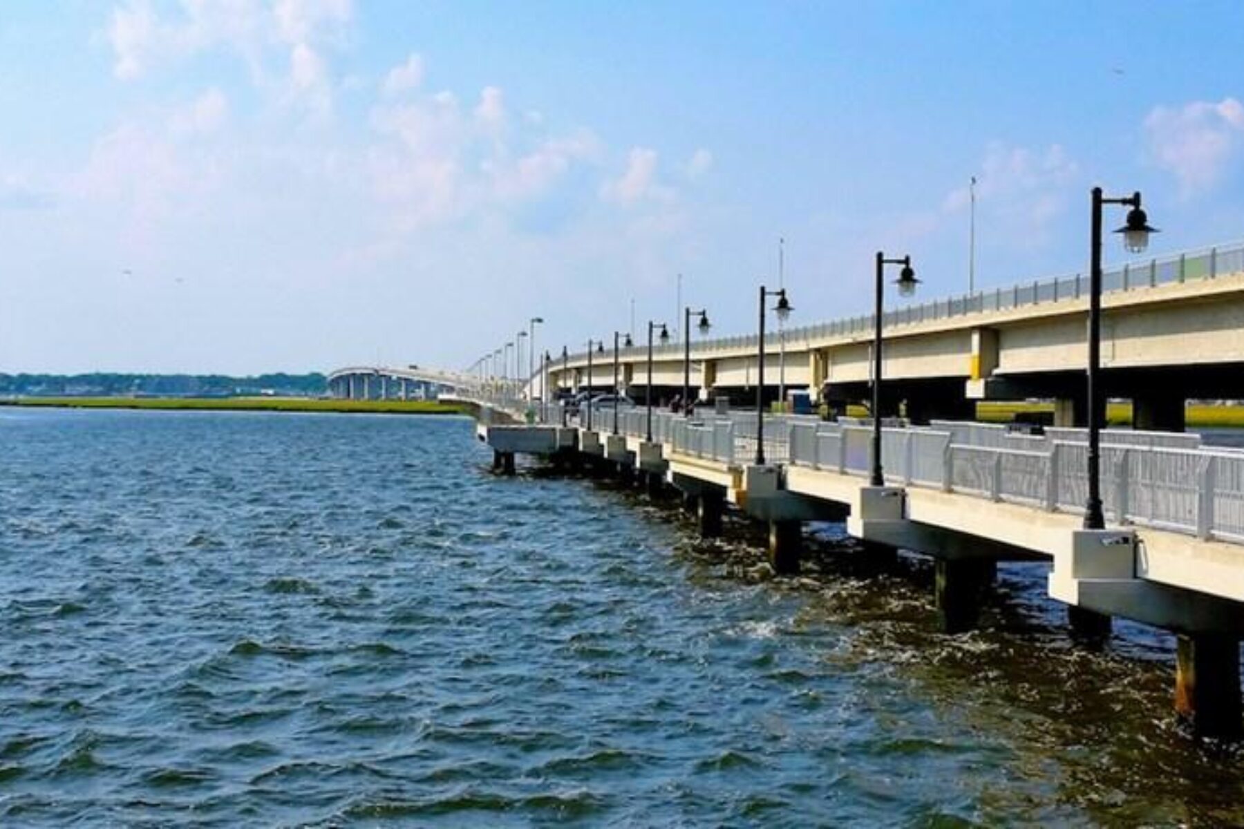
“The Route 52 bridge trail is the shining example in our region of a bike/ped facility .… There’s a counter on the bridge; it’s been almost two and a half years since it was installed, and so far 458,000 bicyclists and pedestrians have crossed that bridge. I wouldn’t have expected those kinds of numbers; nobody thought those kind of numbers would happen. It shows that the demand is there.”
Just north of the Route 52 bridge, a key link in this growing multicounty trail system is on the cusp of being provided. Closing a short gap of only 1.1 miles between two well-used rail-trails—the Atlantic County Bikeway and the Pleasantville to Somers Point Bike Path—will offer a huge benefit to locals who currently have to navigate Black Horse Pike to get from one to the other.
“There’s a four-lane highway between the two, but people are crossing it because they want to use those trails,” says Tom Sexton, director for RTC’s Northeast Region, who is working with New Jersey’s Department of Transportation to address the issue. “This connector—itself utilizing a rail corridor—will add an at-grade crossing with a stoplight at a logical place between the two trails, creating a seamless 16-mile trail experience and, most importantly, a safe one.”
In addition to federal funding for trails, a dedicated pool of local money available through Cape May County’s Open Space Program has been critical for closing gaps in the network and building complementary projects.
“We’ve made a tremendous amount of progress over the 20-plus years that I’ve been here, and I don’t see that stopping,” says Leslie Gimeno, planning director for Cape May County.
Dreaming bigger, trail advocates, guided by RTC’s vision for the network, see opportunities to expand the trail system beyond state borders, northwest to Philadelphia’s Circuit Trails and south—via a bicycle-friendly ferry—to Delaware’s trails in the Lewes and Rehoboth Beach area.
A website for the trail system isn’t yet available as the project is still in the early stages of development. One of the next steps will be a communications plan that RTC is assisting with to raise public awareness and support, but trail enthusiasts can expect more exciting details to come.
This article is from the Spring/Summer 2017 issue of Rails to Trails magazine. It has been republished here in an edited format.
Trail Facts
Trail Under Construction: Cape May County Trail Network
Location: Cape May County, New Jersey
Used Railroad Corridor: A combination of former rail lines are being utilized for the trail system, including the Cape May Seashore Line; West Jersey and Seashore Railroad; and Pennsylvania and Reading Railroad.
Length: 26.4 miles
Surface: Asphalt

Donate
Everyone deserves access to safe ways to walk, bike, and be active outdoors.
Related
View All
Safe by Design: Examining the Impact of Trails and Bike-Ped Infrastructure on Safety in America

Exploring the Nation’s Trailside Geoheritage Sites