Colorado’s Animas River Trail
Trail of the Month: November 2017
“The connection between the trail and the train—it’s real.”
Trains and trails: In Durango, Colorado, the two are inseparable.
For walkers and bicyclists along the town’s scenic Animas River Trail, the white-and-gray plumes of steam rising from the old locomotives and the echo of train whistles are common sights and sounds.
Likewise, a ride on the 1880s-era Durango & Silverton Narrow Gauge Railroad offers abundant views of the leafy river trail occupied by runners, cyclists and families out for a stroll. Farther north, toward Silverton, clusters of backpackers fresh from nearby 14,000-foot peaks wait on small platforms, snapping photos as the old steam engine grinds to a brief halt.
“The connection between the trail and the train—it’s real, and it’s kind of untapped,” said Mary Monroe Brown, executive director of Trails 2000, a local nonprofit trail advocacy organization.
The Animas River Trail shares the train’s right-of-way in places, Monroe Brown said, and the train offers transport for hikers looking for access to the San Juan Mountains. In short, the train and the trail complement one another—each tapping into the town’s outdoor culture. There are approximately 300 such rail-with-trail corridors in the country.
Center of Durango’s Trail System
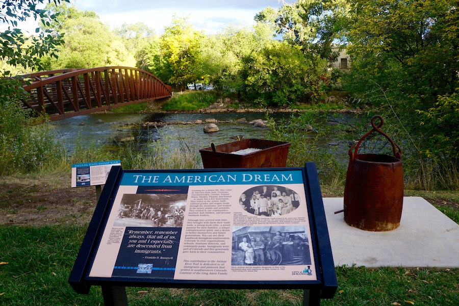
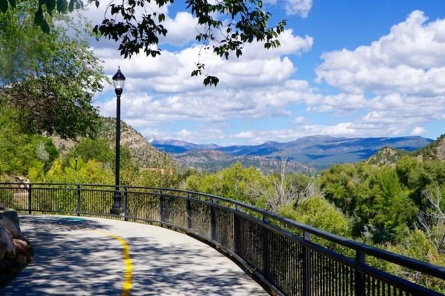
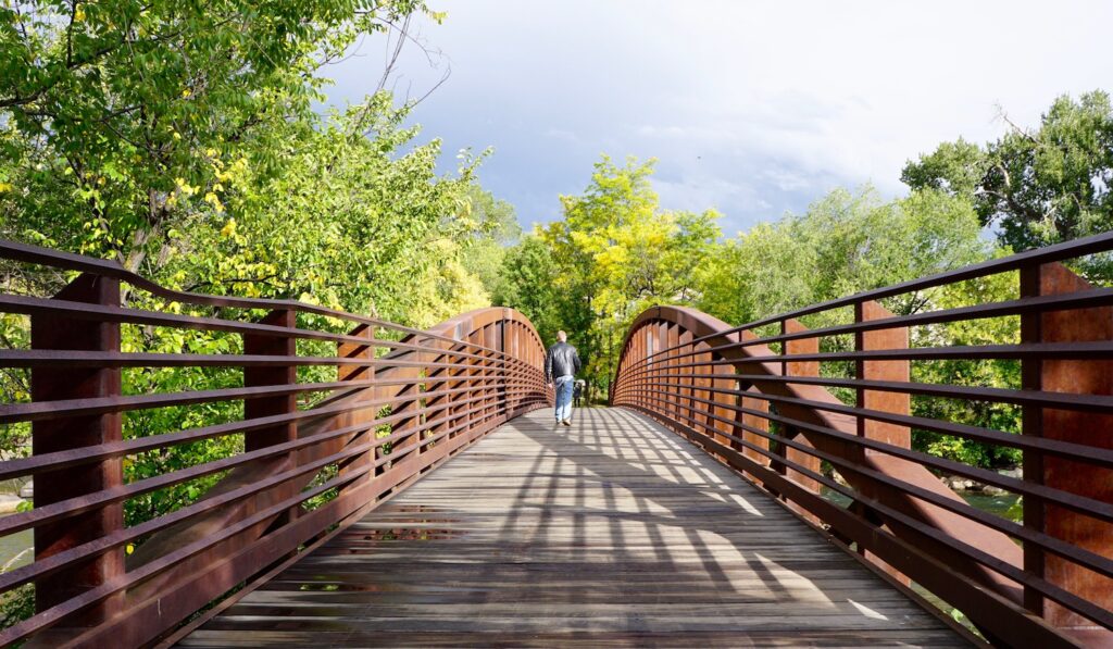
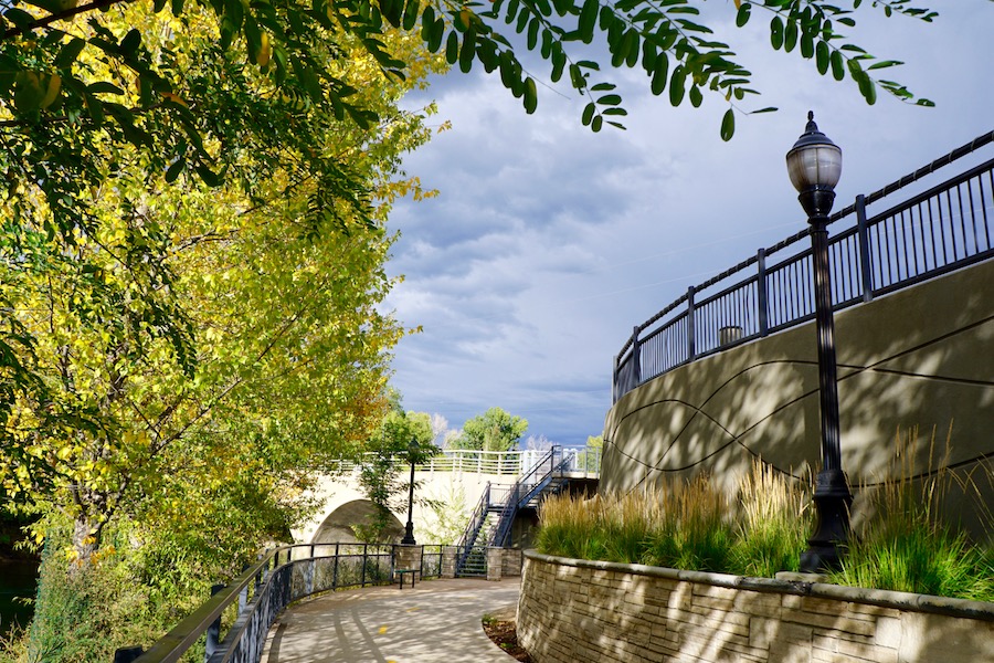
The Animas River Trail hugs the banks of the river for just over 9 miles, passing through the charming downtown, taking in a half-dozen public parks and crossing the river numerous times via picturesque bridges. A series of interpretive signs tells the story of Durango’s intriguing past, while vintage streetlights illuminate the route.
The City of Durango terms the river walk the “spine of the city’s overall trail network,” and Parks and Recreation Director Cathy Metz said 1,000 to 1,500 people use the trail each day. Many of those users are local.
“We have surveys that show that 90 percent of the people who live in Durango use the trail.”
— Parks and Recreation director Cathy Metz
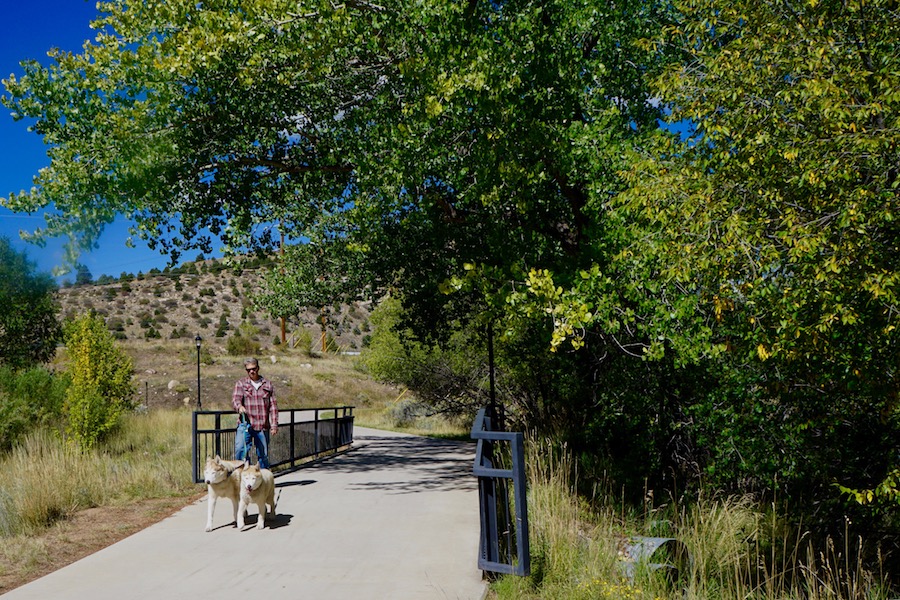
On a recent warm fall day, Durango resident Sam King was out for a walk with his two Siberian huskies, Rhett and Scarlet. A frequent user of the trail, King noted that he regularly walks from his home in the Fourth Avenue area, through the downtown, and sometimes to the city’s dog park, located along the river trail near U.S. Highway 160.
Monroe Brown points out that local residents have shown their support for the trail in another important way as well. “The residents chose to tax themselves twice,” she said, explaining that voters have approved two sales tax increases—one for parks and open land, and another for the public library and the Animas River Trail.
Along with local users, Metz said Durango attracts about 1 million tourists a year, and many of the visitors make their way to the Animas River Trail. Certainly, it’s easy to find—backing up to many of the hotels in the downtown area, and passing by the city’s library on East Third Avenue as well as popular recreational features such as the gazebo at Rotary Park.
Because it passes through various business areas, the route offers plenty of places to stop for refreshments. Just steps from the trail and the train tracks near Rotary Park sits Animas Brewing Company, billed as a “rustic-chic cabin serving Irish-influenced cooking and house-made brews.” Customers who time it right can sip beer on the back patio and watch the train roar past, steam billowing.
On the southern section of the river walk, Serious Texas BBQ takes advantage of its location along the river with a bike-friendly trail spur and an outdoor patio featuring sweeping views of the Animas valley.
Monroe Brown said Durango’s outdoor culture has been good for business in general. “La Plata County has seven bike shops, five outdoors shops, two running shops and a ski area,” she said, adding that the Animas River Trail is a big part of that.
Vintage Rail Experience
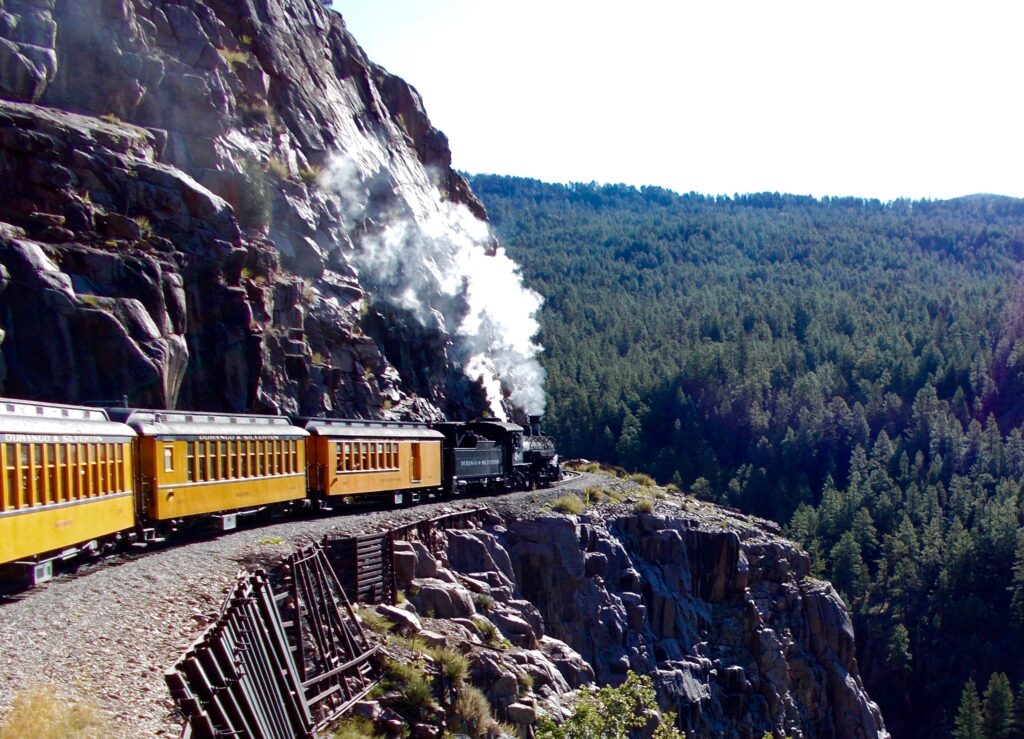
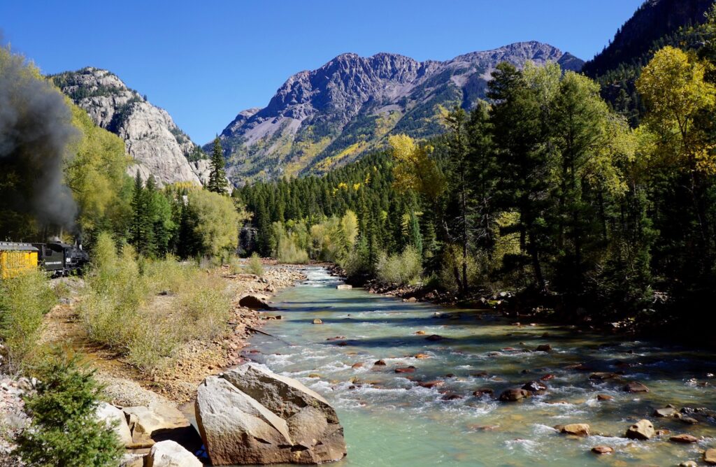
Another major part of the mix is the Durango & Silverton Narrow Gauge Railroad, which follows the river through Durango and then continues north through the San Juan Mountains toward the historical mining town of Silverton. Along the way, it passes by spectacular views of the river, flanked by towering mountains.
Christian Robbins, marketing director for the railroad, says the train is on track to reach about 195,000 riders by the end of 2017—up by several thousand from 2016. While many of the riders are tourists, Robbins said locals also frequent the train as a means of getting quickly into the nearby wilderness area. “We have two drop-offs in the wilderness for hikers,” he said.
The train’s website points out that the Weminuche Wilderness, which is near Durango, is the largest wilderness area in Colorado, at 499,771 acres. The area spans the Continental Divide in the San Juan Mountains and includes the Chicago Basin. With its proximity to three of Colorado’s 14’ers, (peaks of 14,000 feet or higher), the area “is a popular backpacker destination and is easy to access via the Durango & Silverton Narrow Gauge Railroad,” states the website. “Camping in Chicago Basin provides a great base for summiting Eolus, Sunlight and Windom peaks or just enjoying the spectacular vistas of Colorado’s pristine wilderness backcountry.”
The train route also includes the southern terminus of the Colorado Trail, a nearly 500-mile route that runs from Denver to the southwestern corner of the state for use by hikers, mountain bikers and equestrians. Monroe Brown said the popular long-distance trail draws many people to Durango.
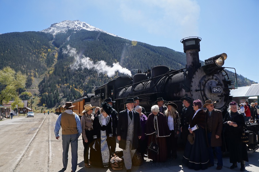
The majority of train passengers, though, are on board to take in the views and to check out Silverton, a pretty, high-altitude mountain town with a rich mining history. The old narrow-gauge (rails are 3 feet apart as opposed to the 4-foot-8.5-inch width for standard trains) locomotive takes its time up the mountain. At a top speed of 18 miles an hour, the train takes about 3.5 hours to travel from Durango to Silverton.
But passengers have ample views to keep them occupied. Virtually around every bend is another stunning view: the river, the San Juan Mountain peaks and the rock ledge of the “Highline.” Once in Silverton, passengers have enough time to stroll the old-west style streets, have lunch and take in the informative San Juan County Historical Society Mining Heritage Center before heading back to Durango.
Local tourism experts say the dual draw of the Animas River Trail and the railroad to Silverton sets the Durango area apart. “It’s definitely a draw,” Monroe Brown said. “People are seeking experiences that are unique.”
Metz sees the two major attractions as being historically linked. “They’ve coexisted for decades,” she said.
Related Links
City of Durango
Durango & Silverton Narrow Gauge Railroad
Trail Facts
Name: Animas River Trail
Used railroad corridor: The trail shares some right-of-way with the 1880s-era Durango & Silverton Narrow Gauge Railroad. The scenic river trail runs parallel to the railroad in certain places (a configuration known as rail-with-trail) and crosses it in others.
Trail website: City of Durango
Length: 9.4 miles
County: La Plata
Start point/end point: Bennett Street at Animas City Park (3274 E. Second Ave.) in north Durango to Dallabetta Park (13616 La Posta Road) at La Posta Road and River Road to the south
Surface type: Hard surface, with a combination of concrete and asphalt
Grade: The trail follows the meandering route of the Animas River and has a gradual south-north rise from 6,371 feet in elevation to 6,565 feet.
Uses: Walking, biking, inline skating, mountain biking, cross-country skiing; wheelchair accessible
Difficulty: Easy, with a gentle grade, paved surface and crossings largely separated from vehicle traffic
Getting there: The Durango-La Plata County Airport (1000 Airport Road, Durango) is served by United Airlines from Denver, American Airlines from Dallas and Phoenix, and seasonally from Los Angeles. The closest international airport is Albuquerque, New Mexico, which is a three-and-a-half-hour drive from Durango. Durango is accessible by car on U.S. Highway 550 from the north and south, and U.S. Highway 160 from the east and west.
Access and parking: The trail passes through several public parks (Dallabetta Park, Santa Rita Park, Schneider Park, Rotary Park and Animas City Park), each of which offer plenty of parking. It also passes through downtown Durango and numerous business areas with public parking options.
Specifically, spaces are available at a small gravel lot along Bennett Road at the trail’s northern end and at the bend of E. 29th Street where the trail crosses, as well as at the CSU Extension campus between the ballfields and the river. Parking is available at: Durango Public Library at E. Third and Park avenues and at Rotary Park at the end of E. Second Avenue; shopping plazas along Main Street on the river’s east bank where the trail crosses; at Schneider Park along Roosa Avenue (two parking areas); at Santa Rita Drive and Camino del Rio (US 550/160); at the Durango Mall; at the end of River Oaks Drive (a few spaces only); and at the southern endpoint at the scenic overlook by River and La Posta roads.
To navigate the area with an interactive GIS map, and to see more photos, user reviews and ratings, plus loads of other trip-planning information, visit TrailLink.com, RTC’s free trail-finder website.
Rentals: Bike rentals are available at: Pedal the Peaks (598 Main Ave. B, Durango; 970.259.6880); and 2nd Ave. Sports (640 E 2nd Ave., Durango; 970.247.4511).

Donate
Everyone deserves access to safe ways to walk, bike, and be active outdoors.