Illinois’ Hennepin Canal Parkway
Trail of the Month: March 2019
“Almost from infancy, the canal was a part of my life—fishing, swimming, ice skating. It was a wonderful childhood playground.”
—Gary Wagle, founder and president of the Friends of the Hennepin Canal
Stories run deep in the Hennepin Canal and the old towpath that runs alongside it.
First an engineering pipedream; then a prematurely obsolete manmade waterway; and later a playground for generations of Illinois families: All have been chapters in the saga of the canal that cuts an east-west swath across northcentral Illinois.
The stories don’t stop there.
For instance, local legend has it that during his growing-up years, Illinois youth and future U.S. President Ronald Reagan learned to swim in the canal’s feeder system.
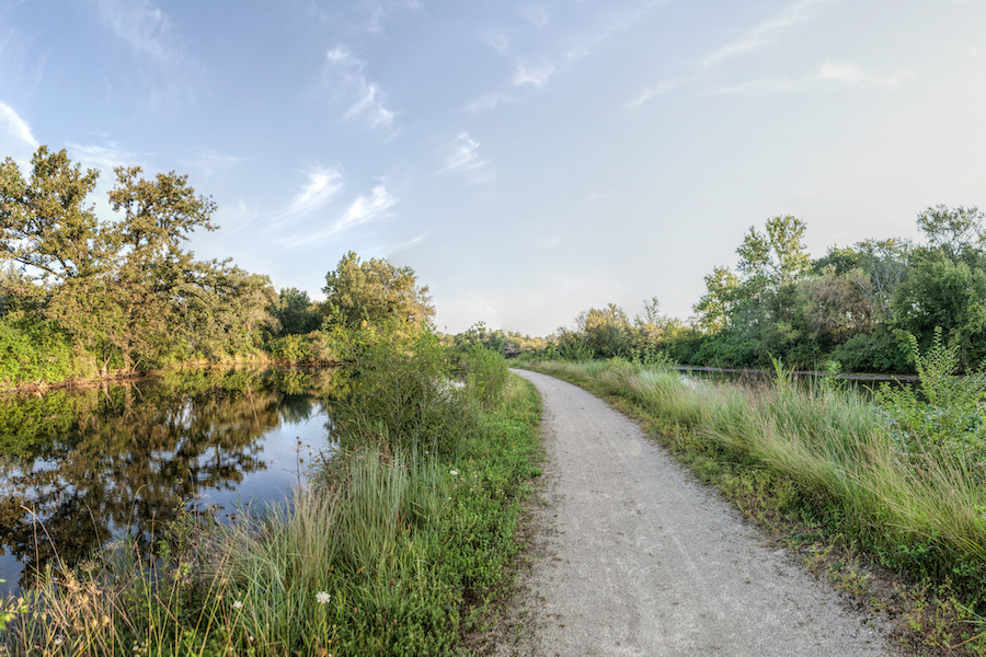
Decades later, the towpath that was originally built as a track for mules pulling barges on the canal was reinvented as a recreational trail.
More recently, the Hennepin Canal Parkway trail has drawn hundreds of elite long-distance runners each October to the small Illinois communities that line the canal.
Now, with its 112-year history, the Hennepin Canal Parkway seems a natural for its latest chapter—as a “gateway trail” in the nearly 4,000-mile Great American Rail-Trail, a cross-country route planned by Rails to Trails Conservancy (RTC) to stretch across the United States, from Washington, D.C., to Washington State.
“Part of what makes the Great American Rail-Trail important is that it is a collection of stories,” said Ken Bryan, RTC’s senior strategist for external relations. The Hennepin’s rich history apparently fits the bill.
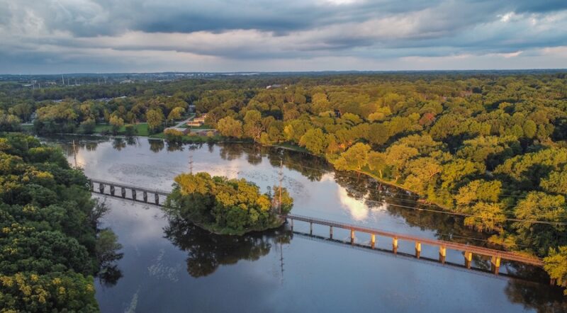
Complementing the canal’s storied past is the parkway’s 104.5 miles of continuous trail—equaling about half the width of Illinois—which is advancing RTC’s goal of piecing together the cross-country route.
“It’s a gateway trail, and it celebrates the work the state has done up to this point,” Bryan said of the parkway.
Early Obsolescence
Passing through five Illinois counties and numerous small communities, the Hennepin Canal has been a regional focus for nearly two centuries.
As far back as the 1830s, Illinois visionaries were eyeing plans for the Hennepin Canal as a cheaper alternative to the railroad by providing a navigable link between the Illinois and Mississippi rivers while reducing the distance between booming Chicago and smaller Rock Island by 419 miles.
Financial woes in the mid-1800s delayed the start of canal work until 1892, and the project was finally complete in 1907.
But the canal’s troubles were far from over. Even as the Hennepin was being constructed, the Army Corps of Engineers had been widening the locks on both the Illinois and Mississippi rivers. Because of evolving engineering standards, the Hennepin Canal was obsolete even before it opened.
Recreational Focus
Transportation may have been its initial purpose, but the canal and its adjacent towpath evolved early on into a center for recreation.
Today, the Hennepin Canal Parkway State Park takes in the entire length of the canal. About 1.3 million people visit the state park each year, said Amy Madigan, greenways and trails outreach coordinator for the Illinois Department of National Resources.
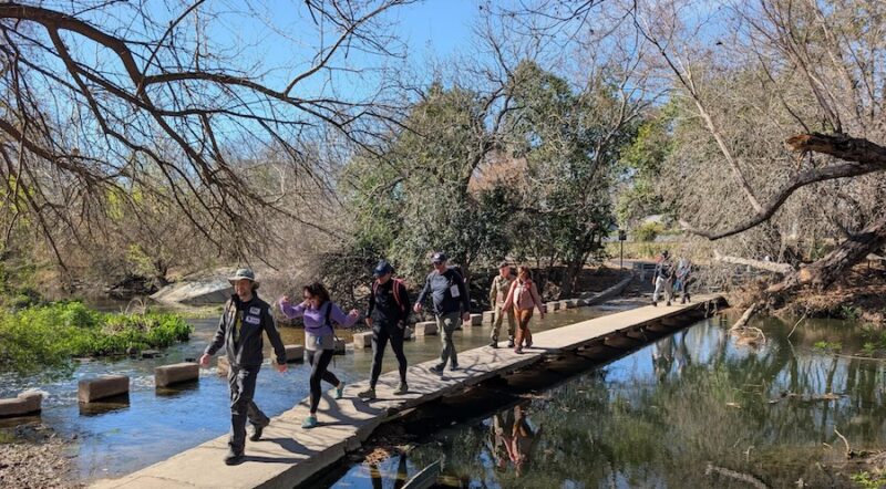
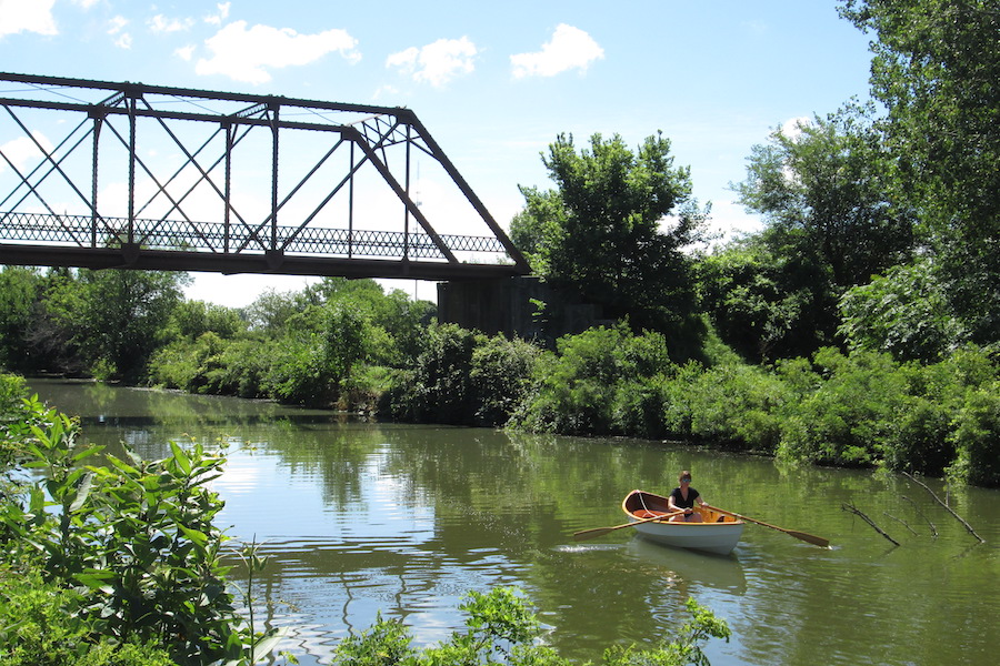
“The trail is a major draw,” Madigan said, noting that park attendance “has tripled since the trail was improved from a previous grass towpath to a paved trail.” Hiking, biking, fishing, boating, canoeing, kayaking, horseback riding and camping are among the park’s most popular activities. (Swimming is no longer allowed.)
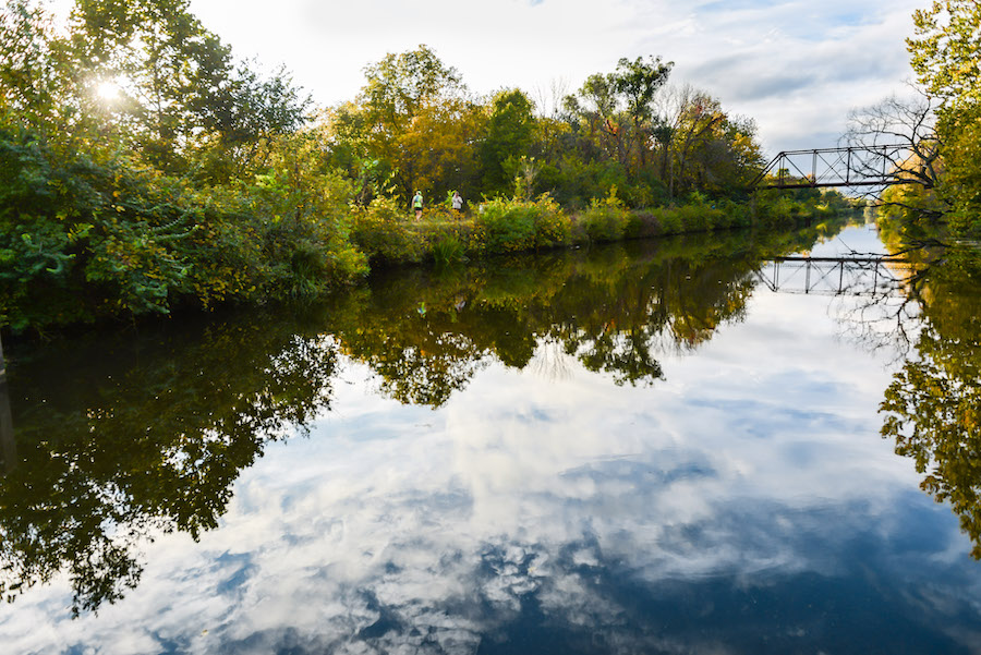
Starting at the Illinois River in the east, the parkway heads northwest from Bureau Junction toward the small towns of Wyanet, Sheffield (site of the Hennepin Canal Parkway State Park Visitor Center), Annawan and Geneseo, before ending at the Rock River, just east of the Mississippi. At approximately the mid-point along the main canal, a feeder canal heads to the north toward Rock Falls and Sterling.
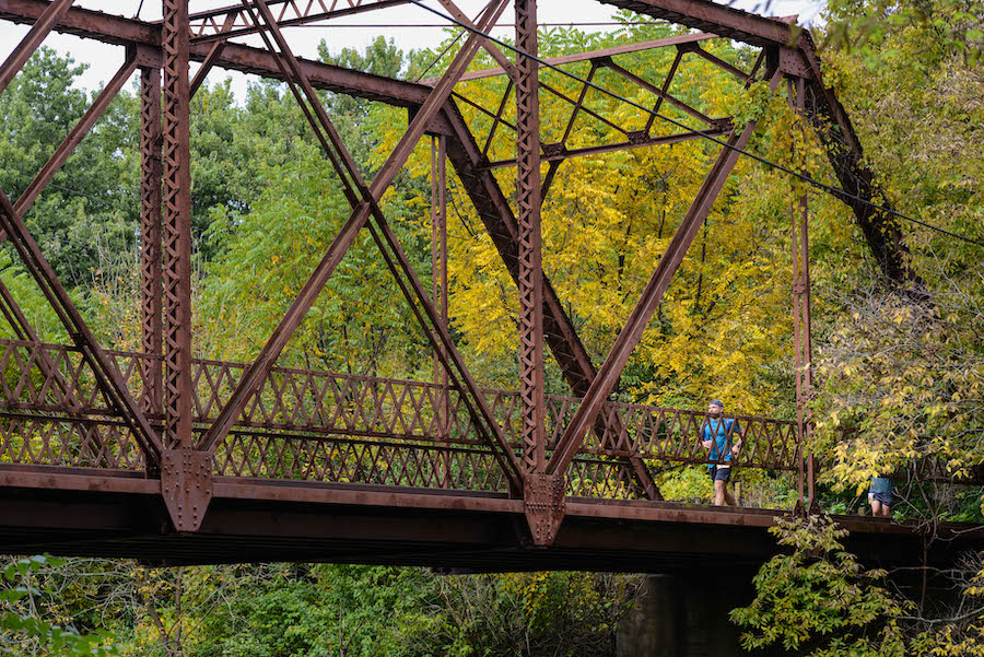
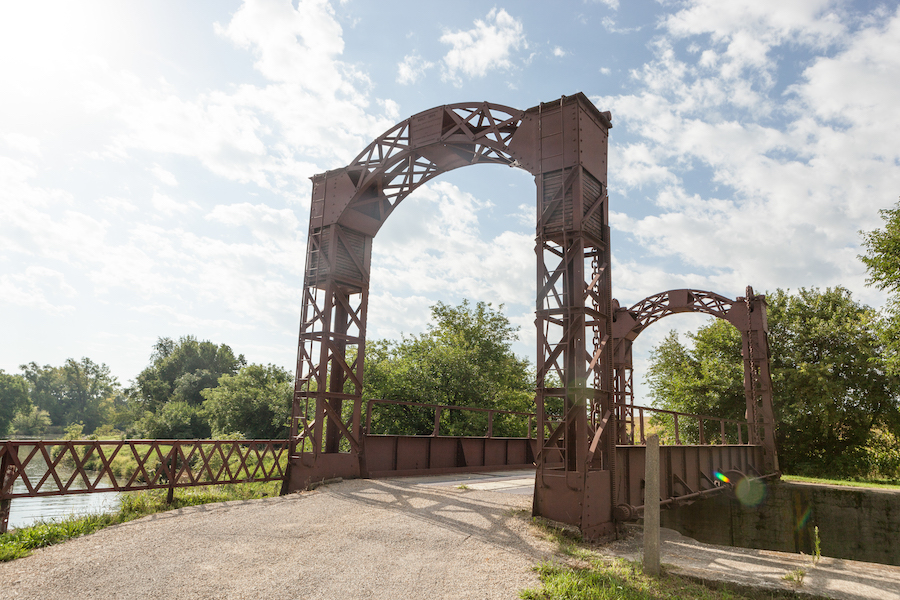
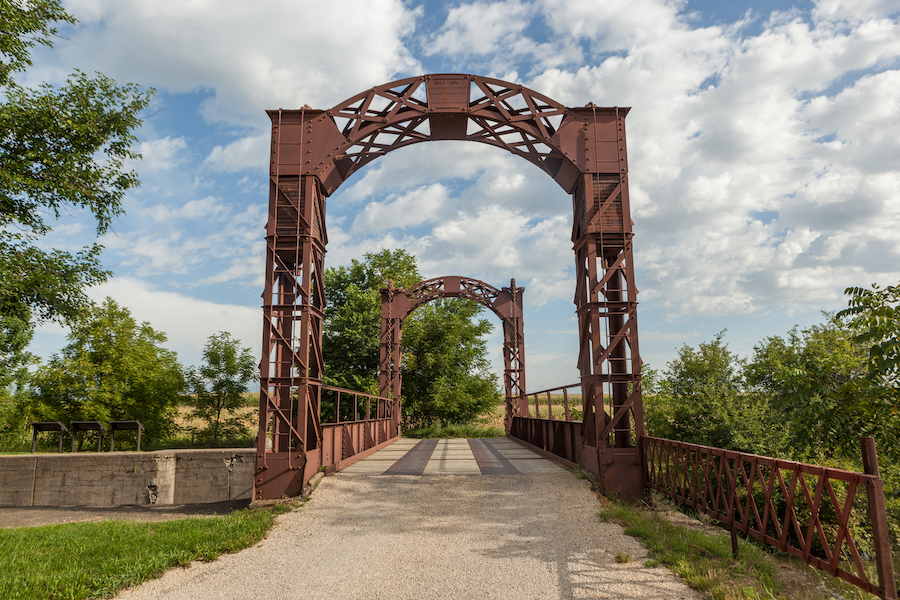
Along the way, plenty of the history-making canal remains. Numerous lift bridges, iron truss bridges, aqueducts, locks and houses where the people who tended the locks once lived are preserved and visible along the route. The entire canal is listed on the National Register of Historic Places.
Childhood Playground
Area native Gary Wagle has a lifelong appreciation for the recreational aspects of the canal. In fact, Wagle says he can’t remember a time when the Hennepin didn’t play an important role in his life.
“I grew up on the canal,” said Wagle, founder and president of the Friends of the Hennepin Canal. “Almost from infancy, the canal was a part of my life—fishing, swimming, ice skating. It was a wonderful childhood playground.”
In 1998, Wagle, a retired schoolteacher from Colona, decided that the Hennepin needed an advocate, and he founded the Friends group, now an 80-member organization with a nine-member board.
Motivating Wagle and his fellow group members is “a passion for the canal and a concern for its welfare,” he said. “The canal is a real treasure of the Midwest, (although) somewhat of an undiscovered treasure.”
‘Small-Town Heartland America’
Michele Hartwig, race director of the Hennepin Hundred ultramarathon running event, can attest to the “undiscovered” aspect of the Hennepin Canal Parkway.
As a longtime distance runner, Hartwig was on the search a few years back for “a flat and fast” Illinois trail for a new 100-mile race. “I live two hours west of Chicago, and I had never even heard of the Hennepin Canal Parkway,” Hartwig recalls.
After visiting the Hennepin, Hartwig said, “I was very surprised—it was a great destination point, and it’s so close.”
Now in the midst of planning for her fifth Hennepin Hundred event, Hartwig is sold on the trail and the area. “[The Parkway trail] has a really cool surface and historic bridges. I was really excited to plan a race around it,” she said.
The surrounding scenic farms and small towns add to the charm. “It is very small-town heartland America,” Hartwig said.
Steve Buchtel, former executive director of Trails for Illinois, says the canal route shows a side of Illinois that is not apparent to those who speed though the state on Interstate 80.
“I-80 through Illinois does not show its best side. You feel like the roadway is depressing,” he said, adding that the towns along the canal “are all postcard”—some with wide streets where cars park down the middle.
Parkway Potential
Buchtel said he had long been baffled by the relative obscurity of the parkway. “It was one of my examples of a big regional trail that in another state would have a tourism plan built around it,” he said. His presentations as director of the nonprofit Trails for Illinois aimed at getting the word out: “Hey Illinois, we have assets.”
Hartwig took Buchtel’s encouragement to heart and ran with it. Despite the rugged conditions on portions of the parkway trail, the Hennepin Hundred thrived, attracting about 500 runners from 25 states and a number of international locales this past year.
“That race was amazing, and it changed the way I think about the Hennepin,” Buchtel said. “There are so many ways to enjoy that trail as it is.”
Although the Hennepin Parkway’s surface is “a mish-mash of trail standards,” Buchtel notes that a few simple improvements would make a big difference.
One of the major needs is better signage. “The trail doesn’t pass through any of the towns; it’s about a mile off. That’s tough,” Buchtel said. “But wayfinding signs saying, ‘a mile down this road is ice cream’ would really help.”
Madigan said the state hopes to work with communities to make that happen. “In addition to working with each community that desires to have a more direct connection to the canal that historically occupied the same, wayfinding is envisioned,” she said. The state also hopes to do several trail repairs, as well as a paved section in the Milan segment.
Daniel Payette, executive director of the Blackhawk Hills Regional Council, says such connections would be crucial to growing the economic impact of the trail.
“What’s going to be important is connecting individual trails to the larger trail system,” Payette said. “Some of these connections exist, and more need to be made. The question is, can you make the connections to other towns?”
Related: A View From … The Great American Rail-Trail
‘Budget Insecurity’
Indeed, Madigan and trail advocates all voice some level of concern about budget cuts that have occurred in the state’s Department of Natural Resources.
“Maintenance and expansion challenges are ongoing with ‘budget insecurity,’” Madigan said. “The agency has been subjected to many budget cuts and staff attrition, and we hope that we can return to a previous level of service.”
Wagle worries about the decline of the canal over the years. “Since 1998, I have witnessed the gradual deterioration,” he said. “It all has to do with finances. The state has been forced to limit the personnel—from 22 to four or five.” Still, he sees “a few sparks of hope,” such as better cooperation between state departments.
And Hartwig stresses that state employees make the best of the budget situation. “DNR – they do try very hard. They have limited funds, but they try,” she said.
Ultimately, she is confident in the appeal of the canal and parkway. “It just hasn’t grabbed the attention yet, but I really think the Hennepin Canal Trail will be able to hang its hat as a big destination,” Hartwig said.
Related Links
Illinois Department of Natural Resources
Friends of the Hennepin Canal
Hennepin Hundred
Hennepin Canal Parkway State Park
Trail Facts
Name: Hennepin Canal Parkway
Trail origin: The Parkway trail follows the route of an old towpath for the Hennepin Canal, which was completed in 1907 and abandoned soon afterward.
Trail website: Illinois Department of Natural Resources (DNR)
Length: 104.5 miles
Counties: Bureau, Henry, Lee, Rock Island and Whiteside
Start point/end point: The east-west spine of the trail runs between West Street/E. Kansas Street in Bureau Junction and the Rock River in Colona; a north-south spur extends from just outside of Mineral to E. 2nd Street/Broadway Avenue in Sterling.
Surface type: Asphalt, gravel and grass
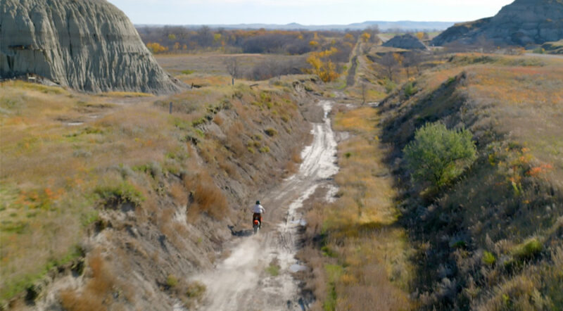
Grade: As an old canal “towpath,” the trail is relatively flat throughout and is described as “one-foot-after-the-other fun.”
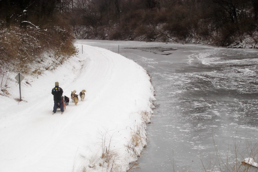
Uses: Walking, biking, mountain biking, horseback riding, fishing, cross-country skiing, snowmobiling and dog sledding; wheelchair accessible
Difficulty: The Hennepin Canal towpath was originally intended for animals towing barges along the canal’s main line and feeder routes but was never used that way. Today, the Hennepin Canal Parkway trail is rated “level and easy.”
Getting there: The closest airport is the Quad City International Airport (2200 69th Ave.) in Rock Island, located 3 miles south of Moline, and served by Allegiant, American, Delta and United airlines. Chicago’s major international airports, O’Hare and Midway, are about a two-hour drive to the eastern end of the Hennepin Canal Parkway in Bureau Junction.
Access and parking: Multiple small parking lots are located at bridges and locks along the mainline canal and feeder canal. The State Park Visitor Center is located off I-80, just west of SR 40, at 16006 875 E. St., Sheffield. Nine primitive state park campgrounds are available along the canal. More information is available on the Illinois DNR website.
To navigate the area with an interactive GIS map, and to see more photos, user reviews and ratings, plus loads of other trip-planning information, visit TrailLink.com, RTC’s free trail-finder website.
Rentals: The Geneseo Campground (22978 Illinois Hwy. 82), located along the Hennepin Canal in Geneseo, has canoes, kayaks and fat-tire bikes for rent—both for its campers and for the public. Rate information is available by calling 309.944.6465. Fishing bait and other supplies are available at five Casey’s General Store locations along the canal—in Geneseo, Sheffield, Princeton, Wayanet and Atkinson.

Donate
Everyone deserves access to safe ways to walk, bike, and be active outdoors.