16 Historic Highlights Along the Route of the Great American Rail-Trail
Rail-trails are the perfect way for us to connect to each other, our communities and our cultural heritage. Unique in makeup and geography, each trail that’s hosting the 3,700-miles-plus preferred route of the Great American Rail-Trail has many stories to tell—some as old as, or far older than, our country itself. Both well known and lesser known, the histories found along the route demonstrate why the “Great American” is a true national treasure.
DC and Maryland: C&O Canal TowPath
Battle Line to Scenic Beauty: C&O Canal
The Chesapeake and Ohio Canal National Historical Park (C&O Canal Towpath) begins in Washington, D.C., a stone’s throw from the National Mall, White House and other historical allure lining Constitution Avenue and the surrounding streets. But the 184.5-mile trail that runs along the Potomac River to Cumberland, Maryland, brims with many historical connections. George Washington used his Revolutionary War cred to successfully lobby for the creation of the precursor “Patowmack Canal Company,” which was ceded to the Chesapeake and Ohio Canal Company in the early 1820s. The C&O Canal would become an important transportation line for a century, and hundreds of relics, including locks, lock houses, aqueducts and other canal structures, still line the trail today.
During the American Civil War, the canal served as a dividing line between the North and South. Union forces protected the canal and used it for transportation and shipping, while Confederate soldiers attempted to sabotage canal operations. It was also the subject of many raids—including by famous cavalrymen Jeb Stuart and John Mosby—and both sides used the towpath as a road to battle.
Fun Fact: In 1977, the C&O national park was dedicated to U.S. Supreme Court Associate Justice William O. Douglas for his championing of the towpath project beginning in 1954.
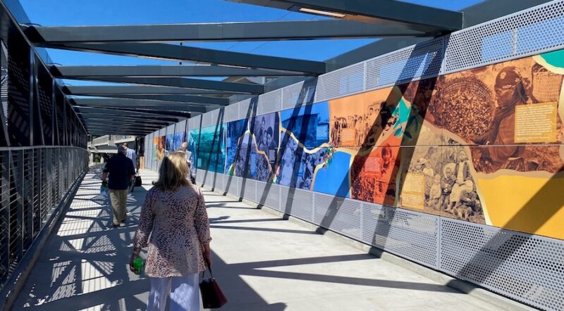
Pennsylvania: Three Rivers Heritage Trail
Seven Years War: Fort Duquesne and Fort Pitt
Over an estimated 24 miles, the Three Rivers Heritage Trail wraps along the banks of the Allegheny, Monongahela and Ohio rivers and provides trail access to everything Pittsburgh, including a place that played pivotal roles in the city and the country’s history: Point State Park.
Situated at the forks of the Ohio River, the Point was considered a gateway to the West and a key trading hub by British and French Canadian colonists. In April 1754, French forces destroyed a British fort there and built Fort Duquesne in its place. The next month, a young commander named George Washington led a successful ambush of French Canadian forces in the first battle of the French and Indian War.
In 1758, following several successful defenses of Fort Duquesne with the aid of their Native American allies, the French—outnumbered—burned down the fort. The British then built Fort Pitt, described as the “most state-of-the-art fort in North America” by the Heinz History Center, which now operates Fort Pitt Museum at the Point. There, you can find exhibits of 18th-century frontier life, as well as outlines of both forts that once stood where the park now does.
West Virginia: Panhandle Trail
Industrial Age of Iron: Peter Tarr Furnace
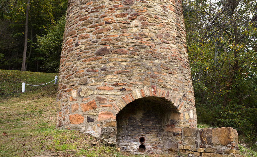
About 5 miles north of the western endpoint of the 29-mile Panhandle Trail, you’ll find a vestige of the industrial age. Weirton, West Virginia, is home to the first iron furnace constructed west of the Allegheny Mountains. The Peter Tarr Furnace, now a historical landmark, produced about two tons of iron a day during the early 1800s. The furnace deteriorated over time before it was rebuilt with on-site materials in 1968. It now borders both Kings Creek, an Ohio River tributary, and a subdivision.
According to a volume chronicling family histories in nearby Steubenville, Ohio, Tarr was a skilled ironworker. He received orders for sugar kettles from faraway Southern plantations. Typically, the furnace cast the ore into household products—pots, kettles, grates and skillets. But during the War of 1812, Tarr’s furnace forged cannonballs utilized by Commodore Oliver Hazard Perry’s fleet during the September 1813 Battle of Lake Erie. While Tarr’s cannonballs are linked to U.S. and Ohio history, the Panhandle Trail connects West Virginia with Pennsylvania, providing passage from Mountain State towns to the western edge of Pittsburgh.
OHIO: GREAT MIAMI RIVER TRAIL
Birth of Aviation: The Wright Brothers
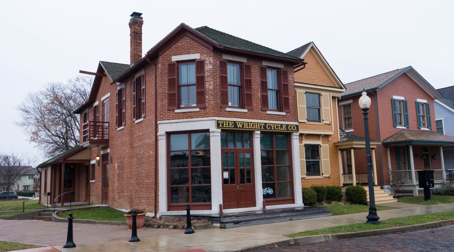
The Wright Brothers’ pioneer status in aviation is common knowledge, but let’s not forget that Orville and Wilbur also ran a bike shop. The brothers caught the “wheeling” bug in the 1890s once they got hold of a safety bicycle, comparable in design, wheel-wise, to today’s. Eventually they started repairing, then building, bikes. Their engineering feats soared in scope from there.
It’s fitting then that their home base of Dayton is the largest city along the Great Miami River Trail. The trail currently features 63 contiguous miles, but two gaps that are expected to be completed in the coming years will increase that total to 86. Stretching from Piqua south to Fairfield, the trail passes through wooded parks, Main streets that remain main streets and, at its heart, Dayton.
There, you can find an array of historical sites connected to the Wright Brothers (and renowned African-American poet Paul Laurence Dunbar). A good starting place is the Dayton Aviation Heritage National Historical Park, especially during the warm months, when park rangers lead bike tours to other interpretive centers in the area.
Fun Fact: In Dayton, near the Great Miami River Trail, is the historic Paul Laurence Dunbar House, commemorating the life and works of one of the country’s first influential African-American poets.
Ohio: Prairie Grass Trail and the Underground Railroad
The scenic 29-mile Prairie Grass Trail—part of the longer 326-mile Ohio to Erie Trail connecting Cleveland and Cincinnati—features a number of communities that played a role in the Underground Railroad between Xenia and London. A highlight of the route is the National Afro-American Museum and Cultural Center, located just north of Xenia in Wilberforce. The museum aims to share information about black history, art and culture. Wilberforce is also the home of two historically black universities: Wilberforce and Central State.
Indiana: Cardinal Greenway
The American Jazz Age: Gennett Records
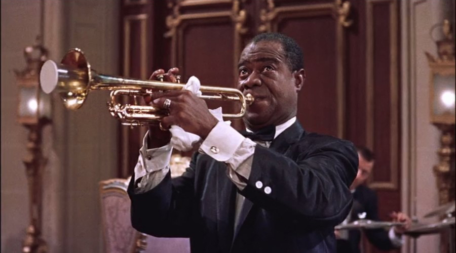
In the 1920s, Gennett Records recorded some of the first notes that jazz legends Louis Armstrong, Duke Ellington and Bix Beiderbecke ever laid down. The little label housed in the brick Starr Piano Company building in Richmond, Indiana, opened its doors to a world of musicians. That included the pairing of “Jelly Roll” Morton with the New Orleans Rhythm Kings, the first interracial recording session in American music history.
Though many influential jazz artists started something big at Gennett, the label recorded anything that might sell, including the sounds of the trains passing by. In addition to jazz, blues, gospel, country and oration offerings, Gennett recorded some of the first sound effects records. Titles included “Hog Calling Contest” and “Railroad Comes Through the Middle of the House.”
Where the railroad once was, the Cardinal Greenway now passes by the preserved remains of the Starr building. Starting near Marion, the rail-trail travels 61.2 miles through Muncie to Richmond, where jazz luminaries took some of their first career steps. Nearby, at Whitewater Gorge Park, their names grace the Gennett Records Walk of Fame, inaugurated in 2007.
INDIANA: Nickel Plate Trail—to the Circus Capital of the World

Near the mid-point of the 41-mile (and growing) Nickel Plate Trail is Peru—once the offseason base for the world’s best circus acts and now home to the International Circus Hall of Fame. In 1884, Ben Wallace opened the first Peru winter season of his Great World’s Menagerie and International Circus. Over the next 50 years, other companies followed— including Sells-Floto/Buffalo Bill’s Wild West Show and the Ringling Brothers. When the latter closed in Peru in 1941, an era ended, but the legacy continues with the Peru Amateur Circus, a summer festival founded in 1960 to reawaken the city’s circus heritage.
Illinois: GREAT RIVER TRAIL
Black Hawk State Historic Site
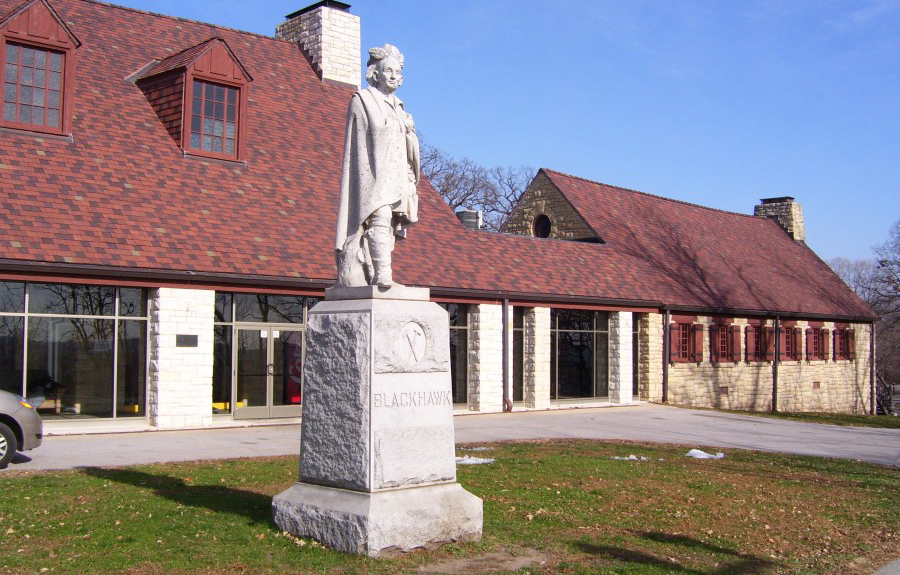
The Great River Trail spans more than 60 miles of Illinois terrain alongside the Mississippi River, taking trail users past various historical sites, including two Native American landmarks, on its way from Savanna to Rock Island. About midway along the trail, you’ll find the Albany Indian Mounds State Historic Site, a burial site for a Native American group named the Hopewell after an Ohio town where similar mounds have been discovered. The Hopewell died out around 350 A.D., and little is known about them.
Near the southern end of the trail in Rock Island, the Black Hawk State Historic Site—built atop the former Sauk village of Saukenuk, where Black Hawk was born—commemorates the Sauk and Meskwaki people. Black Hawk spent much of his life fighting for his tribe and his home, joining alongside the British during the War of 1812 and leading about 1,500 followers in the deadly Black Hawk War of 1832. At the historical site, visitors can view tribal artifacts and exhibits, as well as a to-scale model of the city Black Hawk fought so many battles for.
Fun Fact: The Albany Indian Mounds State Historic Site along the Great River Trail serves as an interpretive center for the Hopewellian culture, active 2,000 years ago.
Iowa: IOWA RIVERFRONT TRAIL
Lewis and Clark + Western Historic Trails
Council Bluffs draws its name from trailblazers Meriwether Lewis and William Clark, who reached the area in late July of 1804 during the Corps of Discovery expedition. There, they held the first meetings between U.S. officials and chiefs of the Oto and Missouri tribes, where they talked of peace, trade and the Native Americans’ new “great father.” Clark named the meeting place, in present-day Fort Calhoun, Nebraska, “Council Bluff.” Just up the Missouri River in Iowa, Council Bluffs took the name and ran with it.
Information about the Lewis and Clark expedition, as well as the Oregon, California and Mormon trails, abounds at the Western Historic Trails Center, which also serves as the southern starting point of the Iowa Riverfront Trail. The 7-mile trail runs alongside the Missouri River, past city parks and the Blackbird Marsh County Preserve. It also offers a connection to the Bob Kerrey Pedestrian Bridge, which spans the Missouri River. Not far from the trail’s northern endpoint, in the Loess Hills, visitors can take in a sweeping view of the West from the scenic overlook at the Lewis and Clark Monument.
Fun Fact: Headquartered in Council Bluffs, Iowa, the 3,700- mile Lewis and Clark National Historic Trail commemorates the Corps of Discovery expedition (1804–1806).
IOWA+NEBRASKA: Bob Kerrey Pedestrian Bridge/Lewis & Clark Landing

Along the Iowa Riverfront Trail in Tom Hanafan River’s Edge Park, one can access the stunning 3,000-foot-long Bob Kerrey Pedestrian Bridge, a cable-suspension bridge that leads across the Missouri River from Iowa to Nebraska. Once across, you’ll find the Lewis and Clark National Historic Trail Headquarters and Visitor Center, and Lewis & Clark Landing, a 23-acre park with interpretive exhibits commemorating the site of the 1804 Lewis and Clark landing on the west bank of the river. The park is connected to the CHI Health Center via the Martin Luther King Jr. Pedestrian Bridge.
Nebraska: White River Trail
In Remembrance: Fort Robinson State Park
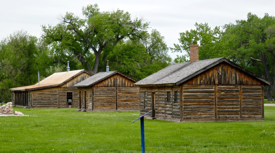
The 3-mile White River Trail connects Crawford, Nebraska, to a 22,000-acre park that attracts many visitors to the northwestern corner of the state. Fort Robinson State Park is a recreational haven, offering stagecoach tours and weekly summertime rodeos, Jeep tours and bike trails. But its history, spanning from frontier days to post-World War II, is a major draw.
Commemorative markers, a museum, and preserved or reconstructed buildings all note the U.S. Army fort’s historical contributions and significance, including the all-African-American Ninth Cavalry headquartered there from 1887 to 1898, and the fort’s days as a World War II K-9 training base and POW camp.
They also include tragic ones. The post that initially provided security for the Red Cloud Indian Agency is also the site of the 1879 Fort Robinson Massacre, during which dozens of imprisoned Northern Cheyenne were killed following a mass escape effort. That took place about two years after Chief Crazy Horse’s 1877 imprisonment and death there. Visitors can now stand where he was killed and reflect.
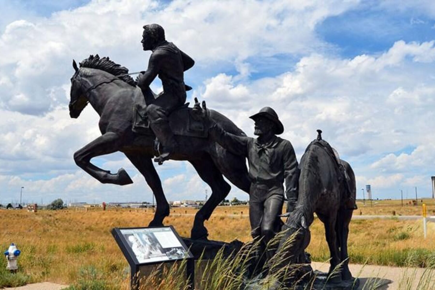
Wyoming: PLATTE RIVER TRAIL
You’ve Got Mail: The Pony Express
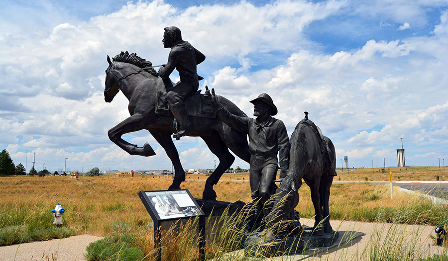
In its earliest years, Casper, Wyoming, served as a convergence of four heavily traveled westbound trails. The California, Mormon, Oregon and Pony Express trails all passed through this corridor, and that pioneer history abounds along Casper’s 10-mile Platte River Trail. The trail hugs the North Platte River and runs past the Fort Caspar Museum, a re-creation of the Army fort first founded in 1859 as a toll bridge and trading post along the Oregon Trail.
There, visitors can explore reconstructed fort buildings, view 6,000 artifacts and find a replica of the Guinard Bridge, which allowed Pony Express riders to zip over the North Platte during the 18 frenetic months that the service made its 1,966-mile, 10-day runs across the West.
Traveling northeast on the parkway takes trail users through city parks and recreation areas and near the National Historic Trails Interpretive Center. There, you can climb inside a replica Conestoga wagon and take a simulated ride across the North Platte that aims to show some of the challenges settlers faced crossing rivers and rocky terrain on the way to a new life.
Fun Fact: The National Historic Trails Interpretive Center in Wyoming captures the lives of 400,000+ pioneers on the Oregon, California, Mormon and Pony Express trails from 1841 to 1868.
Montana: HEADWATERS TRAIL SYSTEM
Sacajawea and the Lewis & Clark Expedition
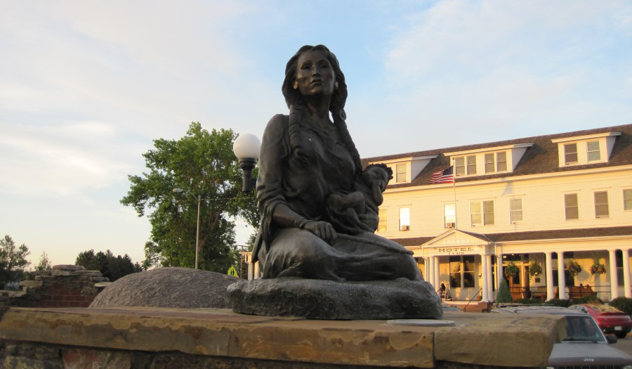
The area around the Headwaters Trail System in Three Forks, Montana, brims with historical ties going back to the earliest recorded history of western expansion. It was here that Sacajawea of the Lemhi Shoshone tribe—who was serving as a guide and interpreter for the Lewis and Clark expedition (1804–1806)—recognized the area whence she’d been captured as a 12-year-old by a warring tribe. Her familiarity helped the expeditioners in choosing the best path westward.
During the expedition in 1805, while crossing the Continental Divide, Sacajawea was happily reunited with her tribe and several of her siblings, including her brother Cameahwait, now chief. The tribe gave further assistance to the expeditioners as they successfully made their way to the Pacific Ocean.
One of the most memorialized women in America, Sacajawea’s contributions are celebrated around Three Forks, including with a statue erected in her honor in the town’s Sacajawea Park. Read more in the Winter 2019 Rails to Trails feature story.
MONTANA: Highway 89 South Pedestrian Trail and the Wild West
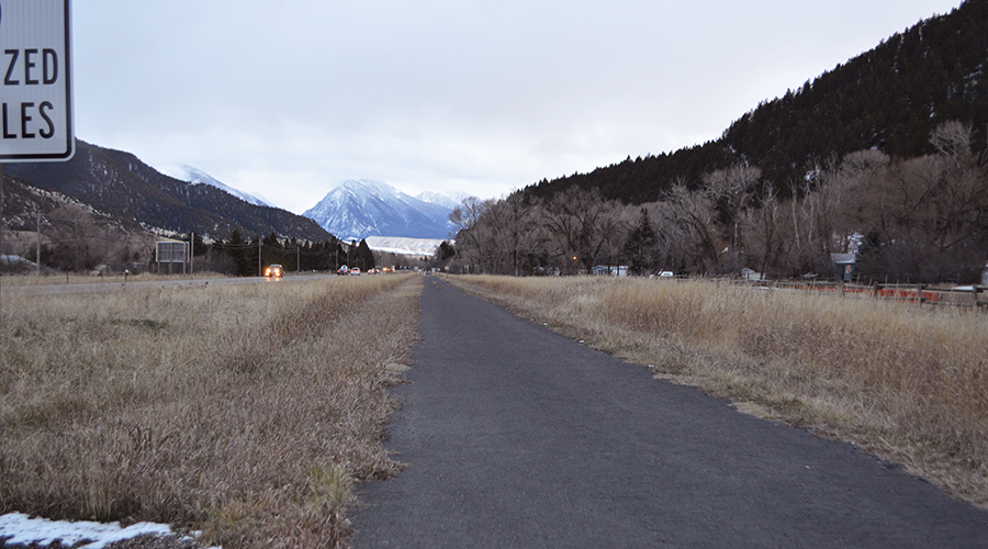
Livingston, Montana, situated in an artists’ enclave and fly-fishing haven north of Yellowstone, was the original gateway town to America’s first national park. In the late 1800s, Yellowstone officials provided a license to an on-and-off Livingston resident to sell her “autobiography” there. Many of the sharpshooting, fort-defending tales were embellished; nevertheless, Martha Canary (aka Calamity Jane) became one of the Wild West’s most infamous women. A book of newspaper clippings is available for sale at the Yellowstone Gateway Museum, not far from the scenic 4.5-mile Highway 89 South Pedestrian Trail, which starts near downtown Livingston.
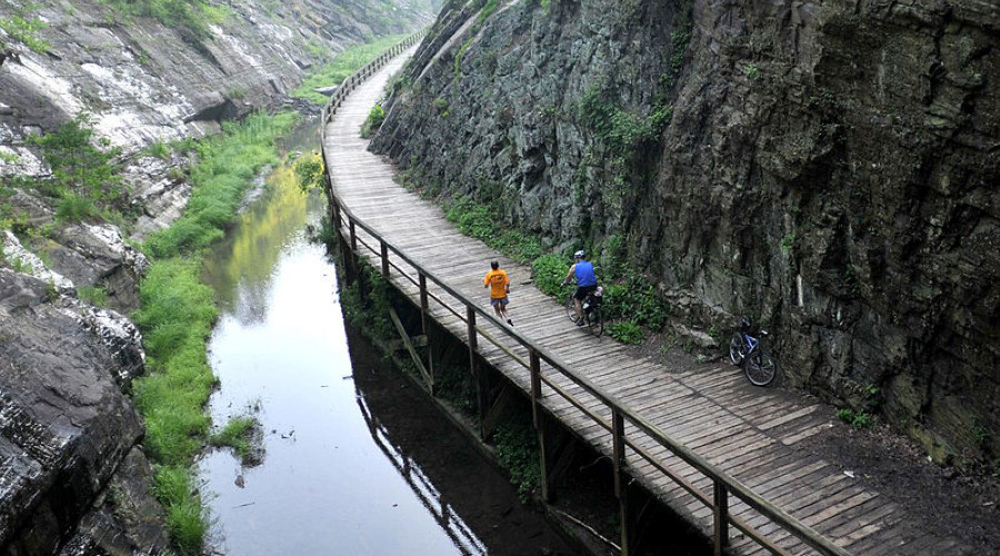
Idaho: TRAIL OF THE COEUR D’ALENES
Coeur d’Alene River Restoration
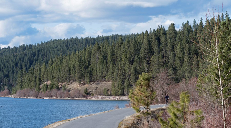
French Canadian trappers first bestowed the French name meaning “heart of the awl” upon the Coeur d’Alenes tribe in the late 18th century or early 19th century in reference to their shrewd trade capabilities. Tribe members also refer to themselves in their own language as “Schitsu’umsh”—“the discovered people” or “those who are found here”—and the tribe that has called upper Idaho home since time immemorial has fought for its environmental restoration for decades.
In 1991, the tribe filed suit against Hecla Mining Co. and other silver mining companies seeking damages for the havoc caused by millions of tons of mining waste released into the Coeur d’Alene River and its tributaries. The United States and Idaho eventually joined the lawsuit, and the groups reached a multimillion dollar agreement to repair or mitigate the damages to the environment. The 72-mile Trail of the Coeur d’Alenes is part of the cleanup effort. The trail travels from Plummer to Mullan alongside lake and river, through farmland and forest, with asphalt and gravel along the trail serving to isolate contaminants while restoration continues.
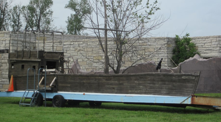
Washington: PALOUSE TO CASCADES STATE PARK TRAIL
Preserving Our Railroad Past: The Milwaukee Road
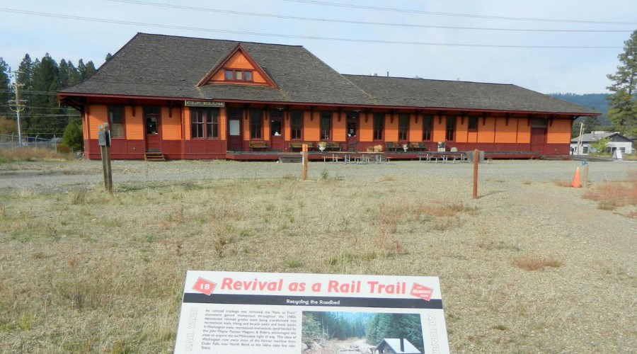
The Palouse to Cascades State Park Trail spans more than 200 miles of Washington terrain along the historic “Milwaukee Road” connecting Chicago and the Puget Sound. Searching for a way to tackle the steep mountain ranges of the West, the line, which came into being in the mid-1850s, began to electrify in 1914 and had electrified about a quarter of its route by 1927. The end result was a scenic ride through the Pacific Northwest, free of obtrusive steam engine smoke.
The Olympian locomotive line was touted by Mr. Electricity himself, Thomas Edison, as “the very last word in transportation” in an ad that ran in the Saturday Evening Post. All it took was 3,000 miles of line, 22 electrical substations and a cost of about $566 million present-day to build it all, according to the Yakima Herald.
Though the power cut off in the 1970s, the rail-trail runs alongside a collection of preserved structures in the Washington town of South Cle Elum, home of one of those 22 substations, which is now a restaurant ironically named Smokey’s Bar-B-Que.
Fun Fact: In 1982, Washington purchased its portion of the disused Milwaukee Road corridor to preserve the historic line for future use as a rail-trail. Today, it is one of the longest rail-trails in the country.
WASHINGTON: Burke-Gilman Trail and Clara Antoinette McCarty Wilt

Nestled in the southern portion of the 18.8-mile Burke-Gilman Trail is the University of Washington, formed in 1861 after the separation of the Oregon and Seattle territories. There, a dormitory is named for Clara Antoinette McCarty Wilt, who became the first graduate of the university in 1876. Several years later, she made history again by becoming the first superintendent of schools in Pierce County and the first woman elected to public office in the territory—three years before women in the territory could vote in local elections and 40 years before women could vote in federal elections.
This article was originally published in the Spring/Summer 2019 issue of Rails to Trails magazine. It has been posted here in an edited format.
By Cory Matteson, with contributions by Amy Kapp

Donate
Everyone deserves access to safe ways to walk, bike, and be active outdoors.
Related
View All
Safe by Design: Examining the Impact of Trails and Bike-Ped Infrastructure on Safety in America

Exploring the Nation’s Trailside Geoheritage Sites