Washington, D.C., and Maryland’s Anacostia River Trail
Trail of the Month: August 2020
“The people’s relationship with the water had been severed. The trail is proving incredibly successful at building those relationships with the Anacostia River and continuing to draw more and more attention to it.”
—Bob Patten, Maryland-National Capital Park and Planning Commission
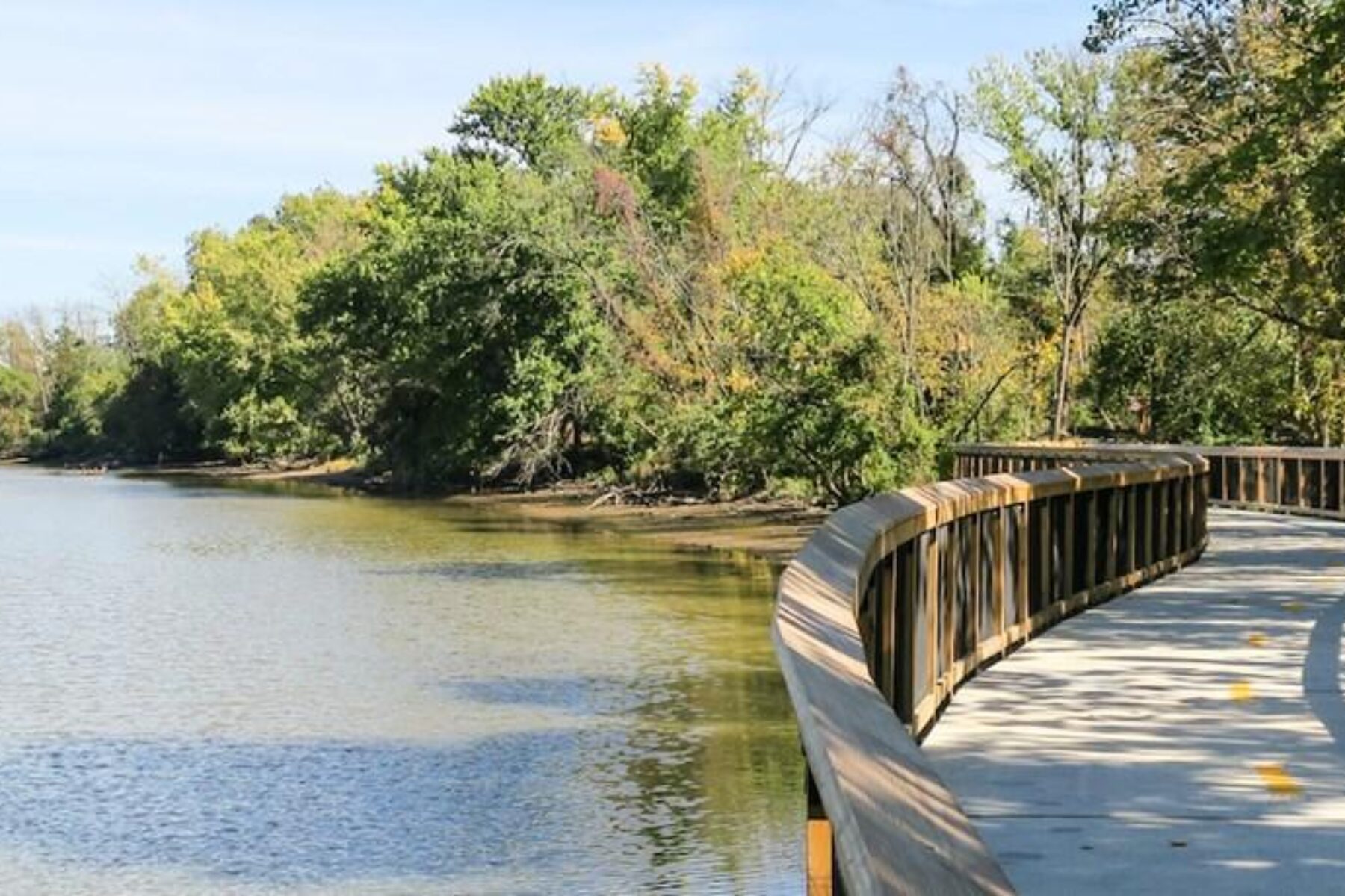
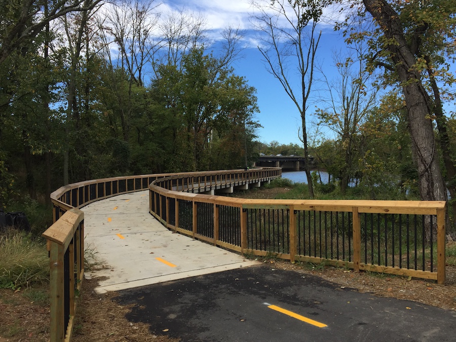
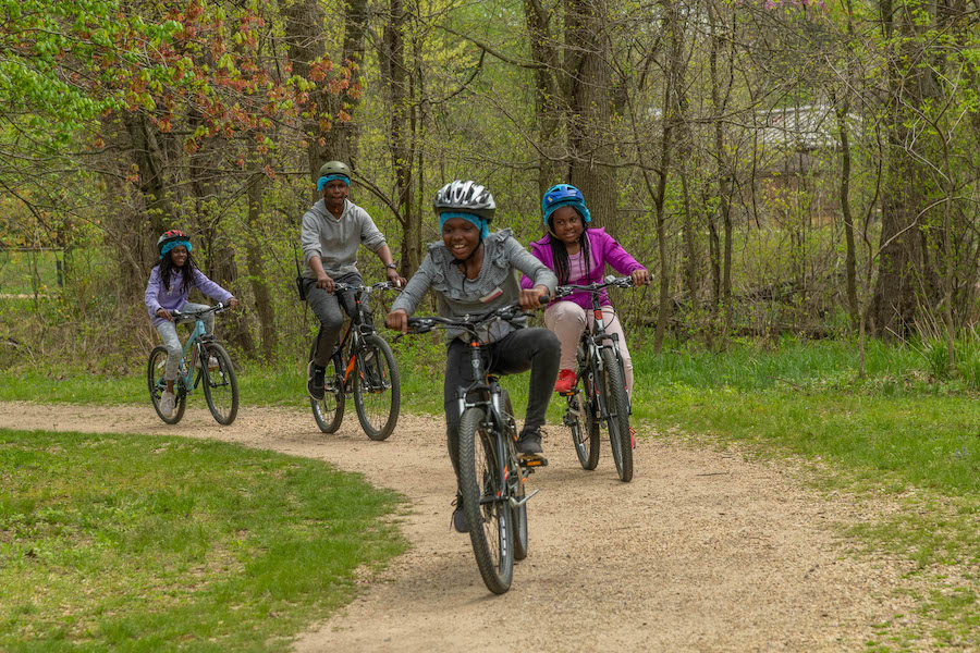
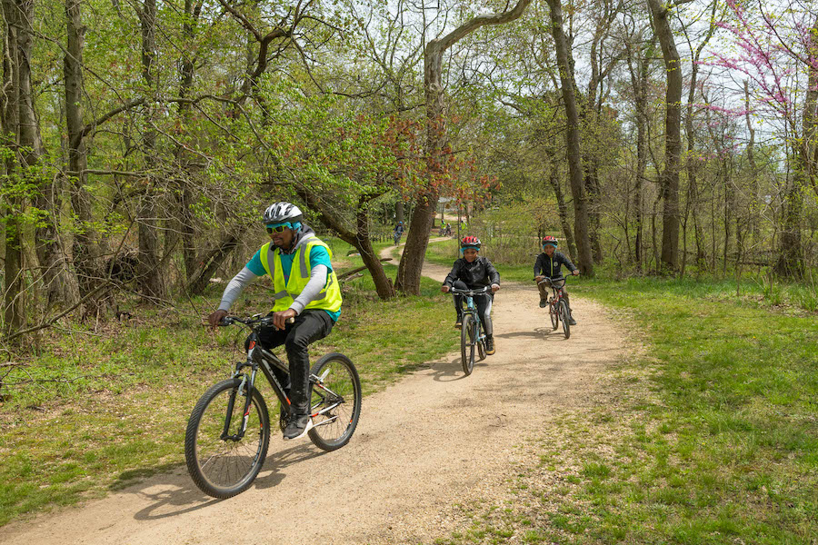
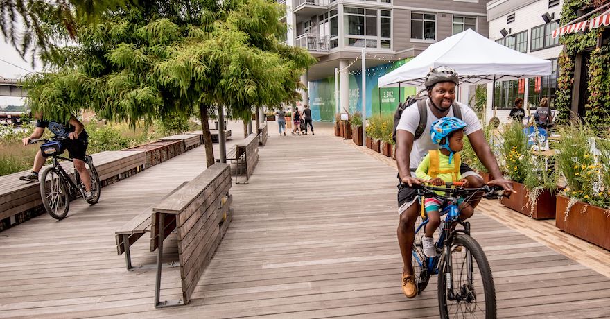
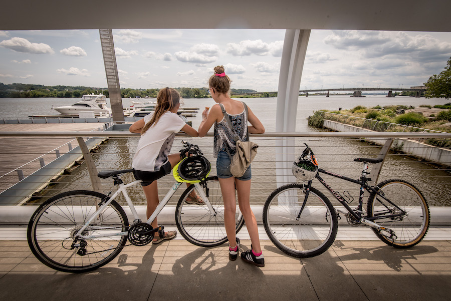
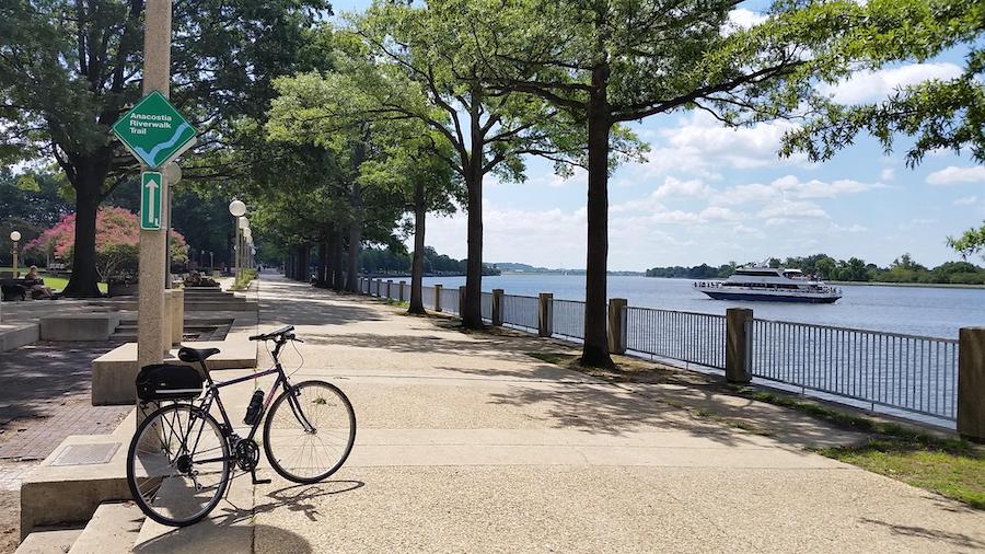
Just beyond the iconic monuments and museums that make up the central core of Washington, D.C., lies one of the area’s best kept secrets: the Anacostia River Trail, a 20-mile route along the city’s eastern waterway that offers an extraordinary tapestry of experiences on its journey to Bladensburg, Maryland. Connecting 16 waterfront neighborhoods and an enticing array of destinations, the paved pathway offers urban hubs humming with restaurants, businesses and cultural attractions coupled with unexpected oases of serenity and natural scenery.
“You could start with your bike on the east side of the Anacostia River near its mouth—where the Anacostia follows into the Potomac—bicycle all the way up the east side almost to the Maryland line, cross over and then bike down the west side of the Anacostia River almost to the mouth again at Buzzard Point,” enthused Vince Vaise, the supervisory park ranger for National Capital Parks-East, which maintains the trail.
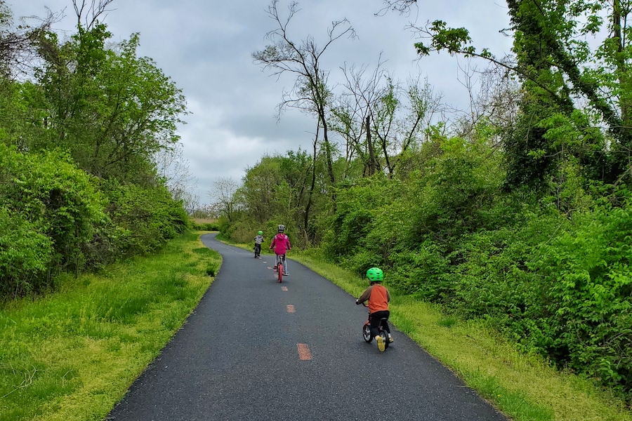
First envisioned nearly two decades ago, the trail welcomed its newest section in 2016, which traverses the beautiful Kenilworth Park and Aquatic Gardens in northeast D.C. Although a recreational gem, the park was relatively isolated and difficult to reach by bike. The addition of the trail increased the park’s accessibility exponentially and has notably increased visitation.

“The Kenilworth Aquatic Gardens offers an otherworldly experience with the different varieties of waterlilies and the lotuses that are found there,” said Tina O’Connell, executive director for the Friends of Kenilworth Aquatic Gardens. “It’s the only National Park site dedicated to the cultivation and display of aquatic plants. As such, you’ll walk in and see an abundance of colorful, exotic flowers in sweeping expanses of different habitat. We have ponds, the river, forests and meadows, and—because of these different habitats—we have all types of animals, everything from blue herons, ospreys, turtles, the occasional snake, deer, fox—it just really feels like a wild place.”
Bob Patten, who was involved in the new section’s development, agrees. “The forested edge of the river on the east side was as close to a pristine forest as there was left in D.C.”
When scouting the area for the trail’s potential alignment, Patten—who serves as the trail development program manager for the Maryland-National Capital Park and Planning Commission—recalls that he and the crew brought machetes and wore long pants as they had to forge their way deep into the forest for what he fondly recalls as a ‘total adventure.’
“Even right after the trail was built, it looked like [the vegetation] had already grown back,” Patten chuckled. “That section just turned out so nice—people love it.”
Crossing into suburban Maryland, the trail continues from the Kenilworth Aquatic Gardens to Bladensburg Waterfront Park, a place where the river takes center stage. Visitors can interact with the water in just about any way imaginable here, with options including canoe and kayak rentals, interpretive riverboat tours, a fishing pier and boat ramp. (Although the Anacostia River Trail is not a rail-trail, you’ll also find a cherry red B&O caboose here, a nod to the area’s past life as a stop on the Baltimore & Ohio Railroad.)
At trail’s end, the pathway splits into a “Y” juncture with two other trails: the Northeast Branch (heading to the City of College Park) and the Northwest Branch (reaching Silver Spring). Following tributaries of the Anacostia River, the three trails mesh with a handful of others that are all part of the expansive Anacostia Tributary Trail System connecting Prince George’s and Montgomery counties with D.C.
A River Rebounds
The trail’s past and future is inexorably linked to the Anacostia River, going back to the Nacotchtank tribes, who once thrived along its banks. In 1608, Captain John Smith—of Jamestown renown—explored the Anacostia and found it to be a wonderous place lined with lush forests and wetlands teeming with wildlife. Local legend has it that the fish were so abundant that his men tried to catch them with frying pans.
Unfortunately, as early as the Colonial era, the river was used as a dumping ground for garbage. In later years, sewage and industrial waste also polluted its waters. Compounding the problems was the clear-cutting of native forests and tobacco farming, which lead to soil erosion. After centuries of misuse, the river has had a challenging road to recovery.
“The Anacostia River was once identified as one of the most polluted bodies of water in America,” said Michael Stevens, president of the Capitol Riverfront business improvement district. “Now people see it as an asset and nature is returning.”
A major turning point for this reclamation came in 2000 with the Anacostia Waterfront Initiative, a joint partnership between 19 different local, regional and federal partners that outlined a 30-year vision for creating a world-class waterfront along a clean river lined with parks, recreational facilities, vibrant neighborhoods and busy commercial centers. A key project that came out of the initiative was the construction of the Anacostia River Trail, which was carried out by the District Department of Transportation.
“The District government, because of Mayor Anthony Williams, said ‘We care about the Anacostia River; it’s part of the city, and we have disadvantaged communities there that should not be ignored,’” said Patten.
An important recent development in the efforts to clean the water is the D.C. Water and Sewer Authority’s plan to virtually eliminate sewage discharge into the Anacostia River by redirecting the waste to a wastewater treatment plant via a massive underground tunnel. The project is expected to dramatically improve the health of the river.

While there is still much work to be done, the Anacostia Watershed Society—which has played a major role in the river’s cleanup since its establishment in 1989—monitors the river’s condition and continues to see improvement in its clarity, toxicity levels, aquatic vegetation and other measures. It’s the group’s aim that swimming in the Anacostia—which has been banned since the early 1970s—will once again be possible by 2025.
“The founders of the Anacostia Watershed Society knew that cleaning the river would be a long haul and, unless they built political support for it, it wouldn’t happen because it was going to cost a lot of money,” said Patten. “They recognized that if we had a trail along the river, that would help build political support, because unless people have a personal relationship with river, they’re not going to care about it. That’s a big part of the reason why the river cleanup took so long to get around to. The people’s relationship with the water had been severed. The trail is proving incredibly successful at building those relationships with the Anacostia River and continuing to draw more and more attention to it.”
Riding Into the Future (and the Past)
Not only does the Anacostia River Trail connect people to the river and its surrounding greenspace, it also transports them into our collective past. On the east side of the river, the pathway travels through the grassy expanse of Anacostia Park, which abuts the Anacostia Historic District. Encompassing one of the District’s oldest suburbs, the historically Black neighborhood houses 550 buildings from the late-19th and early-20th centuries. At its heart, visitors will find the Frederick Douglass National Historic Site, a former home of the famed abolitionist, who lived there from 1878 until his death in 1895.
“Frederick Douglass routinely walked the grounds of what is now Anacostia Park,” explained Vaise, who notes that the National Park Service is planning to add interpretative signage to tell more of the rich stories along river in the future. “One reason he chose the land where he lived was that it was near Washington—within about 20 minutes, you could be in the middle of the District—but, when you crossed the 11th Street bridge and went to the house, it was country at that time. Behind the town of Anacostia, there was farmland; it was like having your country house and, from your front porch, you could see the big city. He had the best of both worlds.”
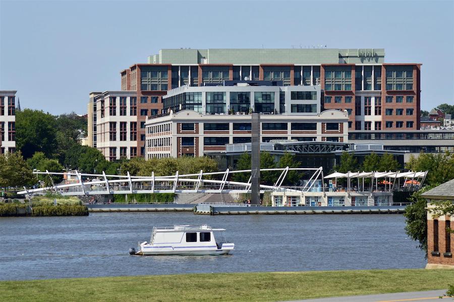
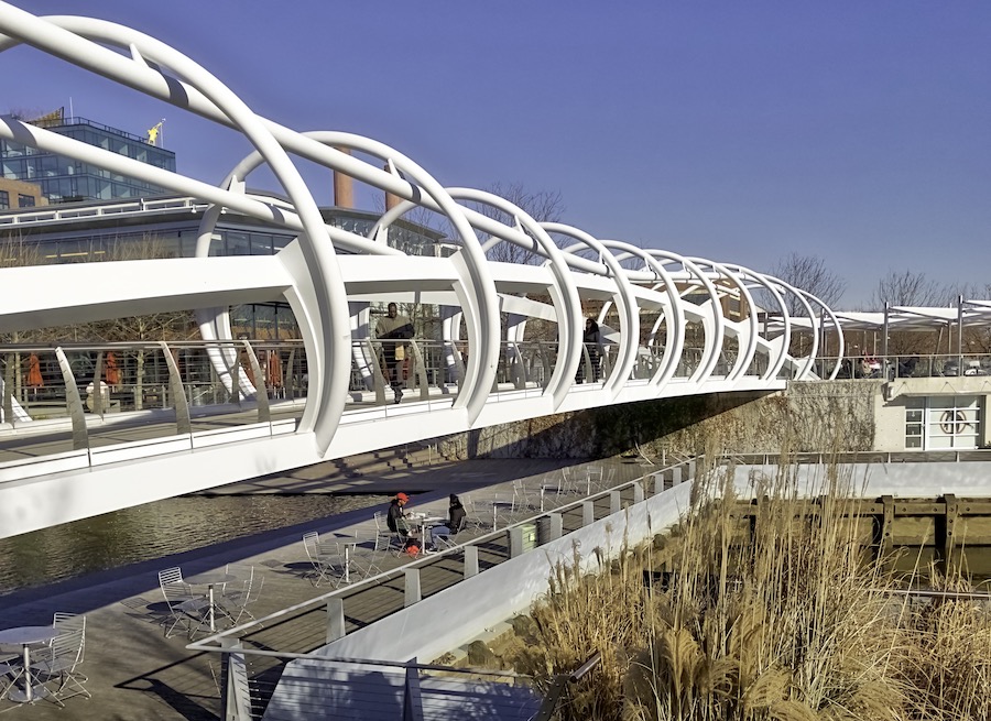
On the west bank, access to the river and its riverwalk trail is a major selling point for the burgeoning mixed-use neighborhood of Capitol Riverfront, home to more than 15,000 residents. Crown jewels of the neighborhood include Yards Park (which features a funky sculptural footbridge), the Washington Nationals Park baseball stadium and the historic Washington Navy Yard, originally established in 1799.
“The Anacostia River Trail is a major form of recreation; it’s a major form of getting up close and personal to the river; of getting open space relief; of getting out in nature,” said Stevens. “You can connect to these wonderful open spaces like the Kenilworth Aquatic Gardens, Kingman and Heritage Islands, and Yards Park. It’s a major trail system that really connects a string of destinations along the river. It’s a huge benefit to us.”
In tandem with the increased residential growth and business development comes more demand for trail connectivity for the Anacostia riverfront, which previously had been challenging to get around by bike or on foot due to the railroad tracks and major highways that had crisscrossed the landscape and cut off access. New projects under development—including the Lincoln Connector Trail, which will provide a link to the riverfront from D.C.’s Fort Lincoln neighborhood, and a bike-ped bridge between the Kenilworth Aquatic Gardens and the National Arboretum—will allow residents to reach even more points of interest.
Cue the vision of the Capital Trails Coalition, which aims to create an 800-mile network of multiuse trails equitably distributed throughout Maryland, Washington, D.C., and Virginia. Further building on that already ambitious effort, the transportation planning board of the Metropolitan Washington Council of Governments approved a plan this past July to broaden the regional trail system even more, covering some 1,400 miles. As a major transportation connector, the Anacostia River Trail plays a key role in both initiatives.
“It’s one thing to have trails, and another thing to have them all connected into an understandable trail system so that people can utilize them well,” noted Stevens. “Having a connected regional trail system will add immeasurably to our quality of life. It provides a healthy transportation alternative and takes cars off the road, it offers an exercise option, and it’s a great way to visit parts of the city.”
Related Links
District Department of Transportation
National Capital Parks-East
Maryland-National Capital Park and Planning Commission
Capitol Riverfront BID
Friends of Kenilworth Aquatic Gardens
Capital Trails Coalition
Trail Facts
Name: Anacostia River Trail
Trail website: District Department of Transportation
Length: 20 miles
County: District of Columbia and Prince George’s County (Maryland)
Start point/end point: In Washington, D.C., the Anacostia River Trail, which is also referred to as the Anacostia Riverwalk Trail, begins at S. Capitol Street SE at Nationals Park and travels along both sides of the Anacostia River for just over 17 miles; the trail then seamlessly crosses the Maryland state line and continues for another 3 miles, ending at Baltimore Avenue/US 1 and Charles Armentrout Drive. At this juncture, travelers can pick up the Northwest Branch Trail and Northeast Branch Trail, which follow tributaries of the Anacostia River.
Surface type: Primarily asphalt with some sections of concrete, boardwalk and crushed stone.
Grade: The trail is relatively flat, with a few short grades, especially on the bridge approaches.
Uses: Walking, bicycling and inline skating; wheelchair accessible; a fishing pier is also available in Maryland’s Bladensburg Waterfront Park along the northern end of the trail.
Difficulty: The trail route has a primarily paved surface and provides easy access to city amenities.
Getting there: The closest airport is Reagan National Airport (1 Aviation Circle, Washington, D.C.), though travelers could also fly into Dulles International Airport (1 Saarinen Circle, Dulles, Virginia). If arriving by train, Amtrak serves Union Station (50 Massachusetts Ave. NE, Washington, D.C.).
Access and parking: The region’s Metro rail service provides convenient access the trail; if taking your bike aboard a train, please observe the transit system’s rules. Several train stops are relatively close to the trail, including: the Navy Yard-Ballpark (200 M St. SE) and Anacostia (1101 Howard Road SE) stations on the Green Line, and the Potomac Avenue (700 14th St. SE) and Stadium-Armory (192 19th St. SE) stations on the Orange, Blue and Silver lines. Near the Kenilworth Aquatic Gardens and the D.C./Maryland border, the Minnesota Avenue (4000 Minnesota Ave. NE) and Deanwood (4720 Minnesota Ave. NE) stations on the Orange Line are the closet Metro stops to the northern end of the trail.
For those who are arriving by car in Washington, D.C., paid parking lots can be found near the southern end of the trail around Yards Park (10 Water St. SE) and Nationals Park (1500 South Capitol St. SE). Public parking is also available in Anacostia Park (1900 Anacostia Dr. SE) and Kenilworth Aquatic Gardens (1550 Anacostia Ave. NE).
On the northern end of the trail in Maryland, parking can be found at Colmar Manor Community Park (3510 37th Ave., Colmar Manor) and Bladensburg Waterfront Park (4601 Annapolis Road, Bladensburg).
To navigate the area with an interactive GIS map, and to see more photos, user reviews and ratings, plus loads of other trip-planning information, visit TrailLink.com, RTC’s free trail-finder website.
Rentals: Capital Bikeshare offers a couple of bike-share stations near the trail. Additionally, Conte’s Bike Shop (1331 4th St. SE, Washington, D.C.; 202.558.9866) at the Navy Yard typically rents bikes, though that service has been temporarily halted during the pandemic. Another option is Bike and Roll’s location on the National Mall (955 L’Enfant Plaza SW North Building; 202.842.2453), about 2 miles from the trail.

Donate
Everyone deserves access to safe ways to walk, bike, and be active outdoors.