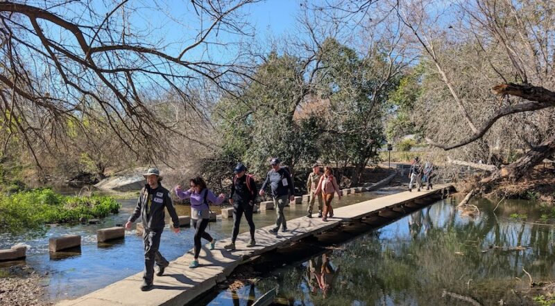
Long-Distance Rides on Hall of Fame Rail-Trails
Here’s a fun look back at some of our previous Hall of Fame trails spanning nearly 100 miles or more. This collection of prestigious pathways—selected on merits such as scenic value, trailside amenities, historical significance and community connections—showcases some of the country’s best trail tourism destinations and long distance rides.
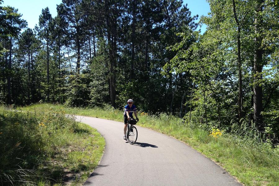
Minnesota’s Paul Bunyan State Trail
LENGTH: 119.3 miles
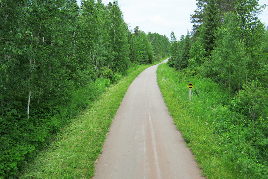
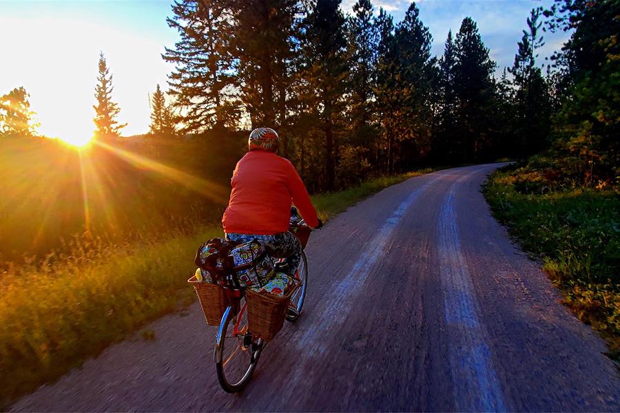
WHAT TO SEE: Nestled among aspens, maples and oaks, and featuring stunning views of several of Minnesota’s many lakes, is the 119-mile Paul Bunyan State Trail. This paved route immerses you in the quiet beauty of the north-central woodland region of the state while passing through welcoming small towns that cater to trail users by offering numerous amenities, including shuttle services.
Beginning at the southern end of the trail in Brainerd’s Crow Wing State Park, travelers will head north, catching glimpses of the Mississippi River and traversing the scenic Brainerd Lakes Area, a popular recreational and resort destination.
Along the way, adventurers will see various sites that pay homage to the iconic lumberjack Paul Bunyan and Babe the Blue Ox. In Pequot Lakes, you can relax in Paul’s chair at Bobber Park; in Pine River you can stand in his wooden baby boots; and in Hackensack you can see a 17-foot-high fiberglass statue of his sweetheart, Lucette.
North of Walker, you’ll enter the Chippewa National Forest, where you’ll find trees that are more than 350 years old, and a pristine landscape speckled with lakes and streams. Keep an eye out for bald eagles, hawks, woodpeckers and other wildlife. The trail continues to its end in Lake Bemidji State Park, where travelers can take a well-earned break at the lake’s swimming beach, or enjoy one of the park’s nature hikes. Ambitious riders can also connect to the nearly 100-mile (unpaved) Blue Ox Trail, which heads north to the Canadian border.
SURFACE: The Paul Bunyan State Trail is paved with asphalt for its entirety, making for an easy, family-friendly ride. Before you go, visit the Minnesota Department of Natural Resources website to help plan your trip.
WHERE TO STAY: The rail-trail is bookended by state parks offering tent, cabin and RV camping: on the trail’s southern end is Crow Wing State Park; to the north is Lake Bemidji State Park. The Chippewa National Forest, on the trail’s northern end, provides additional camping opportunities. For more lodging choices, PaulBunyanTrail.com has a diverse listing of options adjacent to the trail, including bed and breakfasts, hotels and campgrounds.
RELATED: Trail of the Month on Minnesota’s Paul Bunyan State Trail (February 2011)
Alabama’s Chief Ladiga Trail and Georgia’s Silver Comet Trail
LENGTH: 94 miles
WHAT TO SEE: Offering a combined 94-mile experience, the Chief Ladiga and Silver Comet trails connect two states and numerous small towns on a tranquil route through picturesque natural surroundings within easy reach of downtown Atlanta.
Beginning on the route’s western end in Anniston, Alabama, travelers will be on the Chief Ladiga Trail, named for a Muscogee tribe leader. The trail soon passes through Weaver and then Jacksonville, where you’ll traverse the Jacksonville State University campus and can stop in an 1860s train depot that’s been refurbished for use as a trailhead. Continuing northeast, the rural countryside and Talladega National Forest backdrops offer a nice mix of scenery. At Piedmont’s Eubanks Welcome Center, travelers will find the final trailhead amenities before reaching the state line.
At State Line Gateway Park, a seamless transition can be made to Georgia’s Silver Comet Trail as you pedal under an archway marking the border. About 10 miles east of the Alabama-Georgia line, pop into the Cedartown Welcome Center, housed in a replica of the original depot, for information on local history and attractions.
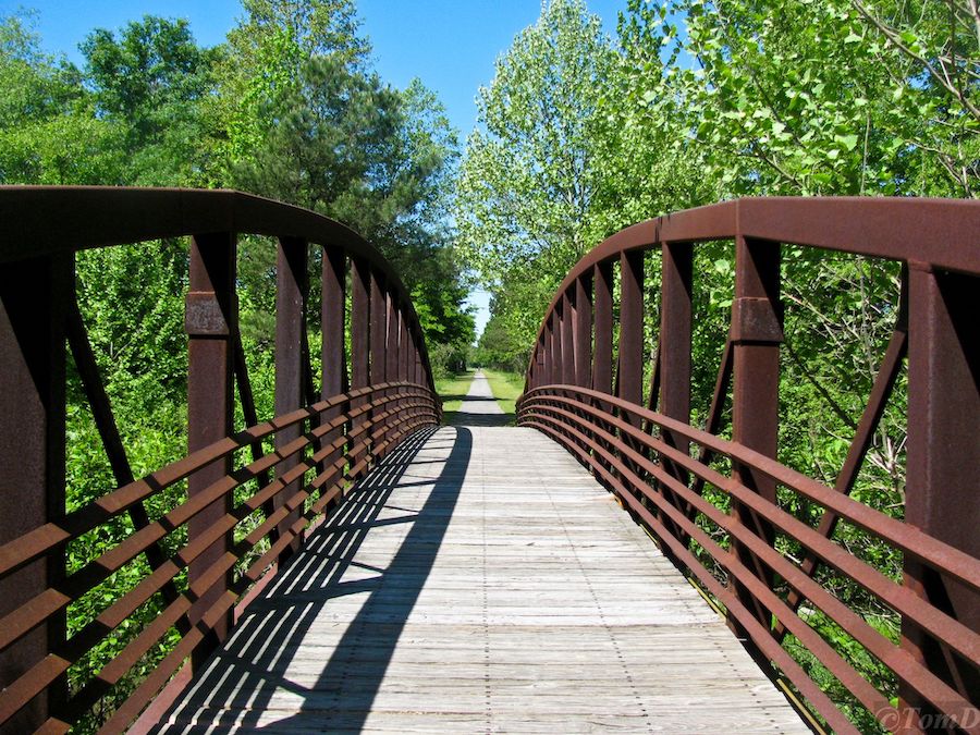
East of Rockmart, Coot’s Lake Beach, a popular swimming spot, offers the perfect place to relax and cool down for a bit. Shortly afterwards, you’ll traverse the 800-foot Brushy Mountain Tunnel (circa 1912), and approaching Dallas, you’ll see the dramatic Pumpkinvine Trestle. Built in 1901, this bridge is more than 750 feet long and rises 126 feet over Pumpkinvine Creek.
The trail continues to its end in Smyrna with many lushly wooded sections offering shade along your journey. Highlights of this eastern end include a cherry-red caboose at the Hiram Trailhead and a high-elevation trestle over Nickajack Creek. Future plans call for extending the route to downtown Atlanta via the Silver Comet Connector; this burgeoning pathway will also cross another important and developing rail-trail, the Atlanta BeltLine, which will one day encircle the city.
SURFACE: With a fully paved surface and a relatively gentle grade (except for a few inclines between Cedartown and Rockmart along the Silver Comet Trail), the route is suitable for most abilities.
WHERE TO STAY: The Explore Georgia website provides a searchable directory of accommodations by city and type. Tourism websites for Alabama’s Calhoun and Cleburne counties, and Georgia’s Cobb, Paulding and Polk counties, provide additional lodging options. Another resource is BikeSilverComet.com, which lists various places to stay (as well as other businesses and services) for the towns along both trails.
RELATED: Trail of the Month on Georgia’s Silver Comet Trail and Alabama’s Chief Ladiga Trail (June 2009)
South Dakota’s George S. Mickelson Trail
LENGTH: 109 miles
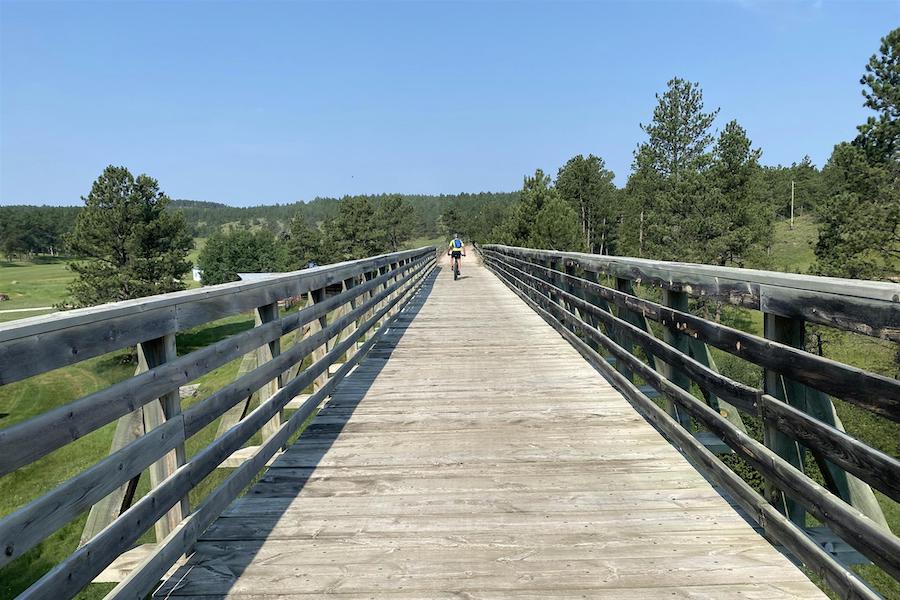
WHAT TO SEE: Experience a piece of Wild West history along the 109-mile George S. Mickelson Trail as it travels into the heart of South Dakota’s Black Hills. Although a majority of the rail-trail does not exceed a 4% grade, starting from its northern end in the former gold-mining boomtown of Deadwood and heading south allows you to enjoy the slight downhill route as you wind through ponderosa pine forests, narrow valleys, high mountain meadows and open prairie.
Founded illegally in the 1870s on land that had been granted to the Lakota, Deadwood once epitomized a lawless frontier town. Just blocks from the trailhead, you can stop by the Adams Museum and Historic Adams House to learn more about the region’s history. You’ll also want to pick up a trail pass for those over age 12; daily passes can be purchased for $4 at trailhead self-pay stations.
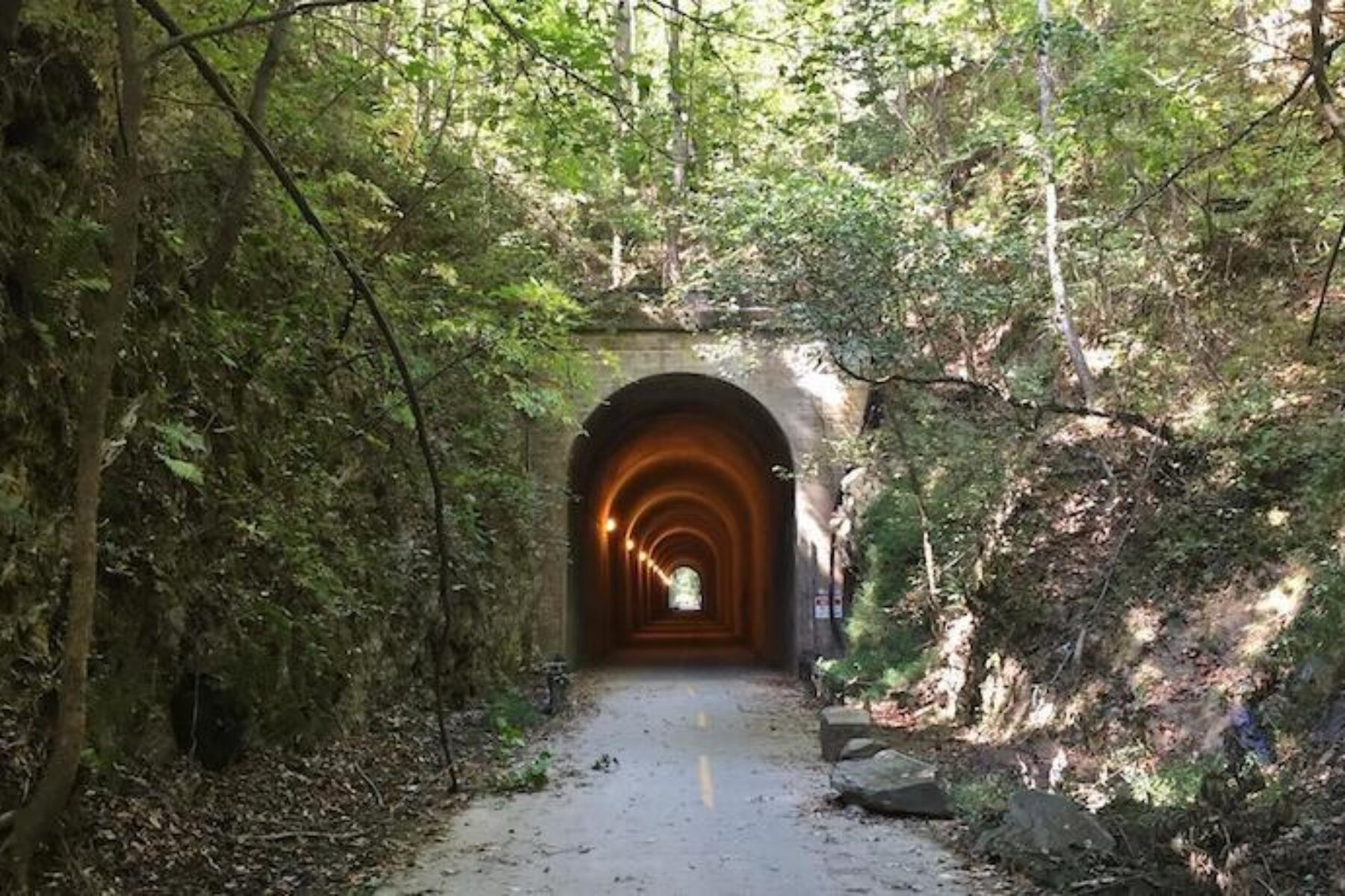
The Mickelson Trail passes through historical mining towns such as Lead and Englewood, and the ghost towns of Rochford and Mystic. Remnants from the corridor’s railroad heyday also populate the pathway: more than 100 converted railway bridges, four dramatic tunnels that burrow through rock and an old caboose in Custer’s Harbach Park. Railroad buffs should be sure to visit the South Dakota State Railroad Museum adjacent to the trail in Hill City, too.
In Custer, located a little past the halfway point of the trail, you can take a 3-mile spur to Custer State Park to enjoy swimming, fishing, camping and hiking opportunities, as well as the chance to see bison, bighorn sheep, antelope and other wildlife.
The trail continues to its southern terminus in Edgemont, a small town established in 1889, the same year that South Dakota became a state. But the adventure doesn’t have to end there; the region is rich in fascinating cultural and historical landmarks, including Crazy Horse Memorial (depicting an Oglala Lakota warrior), Mount Rushmore National Memorial and Wind Cave National Park, which are within a few miles of the trail.
SURFACE: The trail surface is primarily crushed limestone and gravel. Prior to your trip, be sure to check the South Dakota Game, Fish and Parks website for trail conditions and alerts.
WHERE TO STAY: Just three miles from the trail, Custer State Park offers several campgrounds. Other accommodations can be found on the Mickelson Trail Affiliates website. Another local resource for lodging is the Black Hills & Badlands Tourism Association website.
Missouri’s Katy Trail State Park
LENGTH: 239.6 miles
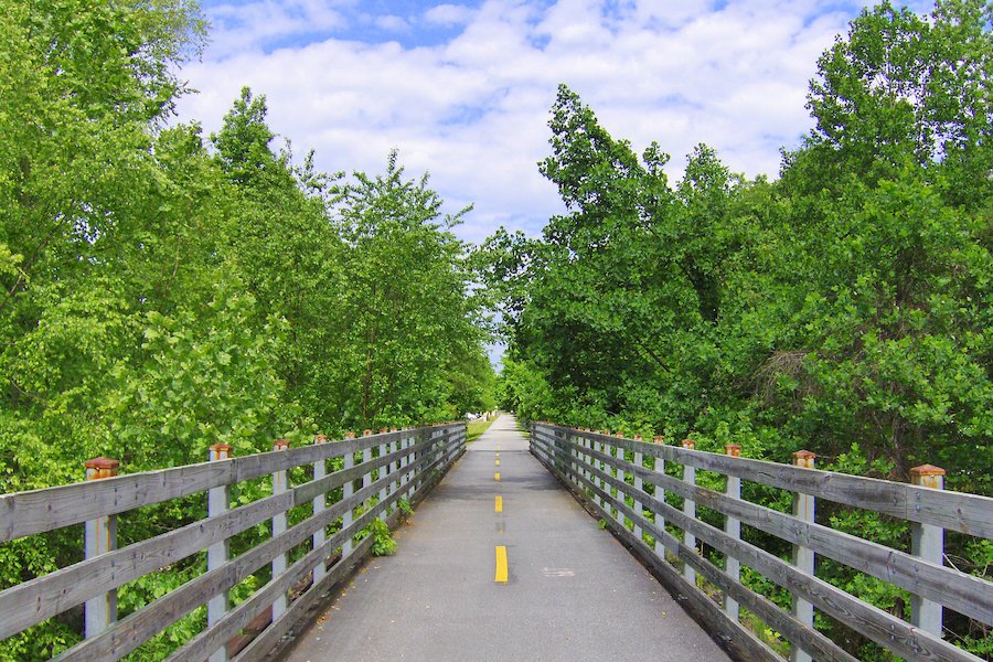
WHAT TO SEE: Traversing almost the entire state of Missouri, the nearly 240-mile Katy Trail State Park is the longest rail-trail in the country and features some of the most striking natural areas of the state, including dense forests, wetlands, prairies and rolling hills.
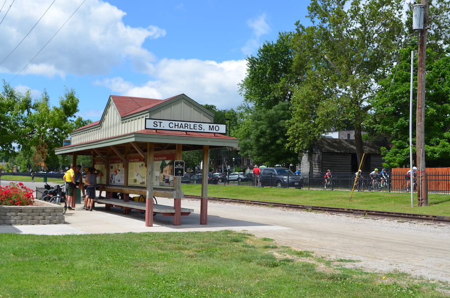
The Katy Trail begins northwest of St. Louis in Machens and heads westward along the majestic Missouri River with limestone bluffs to one side and the river to the other. The crushed-stone pathway passes through the state capital in Jefferson City and, via a spur, connects to Columbia. The trail then leaves the river behind, turning southwest to its endpoint in Clinton.
Along the way, the route weaves through more than 40 towns, many of which had been reliant on the railroad and have seen their economies revitalized since the rail-trail was created. Today, many inns, restaurants and businesses cater to trail users, and for intrepid souls seeking to bike the entire route, it is easy to find lodging and bike shops that will provide shuttle services, making the logistics that much simpler. MO 94, known as Missouri’s wine road for the number of wineries (and breweries) located along it, also runs close to the Katy for almost 100 miles, with many vineyards easily accessible from the trail.
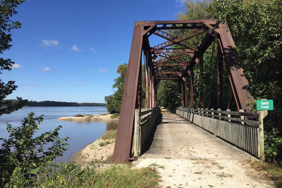
Between St. Charles and Boonville, the Katy has been designated an official segment of the Lewis and Clark National Historic Trail. At trailside markers and in towns along the way, you can learn more about the historical events that shaped this region and see numerous relics from the former railroad.
At Windsor, travelers can connect to the Rock Island Spur of Katy Trail State Park, which stretches nearly 50 miles northwest to Pleasant Hill, a suburb of Kansas City. Eventually, more rail-trail will be developed through the Rock Island corridor, heading east from Windsor to connect with the Katy a second time near Washington. Together, the Katy Trail and the Rock Island Spur will form a continuous rail-trail loop and cover nearly 450 miles between Kansas City and St. Louis.
SURFACE: The Katy Trail is surfaced in hard-packed, crushed stone, so mountain bikes or hybrids will provide the most comfortable ride. Horseback riding can also be enjoyed along the trail’s middle section from Portland to Tebbetts, as well as on the trail’s western end from the state fairgrounds in Sedalia to Calhoun. Before heading out, check current trail conditions on the Missouri State Parks advisory map for the Katy Trail.
WHERE TO STAY: The Missouri State Parks website includes a listing of camping and other lodging options available near each trailhead, as well as links to convention and visitors bureau websites for the communities surrounding the trail to learn more about local businesses and services. The BikeKatyTrail website also provides detailed information for planning a trip along the trail.
RELATED: Pathway to Prosperity article in the Fall 2016 issue of Rails to Trails
MORE LONG-DISTANCE READING
For more great long-distance rides, like the famed Great Allegheny Passage (gaptrail.org), check out our stories on the 3,700-mile Great American Rail-Trail developing across the country: “Four Long-Distance Rides Along the Great American Rail-Trail” and “Great American Rail-Trail: Long-Distance Adventures.”
Rail-Trail Hall of Fame Guidebook
Want to experience one of these bucket-list-worthy trail destinations across the country? You’ll find maps, helpful details and beautiful photos of America’s premier rail-trails in the 2020 edition of our Rail-Trail Hall of Fame Guidebook, available from our online Trail Shop.

Donate
Everyone deserves access to safe ways to walk, bike, and be active outdoors.