Top 10 Trails in New Mexico
The Land of Enchantment, New Mexico offers an arid landscape of mountains, high plains and desert with a beauty all its own. New Mexico is our fifth-largest state by area, and also our driest, with less than a quarter of a percent of its total surface area being water. Rivers and later railroads shaped the region’s growth, and it’s perhaps no surprise that most of our trails here follow one or the other.
Paseo del Bosque Trail
County: Bernalillo
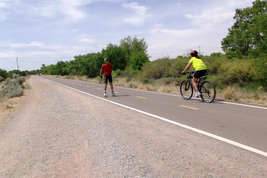
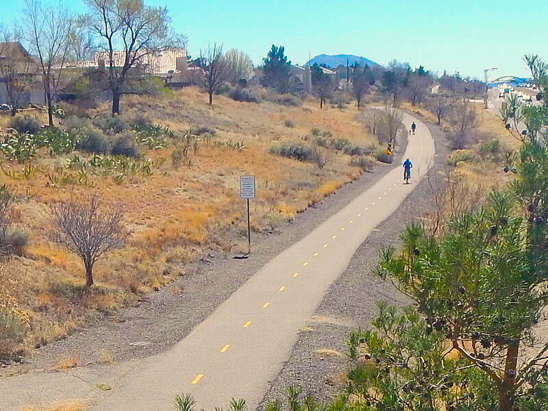
Like the Rio Grande River it follows, the Paseo del Bosque Trail cuts through the heart of Albuquerque. The six-foot-wide ribbon of asphalt is well removed from auto traffic and well beloved by residents, offering easy access to such city favorites as botanical gardens and the zoo. A paralleling dirt track is used by equestrians. Running within the Rio Grande Valley State Park for 16 miles and providing easy access to the Rio Grande Nature Center, the trail almost paradoxically lacks much of one particular thing—views of the Rio Grande itself. Thick scrub and cottonwood trees at the water’s edge usually obscure the mighty river; the translation of the name, after all, is forest walk. A great time to visit is early October when the city hosts its renowned hot air balloon festival, and colorful balloons float aloft in the early morning light.
Santa Fe Rail-Trail
County: Santa Fe
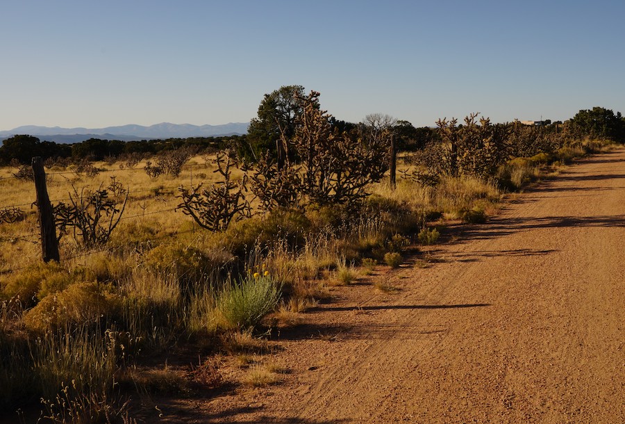
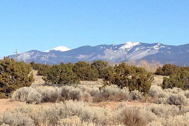
Starting in the center of Santa Fe, the first 4 miles of the Santa Fe Rail-Trail are paved and urban as you make your way southward out of town. (Numerous intersecting trails can make it a challenge to follow, so check the signage and your map frequently.) Shortly after passing under I-25, trail-goers are surrounded by the stark serenity of the American Southwest with an almost shocking suddenness. Amid a seemingly endless expanse of yucca, junipers and piñon trees, the next 13 miles of rolling hills along hard-packed dirt make for a more strenuous trip than the urban section. The entire route is a rail-with-trail, so the tracks of the Santa Fe Southern Railway, an active tourism line, will be a constant companion. There are no refueling options once outside the city, so be sure to carry the water, food and sunscreen you’ll need for a desert ride. Near the southern terminus at US Highway 285, railroad buffs may want to continue on another mile and a half along sparsely traveled roadways to check out the century-old train depot in the town of Lamy.
Canyon Rim Trail
County: Los Alamos
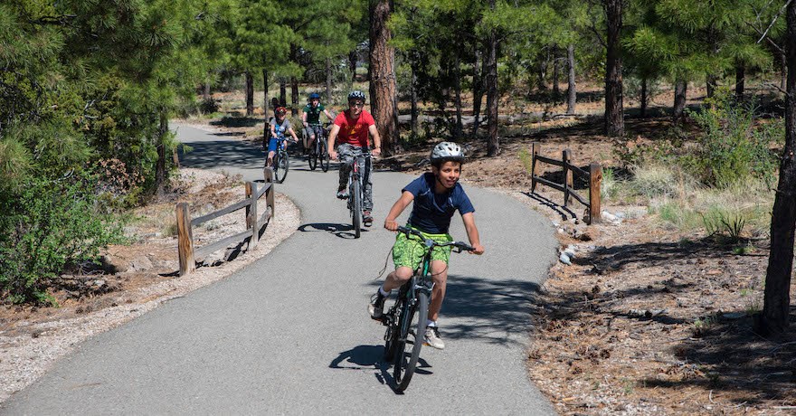
The Canyon Rim Trail is a favorite among Los Alamos residents. Paved and separated from the roadway, the trail offers views of both a canyon below and the Sangre de Cristo Mountain above. While short at only short 2.5 miles, the trail is one of many that crisscross the surrounding country. About a mile from the trail is the Los Alamos Nature Center, a free facility with interactive exhibits, a wildlife observation room, indoor and outdoor play areas, and a full-dome planetarium. While trail-goers are unlikely to encounter big wildlife in the city, the surrounding area is home to black bears, mountain lions, elk and bighorn sheep.
Spring River Recreation Trail
County: Chaves
An urban trail along the north side of Roswell, the Spring River Recreation Trail offers a bit more than 4 paved on-path miles in two discontinuous sections that can be bridged by a short, two-block trip along lightly trafficked roads. Threading its way along a golf course and through local parks, the route includes highlights such as a bird sanctuary and nature center, the Roswell Museum and Art Center, a planetarium within the museum, and the Spring River Zoo at the eastern terminus of the trail. This small zoo has no admission fee, but donations are welcome. It features a children’s train that circles the park and a vintage 1927 carousel with a menagerie of carved animals. While the International UFO Museum and Research Center is a mile removed from the trail, a visit to Roswell would hardly seem complete without a stop there.
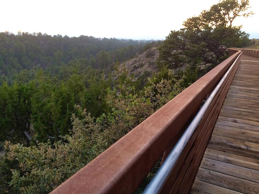
Cloud-Climbing Trestle Trail
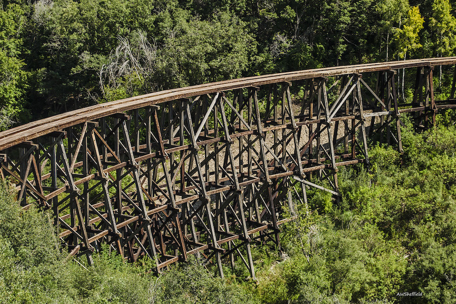
County: Otero
Situated within Lincoln National Forest, the small town of Cloudcroft—a name meaning pasture for the clouds—is a quaint mountain village that thrives on tourism. The Cloud-Climbing Trestle Trail, on the west end of town, begins at a replica railway depot, follows the route of the former Alamogordo and Sacramento Mountain Railroad and ends at an observation area overlooking the surrounding forest and the Mexican Canyon Trestle. This 323-foot curved wooden railroad bridge, built in 1899, rises some 60 feet above the canyon floor and was originally one of 58 such structures built to carry A&SMR trains through the Sacramento Mountains. The mile-long path is paved for the first half and dirt for the remainder.
La Llorona Multi-Use Path
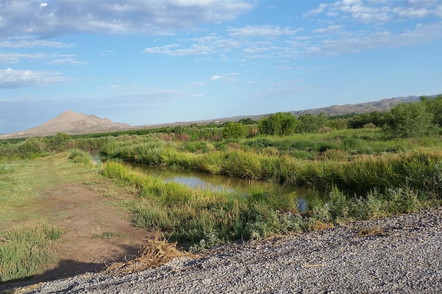
County: Dona Ana
Following the Rio Grande River along the west end of Las Cruces, the La Llorona Multi-Use Path is a smooth, paved 4-miles-plus pathway popular with city residents for its easy access to swimming and tubing fun—when the water is flowing. The Rio Grande is one of the American Southwest’s principal waterways, but its flow is so controlled by many large dams that the river can be effectively turned off. The pathway offers easy access to picnic areas and a playground. The Las Cruces Railroad Museum, accessible via sidewalks and city streets, is located 2.5 miles from the trail in a historic Santa Fe Railroad depot and offers free admission. La Llorona is a designated segment of New Mexico’s visionary Rio Grande Trail, a 500-mile route across the state.
North Diversion Channel Trail
County: Bernalillo
Stretching for about 8.5 miles through central Albuquerque, the paved North Diversion Channel Trail runs between the University of New Mexico to the south and Balloon Fiesta Park to the north. The park is the hub of the famed International Balloon Fiesta, Albuquerque’s single largest tourist draw. The path, following a massive concrete-lined channel designed to safely carry floodwaters from the city, is a great way to access the balloon festival and avoid the stress of crowded streets and scarce parking. Even if your visit doesn’t coincide with the annual festival in early October, the city’s balloon museum is a must-see destination. With numerous opportunities to exit the trail as it makes its way through the city, amenities are rarely more than a few minutes away.
Cinder Road River Trail (Gallinas River Walk)
County: San Miguel
Almost due east of Santa Fe on the other side of the Sangre de Cristo Mountains lies the other Las Vegas. Less well known than Sin City, this town of 30,000 has nonetheless been the shooting location for a surprising number of films and TV shows. Running alongside Gallinas Creek, the upper half of the Cinder Road River Trail parallels its namesake road, while the lower portion was built on the bed of a former railroad spur that ran between Las Vegas and nearby Montezuma. The line carried timber, passengers, and—perhaps unexpectedly—ice. Before the era of artificial refrigeration, Montezuma Pond was a source of natural ice throughout the Southwest. The 2.8-mile trail is paved and runs just a block from the city’s historical center, built in a classic Spanish colonial style that features a central plaza surrounded by buildings that could serve as fortifications in case of attack.
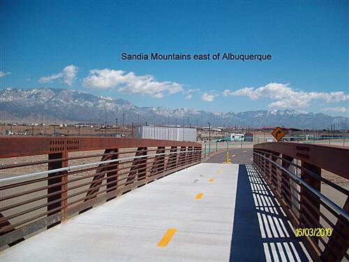
Tramway Recreation Trail
County: Bernalillo
Running nearly ruler-straight along the eastern edge of Albuquerque, the 8.5-mile-long Tramway Recreation Trail might be dull if not for the stunning scenery of the nearby Sandia Mountains. The route runs along Tramway Boulevard, a major thoroughfare; while the trail is well separated from the roadway, all road crossings are at grade, so use caution at intersections. This trail is popular with locals and can get crowded on nice-weather weekends. Many pieces of public art are found along the Tramway, as are numerous opportunities for side trips via hiking and mountain biking trails in the Sandia foothills less than a mile to the east.
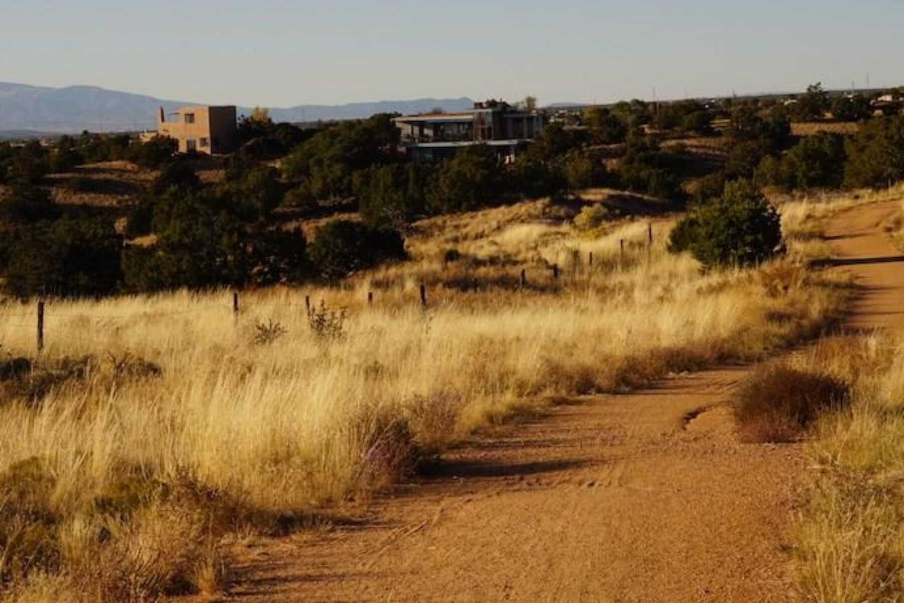
Arroyo de los Chamisos Trail
County: Santa Fe
Connecting to the Santa Fe Rail Trail at Siringo Street, the Arroyo de los Chamisos Trail maintains a more urban feel as it courses less than 4 miles through residential areas—passing parks, playgrounds and a disc golf course before branching into neighborhood trails near the Santa Fe Place Mall. The paved path never strays from its namesake arroyo, and those not familiar with southwestern geography might be puzzled by these rivers of arid dirt. Dry for most of their lives, arroyos become a torrent of rushing water when infrequent rainfall in the nearby mountains is channeled into them and sweeps through town. Less than a mile from the trail and accessible by connecting trails and bike-friendly streets is the famed Meow Wolf, an immersive art installation that has been described by a prominent art critic as big fun art.
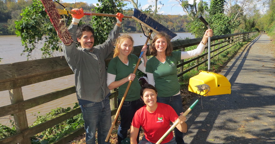
When you subscribe to Rails to Trails magazine, you’ll have access to many other features like this one. Our magazine is a premium of Rails to Trails membership. Join today to start receiving the magazine!

Donate
Everyone deserves access to safe ways to walk, bike, and be active outdoors.
Related
View All
New England Rail-Trail Leader Alex Bernhard Passes Away at 89

Safe by Design: Examining the Impact of Trails and Bike-Ped Infrastructure on Safety in America