South Carolina’s Three Rivers Greenway
Trail of the Month: July 2021
“When these connections are finally made, this will be one of the best trails in the country.”
—David King, co-founder of the Cola Town Bike Collective
While pedaling the completed 19.4 miles of South Carolina’s Three Rivers Greenway, the word “potential” keeps popping up in my mind.
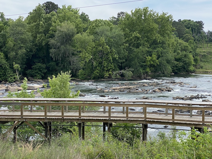
The greenway follows the Broad, Saluda and Congaree Rivers, and everywhere I look, people are swimming, floating and otherwise having a good time. Before the trail was built, people had little to no access to the river. Much of the area had fallen into disrepair, only to be revitalized as asphalt was laid and infrastructure constructed. It’s yet another trail success story.
However, there’s room for improvement: The Three Rivers Greenway is currently open in a handful of unconnected sections. Although the three rivers give a dramatic backdrop to the greenway, they also pose challenges for planners attempting to bridge those trail gaps. With other bike and pedestrian infrastructure lacking in metro Columbia, completing the trail network will greatly improve safety, giving both locals and visitors a more protected way to traverse the area.
“Once connected, the trail would be more than 20 miles,” said David King, co-founder of the Cola Town Bike Collective. “It could even stretch to 50 miles with expansion, and eventually become a true cycling destination.”
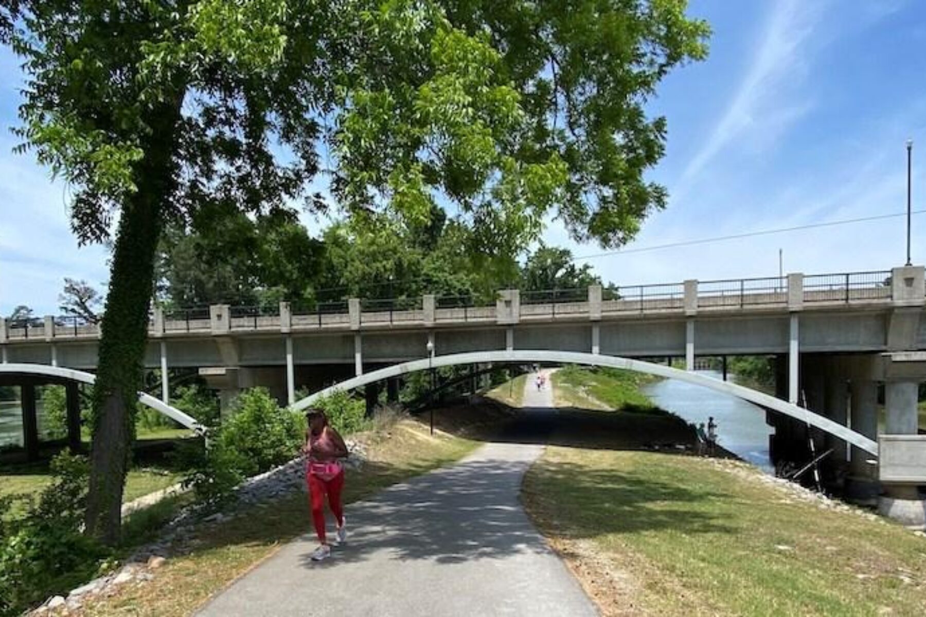
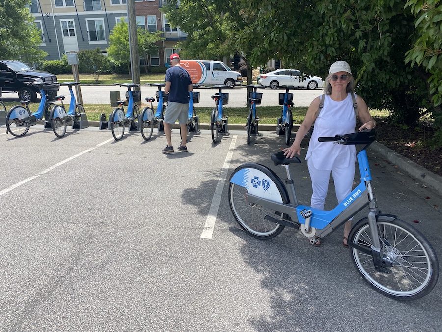
I started the first leg of the trail at Riverfront Park, where a Blue Bike bike-share station, one of 18 stations throughout downtown Columbia, stood right off the trail. Here, a bridge spanned the Congaree River, allowing visitors to cross from the trailhead to the park. The Congaree flanked this 3-mile section of trail on one side, while the Columbia Canal sat opposite.
“We built the trail 10-feet wide on purpose, so that a young kid on a brand-new bike can’t get into too much trouble,” said Mike Dawson CEO of the River Alliance, the nonprofit responsible for building the trail.
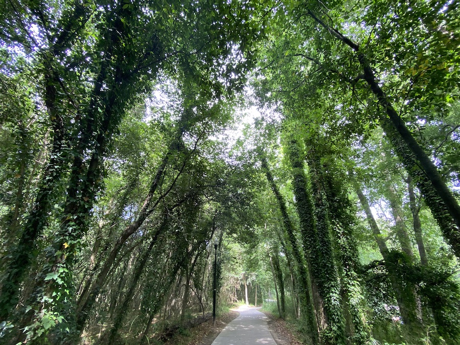
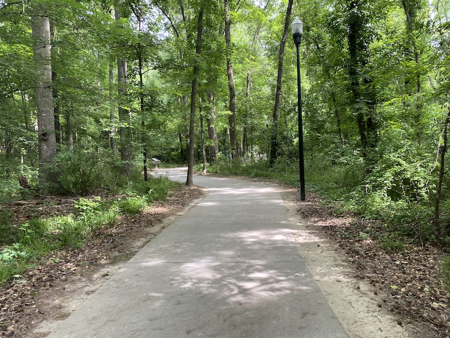
Getting to the Caycee Riverwalk segment of the greenway from Riverfront Park meant crossing the massive Gervais Street Bridge and riding with multiple lanes of fast-paced traffic. But once on the trail, I couldn’t help but smile as the greenway weaved and zig-zagged through the dogwood and oak trees. I thought it was designed to keep riders engaged and entertained, but Dawson gave an even better explanation: They simply wanted to save as many trees as possible. Nearly every tree bigger than 4 inches in diameter was spared the chainsaw, and they just laid out the trail around them.
History at Your Feet
The seeds for a riverfront path were originally planted more than a century ago, Dawson said, but didn’t truly begin in earnest until 1994. The River Alliance was formed around that time as part of an intergovernmental agreement between the cities of Columbia, West Columbia and Cayce, as well as their counties. At the time, there wasn’t much, if any, public access to the rivers, save for fishing from the shore.
The River Alliance board—typically a mix of politicians, business owners and everyday citizens—visited Nashville, Tennessee, to see what they had done with their riverfront areas. Soon after, a plan was developed revolving around greenways and parks. In 1998, the first section of trail was built. In the ensuing years, more asphalt would be laid and a 500-seat amphitheater built near the water.
As I followed the route, many of the business buildings around the trail seemed relatively new, and Dawson confirmed that bars, restaurants, condominiums and more have sprung up throughout the nearby neighborhoods. A former prison near the canal was converted into residential housing. Mill Village, once a mostly self-sufficient community for textile workers, had fallen into disrepair over the next century, only to be revitalized when people began moving to be closer to the trails.
Each mile of trail seemingly has some link to history, from the movements of the dozens of Native American tribes that once were prevalent in the region, to Revolutionary and Civil War skirmishes. Near Congaree Creek, the 600-acre 12,000 Year History Park—with the apropos slogan “History at your feet”—has a greenway segment that winds its way past multiple historical markers and museums, and volunteer guides offer historical walking tours on Saturdays throughout the year.
Spectacular Saluda
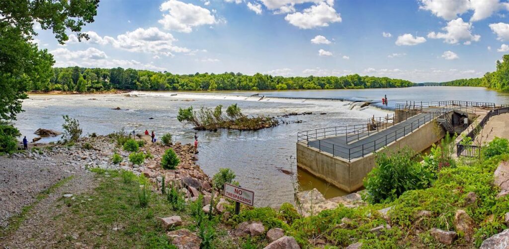
The newest section of the greenway runs directly behind the River Alliance headquarters along the Saluda River. A boardwalk runs parallel to the river for the first quarter-mile and serves as a jumping off point for people looking to enjoy the water. King says he often launches here when he goes bike-rafting, lashing his bicycle to a pack-raft and floating down the river until he wants to stop, deflate his raft and then pedal back to the starting point.
On my visit, I spied hundreds of people—fisherman lined the riverbanks or stood in shallow pools, while a seemingly endless stream of 20-somethings floated downstream on inner tubes. The views of the Saluda were absolutely stunning; water rippled against smooth, tan rocks, while several pairs of turtles sunned themselves on branches sticking out from the water. I couldn’t believe all of this was in the middle of a metropolitan city.
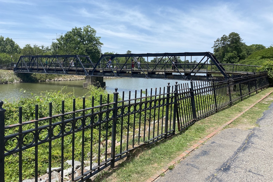
The boardwalk soon gives way to a paved trail that runs for an additional couple of miles. The trail passes by and underneath the city’s Riverbanks Zoo and Garden, and I swear I could hear the roar of a lion or tiger as I strolled past. The paved Saluda segment currently ends less than a quarter mile from Boyd Island Sanctuary, but that small gap may be potentially paved by fall, allowing trail goers to reach a new pedestrian bridge that crosses the river to the small island.
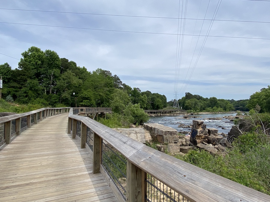
There are also plans to connect the existing Three Rivers Greenway with the newly opened Saluda Riverwalk segment just across the Broad River, but no one knows exactly when that might happen. Speaking to Dawson beforehand, he laid out several large maps on the ground and pointed out specific areas on each where new trails and connections were planned. When pressed for a timeline, Dawson chuckled.
“It’s too hard to predict with so many moving targets,” Dawson said. “[After we get the approvals and plans], building stuff is the easy part.”
After the four current sections are joined, Dawson hopes the greenway could eventually extend another 7 miles connecting Columbia to Lake Murray and its trail network. Potentially the trails could even extend nearly 30 miles to the south, connecting Columbia with Congaree National Park.
Even without the national park connection, the Three Rivers Greenway could—and should—become a huge national attraction in its own right. Local officials estimate that 350-400 people every hour use one of the open sections of the popular trail during weekends.
“We’re so close,” King said. “When these connections are finally made, this will be one of the best trails in the country.”
Related Links
Trail Facts
Name: Three Rivers Greenway
Trail website: The River Alliance
Length: 19.4 miles
Counties: Richland
Start point/end point: There are several disconnected segments of open trail, including sections through Riverfront Park and Granby Park, as well as the West Columbia Riverwalk, Cayce Riverwalk and new Saluda Riverwalk. The River Alliance provides a detailed map of the Three Rivers Greenway’s sections.
Surface type: Asphalt
Grade: The trail offers an easy, paved and relatively flat experience.
Uses: Walking, biking, inline skating and fishing; wheelchair accessible
Getting there: Visitors can fly into Columbia Metropolitan Airport (3250 Airport Blvd., West Columbia), located less than 10 miles from the Three Rivers Greenway.
Access and parking: Parking can be found in the parks that the greenway traverses, including at Riverfront Park’s north entrance (4122 River Dr.) and south entrance (312 Laurel St.); Granby Park (100 Catawba St.); H. Kelly Jones Park (2616 Riverland Dr.); and the 12,000 Year History Park. Additionally, parking is available at the West Columbia Riverwalk’s Moffatt Street entrance (100 Riverside Dr.) and amphitheater (109 Alexander Road).
To navigate the area with an interactive GIS map, and to see more photos, user reviews and ratings, plus loads of other trip-planning information, visit TrailLink.com, RTC’s free trail-finder website.
Rentals: Blue Bike bike-share stations, providing single-trip and daily rentals, are located throughout downtown Columbia, including in Riverfront Park (312 Laurel St.), which the trail traverses.

Donate
Everyone deserves access to safe ways to walk, bike, and be active outdoors.