Top 10 Trails in Georgia
With 200+ miles of open rail-trail—and more in the works—Georgia is the South’s preeminent trail state. Burgeoning trail networks, like the Atlanta BeltLine and Columbus’ Dragonfly Trails, in its major cities, as well as segments of the national East Coast Greenway, are a testament to the growing status of the Peach State in the trail movement. Not to be outdone by their big-city cousins, several rural rail-trail projects are also actively being pursued, including the 39-mile Firefly Trail and 21-mile Man O’ War Railroad Recreation Trail. From urban settings bursting with cultural attractions to tranquil rides through bucolic countryside, here’s a look at some of Georgia’s best trail experiences.
Silver Comet Trail
Counties: Cobb, Paulding, Polk
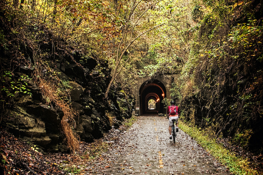
Seamlessly connected and spanning 94 miles across two states, Georgia’s Silver Comet Trail and Alabama’s Chief Ladiga Trail together offer one of the longest paved rail-trail routes in the country. From Smyrna, on the outskirts of Atlanta, west to Esom Hill, on the state border, the Silver Comet Trail offers many nods to its past life as a railroad corridor. From its vantage point of 100 feet above the water, the Pumpkinvine Creek Trestle offers quite a view, and the 700-foot-long Brushy Mountain Tunnel is another impressive sight along the route.
Atlanta BeltLine
County: Fulton
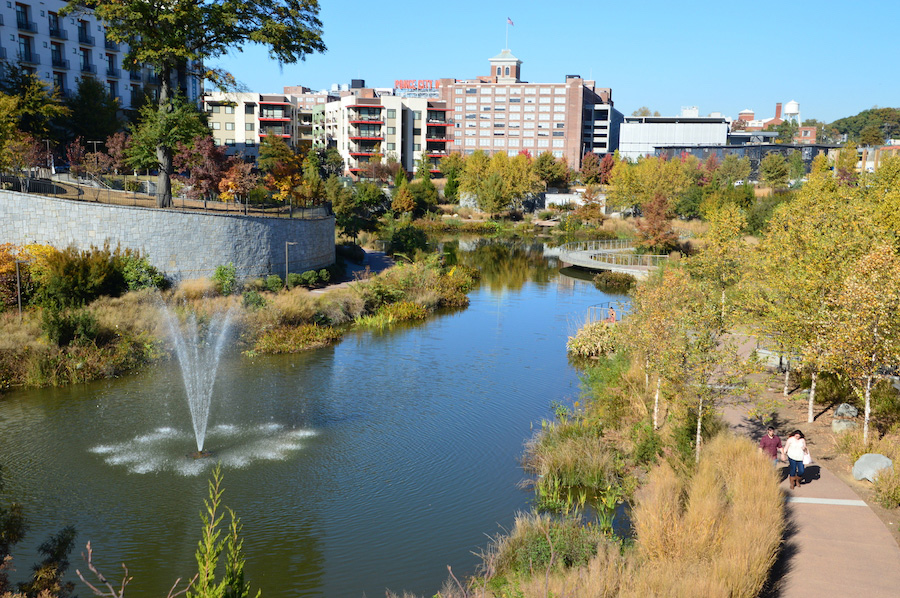
When complete, the Atlanta BeltLine will form a 22-mile loop around the city, with another 11 miles of spur trail that tie into the surrounding neighborhoods. Linking public parks, mass transit stations, schools and businesses, the developing rail-trail is already proving its worth. In 2021, a property tax increase was approved to spur its completion by 2030, and a connection to the Silver Comet Trail is planned.
Favorite spots along the route include Piedmont Park, the crown jewel of Atlanta’s park system, and Historic Fourth Ward Park, centered around a two-acre lake.
Augusta Canal Trail
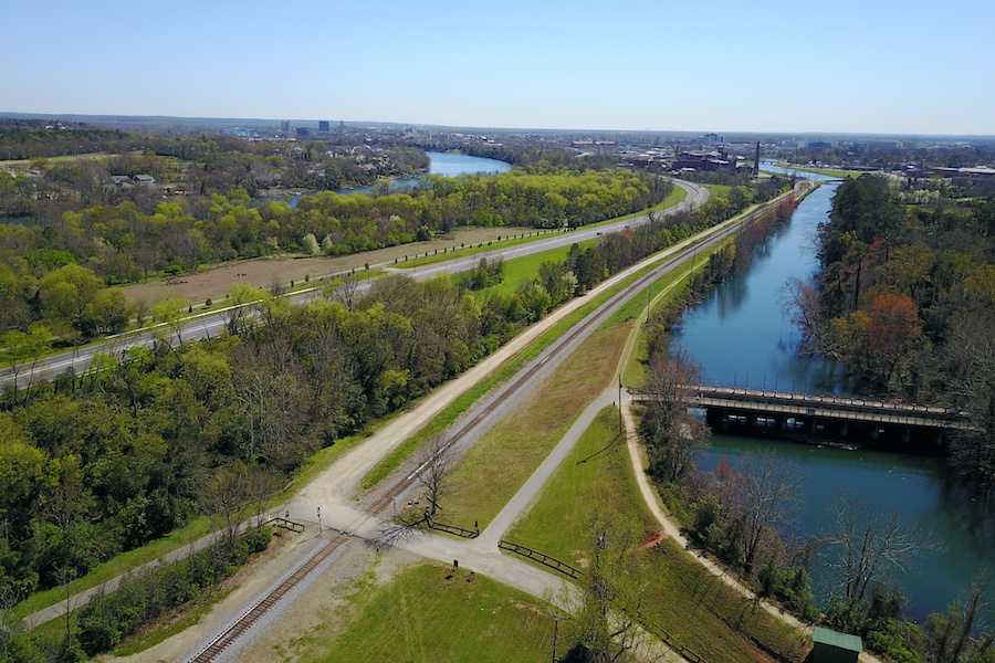
County: Richmond
Eastern Georgia’s Augusta Canal Trail follows an old towpath that is enveloped in history, paralleling the oldest continuously operating hydropower canal in the United States. Nestled into the state’s first National Heritage Area, wanderers will find textile mills dating back to the late 1800s, the house of George Walton (a signer of the Declaration of Independence) and a towering brick chimney once used in the manufacture of gunpowder during the Civil War.
Tucked between the canal and the Savannah River, the nearly 8-mile, natural-surface pathway sits in a green oasis, where the recreational opportunities seem almost boundless. Guided boat tours are a great way to learn about the 19th-century canal, and the waterway also offers fishing opportunities and an easy, family-friendly paddle with canoes and kayaks.
TRAIL OF THE MONTH: Georgia’s Augusta Canal Trail (August 2018)
Carrollton GreenBelt
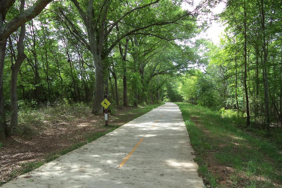
County: Carroll
The Carrollton GreenBelt loops around its eponymous city, providing access to neighborhoods, shopping areas, several schools (including the University of West Georgia) and a handful of popular parks. Across its 17 miles, travelers can enjoy open pastures, stands of tall trees, and picturesque lakes and rivers. Its construction began a decade ago, and its reach is still expanding, with neighborhood connections tying into the loop; just this year, a new milelong spur to downtown was opened.
Arabia Mountain PATH
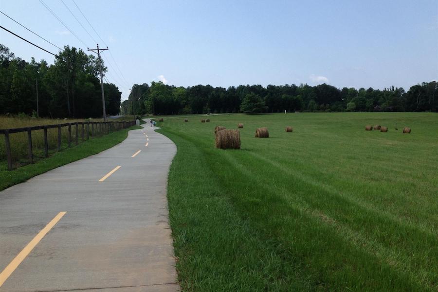
Counties: DeKalb, Rockdale
Southeast of Atlanta, the Arabia Mountain PATH is a regional trail system following a sinuous 30-mile course through lush river valleys with views of granite outcroppings, wildlife-rich wetlands and woodland waterfalls. Highlights of the route include Panola Mountain State Park and the Arabia Mountain National Heritage Area, offering pristine natural greenspace and intriguing historical sites. Along the way, the area’s agricultural heritage can be explored with visits to the Alexander Barn and Lyon Farm, one of the oldest homesteads in DeKalb County.
Columbus Fall Line Trace
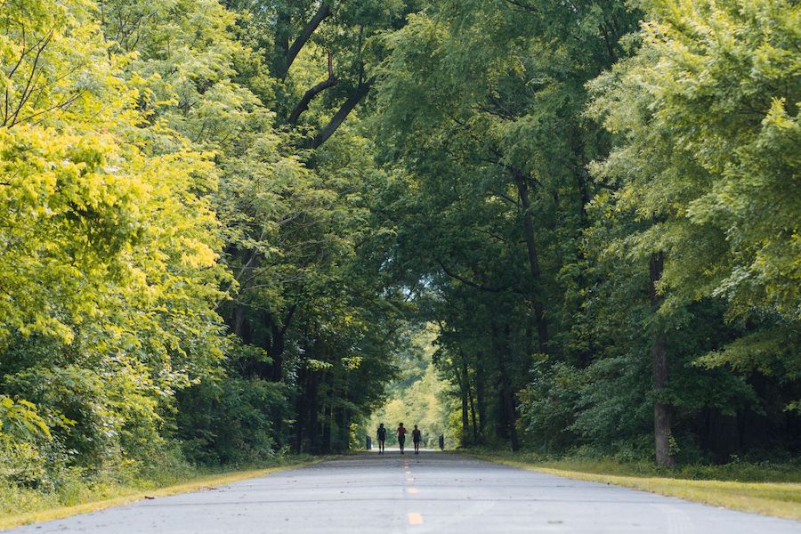
County: Muscogee
Beginning in central Columbus, the Columbus Fall Line Trace guides city residents out to natural areas, taking an 11-mile northeast course to—and just beyond—Flat Rock Park, a great spot for a recreational outing with a lake and waterfall in a wooded setting.
At its western end, the trail joins the Chattahoochee Riverwalk, just north of Woodruff Riverfront Park, for another 15 miles of riding along the city’s waterfront. Both trails are part of the city’s developing Dragonfly Trails network, which will span more than 60 miles when complete.
Jekyll Island Trail
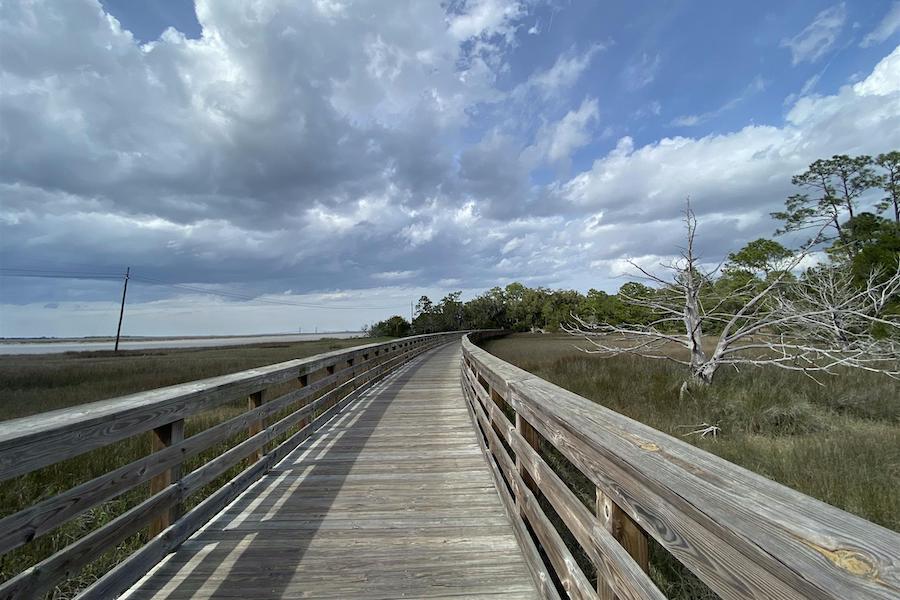
County: Glynn
On Georgia’s southeast coast, the Jekyll Island Trail offers a combination of loops and connecting trails that make up a 24-mile route traversing the 5,700-acre barrier island. The trail falls within the island’s state park, and recreational amenities abound. Travelers can use the trail system to explore beaches, coastal forests and a wildlife-viewing tower, as well as reach picnic areas, shops and the Historic Landmark District. Soon, the trail will be accessible to even more bike tourists as a connection to the state’s East Coast Greenway route is slated to begin in 2025.
Big Creek Greenway
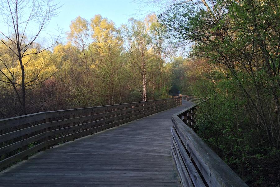
Counties: Forsyth, Fulton
Spanning nearly 20 miles through the northern suburbs of Atlanta, the Big Creek Greenway offers a natural oasis for residents. Winding through a handful of parks and with some sections heavily forested, travelers might see wild turkeys, blue herons or deer along its scenic route.
Although the popular pathway currently has a short gap in its middle through Alpharetta, plans are in the works to stitch the trail’s two halves together, as well as to create a connection to Alpharetta’s Alpha Loop, another trail project that’s just getting off the ground. The Big Creek Greenway was also extended northward in June 2021 to reach the Sawnee Mountain Preserve, a beautiful hiking area with views of the Blue Ridge Mountains.
Tom White Linear Park
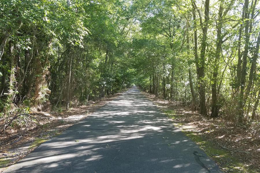
County: Colquitt
Beginning in the heart of Moultrie, the Tom White Linear Park quickly whisks travelers away from the city center, heading 7 miles south beside quiet roads in rural South Georgia. The former rail corridor still serves important transportation needs today, connecting residents to businesses, a stadium, an art center, a recreation complex and the municipal airport. Completed in 2002, the paved pathway is as pretty as it is practical, with tall trees lining the route. It’s named after the late Tom White, a beloved local high school football coach.
Bill and Dustie MacKay Trail
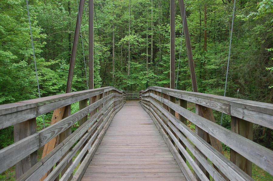
County: Rabun
The Bill and Dustie MacKay Trail packs an unexpected amount of charm into its 1.7 miles. Nestled in Tallulah Gorge State Park, the paved path meanders through an Appalachian forest and crosses a small suspension bridge over the Tallulah River. The route follows the easy grade of the late 19th-century Tallulah Falls Railway, which once shuttled tourists to the park’s spectacular gorge and waterfalls.
Round out your adventures by kayaking down the river or hiking one of the park’s more challenging trails that scale the nearly 1,000-foot granite walls of Tallulah Gorge. And be sure to stop in the Jane Hurt Yarn Interpretive Center to pick up a trail map and view the historical exhibits.
RELATED: Five Rail-Trails for Marveling at National Monuments
Honorable Mentions
Although the McQueen’s Island Trail is currently closed for repair and improvements, it’s slated to reopen by late August 2021, so we wanted to be sure it was on our list! If you’re planning an excursion on the trail, check its status on the Chatham County Parks and Recreation website before you head out.
Built on a stretch of the Savannah & Atlantic Railroad line, the 6-mile rail-trail offers a salt-air excursion for nature lovers and history buffs alike. From its trailhead on the eastern outskirts of Savannah, the gravel pathway parallels the South Channel of the Savannah River, a major shipping route and entry point to the Port of Savannah. Short bridges spirit you across saltwater marshes, and coastal cedars and other native vegetation line this picturesque trail. And don’t miss a visit to Fort Pulaski National Monument, a colonial fort used by the Union Army during the Civil War.
When you subscribe to Rails to Trails magazine, you’ll have access to many other features like this one. Our magazine is a premium of Rails to Trails membership. Join today to start receiving the magazine!


Donate
Everyone deserves access to safe ways to walk, bike, and be active outdoors.

