Southern New Mexico’s Cloud-Climbing Trestle Trail Preserves Unique Piece of Railroad History
The whimsical name alone is enough to make New Mexico’s Cloud-Climbing Trestle Trail virtually irresistible. Add in the region’s splendid mountain scenery and fascinating history, and the 122-year-old railroad trestle in southern New Mexico is a road-trip-worthy destination.
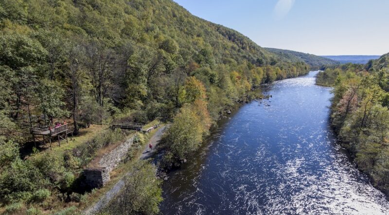
Located in a somewhat remote region high in the Sacramento Mountains in the Lincoln National Forest, the Cloud-Climbing Trestle Trail is one of a network of trails rooted in the history of the Alamogordo and Sacramento Mountain Railway (A&SM), also known as the Cloud-Climbing Railroad. The trail is specifically part of an 8-mile loop that includes another rail-trail, the Switchback Trail.
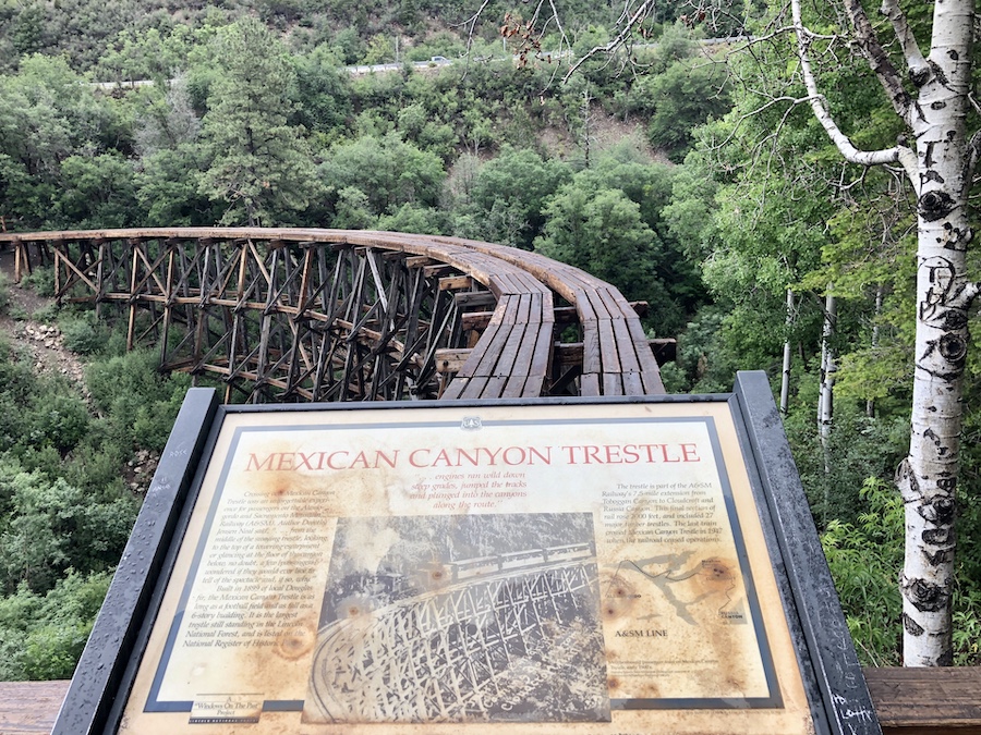
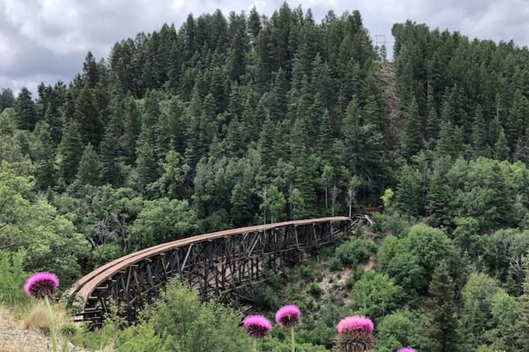
The star of the system is the historic Mexican Canyon Trestle (also known as the Cloud-Climbing Trestle), which lies at the base of the steep Mexican Canyon.
The trestle was built in 1899 as a part of the A&SM’s efforts to access timber in the forest, and after that, the line was used for nearly half a century to transport tourists to Cloudcroft, the picturesque little village located nearby. At 8,675-feet in elevation, Cloudcroft is among the highest-elevation communities in the United States—hence, the numerous references to the clouds.
The trestle was regularly used and maintained by the railroad until about 1947, when the line was abandoned. By the 1980s, a dip had formed in the center of the trestle, and Lincoln National Forest personnel had become concerned about its condition.
Through a coalition of interested parties, including the U.S. Forest Service, New Mexico Rails-to-Trail Association and the Village of Cloudcroft, engineering studies got underway in 1989, and construction took place in 2009 and 2010. A sign at the overlook commemorates the effort, telling the story of “restoring a local treasure.”
Today, the trestle serves as the terminus of a fun rail-trail that dips steeply into the canyon, winding through pine and fir trees, and following ridgelines that offer immense views of the forestland spread below.
At about 1.3 miles one way, the route to the base of the trestle is short, but it includes enough steep stretches, switchbacks and high step-ups to be rated as a moderate hike. The first half-mile of the trail is paved, and the remainder has a dirt surface. A sign at the trailhead cautions that the hike takes at least an hour and a half and that the gate to the trailhead closes at 6 p.m.
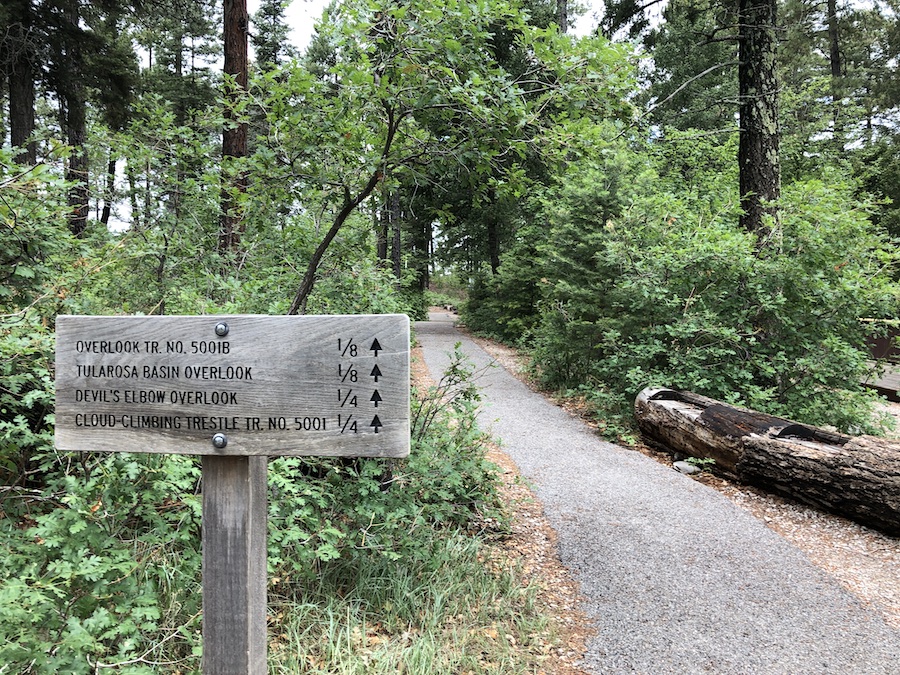
After following the signs for the Cloud-Climbing Trestle Trail (T5001), hikers will come to a small viewing platform that overlooks the base of the trestle. Said to be nearly the length of a football field (323 feet long) and the height of a six-story building, the curved expanse of the trestle is a sight to see.
Just across the canyon, the viewing platform alongside Highway 82 is visible from the base of the trestle. A stop at the overlook before doing the hike offers a great perspective on the width of the trestle and the depth of the canyon.
Hikers should remember that venturing out onto the trestle is not allowed, and signs at the site warn that climbing or being on the trestle is prohibited.
Even though the trestle trail is worthy of a visit on its own, it is far from the only cool attraction in the area. There is also the historic Village of Cloudcroft, a New Mexico sky island that has long attracted visitors looking to beat the heat of the surrounding desert.
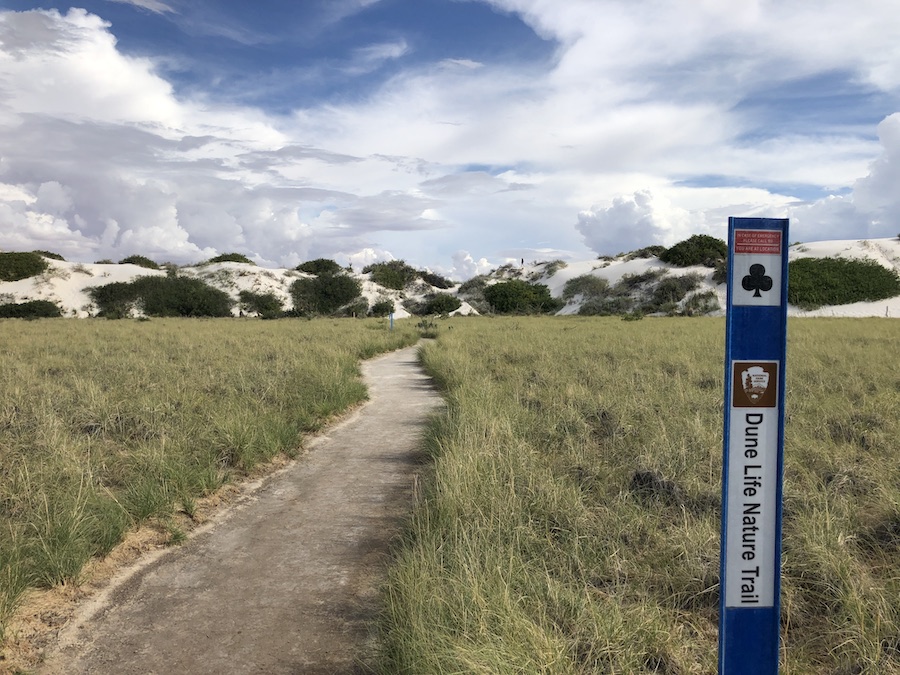
And a 45-minute drive to the southeast is the stunning White Sands National Park, where snowy-white dunes glisten in the sunlight. Owing to the mountainous terrain, the drive along Highway 82 to the nearest city of Alamogordo is steep and twisting.

Donate
Everyone deserves access to safe ways to walk, bike, and be active outdoors.