Top 10 Trails in Kentucky
From the rolling green pastures of Kentucky horse country to mountain hollows and the banks of peaceful waterways, Kentucky’s rail-trails offer an incredible diversity of experiences. Long-distance riders and runners find a myriad of excellent connections, and there are nearly limitless options for a family ride or casual stroll. Many of the former railroads used in these projects hauled lumber or coal from the mountains, and traveling these routes is like a step back in time for history lovers.
While it’s impossible to pick a favorite among the multitude of trails, this “Top 10” list offers an indication of why Kentucky deserves recognition for world-class recreation.
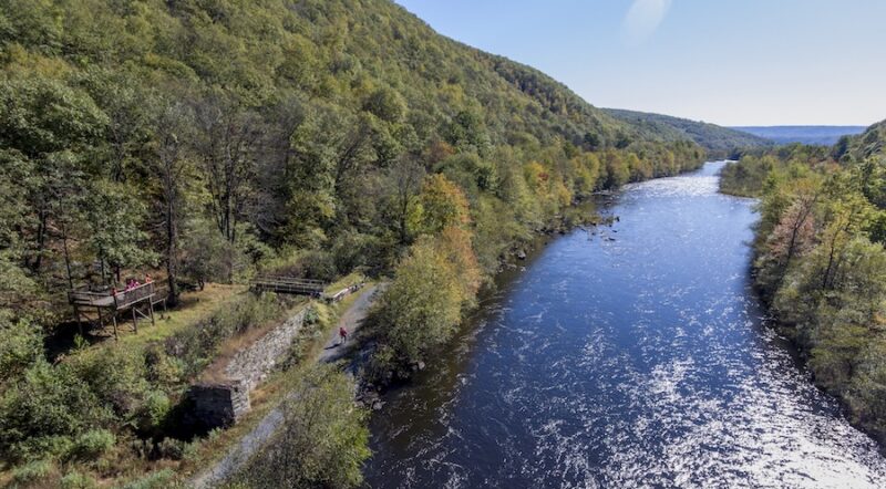
Mammoth Cave Railroad Bike & Hike Trail
Counties: Barren, Edmonson
Reaching 390 feet into the earth, the Mammoth Cave is the longest cave in the world, but for those who prefer to remain above ground, the 9-mile forested path along the Mammoth Cave Railroad Bike & Hike Trail provides a glimpse into what tourists experienced along this former route of Mammoth Cave Railroad between 1886 to 1931. The loose gravel surface is best suited for hiking or mountain biking. The trail is mostly flat, but there is a well-marked steeper section to note. Main access points include the Mammoth Cave Visitor Center and the historic Bell’s Station in Park City.
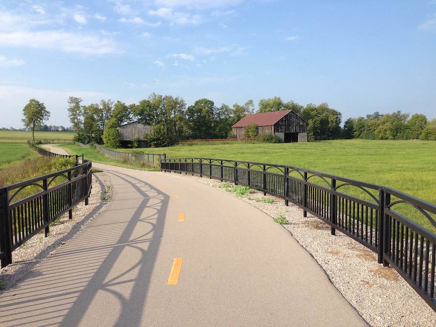
Louisville Loop
County: Jefferson
With the long-term goal of over 100-miles of paved trails connecting parks and neighborhoods, recreationists celebrate the completion of the first section of the Louisville Loop, along the Ohio River Levee Trail and Riverwalk, which runs 25-miles, with some road routes, from downtown near the Big Four Bridge to Farnsley-Moremen Landing. Another 20-mile section of the Loop is through Parklands at Floyds Fork to Broad Run Park. This nearly 4,000-acre park offers over 60 miles total, including off-pavement trails, that wind through forests, wetlands, historically significant areas and overlooks to soak in the stunning scenery.
Dawkins Line Rail Trail
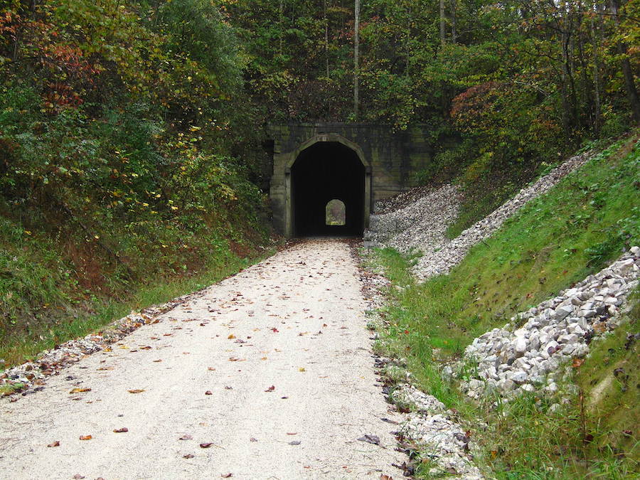
Counties: Johnson, Magoffin
The entire 36 miles of the compacted, crushed-gravel Dawkins Line Rail Trail is complete, although hikers, cyclists and horseback riders can only travel as far as the 1,556-foot Tip Top Tunnel from either end. Starting at KY 825 south of Paintsville, the longest option is 25 miles long, which crosses 24 trestles and travels through the 662-foot Gun Creek Tunnel. There are three other trailheads along this route to shorten the distance. From the Evanston side, it’s 11 miles to the Tip Top Tunnel, which is slated for completion in the near future, making this former timber- and coal-hauling corridor the longest rail-trail project in Kentucky.
Prestonsburg Passage

County: Floyd
With a strong connection to coal mining, it made sense for Prestonsburg to utilize the former route of the coal-hauling CSX Railroad and Abandoned Mine Lands funds to create the 8.6-mile-long paved Prestonsburg Passage Rail-Trail terminating at the former coal camp of David, Kentucky. Crossing six bridges, including the one-of-a-kind school bus bridge, this wheelchair-accessible trail allows hikers, bicyclists and inline skaters a chance to explore the beautiful mountain scenery while keeping an eye open for wildlife in the area, including elk. There is also plenty to see for history buffs, including the Middle Creek National Battlefield.
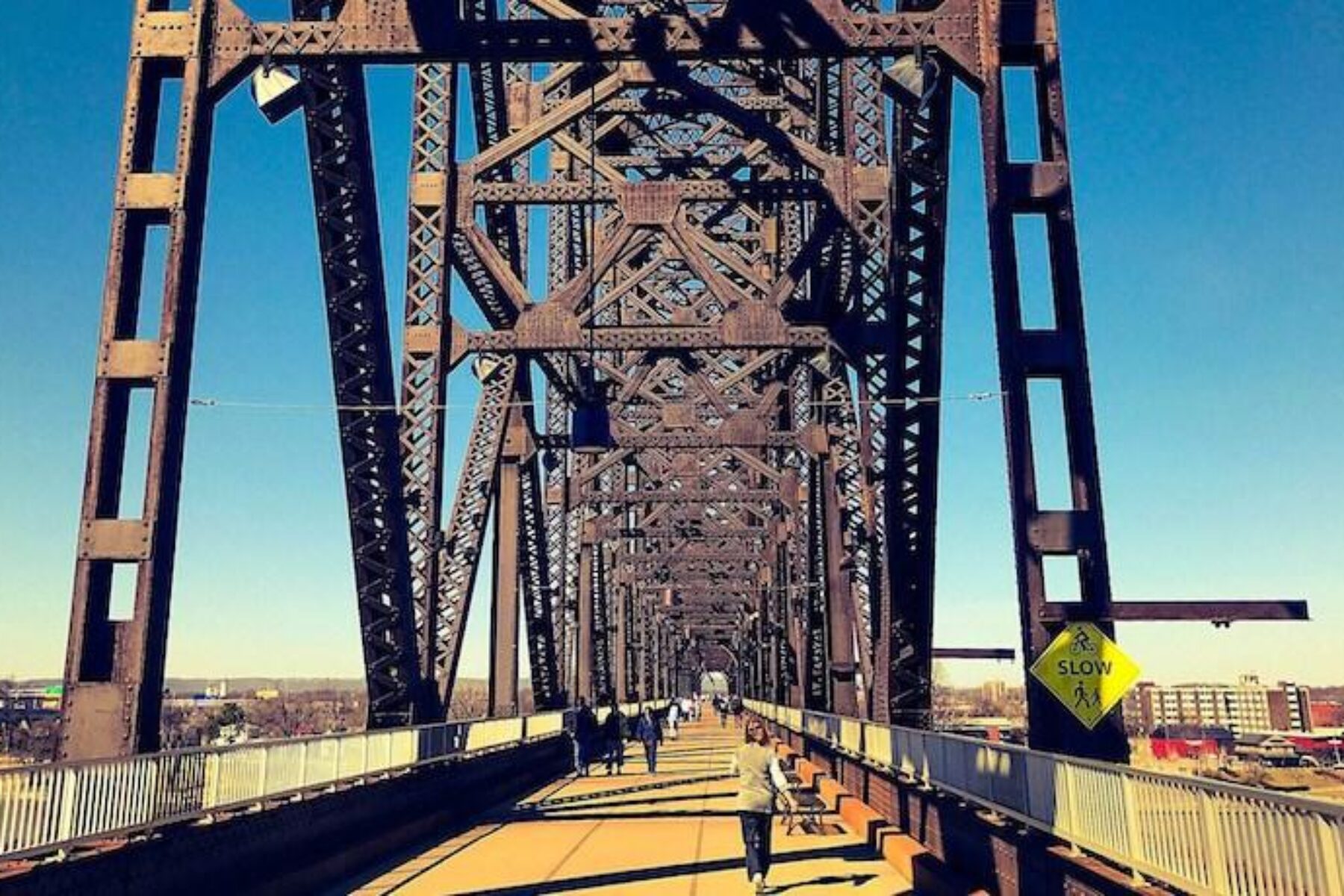
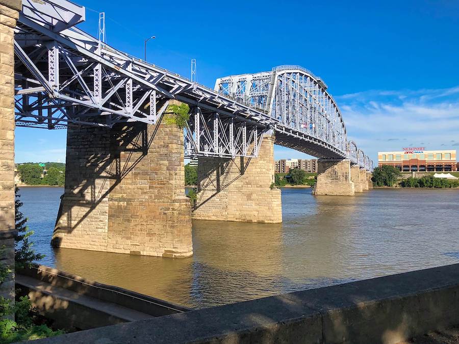
Big Four Bridge

Counties: Clark, Jefferson
Built in 1895 for the Pennsylvania Central Railroad, after being abandoned in 1969, the “bridge to nowhere,” sat idle for 40 years before Louisville refurbished and opened the Big Four Bridge to an enthusiastic crowd in 2013. Now it is truly the “peoples’ bridge” where visitors and locals gather to enjoy the views of the Ohio River and surrounding areas in its half-mile span. Connecting Jefferson, Indiana, to Louisville, the trail meets the Louisville Loop near its beginning. On the Indiana side, options include taking a scenic byway to the Falls of the Ohio State Park, as well as to the Ohio River Greenway and the Clarksville Discovery Trail.
Newport Southbank Bridge (Purple People Bridge)
Counties: Campbell, Hamilton
As the first railroad bridge to span the Ohio River, the Newport Southbank Bridge boasts a colorful life-story. Built in 1872 by the Little Miami Railroad, after carrying trains, streetcars and eventually vehicles, it was redesigned and painted an eye-catching purple in 2001, transforming this aged bridge into a hot spot for bicyclists, walkers, runners and inline skaters. Roughly a half-mile long, the “Purple People Bridge” is the place for entertainment on both sides of the river. A favorite for daily jaunts, the bridge is also large enough to hold festivals, and is considered the best seat in the house for river events.
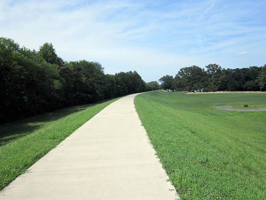
Legacy Trail
County: Fayette
Stretching from downtown Lexington north to Kentucky Horse Park, 8 of the 12 miles of the Legacy Trail follows a dedicated pedestrian/bicycling route accessing the rolling hills of Kentucky’s bucolic landscape. Walkers, bicyclists and inline skaters enjoy art installations, as well as interpretive signs sharing local history, as they travel through beautiful, open horse country. There are several bike repair stations along the way, and water is available near the Coldstream parking area and the Kentucky Horse Park, a 1,200-acre working farm and museum. For those traveling south, continue along the Hope Center Trail and Coolavin Rail Trail for additional mileage.
Paducah Greenway
County: McCracken
Extending over 5 miles with the addition of a section through Schultz Park along the waterfront in 2020, there is a lot to see along the Paducah Greenway, also called the Clyde F. Boyles Greenway Trail. “The Greenway,” as it’s called by locals, links neighborhoods to three city parks, the riverfront, the Perkins Creek Nature Preserve and the McCracken County trail system over its path of crushed stone, dirt and concrete. To explore an extra 1.5 miles along the McCracken County trails, take the Bob Leeper pedestrian bridge following the former railroad corridor of the Chicago, St. Louis and New Orleans Railroad Company.
Lewis and Clark Bridge

Counties: Clark, Jefferson
Captains Meriwether Lewis and William Clark met in Louisville on Oct. 14, 1803, forming one of the most famous partnerships in our nation’s history, and recruiting “nine young men from Kentucky” for the historic Lewis and Clark Expedition. The 2.5-mile asphalt Lewis and Clark Bridge Trail connects Indiana and Kentucky across the Ohio River, paralleling I-265 from Prospect, Kentucky, to Jefferson, Indiana. Pets are welcome as long as they’re leashed, and the trail is popular with walkers, runners, bicyclists and inline skaters. There is an overlook with benches near the bridge for excellent views of the water.
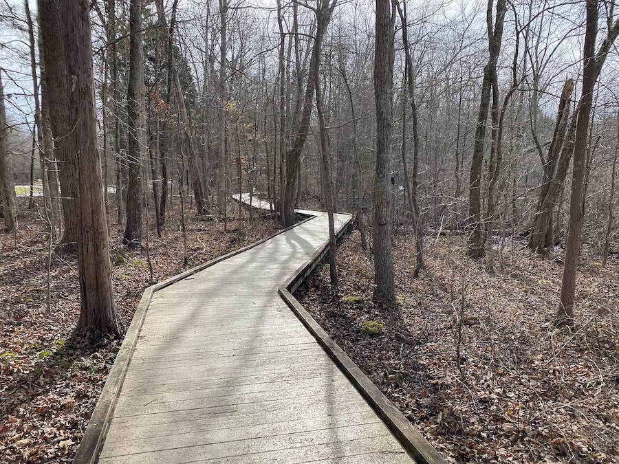
Muhlenberg County Rail-Trail
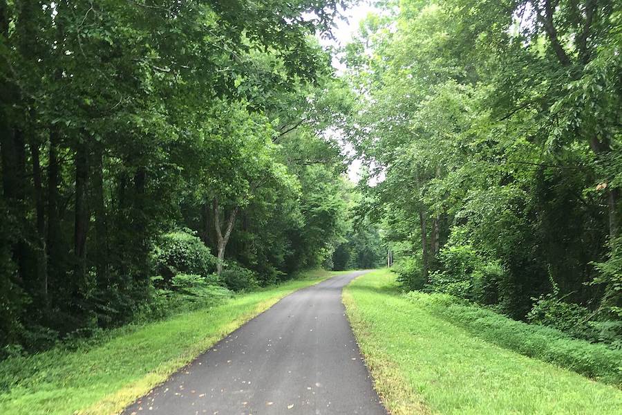
County: Muhlenberg
Trestles, signal towers and an antique caboose serving as a railroad museum at the Central City trailhead are fitting reminders of the Illinois Central Railroad, established in the late 1800s along the corridor that now hosts the 6-mile Muhlenberg County Rail Trail. Keep an eye out for wildlife and birds as the path travels through forests and wetlands before cruising into more open areas. Wildflowers abound in the spring, and the trees are awash in golds and yellows during the cooler autumn days. While the asphalt trail is suitable for wheelchairs, and most of the trail is flat, there is a hilly section near Powderly.
Special acknowledgments: Bill Meyer; Joyce McMullin, Newport Southbank Bridge Company; Mayor Les Stapleton, Prestonsburg; Thomas Clements, Town Branch Trail and Legacy Trail; Ashley Smith, Louisville Waterfront for Big Four Bridge; Bekki Livingston, Louisville Bicycle Club.
Honorable Mention
Town Branch Trail
With construction well underway, the nearly 5-mile long Town Branch Trail in Lexington is on track for completion within the next two years. The intention is to create a safe, pedestrian and bicycle friendly pathway connecting the amenities of downtown area to the largest residential neighborhood, and ultimately the Legacy Trail.
When you subscribe to Rails to Trails magazine, you’ll have access to many other features like this one. Our magazine is a premium of Rails-to-Trails Membership. Join today to start receiving the magazine!

Donate
Everyone deserves access to safe ways to walk, bike, and be active outdoors.