Top 10 Trails in Nebraska

Let me preface my intro by saying that the first story I wrote for Rails-to-Trails Conservancy (RTC) was about the Chief Standing Bear Trail, which begins in Beatrice, Nebraska, about 40 miles south of my home in Lincoln.
Nebraska is a key connector for the Great American Rail-Trail™, with over half of the 591 miles of the preferred route in the state already developed. Those trails include one of the longest in the country—as well as a collection of rail-trails that let users experience the cities, towns, farmland, prairies and everything else that makes the Great Plains unique. Including the wind. As one cyclist put it to me a few years ago when I was writing about the Chief Standing Bear Trail, “The wind is our mountain.”
Whether the conditions are challenging, or you luck out and hit these trails in Nebraska on a pleasant day, they’re worth checking out!
Cowboy Recreation and Nature Trail
Counties: Antelope, Brown, Cherry, Holt, Madison, Rock, Sheridan and growing
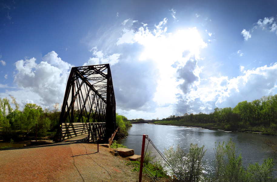
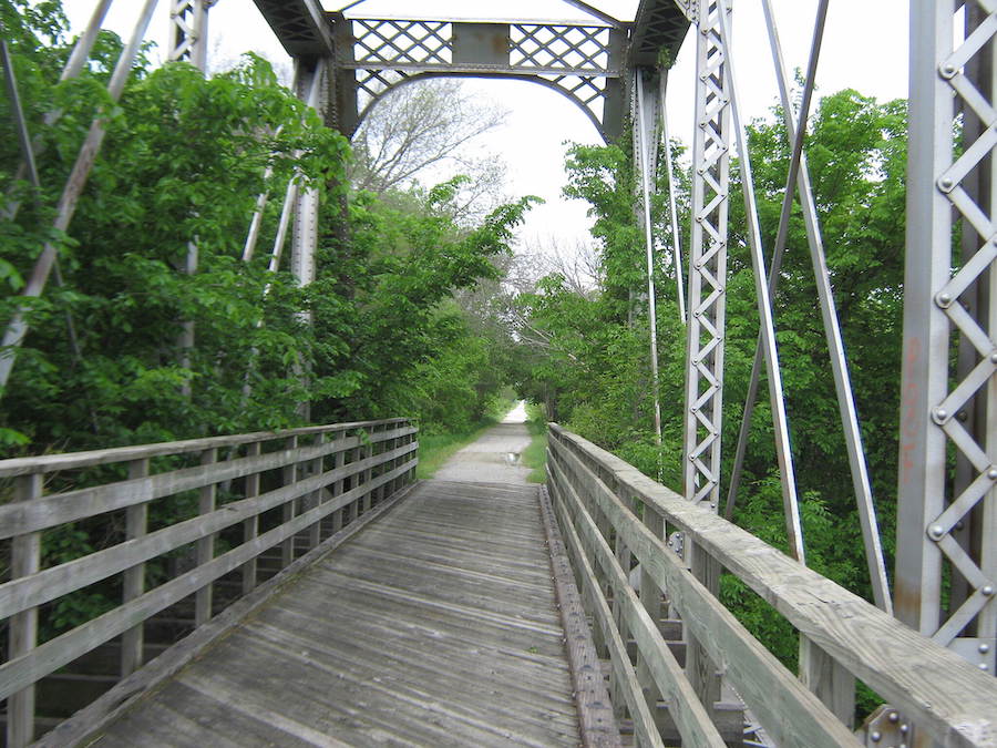
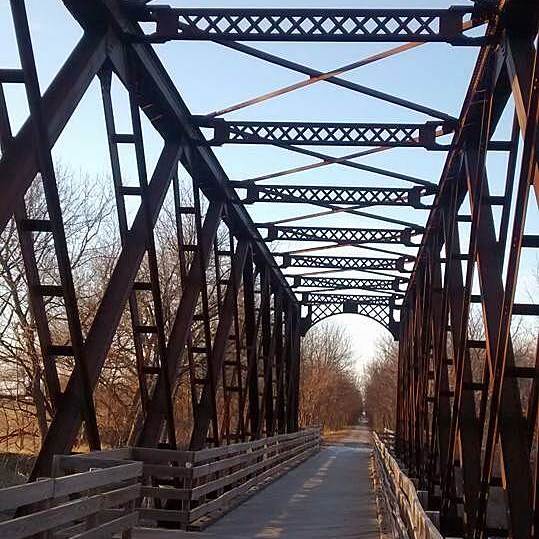
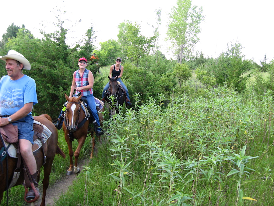
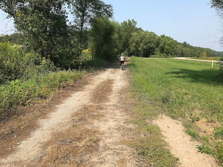
Already among the longest rails-trail conversions in the United States, the Cowboy Trail continues to grow. Trail organizations, local and state government groups, and RTC are among the groups pushing to bridge western gaps from Valentine to Chadron that will make the trail a 321-mile protected path. It serves as a backbone of the Great American Rail-Trail as it passes through the Great Plains. Recently, Chadron officials, the Nebraska Northwestern Railroad and the Northwest Nebraska Trails Association agreed to develop 5 miles of Cowboy Trail leading into Chadron. In 2015, just over 14 miles opened between Gordon and Rushville.
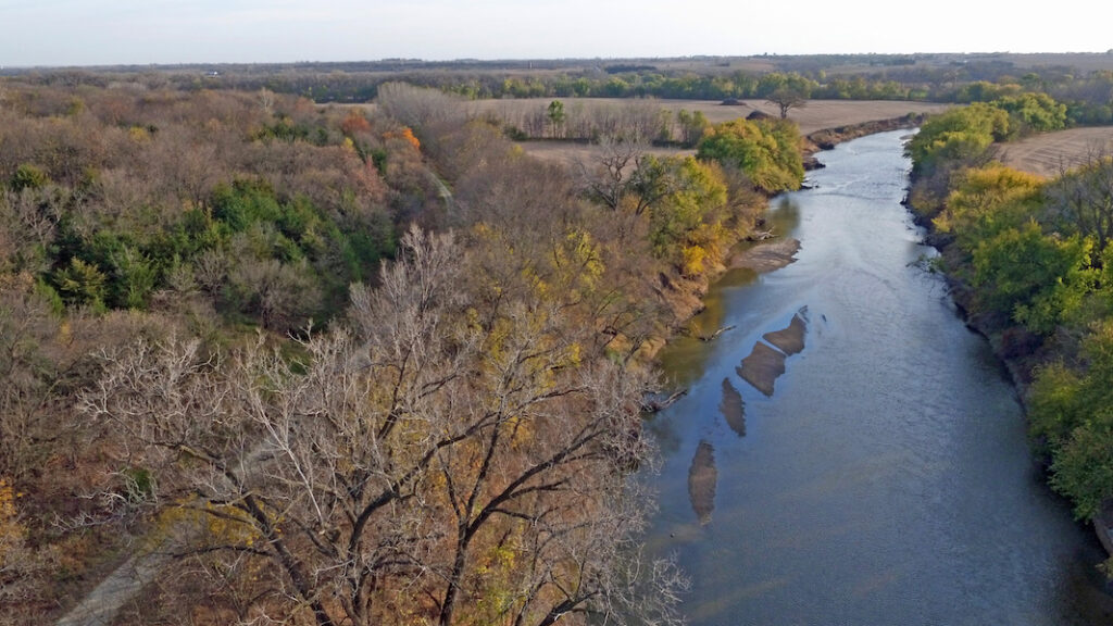
The longest completed stretch, however, is a doozy. It runs nearly 190 miles on the route of the old Chicago and Northwestern Railroad line from its easternmost point in Norfolk, next to the Elkhorn River, through countryside and numerous northern Nebraska communities, and all the way to Valentine, located alongside the Niobrara River. Trail users can cross more than 200 bridges when they tackle that Norfolk to Valentine span, including a 148-foot-high, quarter-mile-long stunner that crosses the Niobrara just east of Valentine. Between Norfolk and Valentine, relics of the trail’s railroad origins abound, including the restored Long Pine depot and the crew quarters next to it that travelers can rent for the night, or the brick depot that’s still standing in O’Neill. The Nebraska Game and Parks Commission provides updates on the trail’s closures and condition, which was impacted in several areas by 2019 flooding.
Dark Island Trail (Central City, Marquette)
Counties: Merrick and Hamilton
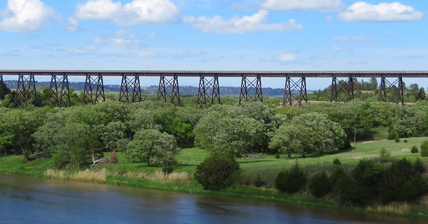
Beginning just northeast of Grand Island in Marquette, the Dark Island Trail runs for a little over 10 miles up to Central City on a former Burlington Northern railway. The fly-ash surface trail passes through farmland and prairie, and also boasts the 1,072-foot wooden-trestle Bader Park Bridge that crosses over the Platte River just south of Central City. It’s a centerpiece trail in central Nebraska. The trail was officially completed in October 2016, and it’s been a hotbed of activity since. The Dark Island Trail boasts a half marathon, and every other Tuesday in bikeable weather, cyclists get together on the trail for a taco ride. Don’t have a bike? The Merrick Foundation offers to let you use a loaner during Taco Tuesday Rides for anyone who wants to get in on the action on one of the state’s newest rail-trails.
Oak Creek Trail
Counties: Saunders and Butler
Starting at one end in Valparaiso, just a skosh under 25 miles north of Lincoln, the Oak Creek Trail connects three Nebraska communities on a corridor once used by the Union Pacific Railroad. The trail runs west out of Valparaiso along a branch of Oak Creek for a few of its 13 miles before reaching its halfway point in Loma, home of St. Luke’s Czech Catholic Shrine and the filming location for a good chunk of “To Wong Foo, Thanks for Everything! Julie Newmar.” The trail continues on to Brainard, where a community swimming pool and the Husker Bar II—no, there isn’t a Husker Bar I—are among the amenities that await trail users. Cyclists, runners, hikers, equestrians and other users pass under canopied portions of the limestone trail that open up to reveal vistas of farmland and sometimes blasts of prairie wind. It’s also a geocaching hotbed. Over 100 registered geocaches are hidden along the Oak Leaf Trail, according to the Lower Platte South Natural Resources District. The rail-trail is fairly flat, and those who want an ultra challenge can get off the trail in Brainard and ride or run the rolling roads that cover the countryside, an area aptly known as the Bohemian Alps.
Jamaica North Trail and Homestead Trail
Counties: Lancaster and Gage
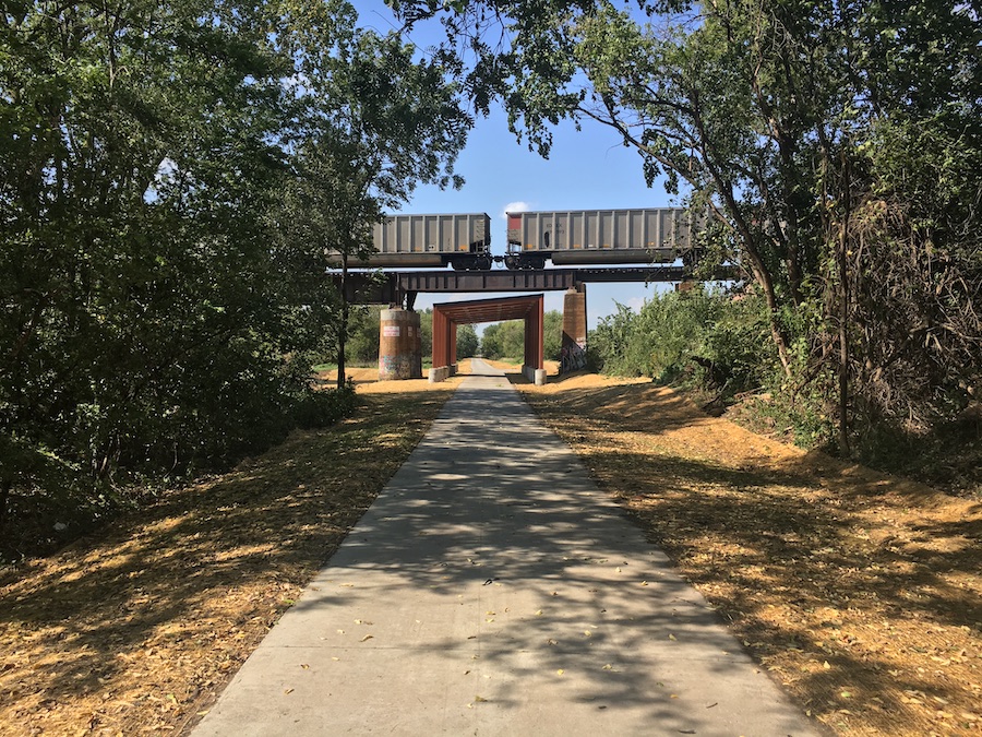
The Jamaica North and Homestead trails are essentially runners on the same relay team. The Jamaica North, a City of Lincoln trail, runs south out of the city for nearly 7 miles before a metaphorical baton gets passed to the Homestead, just north of Roca. From there, the Homestead provides about 30 miles of protected passage south on to Beatrice, home of Homestead National Historic Park. For a good stretch of the Homestead, the trail runs basically adjacent to US 77, which often subjects cyclists to challenging winds but also provides opportunities to refuel at the Cortland gas station or the tavern in Pickrell. Recently, the trails added a new on-ramp or off-ramp, depending on which way you’re heading. The $2.2 million Great Plains Trails Network Connector bridge was installed above an active railway in October 2020. The bridge connects the crushed limestone Jamaica North trail to the paved Rock Island Trail, a heavily trafficked spine of the Lincoln’s vast trail network.
Chief Standing Bear Trail
County: Gage
Along with the Jamaica North and Homestead trails, the Chief Standing Bear Trail helps make up a route of about 80 miles of protected trails between Lincoln and Marysville, Kansas. Owned by the Ponca Tribe of Nebraska and maintained by the Homestead Conservation and Trails Association, the Chief Standing Bear Trail runs 22.9 miles from downtown Beatrice, which maintains the first few miles out of town, to the Nebraska–Kansas border. Outside of Beatrice, the trail transitions to crushed limestone, taking cyclists and hikers under canopies of trees, and bisects rolling farmland before dipping back beneath trees and re-emerging among native prairie grasses, again and again. Sixteen re-decked bridges connect the trail, which follows an abandoned Union Pacific railway path that was similar to one that members of the Ponca Tribe were forced to walk before the railroad was built. In 1877, the U.S. Cavalry ordered the Ponca to leave their homeland in northern Nebraska and resettle in Oklahoma Territory, a story that is recounted on interpretive signage along the trail. The Chief Standing Bear follows a portion of the Ponca’s path to Oklahoma.
MoPac Trail Segments: East, West, Springfield and the Lied Platte River Bridge
Counties: Lancaster, Cass, Sarpy
The western segment of the MoPac Trail begins in the heart of Lincoln and runs east on paved pathway for about 5 miles to a trailhead where the pavement ends and, eventually, a crushed-limestone trail linking Lincoln to Omaha will begin. As it stands, the MoPac Trail East, one of the oldest rail-trails in the state, provides over 20 miles of rural protected pathway on the former Missouri Pacific Railroad Omaha Belt Line. Lincoln residents pack the MoPac on Tuesday nights during the summer and fall for Nacho Rides to Eagle, where the local bar, now called Bailey’s Local, has gone through several ownership changes but continues to serve the aforementioned delicacy to the cycling masses. The trail continues past Eagle to Wabash, and talks are continuing to close the 8-mile gap from Wabash to the Lied Platte River Bridge, a former railway converted to a pedestrian crossing. The bridge reopened in the summer of 2021 after repairs related to the massive 2019 floods were completed. On the other side of the Platte, the MoPac continues for about 12 miles up through Springfield before ending south of Omaha.

West Papio Trail
Counties: Douglas, Sarpy
The West Papio Trail connects a collection of neighborhoods and cities on the edges of metro Omaha. It runs from west Omaha southeast toward Millard, La Vista, Papillion and the Bellevue area, passing by the Bluestem Prairie Preserve and a handful of community parks while hugging close to the West Papillion, or Papio, Creek much of the way. At its south end, it links with Omaha’s Keystone Trail, connecting the West Papio to the backbone of the Metro Area Trails System’s 120-mile paved trail network. A recent gap-bridging segment on the West Papio covers terrain with ties to the transcontinental railroad, and those links are commemorated on interpretive signs near a preserved bridge, as well as on murals painted on underpasses.
RELATED: Preserving History for a Connected Future
Steamboat Trace Trail
Counties: Otoe and Nemaha
Beginning at its northern point, just south of Nebraska City, the 22-mile Steamboat Trace Trail follows a former Burlington Northern corridor south through Peru to Brownville, at times running right alongside the Missouri River, hence the trail’s name. The oft-shaded trail is a hotbed of Nebraska wildlife; the Nemaha Natural Resources District mentions that deer, turkeys and bobcats are among the area’s residents, and also shares a YouTube video of the region’s prominent birds. For safety’s sake, the trail closes for 10 days in November and two weeks in January during hunting seasons.
As with trails alongside nearly every waterway in Nebraska, the 2019 floods caused extensive damage to the Steamboat Trace Trail. As of fall 2021, the northern half has opened, but the trail remained closed from Brownville to Peru. The Nemaha NRD is providing condition updates here as the trail comes back online for residents and visitors alike.
White River Trail
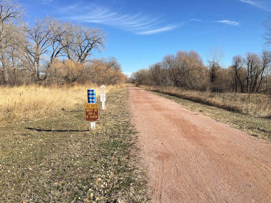
County: Dawes
The 3-mile White River Trail connects Crawford, Nebraska, to the 22,000-acre Fort Robinson State Park, a recreational haven with numerous historical connections, in the northwest corner of the state. The trail offers views of fields and buttes and crosses the White River a few times over former railroad bridges. At Fort Robinson, visitors can take in numerous recreation opportunities, along with the park’s history. The state park was once the headquarters for the African American Ninth Cavalry from 1887 to 1898, and also served during World War II as both a K-9 training base and a POW camp. The post that initially provided security for the Red Cloud Indian Agency is also the site of the 1879 Fort Robinson Massacre, during which dozens of imprisoned Northern Cheyenne were killed following a mass escape effort. That took place about two years after Chief Crazy Horse’s 1877 imprisonment and death there. Visitors can now stand where he was killed and reflect.
Bob Kerrey Pedestrian Bridge

Counties: Douglas, Pottawattamie (Iowa)
Ok, technically, this is not a rail-trail, but it is the gateway that connects Omaha (and its 150-miles-plus trail network) to Council Bluffs, Iowa. The 3,000-foot cable-stayed Bob Kerrey Pedestrian Bridge allows pedestrians and cyclists to cross over the Missouri River on one of the longest pedestrian bridges in the country and is the first to connect two states. The bridge is named for former Nebraska Senator and Governor Bob Kerrey, who secured federal funding that covered most of the costs to build the bridge, which opened in 2008.

Honorable Mention
Al Bengston Trail
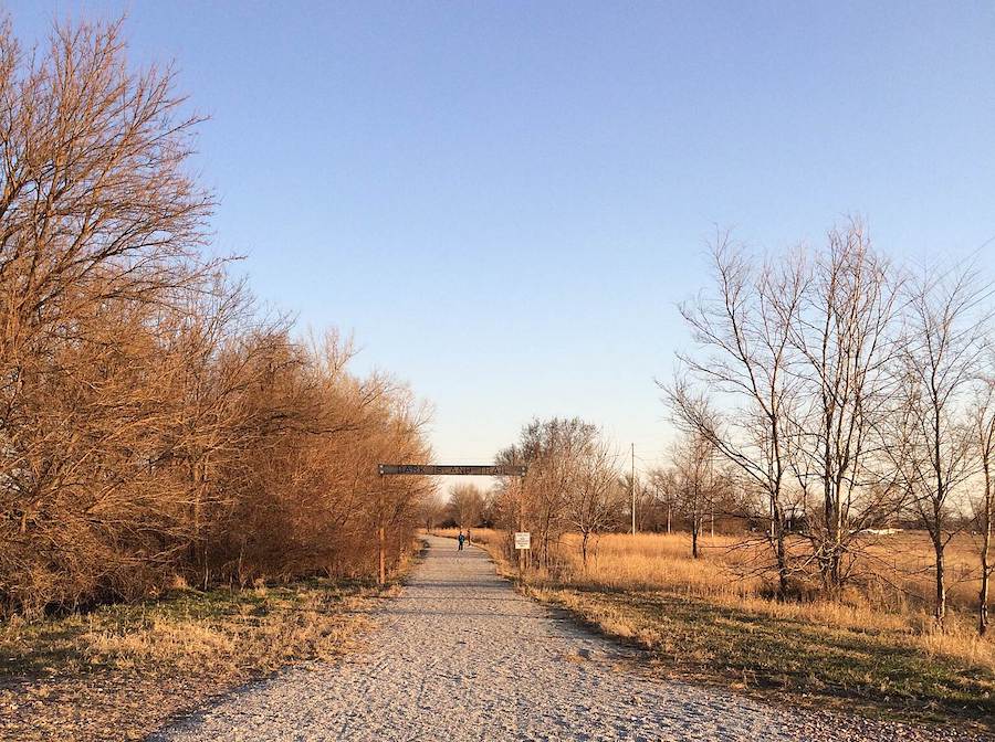
The bulk of Nebraska’s rail-trails are located around Lincoln and Omaha, and the Cowboy Trail covers Nebraska’s northern tier, but Hastings, North Platte, Sidney and other cities have invested in trail development in metro areas. And development of one of the state’s longest pedestrian and bike trails began in the 1970s, before railbanking legislation passed. South Sioux City’s Al Bengston Trail is named for the civic leader who advocated for the trail’s development, and now provides people in the northeast corner of the state (and neighboring South Dakotans and Iowans) with over 20 miles of trail.
When you subscribe to Rails to Trails magazine, you’ll have access to many other features like this one. Our magazine is a premium of Rails-to-Trails Membership. Join today to start receiving the magazine!

Donate
Everyone deserves access to safe ways to walk, bike, and be active outdoors.