Travels Through Time on the Tahoe-Pyramid Trail
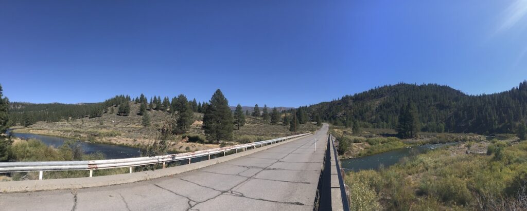
The bi-state Tahoe-Pyramid Trail (TPT) intersects some of the richest histories that have shaped the West as it follows the Truckee River on its developing 114-mile journey from the Lake Tahoe shoreline in California to Nevada’s Pyramid Lake. Here we showcase some of the diverse historical events trail users can learn about along the way, including the area’s Native American heritage, the West’s first train robbery, the impact of Reno on America’s divorce culture, and battles over the region’s most precious resource: water. From forest and wildflowers to sagebrush and scampering coyotes, the TPT serves as both a living museum and an incredibly scenic experience.
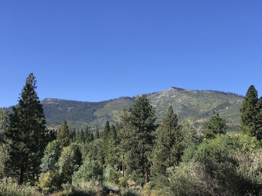
Lake Tahoe Water Wars
In the dry and turbulent Old West, Lake Tahoe’s 37 trillion gallons of water were more valuable than gold or silver—sparking fierce competition for this resource. In the 1860s, civil engineer Alexis Waldemar Von Schmidt concocted a plan to reroute the lake’s only outlet, the Truckee River, to join with the American River and flow westward toward San Francisco. Because San Francisco had no ground water, residents relied on water being transported into the city, presenting a lucrative business opportunity that Von Schmidt jumped on. Though a rudimentary dam was built as part of his project, the grand plan failed and the Truckee continued to flow east through the high desert.
Decades later, in 1908, there was a proposal to drain Lake Tahoe’s waters to feed the Newlands Project, a farming initiative near Fallon, Nevada. Heavy opposition stopped the project and ushered in support for protecting the lake. Today, the Lake Tahoe Dam, built in 1913, distributes the lake’s water into the Truckee River, regulating the water for the irrigation of cropland in the Lahontan Valley of western Nevada.
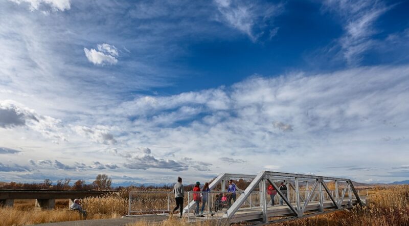
Trail Connection: This section of the TPT overlaps the Tahoe City Public Utility District Multi-Use Trail System and parallels the west side of W. Lake Boulevard in central Tahoe City, California. To reach Lake Tahoe, cross the boulevard and enter William B. Layton Park, which gives you access to both the beach and the Lake Tahoe Dam. The park is operated by the North Lake Tahoe Historical Society and features two museums. Bikers must walk their bikes through the park and along the dam.
1960 Winter Olympics
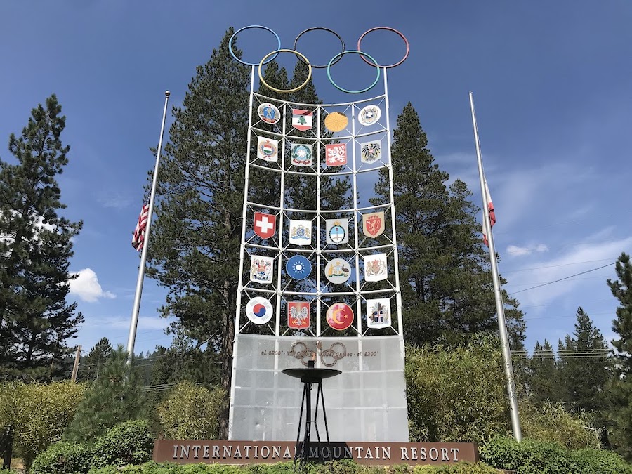
If Schmidt had been successful in his water re-route, he would have blasted through what is now Palisades Tahoe, a ski resort tucked in the Sierra Nevada range—ultimately altering winter sports as we know them. In 1949, Wayne Poulsen and Alexander Crushing opened this ski area to the public with what was then the longest double chairlift in the world.
Just five years later, Crushing placed a bid for the 1960 Winter Olympics, thinking it would serve only as a publicity stunt. After all, his chairlift operation would face well-established and internationally recognized resorts. However, he won the International Olympic Committee bid by two votes. It was the first time the Olympic Games were televised in the United States, which produced a surge of interest in skiing and was among the first uses of the instant replay.
Trail Connection: From the TPT in Olympic Valley, California, you’ll be able to see the Olympic torch and monument. If you’d like to check out the Olympic House or take a scenic ride up the aerial tram, it’s a beautiful 2-mile ride on a paved bike path.
Donner Party
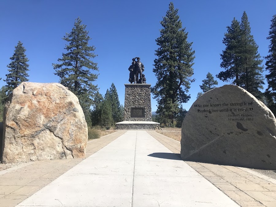
In 1846, a group comprising several families set off for California from Springfield, Illinois, like many others at the time, migrating West in search of fertile farmland and economic opportunity. Called the Donner Party, they were one of the few groups of pioneers to take the newly discovered Hastings Cutoff, promoted as a shortcut for a portion of the California Trail. A journalist named Edwin Bryant, who rode a section of the route on horseback, unsuccessfully left warnings for the Donner Party advising against taking the route.
The determined wagon train lost cattle, wagons and morale as they made their way through rugged Utah and Nevada, but made it to Truckee, California, despite the difficulties they faced on the cutoff. However, once they reached Truckee in late October, frequent heavy snowstorms stopped them from traveling any farther. A rescue party was finally able to reach the stranded travelers in mid-February, finding emaciated survivors and evidence that some had resorted to cannibalism as their food ran out.
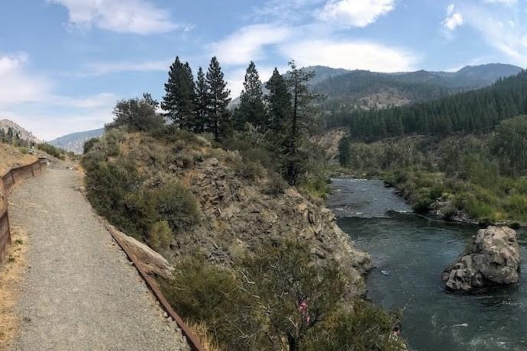
Trail Connection: In Truckee, the TPT overlaps the Truckee River Legacy Trail. You can learn more about the Donner Party at the museum within Donner Memorial State Park reachable via a short on-road connection. Shortly before the trail ends at Truckee River Regional Park, take the pedestrian bridge north across the Truckee River and turn left on East River Street. In 1.3 miles, turn right at McIver Crossing; at the traffic circle, turn left to get on Donner Pass Road and pass under I-80. From here, it’s 2.5 miles to the park.
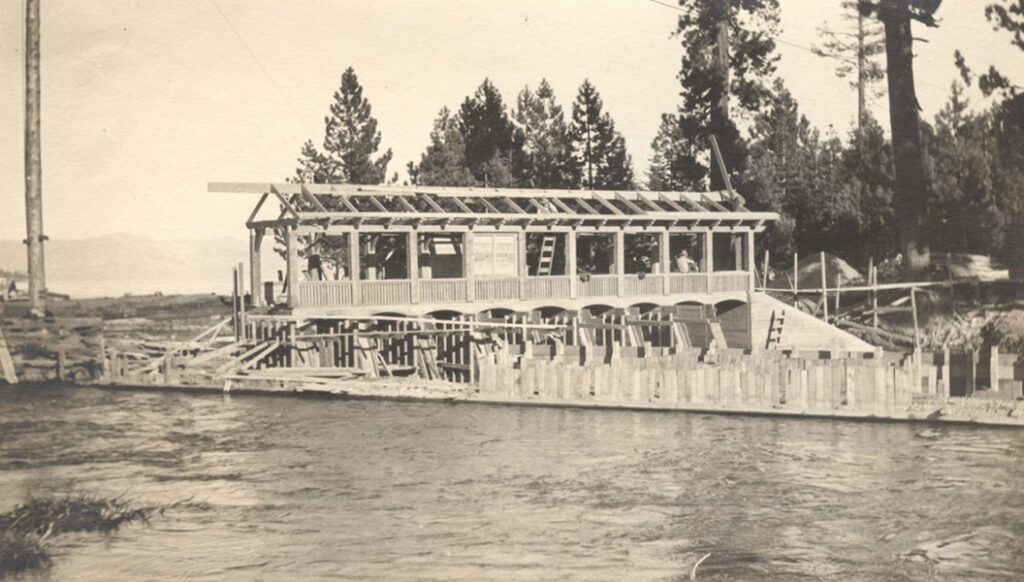
Truckee Lumber Company
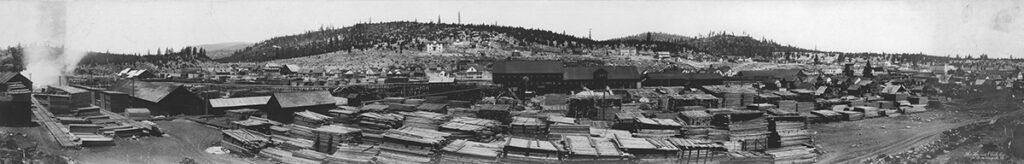
Lumber mills around Truckee played a pivotal role in the building of the West. The Truckee Lumber Company, which used to sit along the TPT on West River Street in downtown Truckee, was one of the largest, cutting up to 12 million board feet in a typical summer season. The company—which operated from 1867 until 1909 when the supply of viable trees thinned—supplied the lumber that built the homes, mines and train tracks of Reno, Truckee and Virginia City. Though the mill is no longer there, some of the workforce housing still exists today in downtown Truckee’s Brickelltown Historic District.
Trail Connection: From the western endpoint of the Truckee River Legacy Trail in Truckee River Regional Park, turn right (west) on Brockway Road and travel 0.5 miles—crossing the Truckee River, where the roadway becomes Bridge Street. Take a left on Donner Pass Road and, in about 500 feet, you’ll reach the Historic Downtown Truckee visitor center and the beginning of Brickelltown, which stretches from nearby Spring Street to the Donner Pass Road/High Street roundabout.
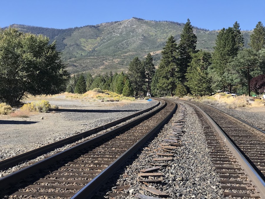
Transcontinental Railroad
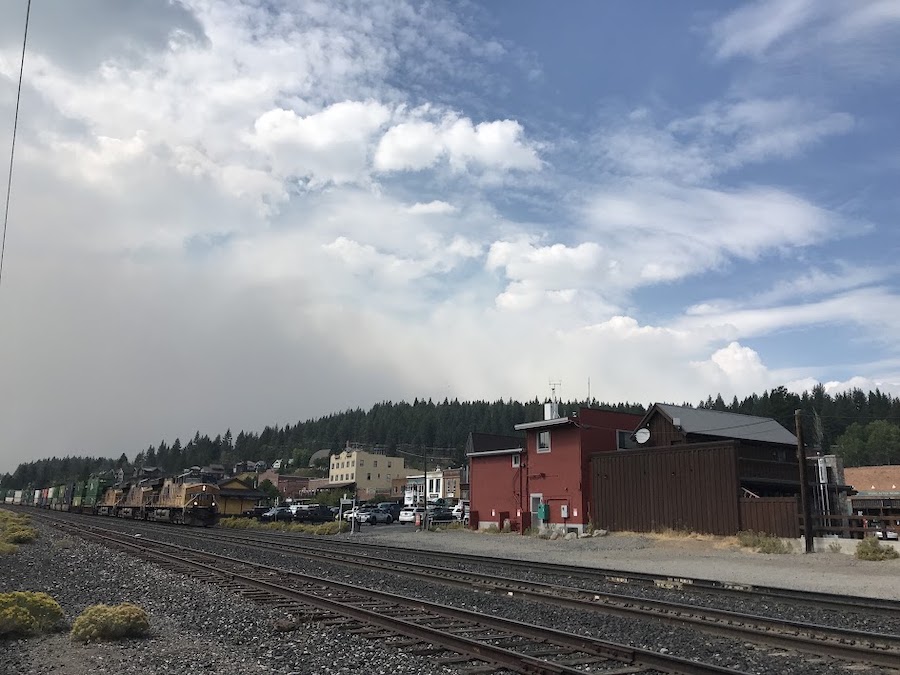
The Transcontinental Railroad was one of the most impressive engineering accomplishments of its time and Truckee was integral to making the dreams of Theodore “Crazy” Judah, civil engineer and designer of the project, a reality. The train required 15 tunnels to ascend the steep grades of Donner Pass; the most difficult was the curved Tunnel 6 that goes through nearly 1,700 feet of solid granite and took two years to complete.
Despite the hardships, the railway was completed in 1869, just six years after breaking ground. During this time, Truckee became the staging ground for supplies and a temporary home for workers. The downtown flourished as the completed train connected it to neighboring communities and brought travelers crossing the country.
Trail Connection: To learn more about the railroad and how it shaped Truckee, visit the Truckee Railroad Museum located downtown adjacent to the visitor center mentioned above. The museum is free and open to the public 10 a.m.–4 p.m. on weekends (depending on the availability of docents).
Lincoln Highway
As you leave Truckee’s eastern neighborhood of Glenshire and turn onto Hirschdale Road, you will ride on a portion of the historical Lincoln Highway that is now only accessible via the TPT. The Lincoln Highway was the country’s first transcontinental road, connecting New York City to San Francisco. It opened in 1913 but ceased to be the backbone of American driving culture just 13 years later when an influx of roads, highways and interstates prompted a nationwide numbering system that broke apart the Lincoln Highway into US Highways 1, 30, 530, 40 and 50. Today, enthusiasts can still drive on other portions of the original highway route.
Trail Connection: The TPT follows the historical Lincoln Highway after it turns onto Hirschdale Road from Glenshire Drive east of Truckee. From here to northwest Reno, the two meander through the Truckee River canyon, mingling in sections as short as half a mile and as long as 5 miles. Markers for the Lincoln Highway can be found on major roads such as W. 4th Street in Reno.
Crystal Peak
As you enter Verdi’s Crystal Peak Park, you may notice the white dome of a mountain looming across Truckee River. This is Crystal Peak, the mountain of quartz that helped win World War II by supplying an integral component of two-way radios. The quartz mine was originally built in 1864 and taken over by the federal government when war efforts began.
Today, you can enjoy views of Crystal Peak from the park’s interpretive trails, where you’ll also find remnants of the Verdi Glen Resort’s fireplace and swimming pool. Open between 1926 and 1938, the resort once served as a lively dance hall and divorce ranch, where a person might stay to establish residency in order to file for a quickie, no-fault divorce under Nevada’s lenient divorce laws.
Trail Connection: If you’re following the TPT eastward, 3.4 miles after you cross over the California border into Nevada, you’ll reach Crystal Peak Road in Verdi, Nevada; you’ll quickly cross under I-80 and, in 0.4 miles, reach a parking lot on the north side of the road. From here, a sharp left turn will take you into the park. Follow this road down to a smaller parking lot where you will see a tunneled walkway, which leads to what’s left of the Verdi Glen Resort.
First Train Robbery in the West
As the evergreen trees along the trail open to sagebrush country, images of the Wild West may paint the imagination. It was here in 1870, between Verdi and Reno, that the West’s first train robbery occurred. The Central Pacific Overland Express was taken by five men who stole $41,600. The men, led by John Chapman, split up after the robbery, causing a bi-state effort to capture them. After four days, the men were all arrested and nearly all the money recovered. That might be where the story ends along the TPT, but not for this gang. In 1871, all but one of the robbers made a break from the Nevada State Prison in Carson City, leading police and bounty hunters toward a bloody battle at what is now called Convict Lake near Mammoth Lakes, California.
Trail Connection: Nevada State Historical Marker No. 128 in Verdi describes the events of the train robbery. This marker is just off the TPT. From Crystal Peak Park, ride along US Highway 40 eastbound for 0.3 miles and make a right at Bridge Street. The marker is located on the other side of the train tracks, where Bridge Street deadends into S. Verdi Road in 0.1 mile.
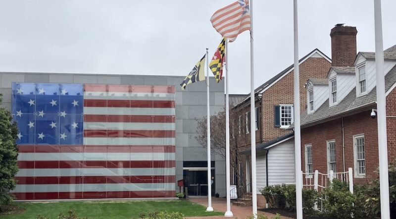
Wedding Ring Bridge and Riverside Hotel
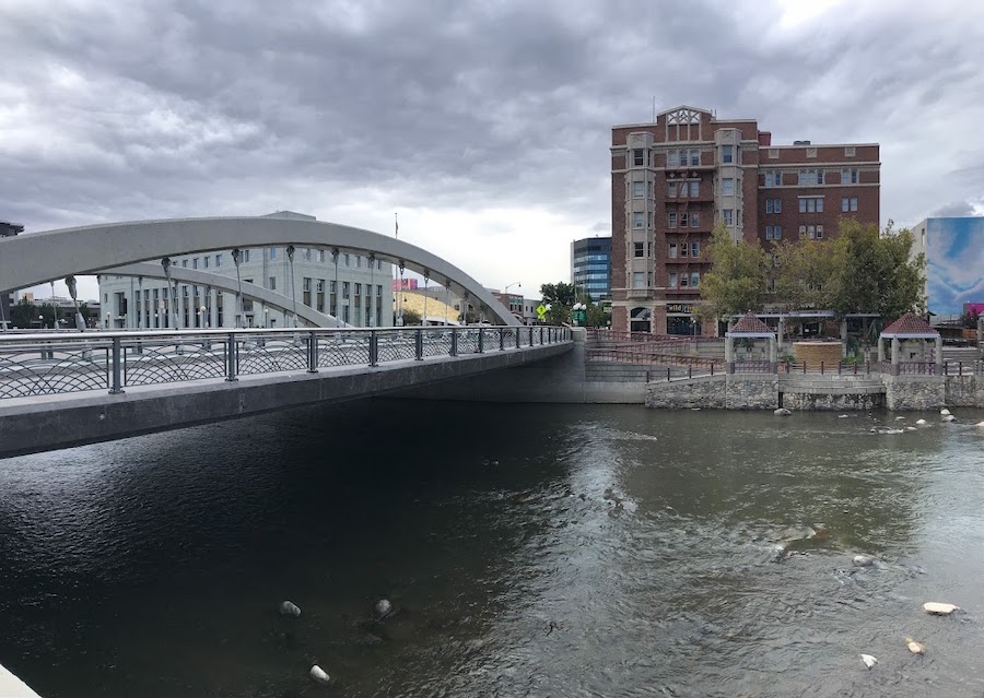
From the early 1900s to 1969, Reno was considered the “Divorce Capital of the World” because of the ease of divorce here with Nevada offering more grounds for divorce than any other state at the time. Out-of-state hopefuls could also legally file for divorce after just six months of continuous residency. Separations sought by the powerful, rich and famous who flocked to the area enticed the media to report these sightings to the rest of the country from this charming Western town. The people of Reno embraced the city’s reputation, rushing to build luxury housing for these temporary residents and further reducing the residency requirement to just six weeks.
Trail Connection: As the trail enters bustling Reno, take notice of the stately Riverside Hotel. This luxury divorce destination was built in 1927 next to the courthouse and was made famous through countless articles, novels and films. The hotel sits adjacent to the Wedding Ring Bridge, said to be a popular spot for newly divorced women to throw their rings into the raging waters of the Truckee, cleansing them of their soured relationships—as Marylin Monroe depicted in The Misfits. Both the original bridge and hotel are no longer, but their replacements stand at the intersection of the TPT and Virginia Street.
Pyramid Lake War
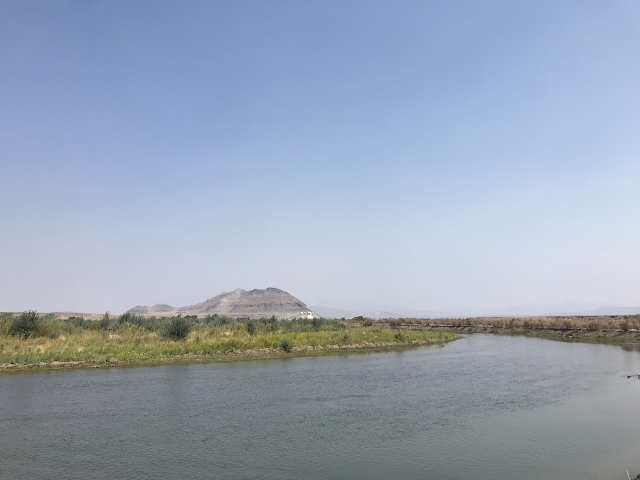
Although Pyramid Lake is peaceful now, in 1860, a war waged between immigrants and local tribes resulting in the deadliest confrontation for settlers in nearly 70 years. The silver rush produced intense competition for precious resources in the area and tensions were palpable. Over 100 men from Virginia City, Silver City, Carson and Genoa set out to confront the Paiutes on the banks of the Truckee River at the southern edge of the lake. It’s estimated that nearly two-thirds of the settlers died, the rest fleeing to send telegraphs for backup. With an army of more than 700, the men returned for another battle. The Native Americans were likely outnumbered. It’s said they fought a fierce battle but the Paiute men had to escape the area, effectively giving victory to the white men.
Pyramid Lake is now part of a reservation of the Numu (Paiute) people on land where they’ve lived for centuries. The oldest dated petroglyphs in North America were found not far from the TPT—they are estimated to be 15,000 years old!
Trail Connection: You can learn more about the Paiute tribe’s long history in the Pyramid Lake area by visiting the Pyramid Lake Paiute Tribe Museum and Visitors Center, easily accessed from the TPT. After you pass the Nixon Store gas station on Highway 447 in Nixon, Nevada, make a left onto Highway 446. Ride 0.3 miles, then take a right onto State Street, where you will see the large stone building that houses the museum.
Related: Top 10 Trails in Nevada
Related: Top 10 Trails in California

Donate
Everyone deserves access to safe ways to walk, bike, and be active outdoors.
Related
View All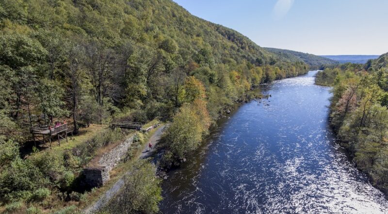
Life, Liberty and the Pursuit of Happiness: Pennsylvania’s Delaware & Lehigh Trail
Best Of: Trailside Sites That Encapsulate America’s History