North Carolina’s Charlotte Rail Trail
Trail of the Month: January 2023
“What was an afterthought has become a premier element of the entire project.”
—Jason Lawrence, Director of Planning, Charlotte Area Transit System
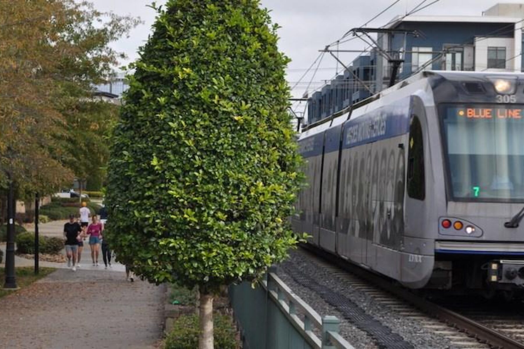
The bustling Charlotte Rail Trail is a 12-foot-wide swath of urban utopia in North Carolina’s largest city. Bikers stream by in packs, toddlers sprint away from their stroller-pushing parents, curious puppies on leashes pull their owners to every corner of the path; these are just a few of the sights that pop up along the way.
“You can see the diversity of Charlotte and of our population, so it’s really a place where urbanity is on display,” said Erin Chantry, manager at Charlotte’s Urban Design Center.
A 3.5-mile through-line for the Queen City, the paved pathway connects neighborhoods from Uptown to the South End, providing access to a vibrant patchwork of trailside businesses, eye-catching art installations, restaurants and popular gathering spots. And it does this while comfortably tucked alongside an active commuter rail—a configuration known as rail-with-trail—expanding transportation options for Charlotte’s nearly 900,000 residents.
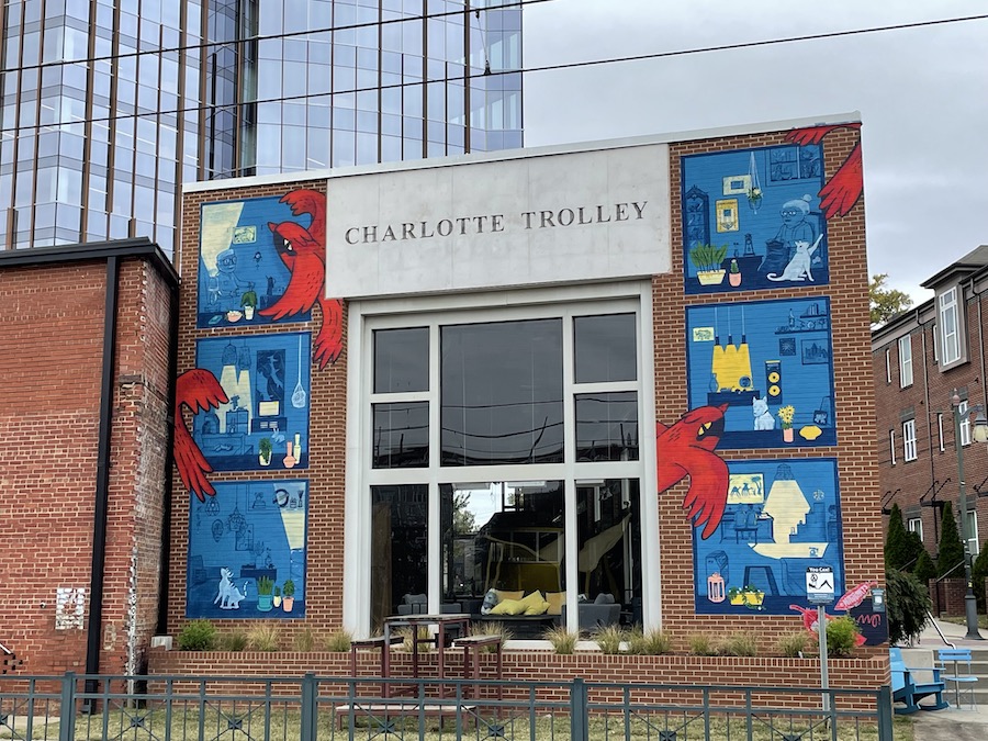
Trolley Heritage
To see it now, a lively corridor featuring eateries selling bowls of tonkotsu ramen and craft beer shops pouring hazy IPAs, you’d never guess how it began—as a maintenance path along a refurbished trolley line back in the mid 1990s.
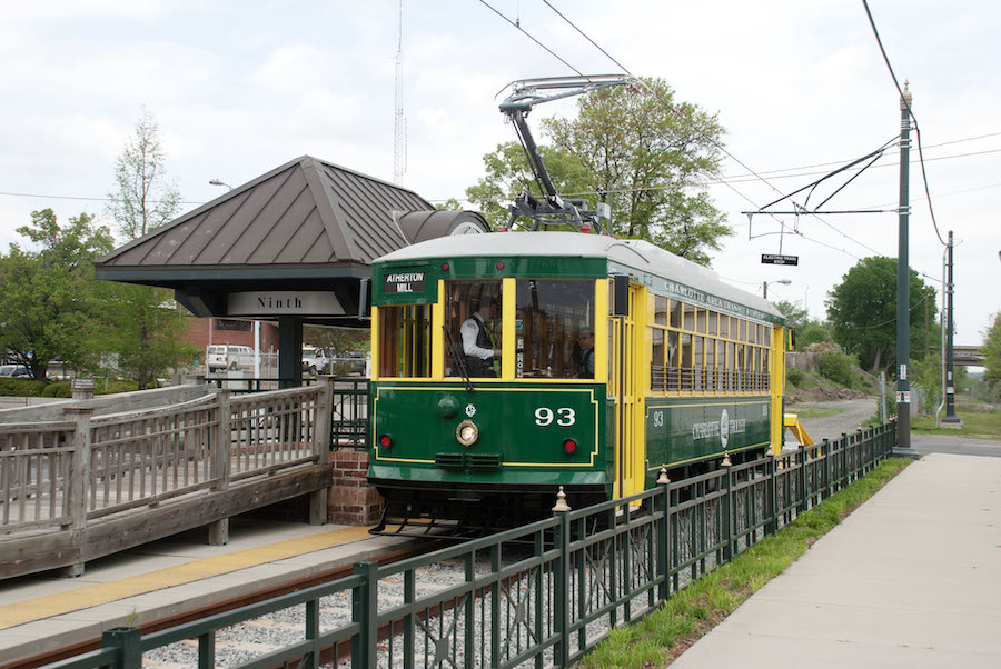
“A group of enthusiasts wanted to bring back the historic trollies in Charlotte,” explained Cheryl Myers, chief planning and development officer and senior vice president at Charlotte Center City Partners.
The original network of electric streetcars—constructed by the Edison Electric Company to replace an earlier line of mule- and horse-drawn streetcars—rolled through Charlotte from 1891 through 1938. Nearly six decades later, a group of volunteers interested in drawing visitors to the city center raised enough money to restore a few of the old trollies.
“These vintage trolley enthusiasts sparked the imagination of some of the movers and shakers in Charlotte to go, ‘Hey, why don’t we get this trolley back on the line?’” added Myers.
Those movers and shakers—a team of creative designers, architects and urban planners working together to grow the Queen City—concurred that a trolley line would help boost tourism. Myers and her team at Charlotte Center City Partners, a nonprofit that works to promote and enhance the city’s central business district, put together a design charrette for city leaders. As a result, the city raised the funds to build the vintage Charlotte Trolley line. Spanning roughly 3 miles, the volunteer-run heritage railroad served as a destination for people throughout the Carolinas until 2010.
“Families would come and bring their kids; it was fun for them to ride the trolley back and forth between Uptown and South End,” Myers said. “It was a novelty.”
And while the design and scope of the trolley line took shape, a perfunctory part of creating a rail line ultimately led to something of an aha! moment.
“You need to have an emergency-vehicle access pathway along a rail line,” said Myers, explaining the requirement for a space for fire trucks, police or ambulances to reach the trains. But soon, the conversation became, “‘Why not make this utilitarian asphalt pathway something special?’”
Over time, this access route evolved into a pathway for the public. “And as development occurred [along the rail line], we required developers to build segments of [the trail],” explained Jason Lawrence, director of planning for the Charlotte Area Transit System (CATS). “What was an afterthought has become a premier element of the entire project.”
RELATED: Top 10 Trails in North Carolina
Rail-With-Trail: A Perfect Pairing
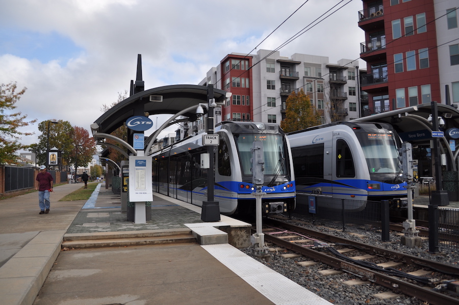
By the early 2000s, it became apparent that the trolleys were not the people-movers the growing city needed, and around this time, the idea for a light rail was gaining momentum. Operated by CATS, the LYNX Blue Line’s first phase opened in 2007, becoming the first major rapid rail service in the state. Today, the 19.3-mile line extends from the University of North Carolina at Charlotte through the NoDa neighborhood (named for its main thoroughfare, North Davidson Street), Uptown and South End. It also continues south along South Boulevard to just north of Interstate 485.
When asked how the trail paralleling the train has improved transportation options for residents, Chantry enthusiastically replied, “by infinite gold.” Nine of the light rail’s stations are directly accessible from the pathway, including the Charlotte Transportation Center, which serves as a central hub for bus lines in addition to trains. Bikes are permitted on the trains, and Charlotte Joy Rides—the first bikeshare system in North Carolina—has more than two dozen stations sprinkled throughout the city, including a handful within a block of the rail-trail.
Chantry also noted that the trail has been key to the success of the commercial development that surrounds it.
“Without the rail-trail, there would not be the public realm or the pedestrian space to support transit-oriented development,” Chantry said. “The rail-trail along the rail has basically provided a whole other space to be activated with ground-floor retail and other active uses that are incredibly supportive of transit.”
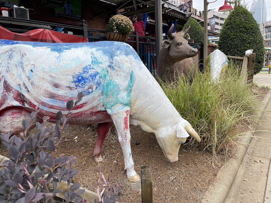
To understand how the train’s development shaped and impacted this area once brimming with textile mills and warehouses, one glance at the booming construction from Uptown to South End gives an inkling of its rapid-fire growth. Along the trail, there are now restaurants scooping specialty ice cream, sliding vegan doughnuts into to-go boxes and pouring Spanish wine in the South End. At Atherton Mill, a retail hub that was one of Charlotte’s first textile mills, crowds of people shop for artisanal goat cheese at the farmers market, while others sweat through exercise classes. Lined with multifamily residential buildings, the pathway has a friendly, neighborhood feel, and those living along it quickly get used to being part of this urban fabric.
“We require apartments [built in the corridor] to have a doorway to it,” explained Lawrence. “It’s not the back of the house—it’s a front door. This encourages it to be an active space.”
Community and Connection
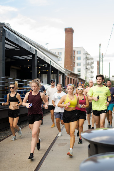
Being active is second nature to South End resident Rico Marcelo. Living just a block from the rail-trail, it’s his go-to place to run every day. His passion for fitness led to his starting the Barn Burners Run Club in 2022. Every Monday, he and upward of 50 of his fellow runners meet at the trailside Trolley Barn Fermentory and Food Hall, its name a nod to Charlotte’s early electric trolleys.
“Our mission is to promote health and fitness, inspire change and create community,” he said. “There are so many people active on [the rail-trail], it already creates community itself—we’re just adding to that.”
He also loves its revolving art installations and the free little libraries along the way, where folks are encouraged to take a book or leave one for the next reader. But for Marcelo, the trail’s standout feature is accessibility. “It connects everything as far as the different neighborhoods.”
That connectivity is what keeps bringing Marcelo, and countless other trail enthusiasts—more than 2,000 trail users a day in some locations—to the once-industrial corridor. Brigitte Acosta, a South End resident since 2015, said her move to Charlotte from Florida had a lot to do with how the rail-trail was taking shape.
“When I moved there in 2015, I saw that they were really pushing the rail-trail and the local businesses on the rail-trail, and I just really loved the idea of being in a growing neighborhood,” she said. “And I’ve loved it ever since.”
Pops of Happiness
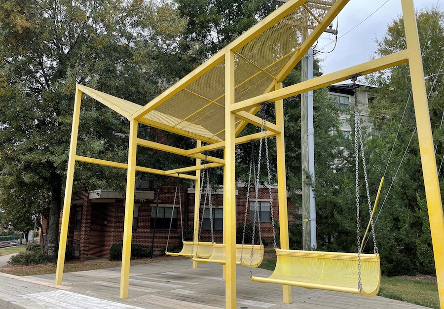
The beauty of the rail-trail extends beyond being an artery through the heart of downtown. It has also become a hub for urban art—an interactive, creative commons for passersby—and an intentional part of the project’s development.
In 2013, three designers—David Furman, Richard Petersheim and Terry Shook—came together and collaborated on a plan for enhancing the trail. Two years later, the team presented their vision for transforming the utilitarian infrastructure along the Blue Line light rail into an urban, linear commons uniting the neighborhoods between Sedgefield and Uptown.
During the visioning process, they noticed there were more than 70 underutilized spaces along the trail just waiting to be transformed. “The idea was, ‘Hey, let’s come up with some neat activity areas and use public art in these leftover spaces to activate the trail,’” Myers explained.
It was just the stimulant the trail needed to become even more vibrant—even more of a destination. The key was including art installations that changed.
“You want to put things along the trail that are dynamic,” said Myers. “It’s like a museum: You have the permanent collection, yes, but you want to have new exhibits installed periodically, so visitors have another reason to come back.”
Acosta loves the itinerant nature of the art, enjoying the sensory surprises she discovers on the rail-trail, like flowers sprouting up in unexpected places and light installations that illuminate the trail at dusk. “It kind of makes my day,” she said. “I like having the pops of happiness when I walk around.”
One of the trail’s unique art installations is the Color Forest, designed by Charlotte-based artist Ivan Toth Depeña and featuring 100 steel poles in a rainbow of hues: sky blue to sour apple green and honey lemon yellow. These bright rods line both sides of the rail-trail just north of South End’s Bland Street. Farther north, near the light rail’s Carson Station, is Edna’s Porch, named after Furman’s grandmother. What was once just a sliver of space with a little grass is now an inviting place to relax with swings, benches and a patio.
The Rail Trail Chalkboard is another must-see (must scrawl?) favorite. Perched like a billboard, it asks trail users to complete prompts such as “I love the rail-trail because … ”—giving passersby a reason to stop, reflect, write and create.
“That took off like lightning and is still really popular after all these years,” Myers recalled about the chalk-decorated installation. “We’re constantly cleaning it off!” she added with a laugh.
Moving Forward
I-277 currently splits the trail into two discontiguous sections: Trail users traveling northward from Charlotte’s South End neighborhood into City Center see the trail end shortly after the Blue Line’s Carson Station, just past the East Morehead Street underpass. And as it stands now, users must exit the protected pathway and take a busy vehicular crossing over the interstate before rejoining the trail less than a mile farther on, where it begins again east of the convention center.
But an $11 million project is underway to unite the trail with a stunning pedestrian bridge that will continue to parallel the city’s Blue Line across the interstate and provide a seamless experience to trail users.
The bridge design—created by Depeña, the same artist who designed the Color Forest—calls for visually striking double arches that swoop across the span and reach heights of some 40 feet above the highway below. The bridge, which will be vibrantly lit at night, will also be the broadest portion of the trail at an impressive 16 feet.
With the design phase complete and funding largely secured, the real estate acquisition phase is underway; construction is slated to begin in 2023, and the bridge is expected to open in spring 2025.
The Charlotte Rail Trail is in constant evolution, driven by the efforts of those who can’t imagine living and thriving in the Queen City without it. “Our CEO often says, ‘People will come visit to ride the light rail, but leave talking about the rail-trail,’” Lawrence reflected.
Business Booms Along the Charlotte Rail Trail
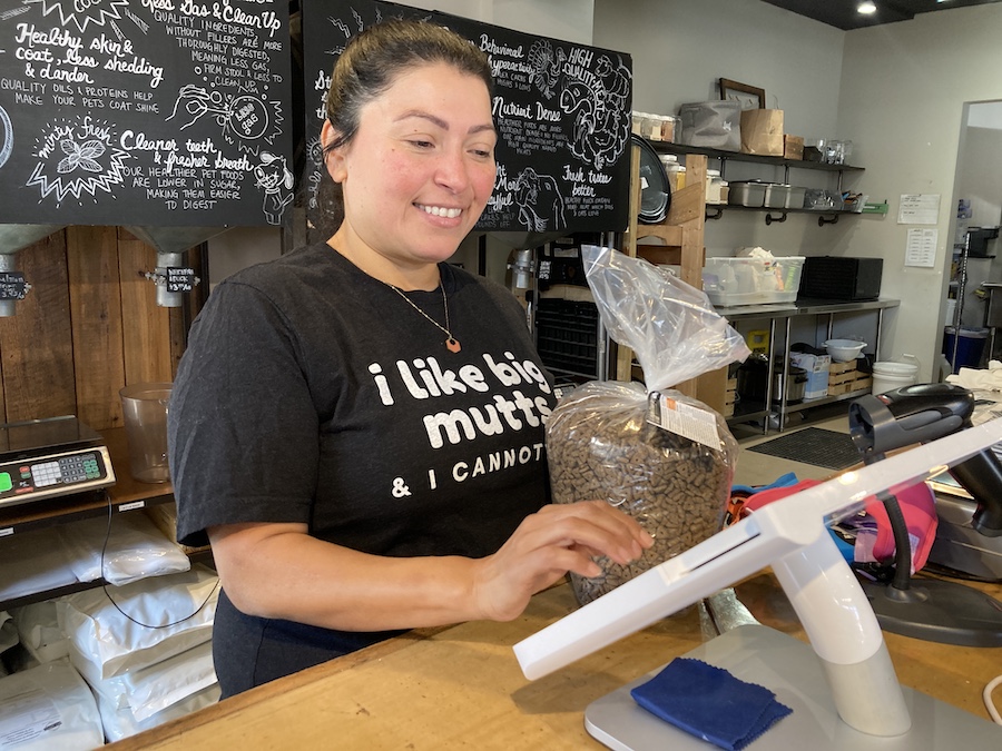
The Charlotte Rail Trail isn’t just a hub for walkers and runners. It’s also a must-woof destination for the loads of canine friends who call the Queen City home. Just ask dog-lover and small business enthusiast Carmen Larreynaga. She owns Pet Wants, a pet food boutique in South End, just south of the Bland Street light rail station and across the street from the trail.
Between walls lined with toys for pups and scores of dog treats, Larreynaga explains how she moved her natural pet food store from a different location in South End about a year ago. She said the exposure has been incredible. “A lot of people walk their dogs there, so they see us. And, also, the people riding the train.”
The rail-trail is a bonafide pooch paradise with water dishes, poop-bag dispensers and plenty of room for pets to stroll with their humans. Larreynaga said another plus to the destination is how accessible it is for all walks, and woofs, of life: “I think it brings people from different parts of town to South End.”
The boost in visibility has been a boost to her business, too. “I think we’ve doubled our sales,” she said with a smile. “It’s definitely helped a lot.”
Related Links
Trail Facts
Name: Charlotte Rail Trail
Active railroad corridor: LYNX Blue Line light rail system
Trail website: Charlotte Trolley Trail
Length: 3.5 miles
County: Mecklenburg
Start point/end point: E. 12th St. and Alpha Mill Rd. to South Blvd. and Hartford Ave.
Surface type: Asphalt, brick, concrete
Grade: The trail provides a relatively flat experience with no challenging hills.
Uses: Walking, bicycling and inline skating; wheelchair accessible
Difficulty: This short, paved pathway provides an easy route through the heart of Charlotte.
Getting there: The Charlotte Douglas International Airport (5501 Josh Birmingham Pkwy.) is located about 5 miles west of the Charlotte Rail Trail. Charlotte is also serviced by Amtrak with a station (1914 North Tryon St.) located 1.5 miles northeast of the trail.
Access and parking: Trail access is easily provided from nine adjacent LYNX Blue Line light rail stations (from north to south):
- 9th St. Station
- 7th St. Station
- CTC/Arena Station
- 3rd St./Convention Center Station
- Brooklyn Village Station
- Carson St. Station
- Bland St. Station
- East/West Blvd. Station
- New Bern Station
To navigate the area with an interactive GIS map, and to see more photos, user reviews and ratings, plus loads of other trip-planning information, visit TrailLink.com, RTC’s free trail-finder website.
Rentals: Charlotte’s bike-share service, Joy Rides, has more than two dozen stations sprinkled throughout the city, including a handful within a block of the rail-trail.
This article was originally developed for the Winter 2023 issue of Rails to Trails magazine and has been reposted here in an edited format. Subscribe to read more articles about remarkable trails while also supporting our work.

Donate
Everyone deserves access to safe ways to walk, bike, and be active outdoors.