Illinois’ Bloomingdale Trail: October 2026 Trail of the Month
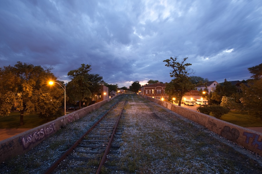
Like so many interesting ideas, the proposal to form the Friends of the Bloomingdale Trail emerged in a bar basement. In 2002, six residents of the Chicago neighborhoods surrounding an abandoned section of the former Bloomingdale Line freight tracks got together to strategize how to convert the elevated, weed-choked railbed to a trail.
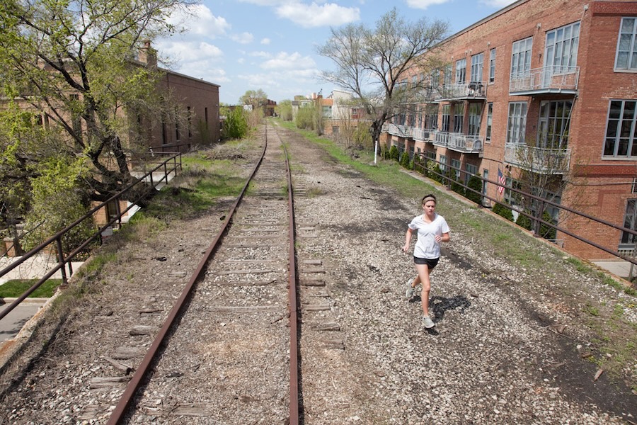
The group’s members, as well as countless others, had been sneaking onto the 18-foot-high railbed for years despite it being locked behind a fence. “It was a place to just get away from traffic for a little bit and walk undisturbed,” said founding member Ben Helphand. “[That’s] something you can do on the lakeshore, but you could never really do inland. The ability to walk for almost 3 miles without having to cross a street was very exciting for people.”
Eventually, they concluded the experience was too wonderful to keep to themselves. “A few of us thought, ‘Gee, wouldn’t it be nice to share this with more people?’” said Helphand. “Because if you’re in a wheelchair, you can’t go up through the fence. If you’re a little kid, you’re not going to venture up here on your own. We wanted it to be universally accessible and something that everybody could enjoy.”
Thanks in part to the efforts of the new advocacy group and enthusiastic support from city officials, the 2.7-mile Bloomingdale Trail opened in 2015. Running through the Northwest Chicago neighborhoods of Logan Square, Humboldt Park, Bucktown and Wicker Park, it’s one of the longest elevated rail-trails in the world. The trail itself is part of the city’s larger 606 park system (so named for the area’s ZIP code prefix), which also includes four neighborhood parks adjacent to the trail, a space observatory and various art installations.
A New View of Chicago
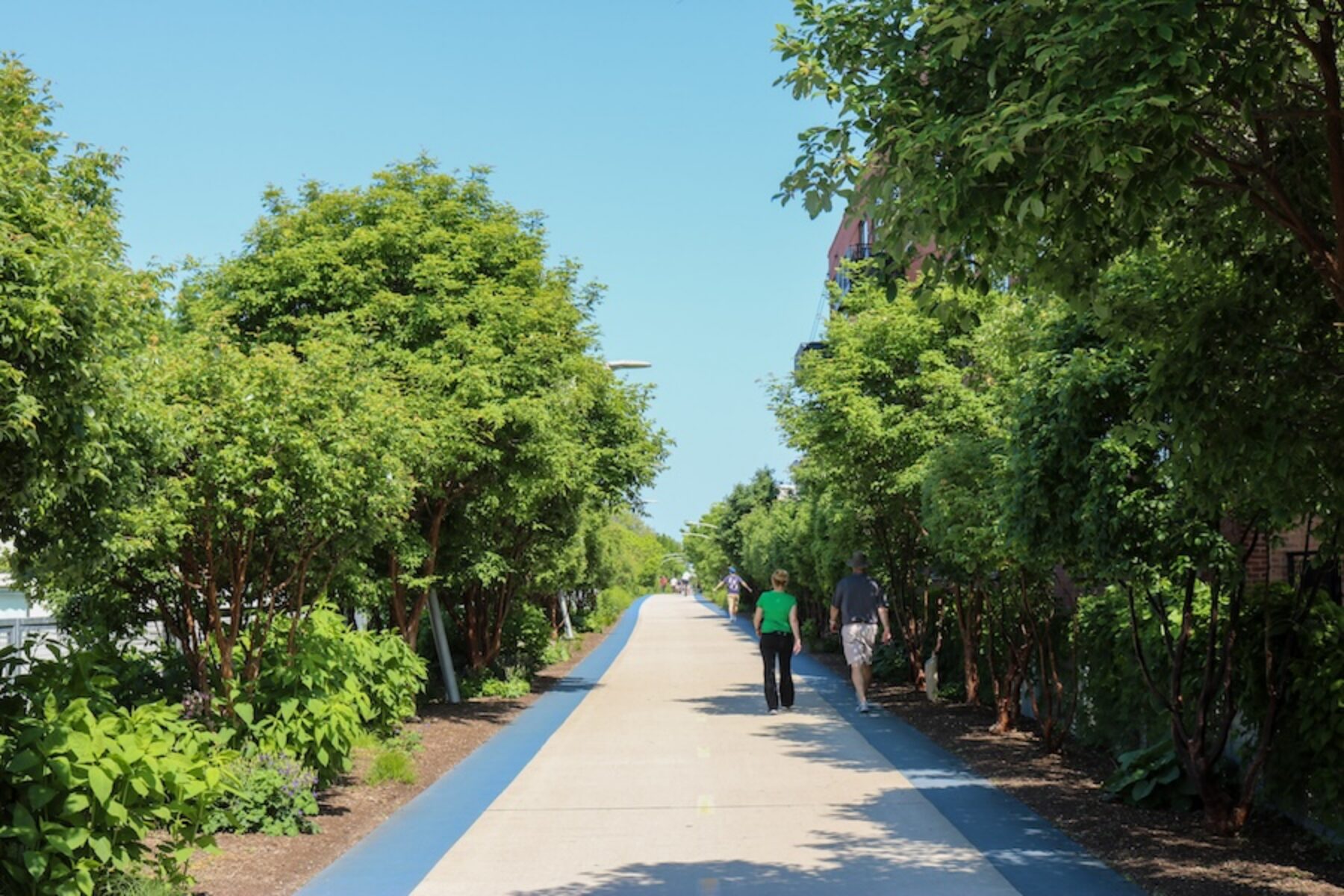
Elevated above the hustle and bustle of the crowded streets of America’s third-biggest city, Bloomingdale Trail users encounter natural plantings, unique architecture and numerous murals created by neighborhood artists—offering an entirely different look at the Windy City, beyond its classic vistas of iconic skyscrapers and Lake Michigan.
One section of the trail is lined by birch trees, creating the feeling that “you’ve traveled an hour out of the city,” said Luke Scaletta, community engagement manager for the Wicker Park Bucktown Chamber of Commerce.
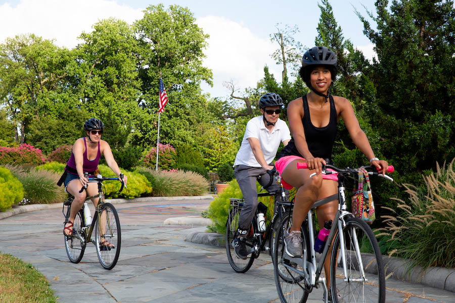
Traversing a former elevated railbed is “sort of a surreal experience,” said Josh Rosen, a longtime resident of the city’s Lincoln Park neighborhood (and this author’s brother). “Just like when you’re on the ‘L’ [Chicago’s rapid transit system], you’re moving in between all of these buildings and neighborhoods.” At the beginning of the COVID-19 pandemic, he regularly biked to the trail and rode it from end to end, a trip of about 10 miles. With so many places in the city shut down, it became something of a lifeline during a deeply challenging time.
Before the trail was constructed, he would visit the small parks next to it with his wife and young kids; after it opened, in 2015, they would regularly walk and ride on the trail on weekends. While these days he doesn’t visit as often as he’d like, he said he appreciates the wide variety of opportunities it offers. “You can go walk on the trail for a bit, then get off a ramp and check out a shop or place to eat.”

Oil painter Tiffany Stronsky’s studio is located in the Kimball Arts Center, a former industrial building at the nexus of the Logan Square and Humboldt Park neighborhoods just feet from the trail. This proximity was an important reason she decided to relocate her studio to the building, which is home to several dozen tenants including entrepreneurs, artists, retailers and therapists. She said several of her works of abstract expressionism are directly inspired by photos she’s taken on the trail.
Apart from the trail’s artistic benefits, she believes it has helped more people discover Logan Square and Humboldt Park. Located several miles west of Chicago’s downtown and its world-famous attractions, these neighborhoods have historically been overlooked—though that’s been changing, thanks in part to the trail.
In fact, the trail is considered such an attractive amenity that it’s become a centerpiece of the Wicker Park Bucktown Chamber of Commerce’s marketing efforts. As part of his role, Scaletta is responsible for arranging tours of the neighborhoods for visiting bloggers, journalists and influencers. During each visit, he is sure to take them for a stroll on the trail. He says the section of trail that crosses over N. Damen Avenue is especially favored by visitors for photos and city-watching.
Scaletta said he also frequently visits it during his lunch break to get in a few miles of running, and he often takes his bike on it to avoid rush-hour traffic. He’s not the only one using the trail to bypass the densely packed neighborhoods’ busy thoroughfares. On any given weekday morning or afternoon, said Helphand, groups of students and commuters heading off to school and work can be seen along the trail. There are nearly 25,000 children and more than 20 schools within a 10-minute walk of the route.
Good Timing
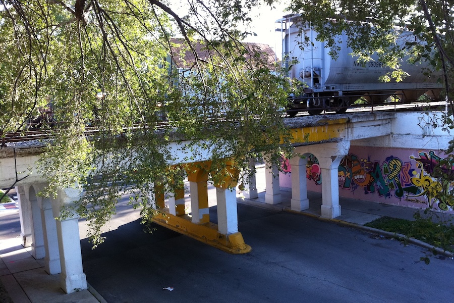
The Friends of the Bloomingdale Trail’s decision to form didn’t come out of thin air. Converting the elevated line to a public space had been on the city’s radar since the late ‘90s, and in 2004, it officially adopted the Logan Square Open Space Plan, essentially a blueprint for increasing public space in the neighborhood. As the plan pointed out, though Logan Square was one of the city’s most densely populated neighborhoods, it had the least amount of open space. It identified 11 opportunities in the neighborhood, including the development of a linear park. This called for negotiating with the most recent owners of the railbed, Canadian Pacific Railway, to purchase it; assessing the safety of the 37 viaducts along the path; and exploring potential funding sources.
In 2007, Friends of the Bloomingdale Trail (an all-volunteer organization) reached out to the Trust for Public Land for help. According to Helphand, the highly respected national nonprofit essentially took the lead on the project, managing collaborations with the city government, the Chicago Park District and the Chicago Department of Transportation. Things seemed to be moving forward at an impressively quick pace, especially considering the amount of coordination and infrastructure work required.
And then, in late 2007, the recession hit. Securing funding suddenly became much more of a challenge. Though the trail had been awarded a $39 million Congestion Mitigation and Air Quality (CMAQ) Improvement Program grant from the Federal Highway Administration—a huge financial and symbolic achievement—the funds couldn’t be released because there weren’t enough matching funds from private donors.
“It was very frustrating as an advocacy group. There was very little we could do,” said Helphand. “What we did do was push what could be pushed so if the trail funding wasn’t moving, we made sure that the access point projects were moving.”
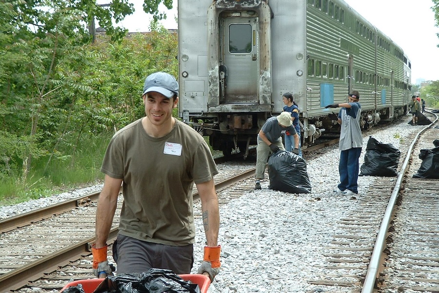
The Friends turned their focus to advocating for Julia de Burgos Park, a half-acre park in Logan Square abutting the rail line. After it opened in 2009, visitors naturally started asking about the conspicuously undeveloped rail line running just above it. Grassroots pressure continued to build. After longtime Chicago Mayor Richard M. Daley stepped down in 2011, the trail became an important enough topic that several mayoral candidates campaigned on completing it (including the eventual winner, Rahm Emanuel).
“My advice to other trail groups is to take victories where you can find them,” said Helphand. “It may not always be a linear process, but you’ve got to keep the ball moving.”
Looking Ahead
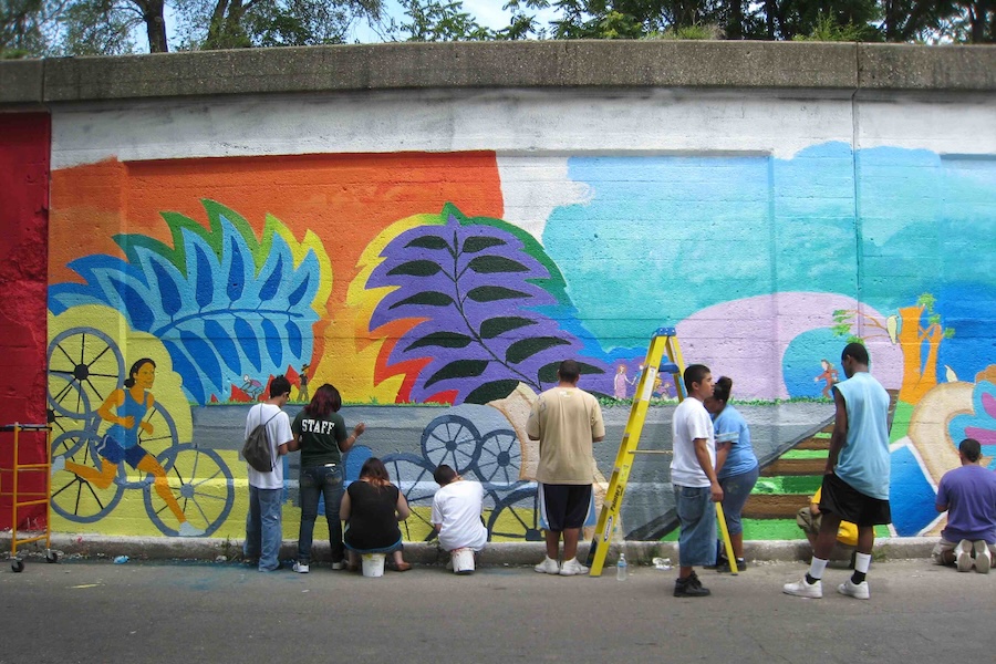
Today, the trail averages roughly 1.2 million users a year. In addition to the typical mix of pedestrians and bicyclists, it’s also not unusual to spot cross-country skiers and snowshoers using the trail after a good snow in the short window before it’s cleared.
But with its increasing popularity, one concern about the trail has been that some longtime residents risk being displaced by newer, wealthier buyers attracted to living in the neighborhoods the trail runs through and the 606 park system. One way the city has tried to address this is by imposing so-called “teardown” surcharges on homebuyers in certain areas near the trail who purchase multiunit residences and either convert them to a single-family home or demolish them and build a single-family home. These fees then go into an affordable housing land trust.
Additionally, in 2025, an 89-unit fully affordable apartment complex called Encuentro Square opened in Logan Square just off the western terminus of the trail. A second phase that will add an additional 98 homes is currently in development.
The city also continues to make strides to further connect the trail for residents. Next year, construction is expected to begin on a key extension east that will take the trail across the busy Ashland Avenue artery, the I-90 and I-94 interstates, and a large railyard. Advocates hope it will position the trail to eventually connect to the Chicago Lakefront Trail, the city’s 19-mile jewel running parallel to Lake Michigan.
A potential new connection on the west end of the Bloomingdale Trail has also been discussed. Called the Crosstown Trail, the project would convert another underutilized elevated rail line running 3.2 miles north-south between Cortland Street and Montrose Avenue into a multiuse pathway.
In addition to its utility as a transportation corridor and citywide connector, the Bloomingdale Trail provides Chicago residents access to deeply appreciated green space and recreational areas. “The feeling of being elevated above the traffic and the noise kind of puts you in a vacation state of mind,” said Stronsky, the oil painter. “I will joke with friends who live in the mountains in Colorado, ‘Well … I’m out in nature.’”
Related Links
Trail Facts
Name: Bloomingdale Trail
Used railroad corridor: Bloomingdale Line
Trail website: Friends of the Bloomingdale Trail
Length: 2.7 miles
County: Cook
Start point/end point: Dead end of N. Ridgeway Ave., 500 feet south of W. Cortland St.; Walsh Park on Ashland Ave.
Surface type: The main pathway is concrete, which is flanked by a rubberized track on either side for runners.
Grade: Flat, with minimal grade; there are 12 ADA-accessible ramps to reach the trail from street level.
Uses: Walking, bicycling, running, inline skating; wheelchair accessible.
Difficulty: The trail is considered easy for most abilities with its flat, paved route.
Getting there: Midway International Airport (5700 S. Cicero Ave.) is located about 10 miles from the trail, while O’hare International Airport (10000 West O’Hare Ave.) is just a touch farther out, about 12 miles from the trail.
Access and parking: While there’s no dedicated parking along the trail, trail users can arrive by train (or bus) at two nearby CTA stations on the Blue Line: Damen (1558 N. Damen Ave.) and Western (1900 N. Western Ave.).
To navigate the area with an interactive GIS map, and to see more photos, user reviews and ratings, plus loads of other trip-planning information, visit TrailLink, the official trail-finder website and app of Rails to Trails Conservancy.
Rentals: There are over a dozen Divvy bike-share docks within two blocks of the Bloomingdale Trail. Additionally, bikes are available for rent at BFF Bikes (2056 N. Damen Ave.; 773.666.5153), 0.4 miles north of the trail.
Donate
Everyone deserves access to safe ways to walk, bike, and be active outdoors.
Related
View All
Children’s Book Inspired by Real Events Shines Light on Community Trail Stewardship
Profile: Accessibility and Safe Streets Advocate Juliette Rizzo