North Dakota’s Roughrider Trail: April 2026 Trail of the Month
With the deep muddy waters of the Missouri River on one side and the fort from which Lt. Col. George A. Custer’s launched the famous 1876 march toward his “Last Stand” on the other, North Dakota’s Roughrider Trail offers a trove of fascinating historical sites interspersed with riverside greenery and Badlands-like bluffs and gullies.
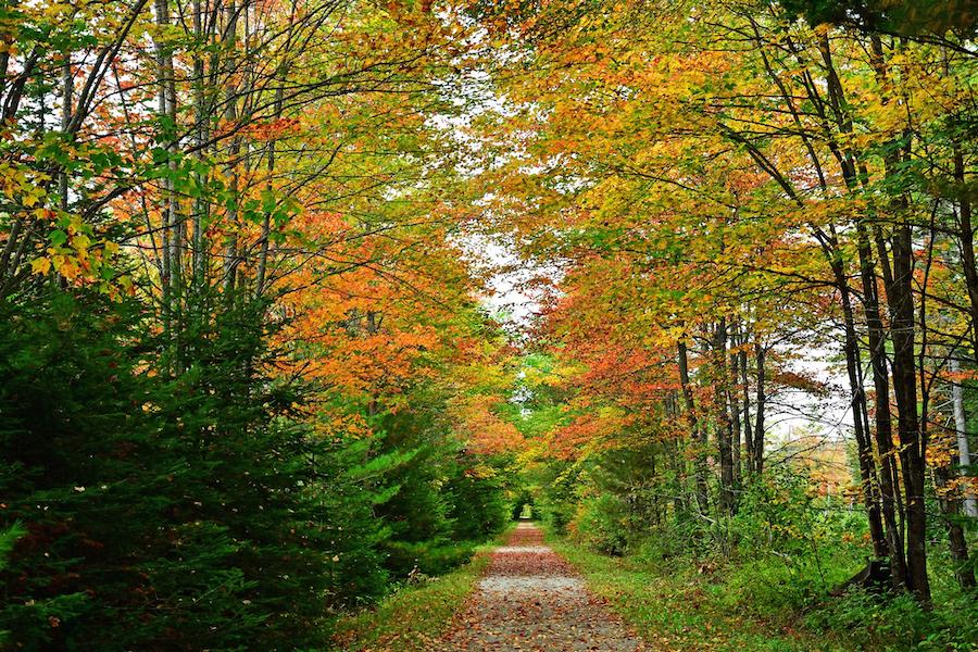
Today, the scene that teemed with wagons, pack mules and infantry companies a century and a half ago has been supplanted by a remote riverside trail that offers a gamut of outdoor activities along its nearly 22-mile journey south of the Bismarck-Mandan area.
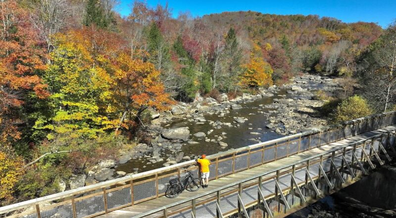
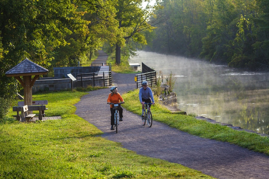
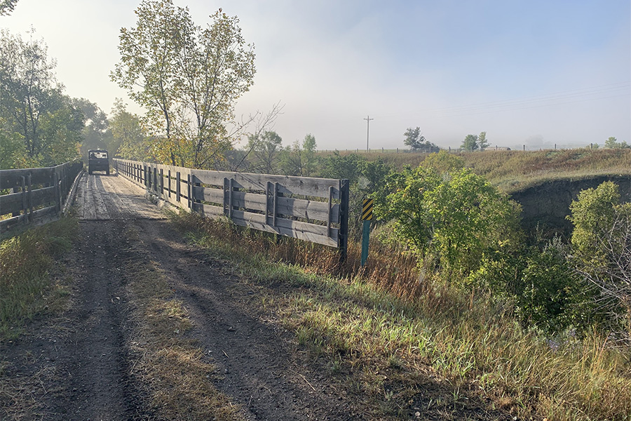
“Just crossing those trestles and looking over the edges is pretty cool,” said Erik Dietrich, manager of the nearby Fort Abraham Lincoln State Park, pointing out that the rail-trail features several historical railroad bridges, which provide vantage points for riverside views. As they cross the bridges, trail users might also catch glimpses of beavers that live under the structures; deer, pheasant and muskrats are also regular sights along the way.
“In North Dakota, we love the access we have to the outdoors,” said Tony Hillig, North Dakota’s recreation chief. “This trail provides us that connection to the outdoors, so we can have those experiences, and have these healthy communities.”
Steeped in History
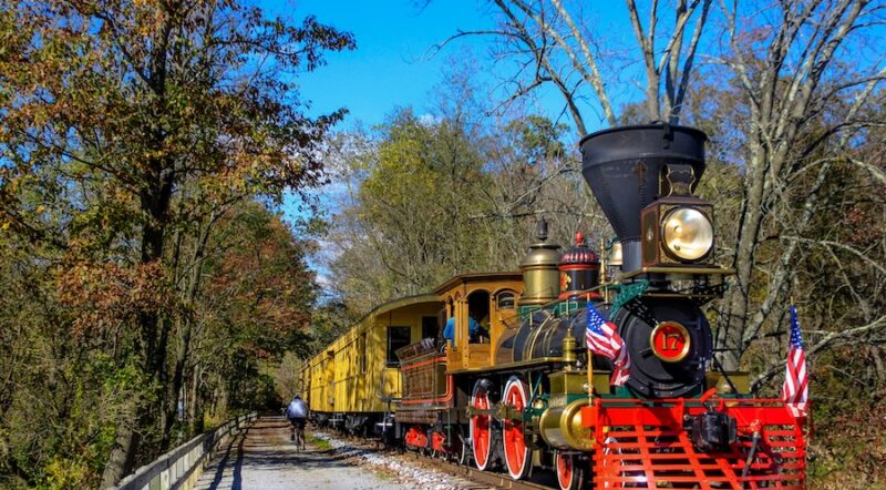
Bracketed by two 1870s-era forts and following the route of a Northern Pacific Railroad line that transported settlers to the West, the Roughrider Trail also has numerous connections to history. Even its name is linked to President Theodore Roosevelt, who famously spent about four years ranching in the Badlands of western North Dakota in the 1880s. Later, he formed the Rough Riders Cavalry Unit in the Spanish-American War.
But the Roughrider Trail is perhaps best known for its connection to Lt. Col. (formerly General) George Custer, whose 7th Cavalry departed here on May 17, 1876, for its fateful encounter with the Lakota Sioux, Northern Cheyenne and Arapaho people at the Little Bighorn River in Montana.
Much of the trail “follows the corridor or route of the original military stage road that connected Fort Abraham Lincoln to Fort Rice,” said Austin Glant, an interpreter at Fort Abraham Lincoln State Park. He added that the two forts would likely have been sending mail couriers back and forth on the route, along with military patrols and supplies.
“[The corridor] was probably frequented by General George Custer, because he was stationed at both forts,” said Mike Jensen, North Dakota Tourism’s outdoor recreation manager. “So, it’s a very historic trail and a very scenic trail.”
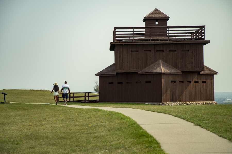
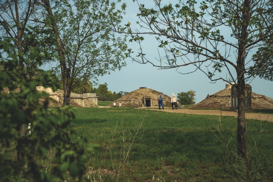
Centuries before the 7th Cavalry’s arrival, the indigenous Mandan people made their home along the river. Prehistoric remains of those early abodes can be explored, both at the Fort Abraham Lincoln State Park’s reconstructed On-A-Slant Mandan Village, once 1,500-people strong, and at the Huff Indian Village State Historic Site, located at about the trail’s midpoint.
And about seven decades before Custer’s time in the region, explorers Meriwether Lewis and William Clark traveled through this part of Dakota Territory during their Corps of Discovery expedition, first in 1804 and then again on the expedition’s trip back to St. Louis in 1806. The expedition is recorded to have stopped to camp in the area three times. In fact, the north-south highway that roughly parallels the Roughrider Trail on the west side of the Missouri River is named Highway 1806, in commemoration of Lewis and Clark’s trek home, while on the eastern side of the river, Highway 1804 commemorates the explorers’ trip toward the Pacific.
Filling a Recreational Need
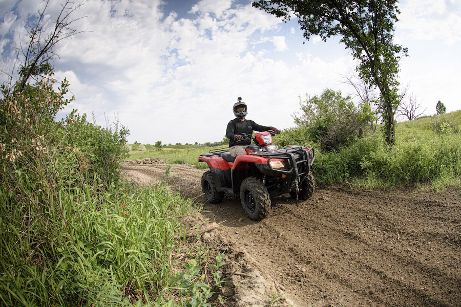
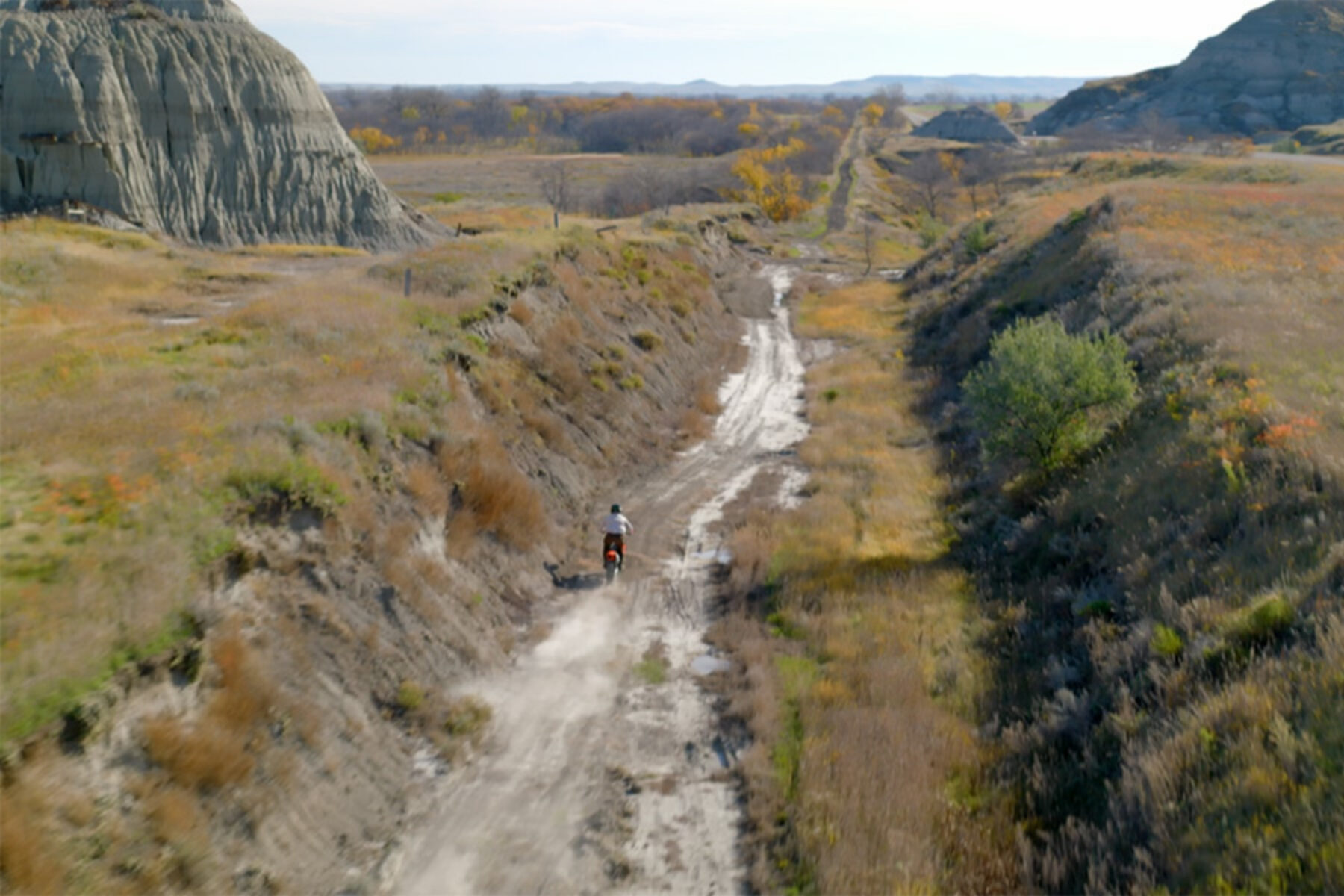
Trail counters indicate that the Roughrider Trail averages about 2,000 off-highway vehicle (OHV) users during its main season from May to October, and it’s estimated that the trail sees an additional 500 hikers, mountain bikers and equestrians each year. And while OHVs are not a typical use on most rail-trails around the country, North Dakota officials say the Roughrider Trail meets the unique needs of the region.
Interestingly, when the corridor was first developed for recreation, it initially served another type of motorized vehicle use: snowmobiles. “The railroad line was deeded over to the DOT [Department of Transportation] in the mid-1970s, and then it was deeded to North Dakota Parks and Rec in 1979 and converted into the Roughrider Trail,” Dietrich explained.
In the early 2000s, the State Parks Department used Recreational Trails Program funding to convert the route into an OHV trail. This crucial federal funding stream supports the development of trails and their ongoing maintenance via a fuel tax paid by motorized recreationists, such as snowmobilers and OHV users, but both motorized and nonmotorized trail needs are supported through the program’s grants.
“This is a multiuse trail, and you’ll see bikers, hikers, equestrians and off-highway vehicles all sharing this trail,” said Hillig, noting that the uses are fairly compatible and that signs are posted at the trailheads to remind people about which users have the right-of-way, with equestrians taking precedence, followed by hikers, bikers and OHV users. Snowmobilers also still use the trail in winter, although the region experienced little snow this past year.
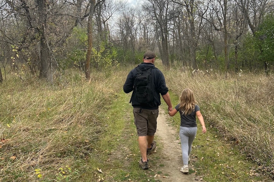
While the rail-trail is relatively flat, its surface is a mixture of dirt and gravel, and local cyclist and manager of Bismarck’s 701 Cycle and Sport Jared Fuchs recommends that cyclists opt for bikes that are appropriate for gravel riding. Hikers looking for more elevation changes could also head to the trail system that is available in Fort Abraham Lincoln State Park, recommended Jensen. “We have really good nonmotorized trails in the park.”
A number of other recreational activities are also available along and near the trail, including multiple campgrounds, fishing spots and the Little Heart Rifle Range.
A Culture of Outdoor Recreation
In 2024, North Dakota joined nearly a dozen other states in establishing a dedicated Office of Outdoor Recreation, as outdoor recreation continues to be a major driver of the state’s economy, contributing $1.3 billion annually.
Hillig noted that his department sees regular requests for recreation opportunities of all sorts. “There is a consistent and constant demand for that, and we’re always trying to find how to create that access for people to enjoy those opportunities—whether it’s hunting or fishing or just general recreation.”
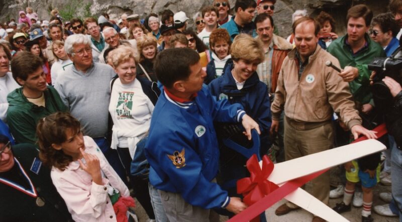
In May 2025, a 5-mile extension of the trail was celebrated, which continued the trail from its southern end to the Fort Rice campground. Dietrich said an important improvement that was part of the project was the addition of a gravel parking lot on the south end of Fort Abraham Lincoln State Park, which allows for trailer and vehicle parking. The parking area was needed “so people could come with their trailers, park and unload, and then come on the trail to head south,” Dietrich said, adding that before that, OHV users were left to park farther south and ended up driving on the road to get to the trail. “This kind of connects that,” he noted.
The improvements were made possible through the cross-collaboration of a number of departments and agencies, including the North Dakota Parks and Recreation Department, the North Dakota Game and Fish Department, Morton County Parks, the State Historical Society and private business partners.
At the trail’s recent ribbon-cutting, Gov. Kelly Armstrong told the crowd, “This expansion gives families more ways to enjoy North Dakota’s natural beauty,” according to a press release about the event. “And it’s about growing something even more important: a culture of outdoor recreation and tourism that fuels our economy and enhances our quality of life.”
Jensen said the state’s goal is to provide recreational amenities for locals to enjoy, as well as tourists. “That’s one of the things the governor is talking about—he wants to have these amenities for both residents and non-residents to use.”
Related Links
- North Dakota Parks and Recreation OHV Trails
- Abraham Lincoln State Park
- Fort Rice State Historic Site
Trail Facts
Name: Roughrider Trail
Used railroad corridor: Northern Pacific Railroad
Trail website: Roughrider Trail
Length: 21.8 miles
County: Morton
Start point/end point: From the southern end of Fort Abraham Lincoln State Park (Mandan) to the Fort Rice Campground at Fort Rice State Historic Site (Mandan)
Surface type: Dirt, gravel
Grade: Overall, the rail-trail is fairly flat, with short stretches of steep climbs of 10% to 15% located roughly 3 miles north of the Huff Indian Village Historic Site.
Uses: Walking, mountain biking, horseback riding, fishing, OHV use and snowmobiling
Difficulty: Moderate
Getting there: Bismarck Airport (2301 University Drive SW) is the closest facility, about 17 miles from the northern trailhead of the Roughrider Trail at Fort Abraham Lincoln State Park (4480 Fort Lincoln Road, Mandan). Several airlines, including Delta, United, American, Sun Country and Allegiant, provide regular flights into and out of Bismarck.
Access and parking: The northern trailhead at Fort Lincoln State Park (4480 Fort Lincoln Road, Mandan) offers parking spaces for OHV trailers and vehicles. Additional parking is available on the southern end of the trail at the Fort Rice Historic Site (830 Campground St., Mandan).
To navigate the area with an interactive GIS map, and to see more photos, user reviews and ratings, plus loads of other trip-planning information, visit TrailLink™, RTC’s free trail-finder website.
Rentals: In nearby Bismarck, about 12 miles from the northern trailhead, 701 Cycle and Sport (411 Fraine Barracks Road, Bismarck) offers a range of options for fat-tire bike rentals.

Donate
Everyone deserves access to safe ways to walk, bike, and be active outdoors.