Top 10 Trails in California
From a temperate rainforest to an arid desert, California offers a climate for just about everyone. And whether you feel at home along the beach or among the mountains, our country’s most populous state probably has a trail experience tailored for you. Here are 10 of our Golden State favorites.
Bizz Johnson National Recreation Trail
County: Lassen
No list of California trails would be complete without the Bizz Johnson National Recreation Trail, among the state’s most scenic rail-trails and a 2008 inductee into the Rail-Trail Hall of Fame. The 25-mile-long dirt and gravel trail follows the Susan River Canyon through pine forest between Susanville and Westwood across 12 bridges and through three tunnels. The historical train depot at Susanville, which serves as the eastern trailhead, is a favorite of railway history buffs. Be aware of equestrians that you may share the way with, and be sure to bring water for the trip. Consider an autumn visit when the trail is particularly vibrant and you can soak up the colorful scenery. The snow-covered trail later in the year brings out fat-tired mountain bikers and cross-country skiers.
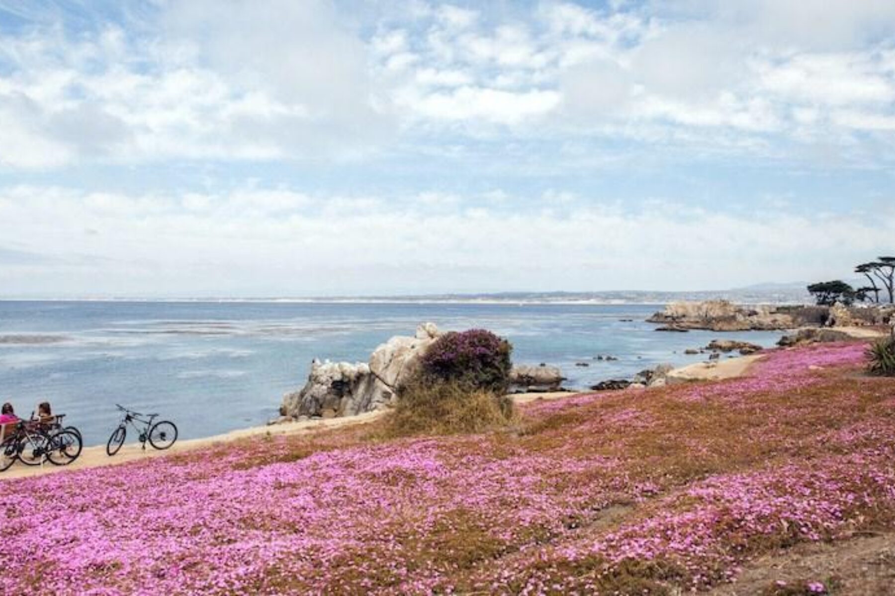
Monterey Bay Coastal Recreation Trail
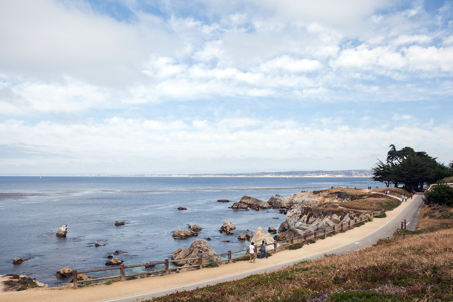
County: Monterey
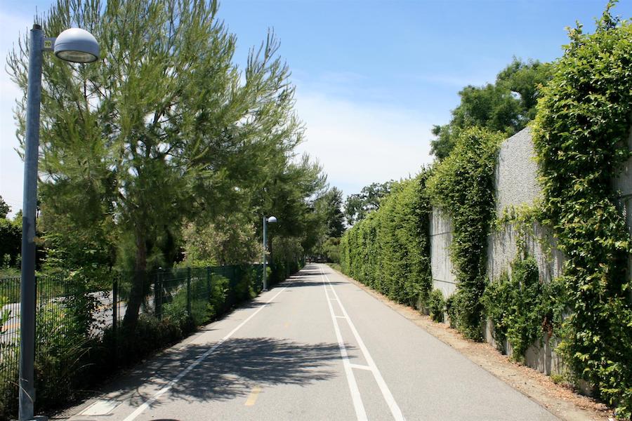
Ocean lovers—this trail is for you! Following the former route of the Southern Pacific Railroad, the southern half of the Monterey Bay Coastal Recreation Trail hugs its namesake bay so closely that waves occasionally wash over it in places. Offering access to sandy beaches, parks, fishing piers and marinas, this 18-mile paved trail also provides ample opportunities for wildlife viewing: sea lions basking on the rocky shoreline, whales in the distance, and plenty of Californians biking, skating and walking the trail with you. Shops along the way rent kayaks and paddle boards for the surf, and bikes and surreys (canopied quadricycles capable of seating up to six people) for the turf. You’ll also pass the renowned Fisherman’s Wharf and world-class Monterey Bay Aquarium.
Bayshore Bikeway
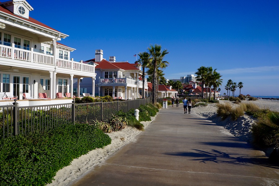
County: San Diego
Wrapping nearly 270 degrees around San Diego Bay, the Bayshore Bikeway may be the perfect way to take in the southern California sunshine. Paved, smooth and almost entirely flat, the trail’s 17 miles offer views of downtown San Diego as well as a straight stretch along Silver Strand State Beach with the Pacific Ocean on one side and the bay on the other. Military buffs may enjoy seeing amphibious hovercraft skimming across the bay or Harrier jets going to or from the U.S. Naval Amphibious Base where Navy SEALs train. You’ll also pass by the famed sloping red roof of the Hotel del Coronado. Note that the trail is on the roadway in parts, and the coastal leg can be particularly windy in the afternoon.
Crystal Springs Regional Trail
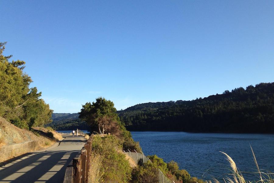
County: San Mateo
The Crystal Springs Regional Trail is a pathway in distinct portions located on the San Francisco Peninsula; it recently closed a major gap near the two artificial lakes that make up the Crystal Springs Reservoir, and in the process connected to a trail that rides atop the dam separating the two bodies of water. In parts asphalt and dirt, the trail follows the path of an old wagon route between Half Moon Bay and the City by the Bay. With impressive scenery and a rich history, the Sawyer Camp segment of the trail near San Andreas Lake is the most popular trail in San Mateo County’s park system.
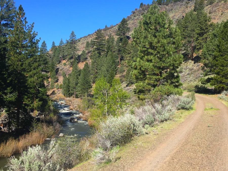
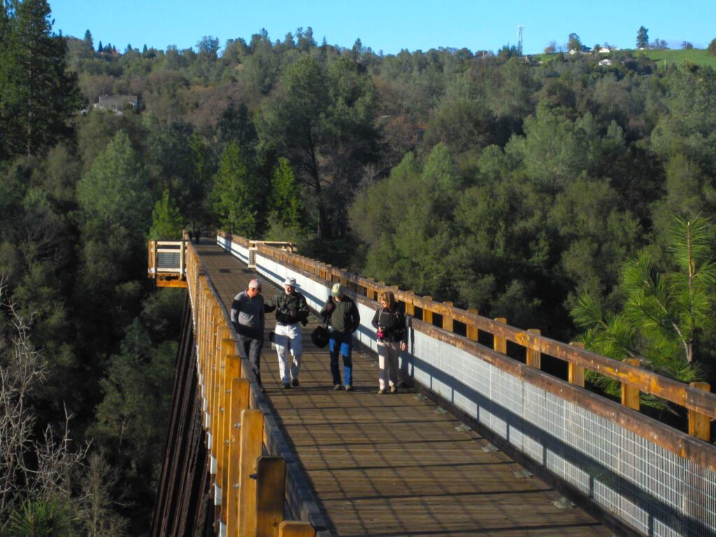
Merced River Trail
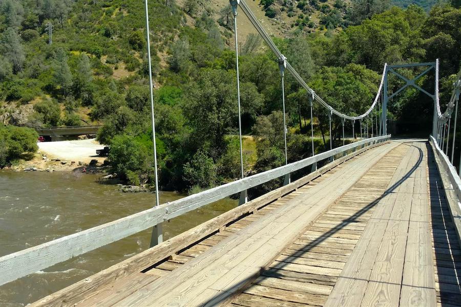
County: Mariposa
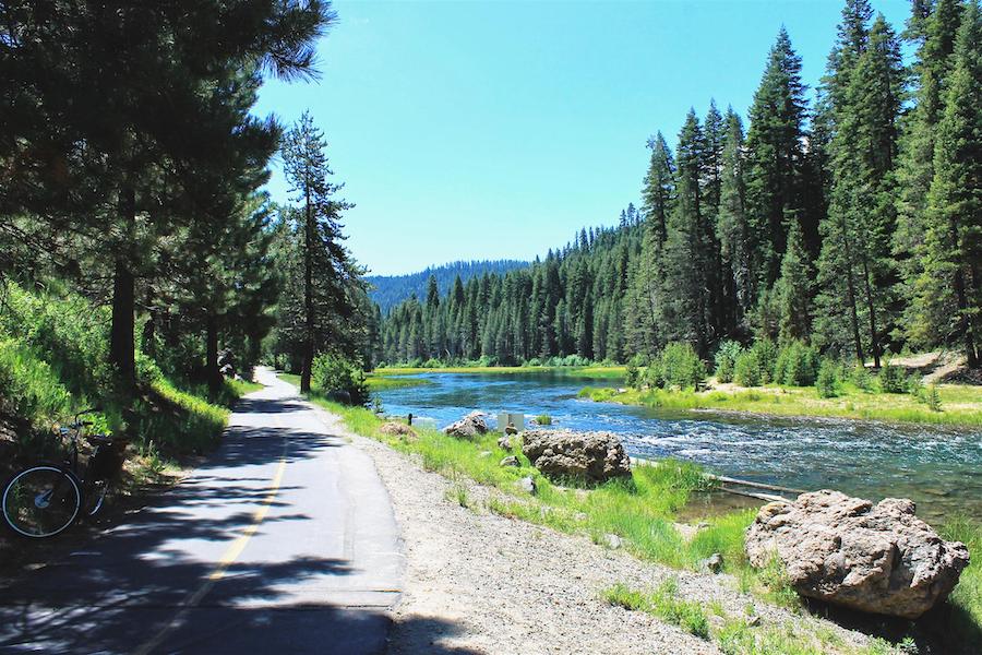
Ungroomed, mostly dirt and somewhat wild, the Merced River Trail is perfect for those on foot, horseback or mountain bike that want to get away from (most of) it all. The trail follows its namesake river between the towns of Bagby and Briceburg west of Yosemite National Park. The area erupts with colorful wildflowers in the spring, and the river is popular with whitewater rafters, anglers and even gold-panners. The occasional car making its way to or between three campgrounds and the Briceburg Visitor Center is a near-certain sight as you’ll share a road for about half the route; a less-certain but still possible encounter is with rattlesnakes that have been spotted in the area. The lack of both shade and amenities can make this trail a challenge, but the rugged scenery along its 13 miles makes it worthwhile.
El Dorado Trail
County: El Dorado
The El Dorado Trail wends 35 miles though the foothills of the Sierra Nevada Mountains east of Sacramento along both paved and natural surfaces best suited for mountain bikes. The trail goes through downtown Placerville, once a stop along the Pony Express route and, toward the end of the California gold rush, the third-largest town in the state. Many historical buildings from this period have survived. The route traces two former rail lines, and while locomotives haven’t rolled along these tracks in more than 30 years, users will occasionally encounter speeders operated by local groups. These pint-sized motorized vehicles were originally used for track maintenance, and while they are speedy compared to a human-powered handcar, they generally don’t outpace brisk bicycling speeds. The track’s railroad ties have been infilled with gravel where speeders are active to make biking easier.
Sacramento River Rail Trail
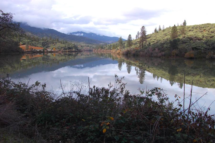
County: Shasta
A dam fine experience awaits trail-goers in northern California along an 11-mile trail sandwiched between two hydroelectric dams. The Sacramento River Rail Trail runs along the banks of the Keswick Reservoir between the upstream Shasta Dam—the eighth tallest in the country—and the much smaller Keswick Dam downstream. The crystal blue waters of the reservoir serve as a near-constant companion as the paved pathway passes through spectacular mountainous scenery amid Bureau of Land Management wilderness. The trail connects with the almost-but-not-quite-the-same-named Sacramento River Trail, which takes travelers to the town of Redding by way of its famed Sundial Bridge. The two trails joined the Hall of Fame together in 2023.
RELATED: California’s Sacramento River Rail Trail and Trail (October 2023)
Orange Line Bike Path
County: Los Angeles
An urban 18-mile asphalt and concrete pathway, the Orange Line Bike Path is a rail-trail running alongside northwest Los Angeles’ Metro Orange Line rapid busway. The path, decorated with native plants and public art, is popular with commuters and recreationalists alike. A top destination is the 80-acre Beilenson Park, home to a range of recreational opportunities from tennis to archery. A Japanese garden and small wildlife reserve add a touch of nature, while swan paddleboats available for rent on Lake Balboa add a little whimsy.
Tahoe Trailways Bike Path
Counties: El Dorado, Placer
Along the western edge of Lake Tahoe is a trail with three distinct personalities. Radiating out from Tahoe City, to the north the Tahoe Trailways Bike Path offers a somewhat more urban feel, paralleling State Route 28 as it heads to Dollar Point, passing a short waterfront promenade, lake overlooks, restaurants and accommodations. To the west, the trail, also called the Truckee River Bike Trail, follows its eponymous river along a former railroad corridor to the Squaw Valley Ski Resort, host of the 1960 Winter Olympics. Trout fishing and rafting are both popular in the river. To the south, the trail parallels a roadway past homes that back up to the lake before ending at Sugar Pine Point State Park, where one can hike, swim, camp and fish. More than 19 miles altogether, all portions of the trail are paved.
Modoc Line Rail Trail
Counties: Lassen, Modoc
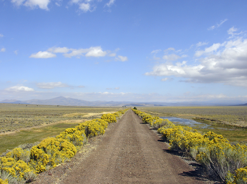
Many of our top California trails are either seaside or urban, so for our last pick, we’ve included a very different side of the state—quite literally. Running along the eastern edge of the state, the Modoc Line Rail Trail offers an immersion into remote, high-desert rangeland. The rail route it follows was once the NCO Line, which was only half-jokingly referred to as the “narrow, crooked, and ornery.” Fittingly, the trail is often rough going with a ballast and gravel surface. Three sections of this still-developing trail are considered complete, although even the gaps between the finished sections are passable for the determined (with the exception of a small segment between Highway 395 and Karlo Road). When complete, the unbroken trail will be 85 miles long. The most scenic leg is the 13-mile Snowstorm Canyon segment between two old railway stations, Crest and Karlo, which are no longer in use. Cellphone coverage is spotty, and there are no facilities along the way, so bring the supplies you’ll need. Be aware that the trail is open to equestrians and off-road vehicles, though motorized vehicles are somewhat rare.
Related: As California ATP Cycle 5 Kicks Off—Here’s a Snapshot of Some Success Stories
This blog has been updated from its original 2013 version. Special acknowledgment: Ben Kaufman, Trail Development Manager, RTC Western Regional Office
The Bay Area Trails Collaborative is working to create a world-class 2,700-mile regional trail network across nine counties in the Bay Area. This includes transformative projects like the San Francisco Bay Trail, which will eventually wrap around the entire Bay and pass through 47 cities. Once complete, the interconnected trail system will serve as an active transportation and recreation corridor for the 7 million people living and working in the Bay Area.


Donate
Everyone deserves access to safe ways to walk, bike, and be active outdoors.


