New Mexico’s Canyon Rim Trail
Trail of the Month: Dec. 2020
“The trail system plays a big part of providing transportation options as part of a healthy lifestyle.”
—Eric Martinez, the county engineer for Los Alamos
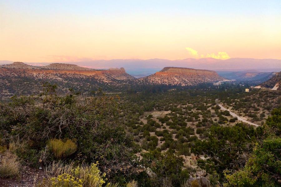
New Mexico’s smallest county is also its healthiest. This fall, U.S. News released its annual rankings of the Healthiest Communities in the U.S., and Los Alamos County, covering just 109 square miles tucked into the mountains on the northern end of the state, was at the top of the list. Undoubtably, some of this vitality springs from the community’s spectacular setting atop a high-desert plateau surrounded by rugged terrain and a national forest. This place of big views and big mammals—black bears, mountain lions, elk and bighorn sheep—provides an irresistible pull to the outdoors.
“We call this area the ‘vertical mile of diversity’ because you’re going from around 5,500 feet in elevation down at the Rio Grande, which is one edge of our county, up to the Jemez Mountains at about 10,000 feet,” said Beth Cortright, the adventure programs manager for the county’s Pajarito Environmental Education Center (PEEC). “That makes it about a mile from the piñon juniper and drier areas in the river valley up to the ponderosa pines and the lusher forests of the Jemez, so we have a really wide variety in the ecology—from the plants to the animals to the geology.”
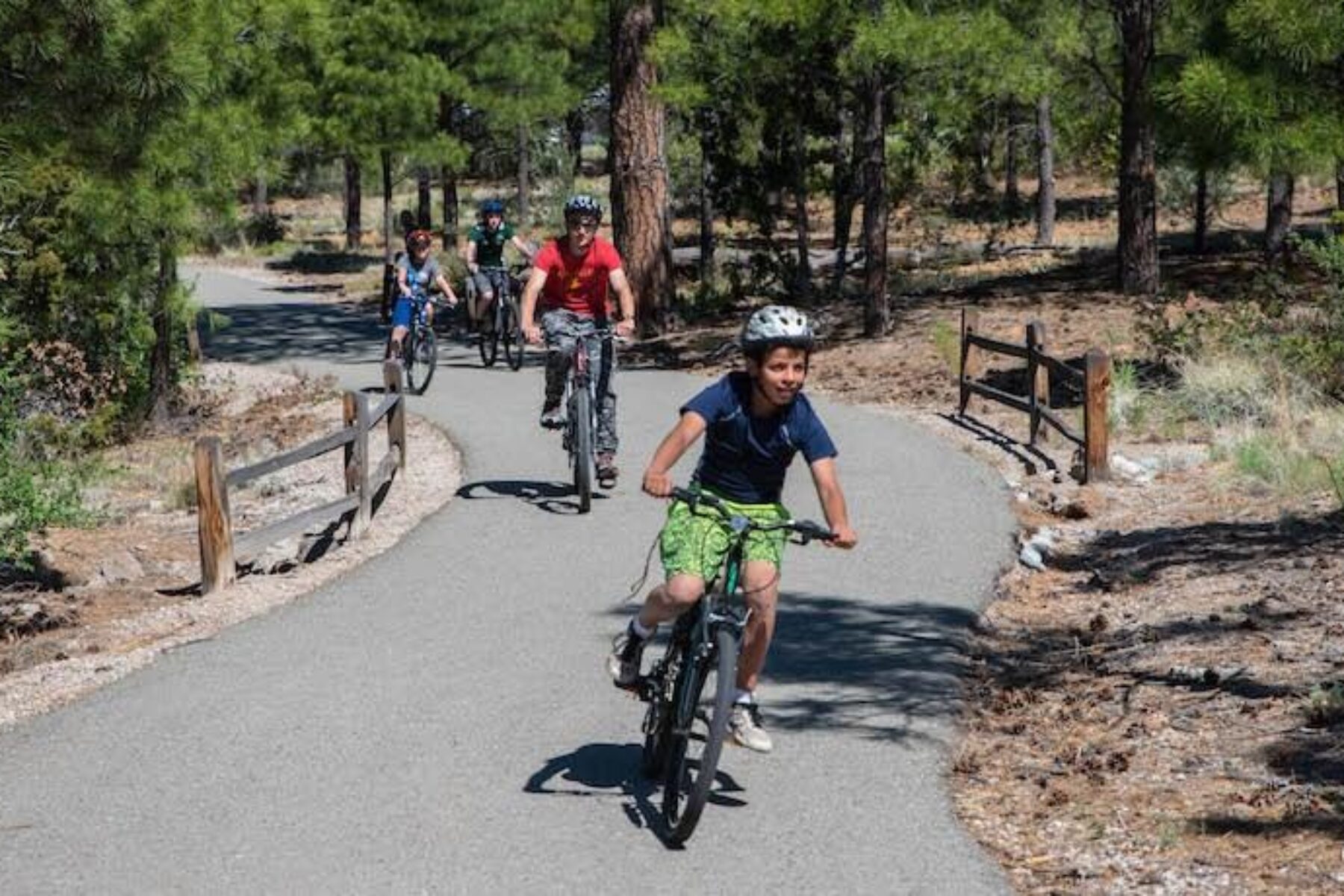
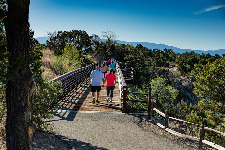
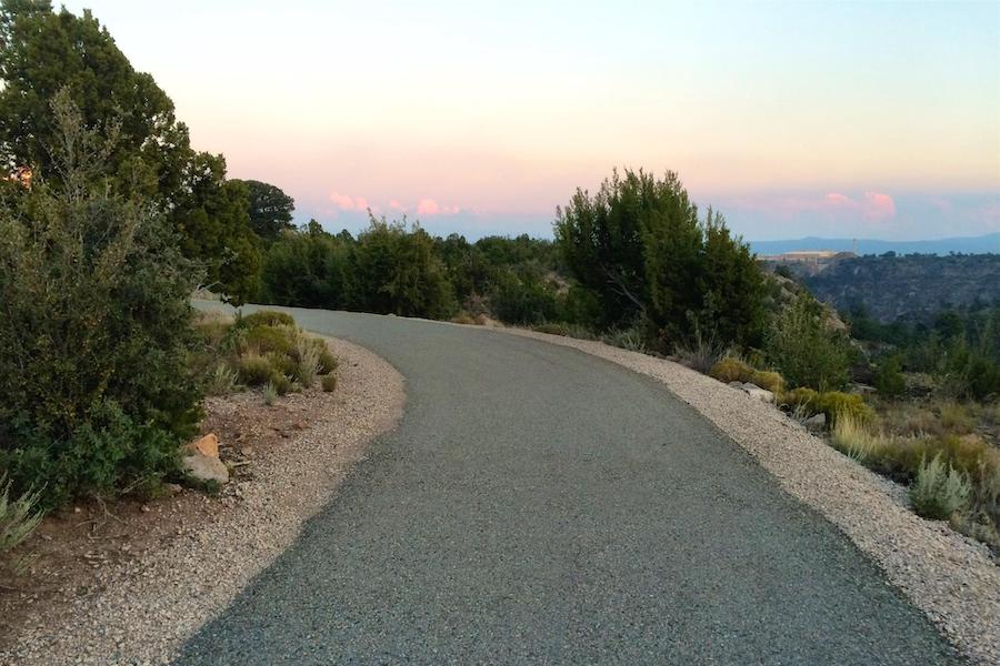
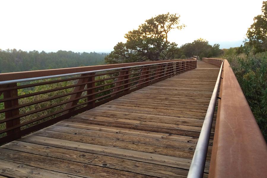
The slogan of Los Alamos County is “where discoveries are made”—a reference to the groundbreaking Manhattan Project housed here during World War II, but which can bring new meaning in the modern era in light of the county’s nearly 60-mile trail system that allows residents to truly uncover the natural beauty all around them. With a trailhead within a few minutes’ walk from every school in the county, these discoveries are within reach of even the littlest explorers. One of the most popular pathways, the Canyon Rim Trail, provides an easy—and easy to reach—option in the heart of the community, packing a lot of wonder into its 2.5 miles.
“One of the great things about the Canyon Rim Trail is that it’s one of our few trails that’s paved,” noted Cortright. “It brings you from downtown Los Alamos to the side of a mesa, so you get these amazing views into the canyon and across the valley toward Santa Fe and the Sangre de Cristo Mountains.”
Land of Enchantment
Only about a mile from the Canyon Rim Trail, a visit to the Los Alamos Nature Center is a not-to-miss (and free) experience. With its interactive exhibits, a wildlife observation room, indoor and outdoor play areas, and a full-dome planetarium, this is the place to learn about what makes the county so special. Nature walks, birding opportunities, wildflower tours and a “passport” program to encourage travel to local trails—by taking rubbings of metal plates at trailheads—are among a slate of activities (in non-pandemic times) aimed at connecting people with this enchanting environment.
PEEC, the group that administers the nature center, also takes an active role in rallying the community for trail clean-ups, tree plantings and other volunteer efforts that enhance the quality of life here.
“PEEC has a huge reach,” enthused Cortright. “Everybody in the region knows of PEEC and that, if something’s going on, we’re probably involved. We try to have jobs for all ages. We actually had a 5-year-old last fall planting seedlings that were almost the size of her!”
That volunteer spirit goes back decades. A citizen’s group first proposed the Canyon Rim Trail in the 1990s, and the project really got traction in the 2009 when the Los Alamos County Council approved funding for its first phase. The pathway, paralleling and offering an alternative to State Route 502, the community’s main thoroughfare, opened the following year. Proving popular, plans for its expansion were detailed in the Canyon Rim Trail Master Plan adopted by the County Council in 2011 and largely complete today, buoyed by federal funding sources such as Transportation Alternatives grants.
“Over the last five years, we have received at least $8 million in federal grants for our trail system,” said Eric Martinez, the county engineer for Los Alamos. “We’re in a fortunate place right now, where we have applied for and received a lot of federal funding that we can invest into our trail infrastructure, and we’re looking forward to continuing that momentum.”
On the Edge of Greatness
The Los Alamos County Council is all in with their support of the grassroots enthusiasm for trails. Their guiding Strategic Leadership Plan includes maintaining and improving recreational amenities, and expanding transportation and mobility options, as top priorities—issues in which trails play a key role.
“We just finished a community survey and found that 86% of our population rated us very high with respect to availability of paths and walking trails,” said Sara Scott, the council chair for the Los Alamos County Council. “It’s an important quality-of-life issue for our community.”
On the heels of their 2017 Bicycle Transportation Plan, Los Alamos County was designated as a Bronze Level Bicycle Friendly Community by the League of American Bicyclists, a distinction they hope to top with a Silver Award in the coming years. The recognition means that the 12,000-person community now rubs elbows with much larger awardees in the state, such as Albuquerque and Santa Fe.
“When we adopted the bicycle transportation plan, quality of life and mobility were key goals that were identified,” affirmed Martinez. “The trail system plays a big part of providing transportation options as part of a healthy lifestyle; it was an important piece of the overall transportation puzzle.”
Next in the county’s sights is the development of the Urban Trail, which will run through Los Alamos’ core. A planned connection between the new trail and the west end of the Canyon Rim Trail will serve to further enhance the latter’s standing as an important commuting route in addition to its value as a beloved recreational outlet.
“The area where the Canyon Rim Trail will extend to, Trinity Drive and 20th Street, that’s an intersection that’s slated to get a traffic signal soon, which will facilitate that connection to the start of the Urban Trail that goes into our downtown area,” said Martinez. “It will link residential, commercial and recreation areas to provide a true transportation corridor.”
Another key improvement for the Canyon Rim Trail is also underway on its east end near Entrada Business Park: a tunnel under busy State Route 502.
“During rush hour, Los Alamos is known to get 2,000–3,000 cars a day coming up the hill for work,” explained Eric Peterson, the county’s open space specialist. “There would always be folks standing along the side of the road trying to run across to get to the trailhead. If we put in this underpass, it will provide a safe crossing for trail users to get under the main road to Los Alamos and connect into the trail network. The project is currently going out to bid, and we are funded to do that work.”
In this strong outdoor culture and community that Cortright calls “extremely environmentally conscious,” the Canyon Rim Trail is well integrated into life and is only getting more so. Known for its spectacular views, the trail’s future looks bright, too.
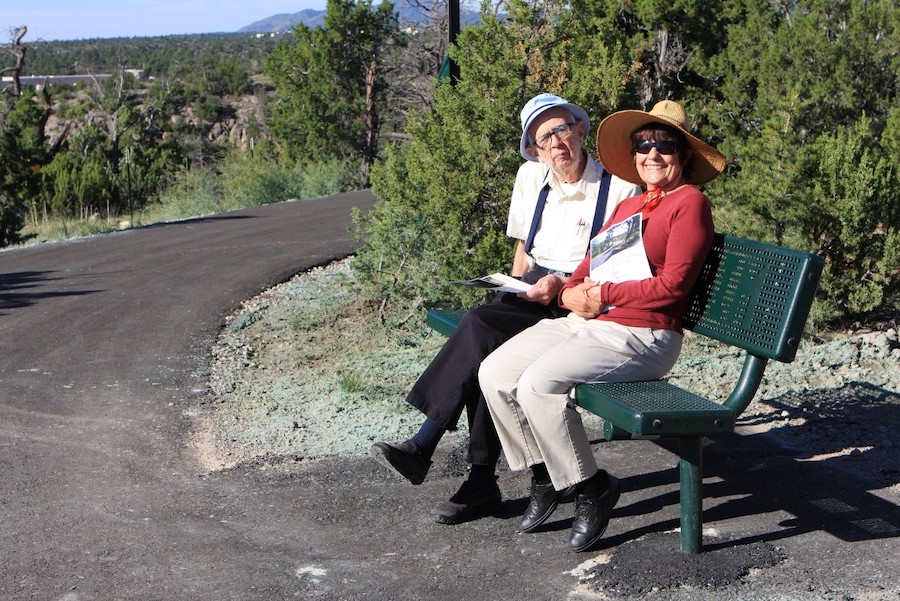
“I walked the Canyon Rim Trail just yesterday,” said Scott. “I like that you see every kind of community member out there: folks with kids and strollers, people running and biking—all ages and abilities. I had an out-of-town visitor that was in a wheelchair, and we were able to go out there and enjoy the great views of the canyon and the fresh air and sunshine. And it’s really exciting that it’s going to go further into town and to the Urban Trail. I think that was fantastic thinking in terms of how to take something that’s really special and continue giving it another important role in the community.”
Related Links
- Los Alamos County
- Pajarito Environmental Education Center
- Discover Los Alamos
Trail Facts
Name: Canyon Rim Trail
Trail website: Los Alamos County
Length: 2.5 miles
County: Los Alamos
Start point/end point: The Canyon Rim Trail begins south of downtown Los Alamos at the dead-end of Knecht Street, a block south of SR 502/Trinity Drive. From there, the trail parallels the southside of SR 502 heading east for 2.5 miles to its end at the Canyon Rim Trailhead across from the Los Alamos Cooperative Market (95 Entrada Dr.).
Surface type: Asphalt
Difficulty: The trail is short and paved, offering an easy, family-friendly walk or bike ride. However, note that there are no drinking water stations along the trail, so travelers should bring water with them.
Grade: The trail is relatively level and ADA compliant, but note that the town itself is at an elevation of about 7,320 feet, so the experience can feel challenging if one is not acclimated to the altitude.
Uses: Walking, biking and inline skating; wheelchair accessible. In winter, the trail is plowed for year-round use.
Getting there: The closest commercial airport is the Santa Fe Regional Airport (121 Aviation Dr., Santa Fe), about 40 miles from downtown Los Alamos.
Access and parking: The main trailhead and parking lot is found at the eastern terminus of the Canyon Rim Trail, across SR 502 from the Los Alamos Cooperative Market (95 Entrada Dr.). Near the west end of the trail, parking is also available in East Park (300 East Road); from the park, reach the Canyon Rim Trail by crossing SR 502.
To navigate the area with an interactive GIS map, and to see more photos, user reviews and ratings, plus loads of other trip-planning information, visit TrailLink.com, RTC’s free trail-finder website.
Rentals: Although there isn’t a bike rental shop in town, the Pajarito Mountain Ski Area (397 Camp May Road; 505.662.5725), about 8 miles west of downtown Los Alamos, offers mountain bike rentals.


Donate
Everyone deserves access to safe ways to walk, bike, and be active outdoors.


