Skip to content

Focus Term: Design


resource
Accessibility Toolkit for Land Managers
October 01, 2020
The Accessibility Toolkit for Land Managers is an informative document meant to help land managers design and maintain with equity and inclusion as a priority. The toolkit dives into what equity and access look like, who we’re talking about with examples of demographics, commonly used equipment, and desired recreation. We discuss shifting the lens and […]
resource
Montgomery County Trail Access, Diversity and Awareness Plan
August 01, 2020
The Montgomery County Trail Access, Diversity and Awareness Plan provides detailed descriptions of the Schuylkill River Trail in Norristown and Pottstown, as well as the portion of the Pennypack Trail located in Montgomery County, PA. Analyzing how a trail looks and functions is the first step to determining which factors may prevent people from using a trail. This […]
resource
MnDOT Bikeway Facility Design Manual
February 01, 2020
The purpose of the Minnesota Bikeway Facility Design Manual is to provide engineers, planners, and designers with a primary source to implement the Minnesota Department of Transportation (MnDOT’s) vision and mission for bicycle transportation in Minnesota. This manual also provides citizens, developers, and others involved in the transportation planning process, guidance on the critical design […]
Blog
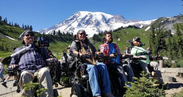
A Serious Injury Changed Cyclist Ian Mackay’s Life. Trails Helped Him Rebuild It.
August 27, 2019

A motorized wheelchair powered by sip-and-puff inputs coupled with the ever-improving voice recognition capabilities of a smartphone offered Mackay a degree of independence, and allowed him to get outside without a caregiver at his side at all times.

Ian Mackay, founder of Ian's Ride (second from left), at the foot of Mount Rainier with friends Jesse Collens, Kenny Salvini and Todd Stabelfeldt | Photo by Teena Woodward
Blog
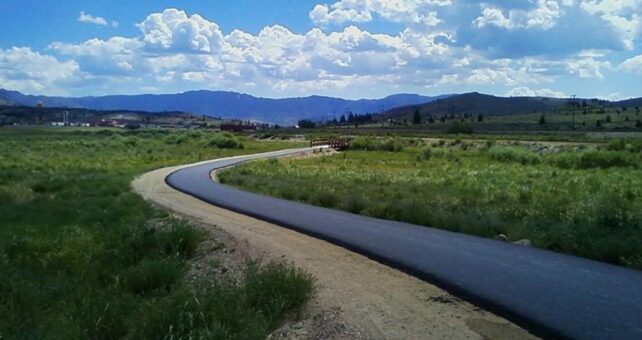
From Toxic Site to Thriving Rail-Trail: Montana’s Silver Bow Creek Greenway
April 20, 2019

By the early 20th century, Butte, Montana, was already being called the richest hill on Earth, an acknowledgement of the nearly inconceivable amounts of ore being mined there. In 1910 alone, 284 million pounds of copper ore were extracted from the Butte area. “Butte electrified America,” said Dori Skrukrud, the community development coordinator for the City-County of Butte-Silver Bow. “Butte provided the metals to win world wars. But it paid a significant price.”

The developing Silver Bow Creek Greenway in Montana is a key player in the tail end of a decades-long environmental restoration effort in the Butte Area. | Courtesy Silver Bow Creek Greenway
Blog
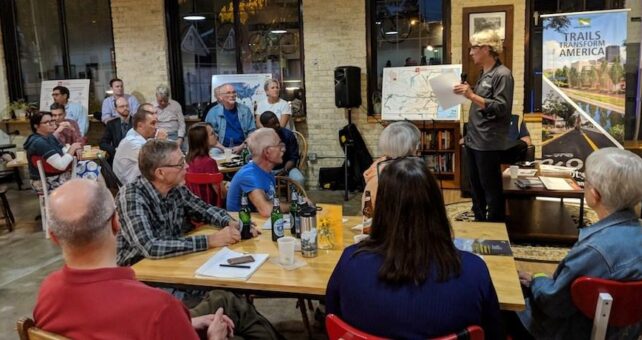
Trail Caucus Kicks Off to Connect Wisconsin as New Projects Build Momentum
October 10, 2018

An active and enthusiastic crowd of trail advocates gathered to kick off the state’s newly formed Legislative Trails Caucus.

Dave Schlabowske, Executive Director of the Wisconsin Bike Fed, discusses the value of building a Trails Caucus | Photo by Brian Housh, courtesy RTC
Blog
1,400-Mile LandLine Plan Is Building Active Transportation Momentum in Boston
August 29, 2018

The LandLine Vision Plan—a newly proposed plan by the Metropolitan Area Planning Council (MAPC) that aims to complete a 1,400-mile connected network of regional trails.

Weekly summer Landline ride at the newly rebuilt trail and boardwalk around the Needham Reservoir in Massachusetts | Photo by David Loutzenheiser
resource
Great Allegheny Passage Graphic Identity & Sign Design Guidelines
August 01, 2018
The Great Allegheny Passage, a truly world-class trail has developed over thirty years, along with of signage that was uncoordinated. Created by the Great Allegheny Passage
Blog
Trail Geek Terminology (A Cheat-Sheet to Satisfy Your Inner Wonk)
January 29, 2018

RTC’s put together this little trail-geek cheat sheet so that we can all bone up on our trail and active-transportation policy speak.

Photo Courtesy RTC
resource
Trail Signage Guidelines: City of San Jose Trail Program
December 22, 2017
The purpose of this document is to provide the required tools for trail planners, designers, and contractors to deploy a cohesive trail signage program throughout the City of San José’s Trails Network. This fully integrated program will give the users a visual understanding of trail rules and regulations, the tools to track distances traveled, the […]
The trail movement needs you! Donate now for Giving Tuesday