Research, Mapping Trails & GIS
Trail user surveys along the Circuit Trails | Photo by Katie Harris
Our commitment to research is driven by a simple but powerful goal: to assist trail builders across America in creating, connecting and maintaining the nation’s trails and trail networks.
RTC built and maintains the nation’s foremost GIS database of multiuse trails and trail networks, and we use this spatial data to analyze opportunities and barriers to developing this infrastructure more deeply. We partner with leading researchers to develop innovative analytical tools and methods to assist communities in building and maintaining trails and trail networks, while providing the insight and data necessary for people and places to prioritize trail networks as essential infrastructure for the nation.
We also collaborate with partners across the United States on national benchmarking and trail use surveys, feasibility studies, and economic impact studies that can be used to influence decision-makers at the local, state and federal levels to support funding and programs for trails and active transportation.
Our research is focused on providing the trail-building community with resources, materials and innovative training methods, while documenting the benefits (and returns-on-investment) of filling gaps in biking and walking systems, leveraging the benefits of strong partnerships with world-class researchers in the field. We compile community success stories and lessons learned that communicate the essential role of trails, and biking and walking infrastructure, and serve as models for other communities and policy makers.
RTC’s Recent Research:
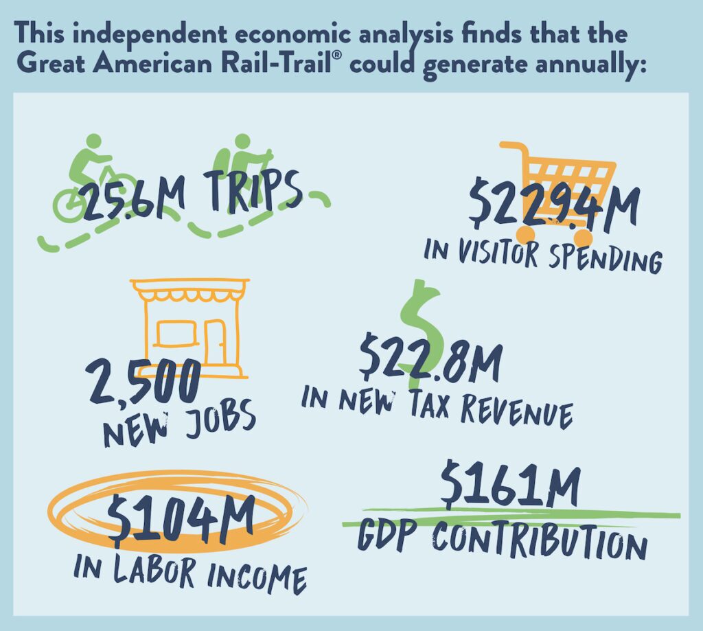
Economic Potential of the Great American Rail-Trail (May 2022)
As the Great American Rail-Trail® is completed, it has the potential to amplify the benefits—on a mass scale—that trails provide. In addition to offering safe walking and biking opportunities for physical activity and recreation, and promoting closer connections to nature, the Great American will serve as an engine economic growth, potentially generating more than $229.4 million in visitor spending, $104 million in labor income, and $22.8 million in new tax revenue.

Trail Networks and Housing Stability (May 2022)
Trails provide substantial benefits for people and communities, but an important issue is whether these benefits impact property values and can contribute to gentrification. Rails to Trails Conservancy’s (RTC) original research examines the relationship between trails and property values and provides guidance from experts on how to maintain housing stability and equitable access to trails. The resources found here offer insights about the impact of trails on gentrification, alongside perspectives from experts in the fields of housing and community development about the impact of trail networks on housing markets and best practices to promote and preserve affordable housing.
New USDOT Report Provides 25 Years of Lessons Learned for Rails-with-Trails (May 2021)
Released by the U.S. Department of Transportation as a long-awaited update to its first release, published in 2002, this report provides in-depth insights on the design, development, operations and benefits of rails-with-trails across America. Developed with support from RTC and more than 100 trail managers, it shares new insights on this growing trend in U.S. transportation.
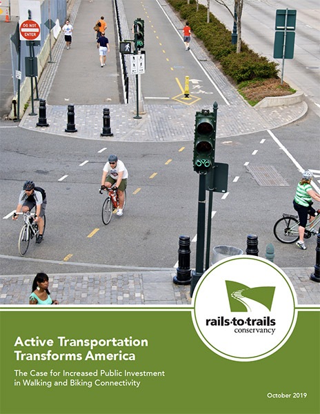
Active Transportation Transforms America (October 2019)
This report explores the massive economic returns and improved quality of life that the buildout of connected active-transportation infrastructure could have on the nation. The findings reveal that the potential annual return on investment could be as high as $73 billion+ in a modest scenario and $138 billion+ in a substantial scenario.

Reconnecting Milwaukee: A BikeAble™ Study of Opportunity, Equity and Connectivity (June 2017)
Milwaukee’s exemplary trails, including the Oak Leaf Trail and Hank Aaron Trail, serve as critical walking and bicycling infrastructure for city residents, the benefits they bring are not equitably shared. This study finds that neighborhoods experiencing inequality disproportionately lack access to biking and walking facilities, and explores current access for bicyclists and pedestrians to employment centers and schools, as well the impact that potential plans for new trails and biking facilities could have on the city.
BikeAble
Assessing low-stress bicycling connectivity involves determining whether a person can reach key destinations without having to bike on high-stress roadways. With BikeAble™, we can use mapping technology to model the low-stress bike route options available from any origin to any destination.
BikeAble™ is a customizable tool for analyzing community connectivity and evaluating how improvements to the bicycle network can help residents reach key destinations safely by bike.
Trail Counter Data
RTC is developing a nationwide database of trail counter data to create a more comprehensive resource for trail data that will help make the case for trails and increased trail funding. Please fill out this short survey if you are willing to share your organization’s trail counter data with RTC and be a part of the national database.
Resource Library
RTC’s resource library is the nation’s foremost curation of timely research, articles and cutting-edge resources for the trails, walking and bicycling movement.

Trail-Building Toolbox
Get all the basics for creating a vibrant trail in your community, including technical tips and tried-and-true methods for generating neighborhood, political and funding support for your project.