Connecting Cleveland to Pittsburgh by Trail
Executive Summary
The small towns and cities between Cleveland and Pittsburgh are home to some of America’s richest industrial heritage and history. Innovations in 19th-century transportation unlocked the region’s potential, delivering new people and new economies, and fueling westward development and a booming industrial market nationwide. As these economies took hold, the “industrial heartland” emerged—from the coal mines of West Virginia to the steel mills of Pittsburgh and Cleveland.
Today, there is a new opportunity to reclaim the potential of the region and to leverage the declining industrial and extractive economies for an economic strategy that is built on outdoor recreation, tourism and trails.
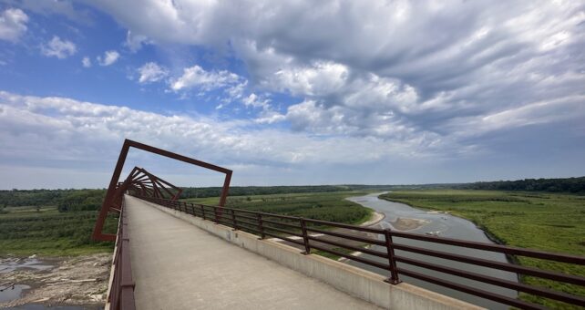
This feasibility study outlines the path forward and the potential in connecting Cleveland and Pittsburgh over 200+ miles of multiuse trails in Ohio, West Virginia and Pennsylvania. The alignment of the 200-miles-plus Cleveland to Pittsburgh (C2P) corridor is primarily made up of existing rail-trails, unused or abandoned rail corridors, and canal corridors. The plan outlined in this study leverages the success of established and well-known trails like the Ohio & Erie Canal Towpath Trail, Conotton Creek Trail, Panhandle Trail, Montour Trail and Three Rivers Heritage Trail to stimulate the political will and development necessary to complete the 72 miles of trail gaps along the C2P route.
In Ohio and Pennsylvania in particular, the stories of economic opportunity and quality of life associated with each state’s trails deliver optimism and promise for the counties, cities and towns along the corridor that have yet to capitalize on their potential trail economies. For example, the Ohio & Erie Canal Towpath Trail reports more than 2.5 million visitors each year, and a recent Rails-to-Trails Conservancy (RTC) Trail User Spending Impact Study found that $6.9 million was spent by the trail’s users—visitors and locals alike.1 In Pennsylvania, economic impact studies of the Great Allegheny Passage (gaptrail.org) have shown that the majority of the trail’s users planned an overnight stay, which translates to direct spending at businesses in the community, who in turn report significant traffic from trail users along the corridor.
As trail systems grow, they generate opportunities for new investment in trailside businesses, recreation outfitters and tourism-related industry. In midsize cities and rural areas, trail systems support existing businesses and bring new dollars into the community. Trails increasingly demonstrate their significance in community transformation through economic activity by trail users, including visitors and locals. RTC studies further demonstrate the power of connecting trails in direct economic potential and trail usage. As trail gaps are closed, trail use increases by as much as 80% depending on the significance of the gap closure. The benefits of connectivity have ripple effects across the entire trail network, delivering increased trail use that is as much as 15% in other sections of the network.2
Communities along the C2P corridor are ideally positioned to benefit from a future long-distance multiuse trail economy. When connected, the trails within the corridor will be competitive in attracting visitors to the region while offering an important amenity for local residents—creating new opportunities to access the outdoors and be physically active, and also providing new active transportation routes to nearby destinations.
This feasibility study outlines the vision for the corridor, as well as the opportunities, challenges and costs associated with its completion. Building on previous mapping work and other local trail-planning efforts, this study does the following:
- Assesses the current conditions and feasibility of trail development within the alignment
- Provides an opinion of probable costs for acquisition and construction of each trail gap
- Presents recommendations and an action plan for completing the C2P corridor
- Serves as a comprehensive vision for connecting the C2P corridor in all three states, providing tools and resources for planners and partners who are working to build trails, improve community connections and encourage the use and stewardship of existing trails
Once connected, the C2P corridor will feed into more than 1,500 miles of multiuse trail that stretch across 51 counties in four states: Ohio, West Virginia, Pennsylvania and New York—one of eight mega corridors that comprise the Industrial Heartland Trails Coalition’s (IHTC’s) regional vision to leverage a burgeoning trail economy to deliver new opportunities to the people who live along its route. It also contributes 146 miles to the Great American Rail-Trail™, a signature RTC project and the nation’s first cross-country multiuse trail, creating a route of 3,700+ miles that is separated from vehicle traffic and entirely walkable and bikeable between Washington, D.C., and Washington State.
As the possibilities of this corridor are explored, it’s easy to become optimistic about its potential—which will be realized by leveraging the success of the existing trails to deliver the expertise and resources necessary to close trail gaps in communities that have yet to unlock their trail futures.
NOTES
1 Rails-to-Trails Conservancy, Industrial Heartland Trails Coalition, and Ohio & Erie Canalway, Ohio & Erie Canal Towpath Trail: Trail User Spending Impact Study (Washington, DC: Rails-to-Trails Conservancy, 2018).
2 Rails-to-Trails Conservancy, Active Transportation Transforms America (Washington, DC: Rails-to-Trails Conservancy, 2019).

Donate
Everyone deserves access to safe ways to walk, bike, and be active outdoors.