Beautiful Inspiration: From Sea to ‘Shining Sea Bikeway’
As spring turns to summer, the opportunities for long, leisurely trail rides through quiet, wooded spaces and relaxing small towns seem to multiply. And as the temperature warms up and the days become longer, many people will enjoy the time-honored tradition of a summer beach vacation.
Even now, some of my fondest childhood summer memories are of making the drive to Cape Cod, Massachusetts, for a week’s vacation with my extended family. While our destination was farther down the peninsula in Harwich Port, a visit to the Shining Sea Bikeway in Falmouth—the only bikeway on Cape Cod to feature a seaside section—is the perfect way to combine both summer treats, trail and beach, for an unforgettable experience.
Beautiful Inspiration
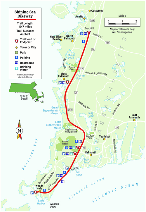
The 10.7-mile Shining Sea Bikeway follows the route of a former railroad line operated by the New York, New Haven and Hartford Railroad Company. It provided service from the Cape to New York and Boston for nearly a century, from 1872 to 1965. After several storms made repairing and continuing rail service unprofitable, the railroad company finally discontinued the line. Local residents Joan Kanwisher, Barbara Burwell (mother of Rails-to-Trails Conservancy co-founder David Burwell) and several other supporters organized in a nine-year-long effort to have the village of Woods Hole acquire the land and build a rail-trail. The Shining Sea Bikeway, now extending from Woods Hole to North Falmouth, officially opened in June 1974.
The trail takes its name from the lyrics to “America the Beautiful,” written by Falmouth native Katharine Lee Bates. And it lives up to that name, boasting beautiful vistas of marshes, rivers and the sea along its paved path.
An Ideal Start
On an idyllic summer day in July, my coworker Anya Saretzky and I, blessed with the task of mapping the Shining Sea Bikeway for RTC’s New England Guidebook Series, begin our journey in Woods Hole at the start of the trail, which is located past the newly constructed ferry ticketing building, just under the Crane Street overpass.
Although parking is available at both ends of the trail, starting at the southern end in Woods Hole is your best bet for an out-and-back experience. The location is the jumping-off point for a number of local museums and the ferry to Martha’s Vineyard and is the shortest route to the trailside public beach.
(Editor’s note: Parking at the southernmost end of the trail at the Steamship Authority can get extremely congested and is not recommended during the tourist season. If you are starting from the southern endpoint, in the event of congestion, please plan to park at one of the additional parking lots that dot the trail as you head north.)
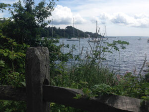
On the right, seaside views of Little Harbor, docked with yachts, offer the first glimpse of what is to come. It’s wise not to get too distracted by the scenery in this section, though, because you share the trail here with slow-moving vehicles driving to and from a parking lot situated directly on the trail. The first 45 spaces are reserved for locals, but parking for visitors is available as well.
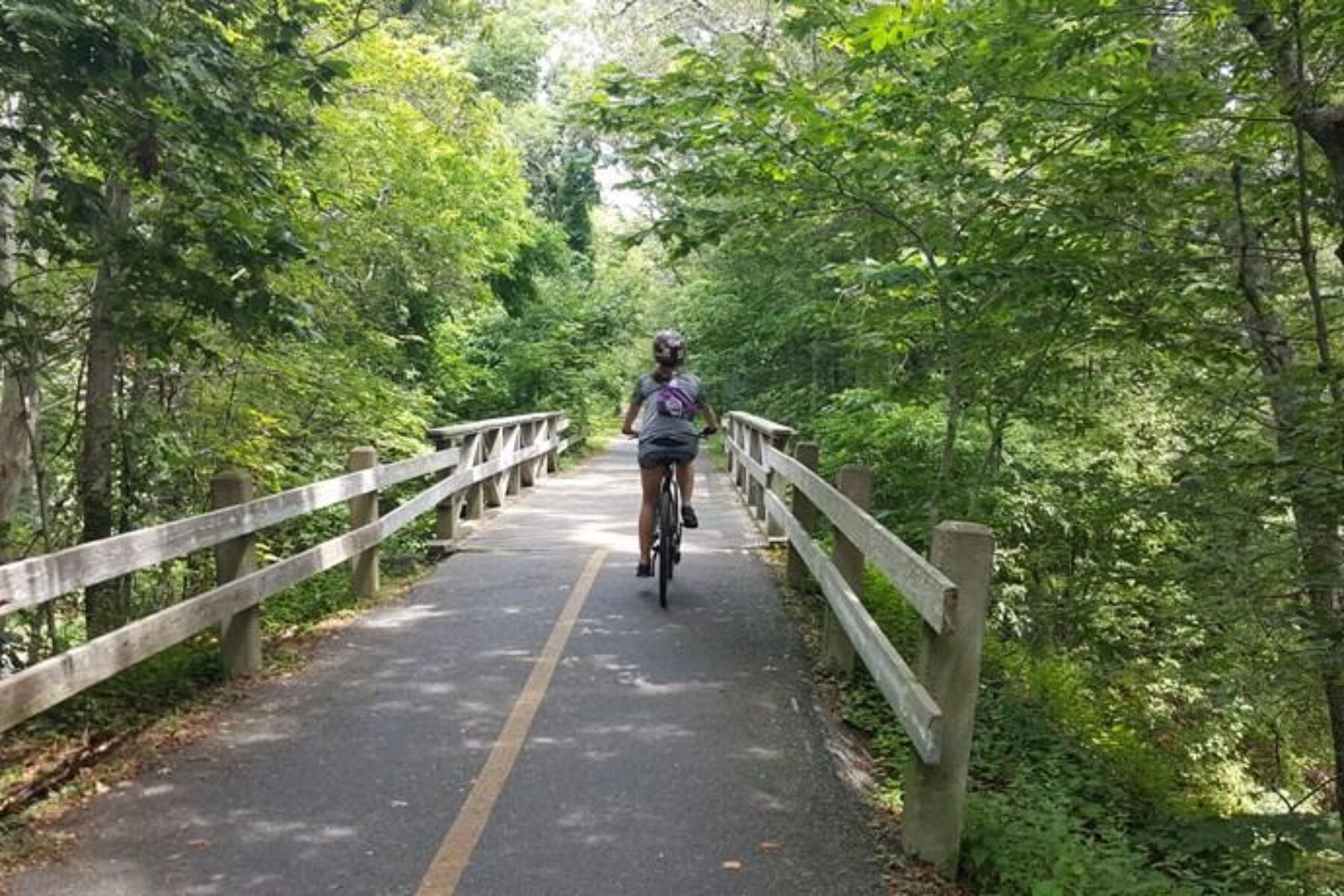
From the harbor, we pass through a wooded section featuring a couple of bridges decorated with images of such water fauna as turtles and frogs. The suburban location is evidenced, however, by the sound of cars on nearby roads and by the houses along the right side the path.
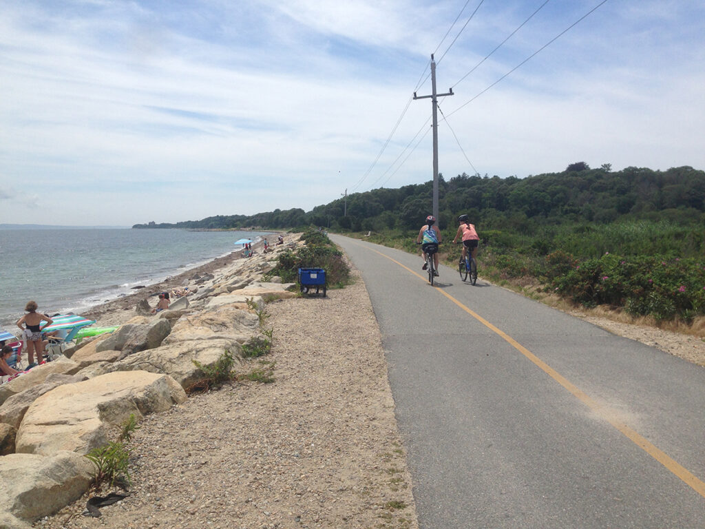
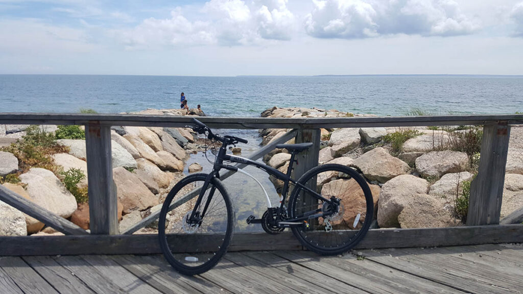
About 2 miles into the trail, the forest opens up to a wide expanse of sea. Traveling down the trail, we reach Surf Drive Beach. As I take in the smell of the salty air and the view of sunlight glittering on the waves, I can’t help thinking this would be a perfect spot for a picnic by the sea. On this particular Friday, there are a number of beachgoers and trail users, but with plenty of open shoreline, the atmosphere feels calm and unhurried. Rather than the buzz of a crowded beach, our ears are filled with the soft, tranquil sounds of the Atlantic Ocean, gently lapping along the shore.
Learn more about this and 111 other trails in our New England rail-trail guidebook series, available now. Visit railstotrails.org/guidebooks for details.
Good Signs
Reluctantly, we leave the beach and continue our journey into another wooded area (Beebe Woods), occasionally crossing streets with light traffic. At 3.6 miles into the trail, we encounter a trailside parking lot and the newly renovated bus station. After another parking lot (near Depot Avenue/Highfield Drive), the wooded scenery of the trail continues, with local trailside businesses dotted along the way.
“My favorite part was enjoying the peace and tranquility of the wooded section,” Saretzky told me later. “And I liked the variety. That’s the kind of trail I like best, when there are multiple destinations along the way.”
There is no shortage of variety along the Shining Sea Bikeway. A trail user has spray painted cues to points of interest along the asphalt path: a bus depot, a cut-through to an ice cream shop, a breathtaking scenic view. The trail clearly is well loved and well used, and friendly signs posting trail rules and proper etiquette only help to reinforce the courtesy and an atmosphere of goodwill demonstrated by all who share the trail.
About halfway into the trail, we reach the Little Sippewissett Marsh. Backpackers can access the Sippewissett Campground from a pathway on the right. The word Sippewissett, meaning “place of a brook,” or “little river,” comes from the Wampanoag tribe, the original inhabitants of the area. Another 1.3 miles ahead, the trail crosses through the Great Sippewissett Marsh, offering expansive views of the water and greenery on either side.
Interpretive signage provides historical and environmental context. You learn, for example, that the salt-water marsh is an important habitat for the local flora and fauna. The peaceful quiet of the marsh is punctuated only by the sounds of water flowing toward the sea, burbles on the surface from creatures coming up for air and the low buzzing of insects across the marsh. Extending out as far as the eye can see, the marsh is a picturesque place to stop and smell the proverbial roses.
Thanks for the Memories
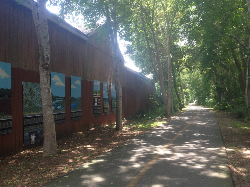
From here, we continue, traveling past more wooded scenery. We then go through an underpass decorated with murals and ride past some trailside sculptures. Saretzky later tells me that she remembers this section “with the deer sculptures” vividly.
“I live in a city where everything is concrete, and the only trees I see are on sidewalks,” she said. “To see trees in nature, it’s like I’m a guest in the woods, rather than the other way around.”
At some points, the trailway is dotted with houses and crosses roads. Finally, we reach a section with railroad ties to our right—a nod to this rail-trail’s history—and we know that we are nearing the end. After crossing the road (and railroad tracks) and turning left, we use the sidewalk to travel 150 feet before turning right into the parking lot on Depot Road, where the trail ends.
For me, being on Cape Cod evoked memories of years past. My family would head out each morning to the beach, enjoying the sun and surf until our noses felt red. In the warm summer evenings, we’d watch children and adults alike ride past on bicycles as we walked to the local gas station for ice cream. Exploring the Shining Sea Bikeway brought back those Cape Cod memories and allowed me to create new ones.
Make memories of your own with a visit to this bike and beach getaway.
GETTING THERE
Falmouth is on the southern side of Cape Cod, 90 minutes from two major airports: T.F. Green Airport (Providence, Rhode Island) and Logan Airport (Boston). From Logan, the Peter Pan Bus Line offers direct service to Falmouth and Woods Hole.
Note: Most attractions, restaurants and accommodations are open seasonally, from about April through September.
WHERE TO EAT
Silver Beach Seafood and Pizza, two blocks from the northern endpoint, is a good choice for a casual meal. Two blocks from the trail in the opposite direction, Epic Oyster, offers modern seafood. Along the trail, Crabapple’s serves comfort food and seafood. At the parking lot where the trail intersects Old Dock Road, a sign points the way to Eulinda’s Ice Cream and the Village Cafe.
In Woods Hole, there is no shortage of eateries. The Quicks Hole Tavern has something for everyone. Water Street Kitchen offers an upscale menu with ocean-view seating.
Note on alcohol: Massachusetts does not accept out-of-state driver’s licenses for proof of age. If you expect to be carded, bring a passport or a U.S. Military ID.
WHERE TO STAY
Almost at the halfway point for the trail, the upscale Frederick William House offers a bike, hike and swim tour of the natural sites in the Falmouth area in the summer. At the southern end of the trail, the Woods Hole Inn and Tree House Lodge are located close to the ferry to nearby Martha’s Vineyard. All three have bicycle rentals available for guests.
WHERE TO RENT
For bike rentals, Art’s Bike Shop and Bike Zone of Cape Cod are near the trail’s northern endpoint. At the halfway point, close to the Falmouth Bus Station and downtown, is Corner Cycle.
Falmouth is considering a license with a dockless bike share for the summer of 2018; check with the town for updates.
WHAT TO SEE
Surf Drive Beach is located off the trail, parallel to Oyster Pond Road. Beach access is free except by car; a parking sticker is required.
The trail ends in Falmouth but one day may connect to the Cape Cod Canal Bikeway in Bourne (ample parking at the Tidal Flats Recreation Area). For those who plan to drive, the 8-mile gap can be covered in about 15 minutes.
Near the southern terminus of the Shining Sea Bikeway is Woods Hole Science Aquarium. The Woods Hole Oceanographic Institution and the Marine Biological Laboratory have exhibit centers. Woods Hole is a great jumping-off point for a visit to Martha’s Vineyard, which has fabulous bike paths, as well as buses to put your bike on if you get tired.
This article was originally published in the Spring-Summer 2018 issue of Rails to Trails magazine. It has been posted here in an edited format.

Donate
Everyone deserves access to safe ways to walk, bike, and be active outdoors.