Top 10 Trails In South Dakota
Despite its somewhat under-the-radar locale in the very center of the United States, South Dakota has plenty of claims to fame when it comes to notable sights. In fact, several of the state’s best-known attractions also happen to be some of the nation’s most iconic images. From the starkly beautiful sandstone buttes of the Badlands National Park to the herds of bison and cathedral-like rock spires of the Black Hills, South Dakota’s famous places are sure to resonate.
The state is also home to sprawling prairies, fertile farmland and glacial lakes. And through it all—from the mountains of the Black Hills in the west to the rivers and grasslands in the east—a growing network of trails provides wonderful access to South Dakota’s treasures. Here are 10 of our favorite trails in South Dakota.
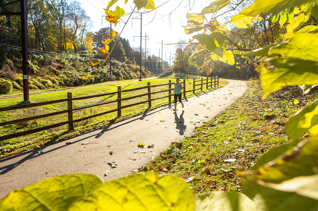
George S. Mickelson Trail
Counties: Custer, Fall River, Lawrence, Pennington
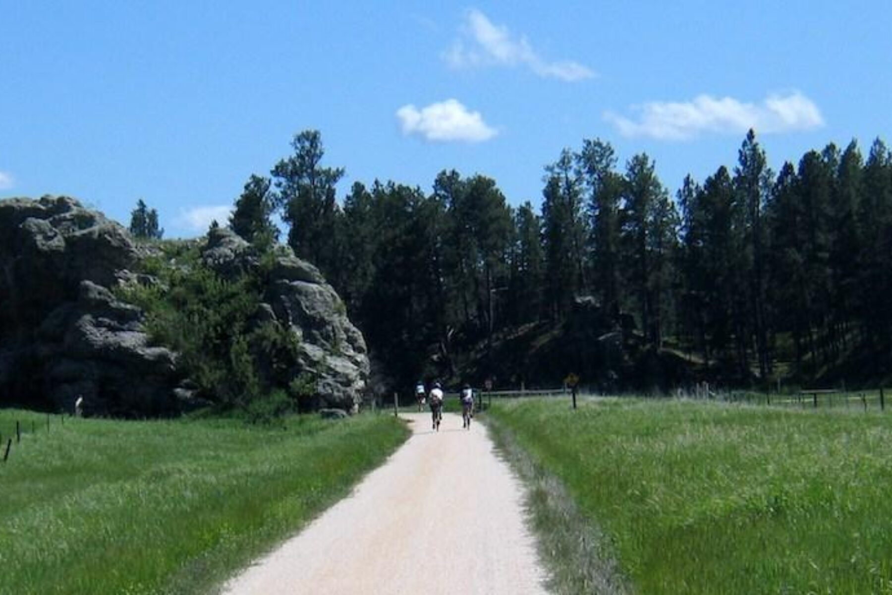
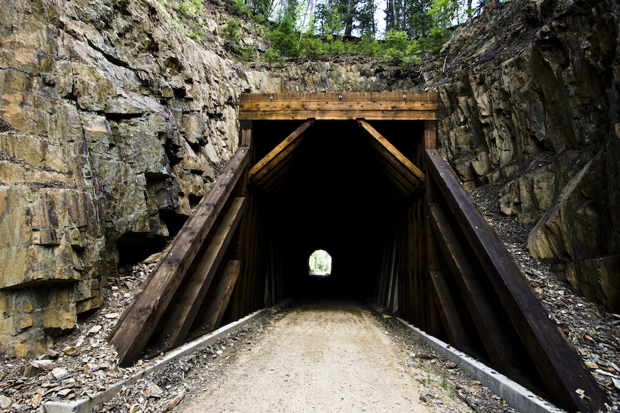
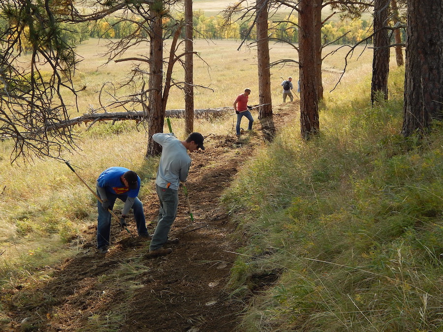
Running through the heart of the gorgeous Black Hills, the George S. Mickelson Trail is widely considered the premier trail in South Dakota. The 109-mile route was inducted into the national Rail-Trail Hall of Fame in 2010, and it regularly scores five-star reviews on Traillink.com™.
Named for the former South Dakota governor who championed it before his death in a plane crash in 1993, the trail follows the old Deadwood-to-Edgemont Burlington Northern railway line. The South Dakota Game, Fish & Parks Department describes the route that passes through a number of Old West towns as “a path where the ghosts of Wild Bill Hickock and Calamity Jane still roam.”
Mountains, ponderosa pine forests, creeks and valleys serve as the backdrop for the trail, which comes within a few miles of major attractions like Mount Rushmore and Custer State Park. Although the trail is popular with long-distance bikers and hikers, 15 trailheads make it easy to jump on for short day rides or hikes as well.
Sioux Falls Bike Trails
County: Minnehaha
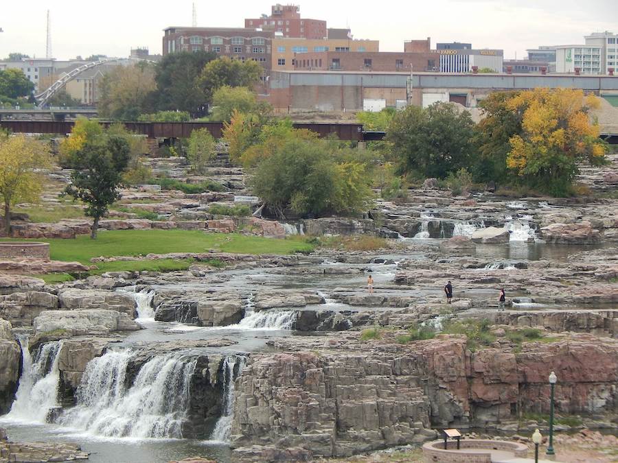
For a quick and scenic way to navigate South Dakota’s largest city of Sioux Falls, the Sioux Falls Bike Trails are hard to beat. Also known as the Sioux Falls River Greenway, the 26.8-mile paved network of trails and spur routes winds through scenic urban and wildlife areas.
Along the way, the bike trail system connects many of the community’s neighborhoods, parks and green spaces, including the family-friendly Great Plains Zoo & Delbridge Museum of Natural History. The greenway also offers easy access to Falls Park, a sprawling 128-acre area along the Big Sioux River that is the community’s No. 1 attraction and the home of the waterfalls that are the city’s namesake.
Oahe Dam Downstream Fort Pierre Trail
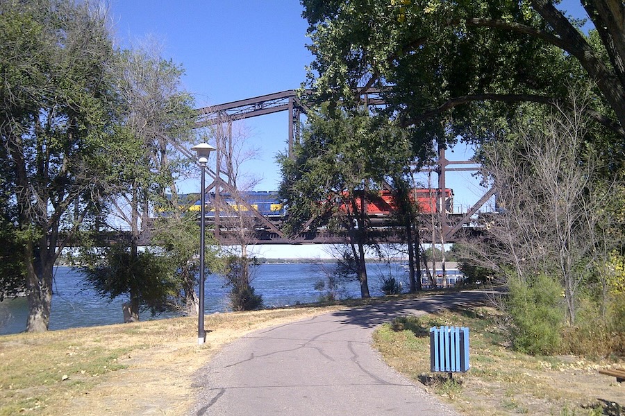
County: Stanley
South Dakota’s capital city of Pierre and its neighboring city of Fort Pierre make the most of their locations right along the Missouri River with a network of scenic walking and biking trails. Among them is the Oahe Dam Downstream Fort Pierre Trail, a 4.2-mile rail-trail that begins at the Oahe Downstream Recreational Area, a state park located under the Missouri River’s Oahe Dam. The trail connects with the Riverfront Trail, which allows cyclists to cross the Missouri River into Pierre. Oahe Downstream is known as a prime location for spotting bald eagles as they roost in the tops of the tall cottonwood trees below the dam.
Other trails in the Pierre/Fort Pierre area include the 30-mile Lewis and Clark Bicentennial Trail that passes by multiple historic and cultural sites, the 10-mile LaFramboise Island Nature Area trails through meadows and towering cottonwoods, and the three-mile Farm Island nature trail that offers a tranquil river setting.
Meridian Bridge Trail
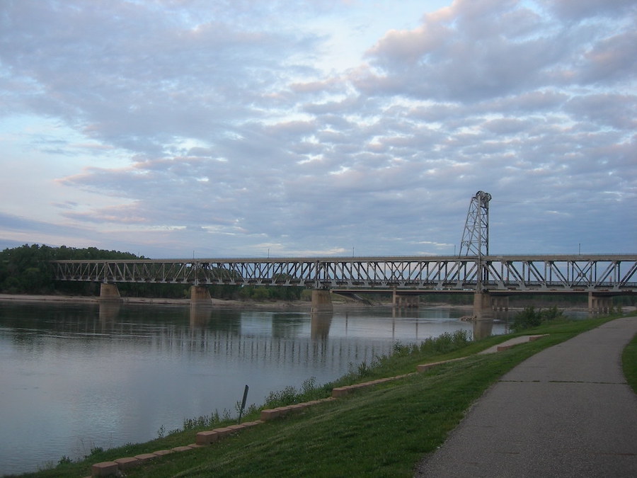
Counties: Yankton, Cedar
Yankton, once known as a crossroads for train and steamboat travelers, now features a series of biking and walking trails that play up the community’s history as a riverside hub. The most legendary is the 0.7-mile Meridian Bridge Trail, a vertical lift bridge that was built over the Missouri River in 1924, allowing for vehicle traffic on the bridge above, along with the shipping traffic on the river below.
After a new bridge was built just to the west, the historic structure was redeveloped as a pedestrian walkway that connects the states of South Dakota and Nebraska across the Missouri River. Today, pedestrians and cyclists can cross the width of the river on either of the bridge’s two levels, taking in sweeping river and city views.
The Meridian Bridge Trail connects with the 1.5-mile Riverside Park Trail, which runs along the banks of the Missouri River through scenic river terrain and into the charming town of Yankton. It connects with the 3.3-mile Auld-Brokaw Trail, named in part after Yankton’s famous son, television newscaster Tom Brokaw.
Leonard Swanson Memorial Pathway
County: Pennington
Rapid City, located within an hour or so from multiple recreation destinations, is known as an ideal base for exploring the treasures of western South Dakota. And the 8.2-mile Leonard Swanson Memorial Pathway offers a convenient way to get around within the city.
Also known as the Swanny Pathway, the trail consists of paved bikeways that follow the route of the scenic Rapid Creek. Along the way, it connects with numerous parks and recreation facilities, such as the pretty Canyon Lake Park, as well as spur trails to other community attractions.
Centennial Trail
County: Custer, Pennington, Lawrence, Meade
For hikers and mountain bikers looking for a rugged, single-track route through the Black Hills, the 111-mile Centennial Trail could be the perfect fit.
Starting at the Bear Butte State Park east of Sturgis and ending at Wind Cave National Park north of Hot Springs, the Centennial Trail traverses some of South Dakota’s most stunning scenery. Portions of the trail pass near Mount Rushmore National Memorial, through Custer State Park and across portions of the Black Hills National Forest.
The trail, which marked the 100th anniversary of statehood for South Dakota in 1989, was designed to represent the diversity of the state. It climbs from prairieland near Bear Butte State Park into the high country of the Black Hills before reaching the rolling grasslands near Wind Cave National Park. Along its route, the Centennial Trail skirts seven bodies of water, including the Sheridan Lake and Pactola Reservoir, and passes through wildlife habitat for antelope, bighorn sheep, deer, elk, turkeys and mountain goats.
Mitchell Community Bike Path and Lake Mitchell Trails
County: Davison
Known mostly as the home of the Corn Palace tourist attraction, the small southeastern-South Dakota town of Mitchell also prides itself on having a robust and growing network of trails.
The Mitchell Community Bike Path is a system of asphalt and concrete trails that takes bikers and walkers past parks, campgrounds and ballfields, and near the charming downtown. The town’s website notes that the system consists of 8.5 miles of paved bike trails and another 8.2 miles of unpaved trails. In addition, there are 13 more miles of hiking and biking trails along the shores of pretty Lake Mitchell, a manmade reservoir that originally served as a source for drinking water but now offers a range of recreational opportunities.
Spearfish Recreational Trail

County: Lawrence
A spectacular canyon, rushing creeks and waterfalls are among the draws of the lovely town of Spearfish, located in western South Dakota near the Wyoming border. And the 5.2-mile Spearfish Recreational Trail traverses many of the community’s treasures.
The scenic rail-trail meanders through the heart of Spearfish, beginning at the gateway to Spearfish Canyon and following the course of Spearfish Creek for much of the way, passing through forests, neighborhoods and businesses.
Along the way, the trail passes by the D.C. Booth Historic Fish Hatchery, which dates back to the late 1800s and today features an educational center and museum.
Watertown Recreation Trail – Orange Loop
County: Codington
Tranquil lakeshore biking and hiking awaits in Watertown, a small city located in eastern South Dakota near the Minnesota border. Known for its proximity to the large glacial body of water, Lake Kampeska, Watertown capitalizes on the lakeside setting with a total of nearly 30 miles of trails, including the Watertown Recreation Trail – Orange Loop that runs along the shore of the lake. The 10.4-mile rail-trail loop features great views of the clear-water lake as well as the region’s rolling farmland.
Watertown’s trail system also includes the 10.5-mile Blue Loop, a rail-trail that follows a portion of the former route of the Chicago and North Western Railroad, and the 4.6-mile Red Loop that passes through open fields and quiet neighborhoods.
Adams Homestead and Nature Preserve Trail
County: Union
Located just west of North Sioux City in the southeasternmost tip of South Dakota is the Adams Homestead and Nature Preserve, a 1,500-acre tract along the Missouri River that preserves the homesite of original homesteader Stephen Searls Adams. The land was donated to the state in 1984 by Adams’ granddaughters as a spot for inner renewal and education about the land.
Running through the preserve is the 6-mile Adams Homestead and Nature Preserve Trail, a crushed-limestone trail for cyclists, walkers and cross-country skiers in the winter. The trail passes through a pristine wooded landscape around Mud Lake and the Missouri River and is known as a prime spot for spotting birds and other wildlife.
The Preserve Trail connects with the North Sioux City/McCook Lake Trail in the town of North Sioux City, a suburb of Sioux City, Iowa, located near the borders of South Dakota, Nebraska and Iowa.
Honorable Mention
Presidential Trail at Mount Rushmore
The half-mile Presidential Trail at Mount Rushmore National Memorial offers an opportunity for a close-up with the memorial’s four famous faces, meandering through pine trees and past the blasting rubble that was left behind as workers carved the mountain sculpture decades ago. The land has important historical significance to the American Indian Tribes who have inhabited the area for millennia, and the Lakota, Nakota and Dakota Heritage Village—located along the first part of the Presidential Trail—pays homage to the customs and traditions of the American Indian communities.
When you subscribe to Rails to Trails magazine, you’ll have access to many other features like this one. Our magazine is a premium of Rails-to-Trails Membership. Join today to start receiving the magazine!

Donate
Everyone deserves access to safe ways to walk, bike, and be active outdoors.
Related
View All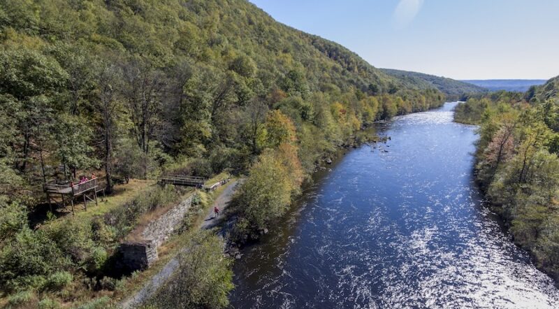
Life, Liberty and the Pursuit of Happiness: Pennsylvania’s Delaware & Lehigh Trail

Best Of: Trailside Sites That Encapsulate America’s History