Oklahoma’s Oklahoma River Trails
Trail of the Month: October 2021
“The real emphasis is on getting people out of their cars and on their bikes. We’ve certainly come a long way.”
—Max Harris, Oklahoma City Planning Department’s Associate Planner
Going from a reputation as one of the least walkable and most obese cities in the country to residents taking a hold of their health and losing a collective 1 million pounds in 2012, Oklahoma City rallies around its trails. In this big city that welcomes people with open arms, it’s all about bringing people together, especially for a walk or ride along their beautiful river or parks.
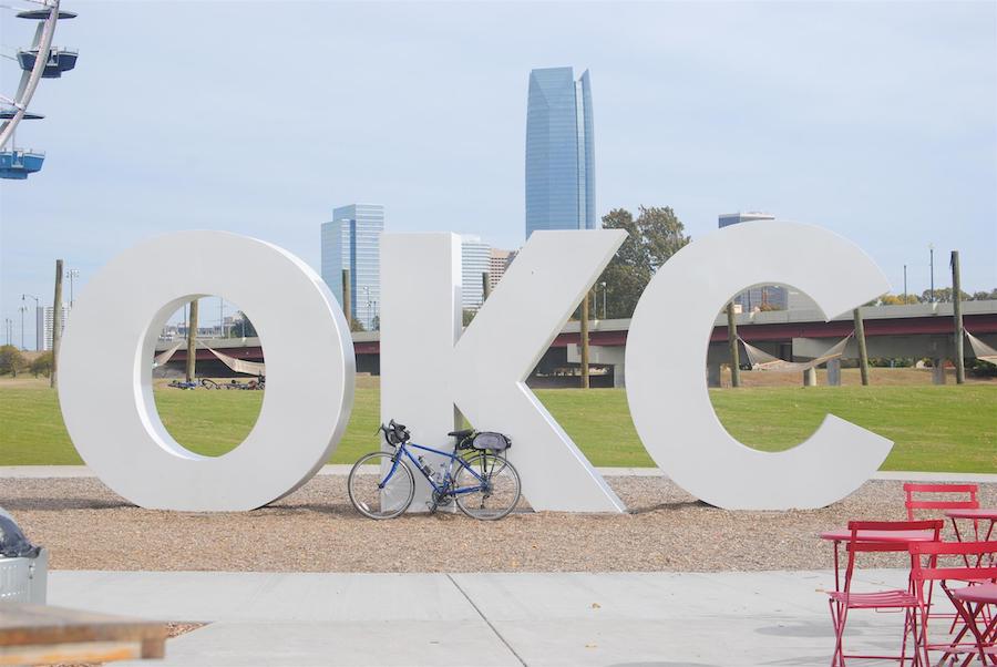
Despite the city’s sprawling nature and 680,000 residents, it has a small-town feel, partly due to roughly 90 miles of trails through 10 connected routes. These routes, including the well-loved Oklahoma River Trails, bring people to the neighborhoods, parks, world-class attractions and the flourishing downtown region.
Forging New Connections
The first paradigm shift happened in 1993 when residents agreed to tax themselves with a Metropolitan Area Projects (MAPS) initiative to upgrade recreational, sports and convention facilities. After the oil industry collapsed in the 1980s, instead of throwing in the towel, Oklahoma City rallied to recreate its image with the goal of enticing corporate entities. Under the leadership of Mayor Ronald Norick (1987–1999), citizens agreed to pay a penny sales tax with the promise of improved assets that would enhance their city.
With the success of that initial MAPS program, more followed, including MAPS for Kids, which focused on projects for public schools, and MAPS 3—wrapping up in 2022—which created more of the trails, parks and sidewalks available today.
Max Harris, associate planner for the Oklahoma City Planning Department, noted that many of the original neighborhoods grew without these amenities, but when the city added sidewalks, it was a natural transition to trail networks, making areas more accessible.
“Connecting everything is the mentality of it,” said Harris. “The real emphasis is on getting people out of their cars and on their bikes. We’ve certainly come a long way.”
This change was inspired from an uncomfortable place. In 2007, Oklahoma City made the Men’s Fitness magazine’s list of the most obese cities in the country, and Mick Cornett, the mayor of Oklahoma City at that time, took notice. Looking at himself, he realized he fit this category. After improving his diet and increasing exercise he dropped 40 pounds in less than a year. This spurred him on to encourage everyone to join the effort, creating This City is Going on a Diet, to give people tools to take charge of their health.
During this time, the MAPS 3 program completed hundreds of miles of sidewalks and numerous new walking and biking trails connecting neighborhoods and parks, making it easier for people to exercise. Churches, schools and community groups encouraged one another to eat better and move more. In 2012, when Men’s Fitness released their annual report, Oklahoma City held a well-earned position on the “fit” list. And while they still have room to improve, the success demonstrated what happens when residents are given opportunities to make healthy choices.
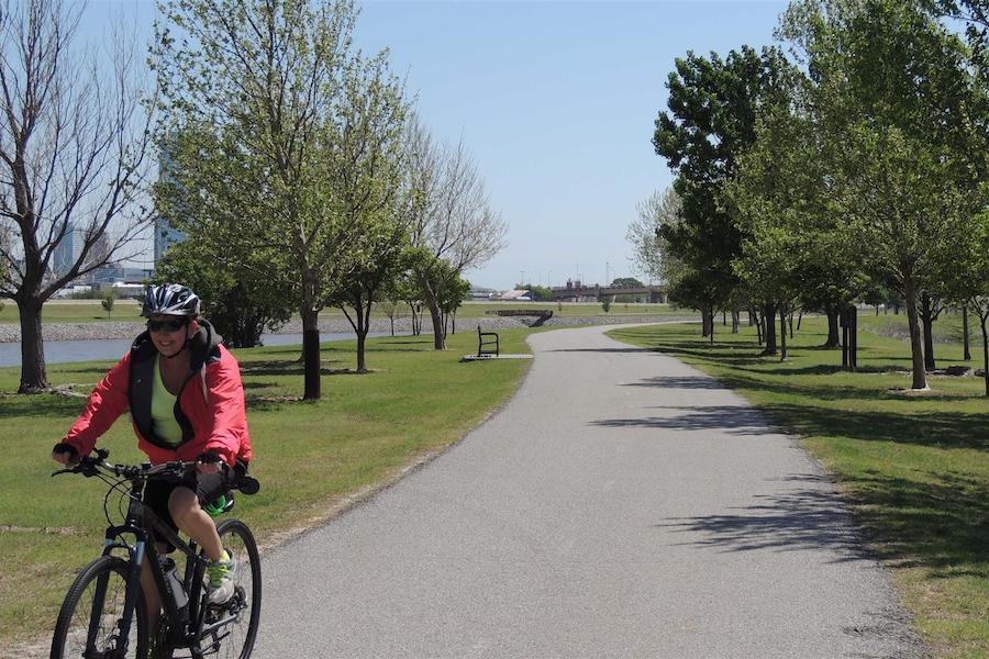
Beyond being beneficial to health, the trail system offers a higher quality of life. Growing up in the area, yet living overseas for many years, Perrin Duncan is passionate about these trails and shares her experiences as digital content creator for the Greater Oklahoma City Chamber. “It’s been such a gift moving back to Oklahoma and realizing what an awesome trail system we have,” she said. “I didn’t think I’d stay in Oklahoma, but the cycling community is so strong. I feel so grateful that Oklahoma City is invested.”
City organizations also strive to make biking easier. Bike racks and repair stations are situated throughout the city, plus the city buses and the OKC Streetcar have bike racks to allow more efficient travel across the area. The Spokies bike-share program offers a 3-speed Classic bike to use around downtown, or the 8-speed DASH bike for longer trips. Both feature front baskets that carry up to 20 pounds, which are perfect for a picnic or grocery run.
“We’re a little bit of a hidden gem,” added Harris, an avid cyclist who uses these trails every day on his commute to work. “There’s more than meets the eye.”
Exploring the Heart of the City on the Oklahoma River Trails
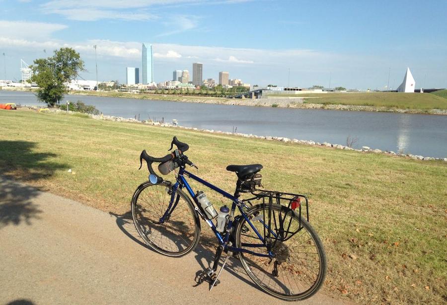
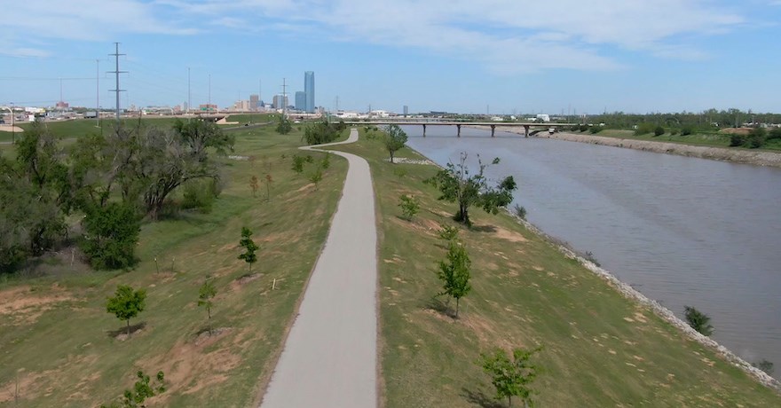
“The river, for so many years, bisected the city; it was just the drainage-way that was there,” said Brian Dougherty, director of the Oklahoma City Community Foundation’s Parks & Public Space Initiative. The 2004 creation of the Oklahoma River Trails, resulting from the original MAP initiative, helped unify and enliven the area.
With trails paralleling each other for nearly 7 miles on either side, residents and visitors can enjoy a total of nearly 14 miles of level, paved pathways that travel along the water and through multiple parks, including the new Scissortail Park, which is part of the most recent MAPS 3 project. This 70-acre multiuse and beautifully landscaped oasis in the downtown area creates a destination spot for boating on Scissortail Lake and visiting the farmers’ markets, as well as enjoying music, festivals and family-friendly events.
Besides eye-catching scenery, activities abound along both River Trail routes. The Boathouse District, a starting point on the east end of the northside trail, is home to several distinctive boathouses, as well as RIVERSPORT Rapids, a hub for water-related activities. Most people don’t consider surfing in the middle of the Great Plains, but it’s possible to catch a wave, cruise the river on a stand-up paddle board or learn to kayak. The shining Chesapeake Finish Line Tower stands along the water as part of Oklahoma City’s world-class canoe, kayak and rowing scene that is renowned in national competitions and Olympic training.
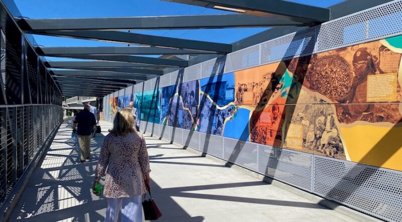
Oklahoma has always been Native land. Even the name “Oklahoma” is derived from the Choctaw words of “okla” and “humma” meaning “honorable Nation” or “a brave people.” Traveling the south trail leads to a unique opportunity to learn and celebrate the lives of the Indigenous People at the First Americans Museum, located across the river from the Devon Boathouse. Exhibits representing 39 tribes, along with hands-on activities and storytelling, illustrate these rich traditions and act as a touchstone between the past and present.
Bricktown, an older part of the town and one of the city’s most popular entertainment areas, is also easily accessible from the River Trails. The entire area is very walkable with the trail paralleling the canal that flows between buildings and under a series of well-lit and landscaped bridges, past gardens and eventually to the boathouses. This is all part of what Harris meant when he said, “There’s an emphasis to create a continuity.”
Planting for the Future
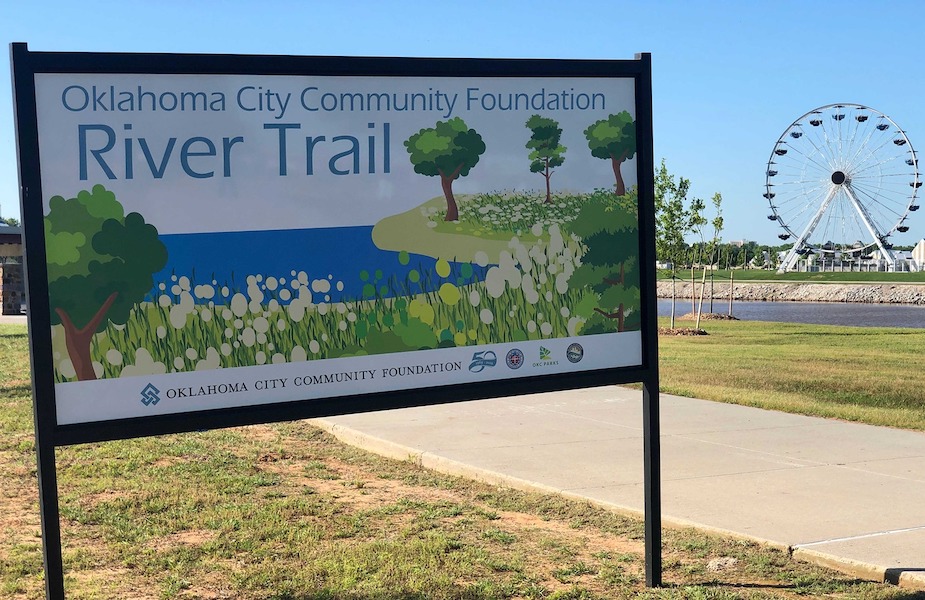
Not to rest on simply creating asphalt trails, Oklahoma City strives to improve the experience along them. “Amenities are one of the big focuses; you want safe, clean, healthy places to walk, run and bicycle,” said Dougherty, who spearheaded a project, in conjunction with the Oklahoma City Riverfront Redevelopment Authority and the City of Oklahoma City Parks & Recreation Department, to plant 800 trees and 3.5 miles of native plants and grasses along the north shore of the River Trails. As a result of the tremendous effort enhancing this area, the city renamed this section the Oklahoma City Community Foundation River Trail.
“It makes the trail safer and cooler,” Dougherty said, noting that they chose a wide variety of native or near-native species such as Kentucky coffeetree, numerous oak and cypress varieties and Western soapberry. “You really need to go back to survival of the fittest. It’s very much of a right tree in the right place,” he explained, but the forward-thinking result is beautiful trees that will be enjoyed by generations 50 years from now.
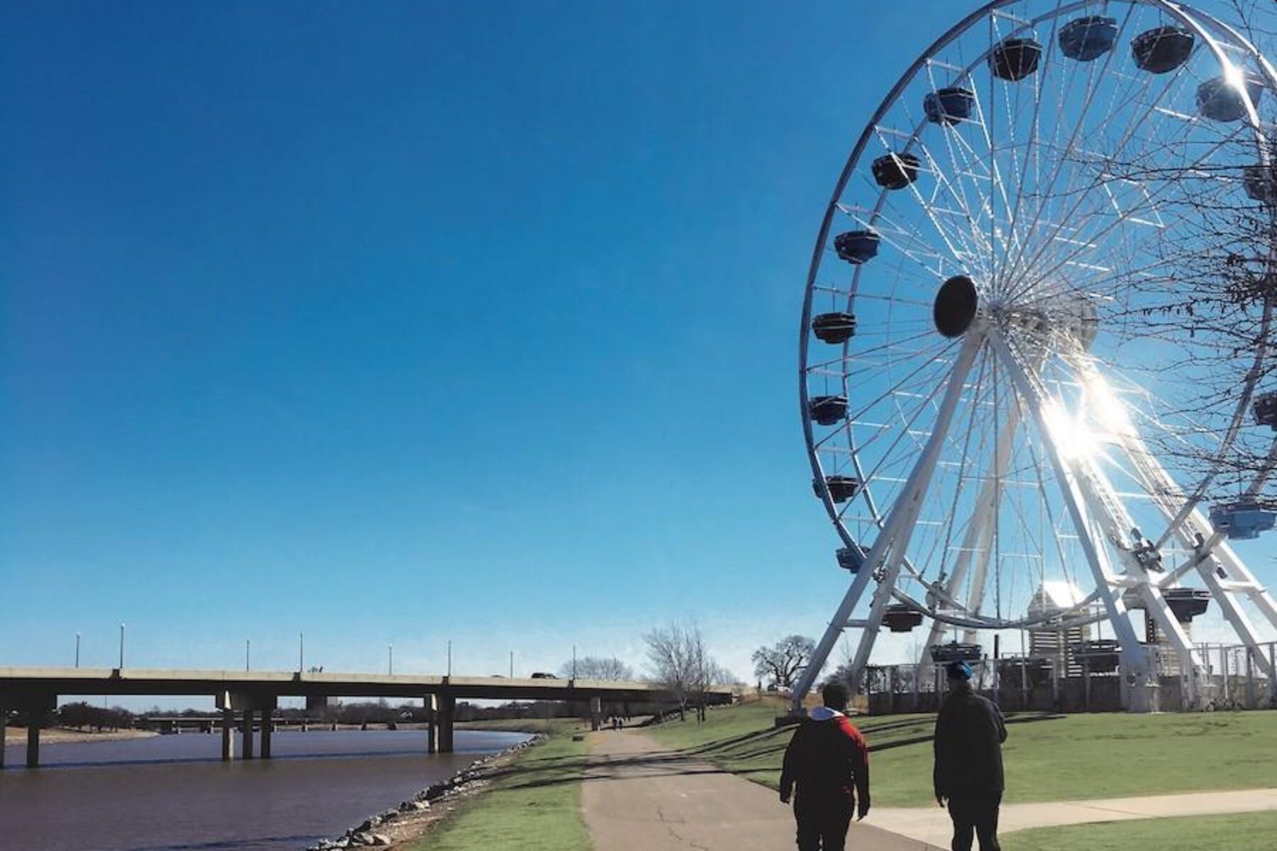
As with many of these projects, the old is renewed, such as in the Wheeler District, which was once the site of the abandoned Downtown Airpark. This urban, multiuse community is designed for people to walk or bike as they wish from the River Trails. The trail also leads to the historical Santa Monica Pier Ferris Wheel that stands 100 feet tall and provides a phenomenal view of the city skyline.
And even the access between the north and south trails continues to improve. Harris points out that the latest project to convert a former railroad bridge for pedestrian and cyclist use along the southwestern section of the River Trails provides access to the Wheeler District’s shops and attractions.
Oklahoma City’s Burgeoning Trail System
With as much as there is to do along the Oklahoma River Trails, these are only one piece of the city’s well-used and beloved trail networks. With over a million users recently counted on the Hefner-Overholser Trail alone, it’s easy to understand the momentum. While this is a popular area because there are many activities and destinations along the route, it demonstrates just how much people here enjoy their trails.
The trails are a part of life for many residents. As Duncan noted, “I ride my bike with several groups. Every weekday night or weekend morning you can find a group to go out. When it’s dark, we just put on our lights and go.”
She said there are cycling races every Tuesday for competitors of all levels. “They made the neighborhoods in a way so they are conducive to racing,” she noted. “It’s a lot of fun. It makes me happy. You don’t have to be a competitive cyclist to enjoy the trails.”
The worldwide health crisis caused more people to appreciate what they have just outside their doorstep. Harris affirmed, “During the pandemic, as with most cities, we saw more people go out on the trails. It’s something positive from the pandemic.”
Pandemic or not, Oklahoma City continues to improve connections. With the recent approval of MAPS 4, the city is creating more bike lanes and trails, including a project extending the Oklahoma River Trails from the Boathouse District to the city’s Katy Trail as part of their overall BikeWalkOKC comprehensive plan to provide additional routes, as well as maintain and improve what is already in place. With dozens of routes combined with a community focusing more on health and outdoor recreation, Oklahoma City has grown over the past decades into a thriving city where friends meet friends along the trails.
RELATED: Top 10 Trails in Oklahoma
Related Links
- Greater Oklahoma City Parks & Trails Foundation
- City of Oklahoma City
- Oklahoma Bicycle Society
- Visit Oklahoma City
Trail Facts
Name: Oklahoma River Trails
Trail website: City of Oklahoma City
Length: 13 miles
County: Oklahoma
Start point/end point: Two trail segments parallel the Oklahoma River. On the river’s north side, the trail runs from S. Portland Avenue to Regatta Park; on the river’s south side, the trail runs from S. Meridian Avenue to I-35.
Surface type: Asphalt
Grade: The trail has a 1-3% grade.
Uses: Walking, bicycling, inline skating and fishing; the trail is also wheelchair accessible
Difficulty: Easy
Getting there: The Will Rogers World Airport (7100 Terminal Dr.) is located west of Oklahoma City along I-44.
Access and parking: There are numerous parking areas along either side of the Oklahoma River, including, on the river’s north side, Wheeler Park (1120 S. Western Ave.) and Regatta Park (701 S. Lincoln Blvd.). On the river’s south side, parking locations include River Park (800 S. Agnew Ave.), Mat Hoffman Action Sports Park (1700 S Robinson Ave.) and Wiley Post Park (2021 S Robinson Ave.).
To navigate the area with an interactive GIS map, and to see more photos, user reviews and ratings, plus loads of other trip-planning information, visit TrailLink.com, RTC’s free trail-finder website.
Rentals: Spokies offers a bike-share service where bikes can be rented with a frequent-users pass, or for just a day; bikes are picked up or dropped off at numerous bike racks around the city after downloading the BCycle App. Alternatively, you can rent a ride for an hour or a day at Ride OKC (152 S. Walker Ave.); they also offer kids’ bike trailers and kids’ co-pilot bikes for families.

Donate
Everyone deserves access to safe ways to walk, bike, and be active outdoors.
Related
View All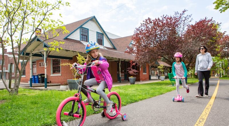
Safe by Design: Examining the Impact of Trails and Bike-Ped Infrastructure on Safety in America

Exploring the Nation’s Trailside Geoheritage Sites