Minnesota and North Dakota’s Greenway of Greater Grand Forks
Trail of the Month: Oct. 2022
“To say the Greenway is one of the community’s greatest amenities is an understatement. We’re very lucky to have such an amazing amenity within blocks of our houses.”
—Alexander “Blue” Weber, Director of the area’s Downtown Development Association
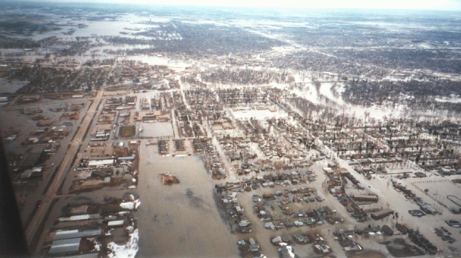
Entire neighborhoods were submerged, businesses went up in flames, and thousands were evacuated from their homes when the Red River of the North, swollen with snowmelt from a particularly severe winter, raged through the sister cities of Grand Forks, North Dakota, and East Grand Forks, Minnesota, a quarter-century ago.
The flood of April 1997 turned out to be a pivotal moment for the two cities located on opposite sides of the Red River, about 80 miles south of the U.S.-Canada border, as seasonal spring flooding had plagued the area for decades. Later that year, planning for a massive flood-protection system got underway.
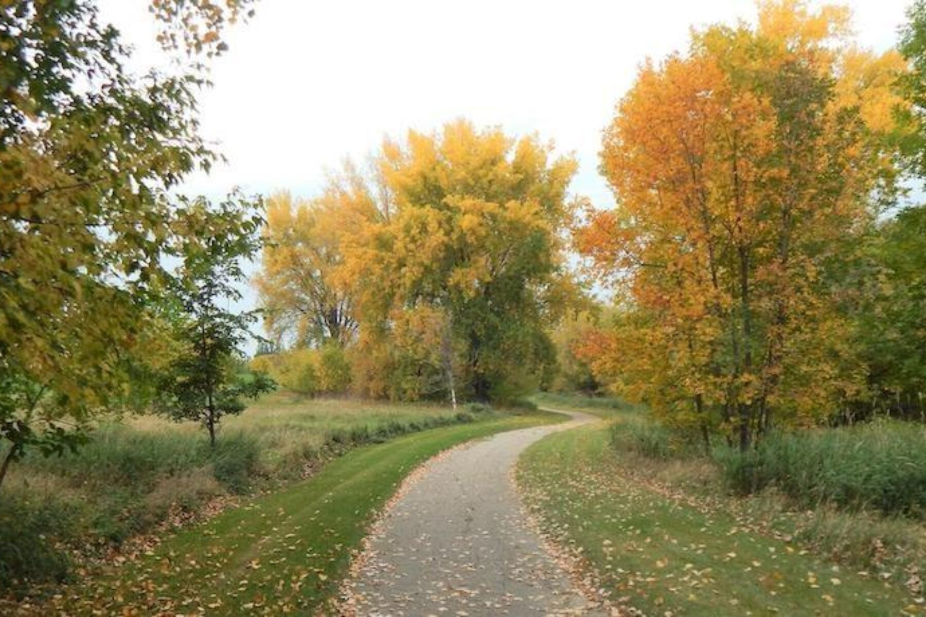
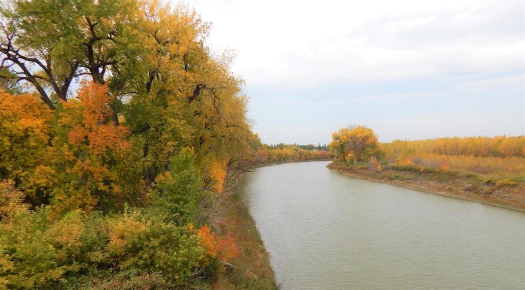
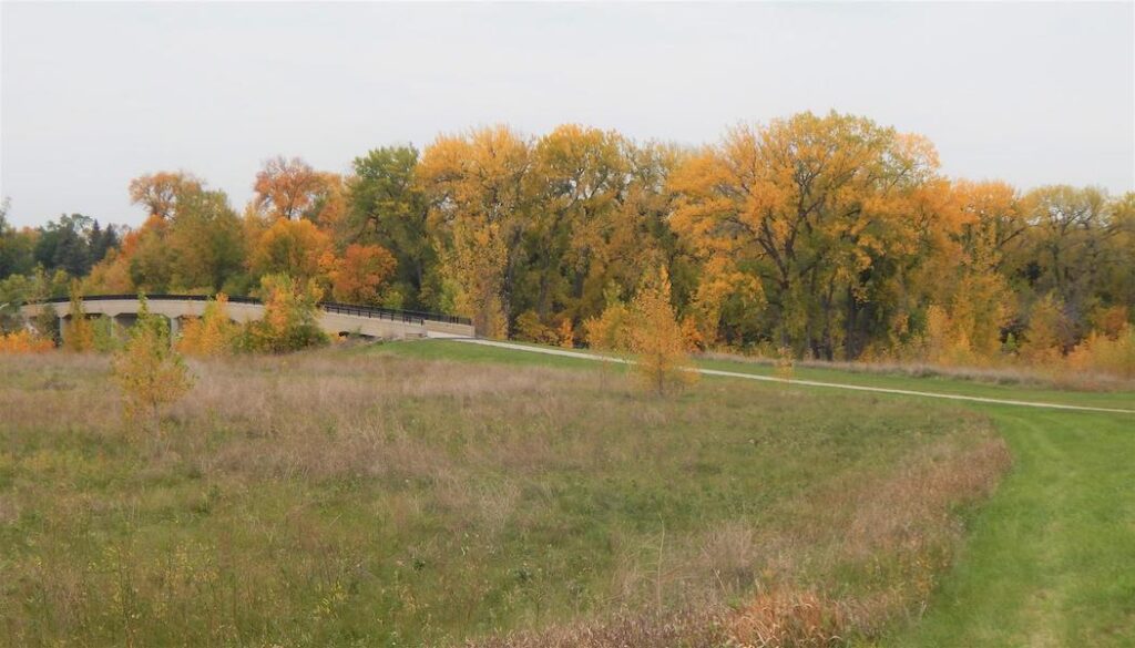
Along with its main objective of preventing another catastrophic flood, the flood-mitigation project served another vital purpose: Its 2,200 acres are now home to the popular trail known as the Greenway of Greater Grand Forks.
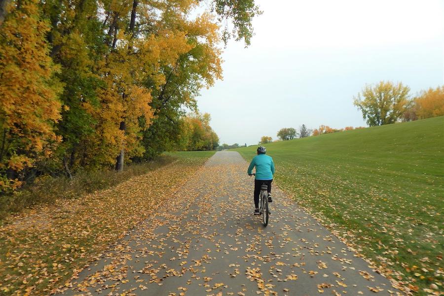
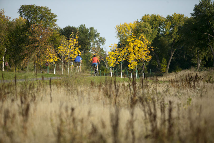
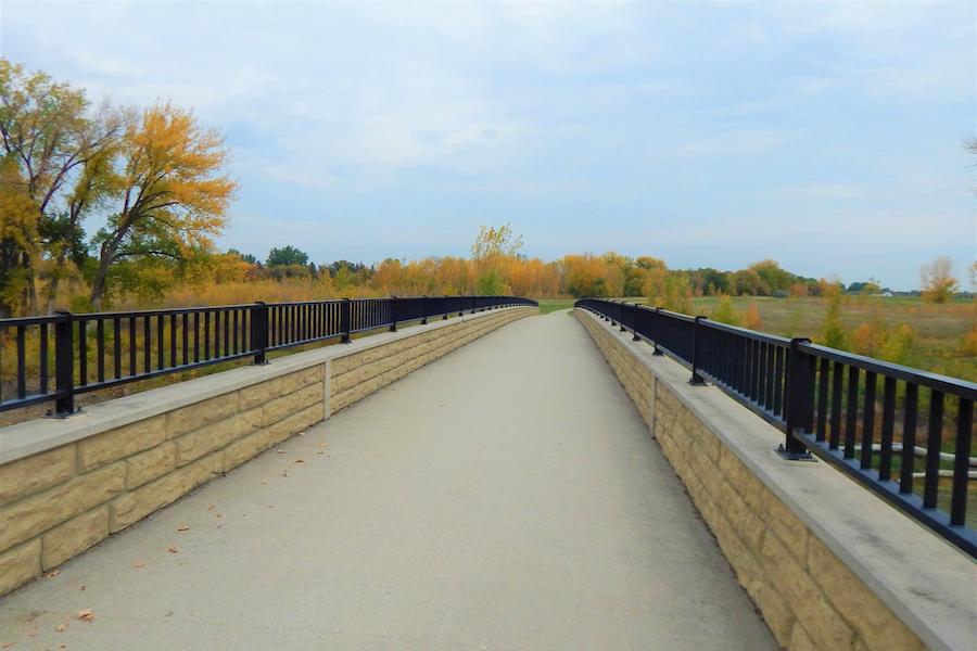
Today, the Greenway is a recreational center for the two communities. Running along the Red River and the Red Lake River, the 21-mile paved trail attracts hundreds of walkers and bikers on warm summer days, as well as hardy cross-country skiers and snowshoers in the winter. Parks, golf courses, disc golf courses, a dog park, fishing piers, playgrounds, hockey rinks and volleyball courts are all located along the Greenway.
“To say the Greenway is one of the community’s greatest amenities is an understatement,” said Alexander “Blue” Weber, director of the area’s Downtown Development Association, and a regular user of the trail. “We’re very lucky to have such an amazing amenity within blocks of our houses. You feel like you’re out in the middle of nowhere.”
Turning Tragedy into Triumph
Julie Rygg, executive director of Visit Greater Grand Forks, said the Greenway is a major draw for people visiting the community. “We certainly hear often from people who visit about what a gift it is.”
Rygg, who remembers the impacts of the 1997 flood, sees the Greenway as an upside of that devastating event. “The community took something tragic and turned it into a positive,” she said.
Mark McDonald, a Greenway of Greater Forks advocate who has lived in the Grand Forks area since 1992, noted that despite the destruction brought on by the flood, the Greenway has been a win for the community. “There was heartache, because we lost that part of town,” he said. “We are a tight-knit town, and we lost an area and part of our history. We lost it, but on the positive side, we gained the Greenway.”
Two and a half decades after the big flood, the flood-protection system has met its objective, said Kim Greendahl, the Greenway specialist for the City of Grand Forks. Although there was some flood damage in the years while the project was being built, she said it was nothing on the scale of the 1997 flood. “It’s held every time.”
The Greenway system is on the flood-protection system’s “wet side” next to the river, explained Reid Huttunen, superintendent of the East Grand Forks Parks and Recreation Department, with the natural Greenway area serving as a buffer that is bordered by a system of large levees and temporary flood walls to protect the neighborhoods located on the dry side. Because the trail and a number of other recreational facilities are located within the wet side of the system, they are impacted when the river rises in the spring. But the recreational features were built with potential flooding in mind.
“After floods, we do have to go in and clean with pressure washers and scrape off the mud,” Greendahl said. “Otherwise, the facilities are built to withstand the floods. Overall, it’s water up, water down, and then clean.”
A Difficult Recovery
Although the Greenway is a valued community feature these days, that was not always the case. “It wasn’t a popular project in the beginning,” Greendahl said, noting that about 700 homes were lost in the flood, and many people did not like the idea of entire neighborhoods being replaced by recreational uses.
After the 1997 flood, the Federal Emergency Management Agency (FEMA) came in and bought out the damaged areas to make way for the system of open areas and large earthen levees. Prominent neighborhoods like Sherlock Park in East Grand Forks and Lincoln Drive Park in Grand Forks were largely obliterated. The most severely damaged homes were demolished, and some structures with less damage were moved to other locations.
The flood-protection project was put on a fast-track for completion, Greendahl said. “The design started in mid-to-late 1997 and was done in four or five phases.”
For property owners in the damaged areas, there was little choice in the matter. “They said, ‘Everything goes,’” Greendahl said of the flood-protection planners. “It was very hard for people.” In Grand Forks’ Lincoln Drive Park area alone, 350 homes were lost, along with an elementary school and an assisted living facility.
Overall, the project cost about $400 million, with the federal government paying 50%, the states taking on 30% and the local governments paying the remainder.
River Revival

After the initial resistance to the Greenway, many in the community came around when the project began to take shape. “When we opened phase 1, they saw the possibilities of a complete system,” Greendahl said.
Over the past two decades, the Greenway has attracted more and more uses, and Greendahl said she often gets requests for new features, such as more river access points. In fact, one of the benefits of the Greenway has been a community shift in attitude about the river.
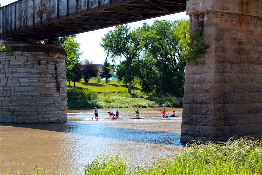
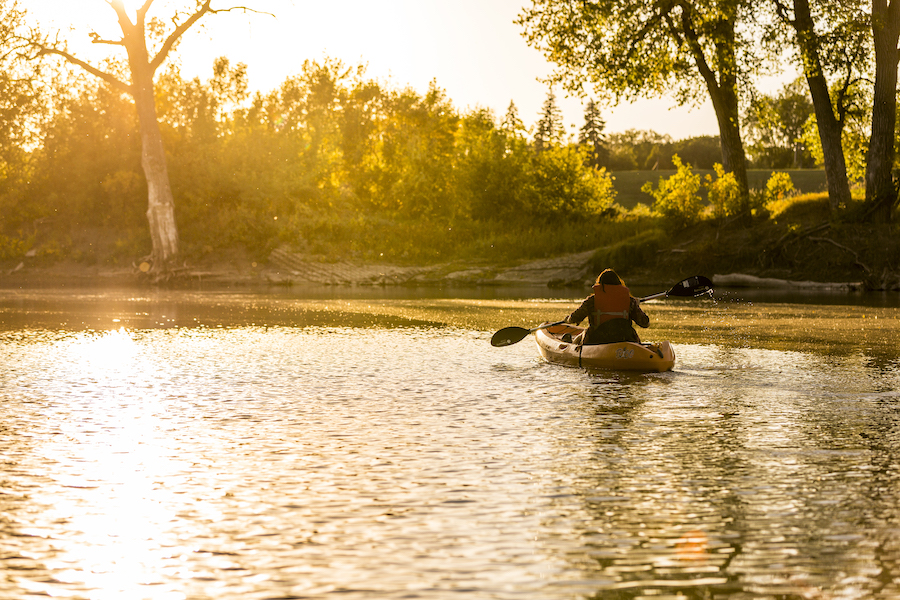
When she was growing up in Grand Forks near the Red River, Greendahl said she and other children were often warned by their parents not to go near the river, and there was little recreation on the water. But with better access and improved facilities, the river has become a recreational amenity in its own right, with watersports like fishing, canoeing, kayaking and paddle boarding becoming increasingly popular. “After fighting the river for years, they’ve decided they love it,” she said.
Weber says the Greenway is a refuge for him and other outdoors enthusiasts. “I moved here from Utah where it is very active,” he said. Without the mountains he was used to, “the Greenway became my favorite place to go—the Red River almost functions as a lake.”
As a bike commuter, Weber uses the Greenway virtually every day of the year. And as the director of the Downtown Development Association, he also heads up the Grand Forks Bike Share Program that offers free use of 60 bikes to the community. Records show that the bike-share use is split about 50-50 between Greenway users and users on the University of North Dakota campus in Grand Forks.
A Treasured Trail
Anecdotally, usage on the trail in both Grand Forks and East Grand Forks is high. “We haven’t done a trail count, but honestly, it’s part of an almost daily routine for almost everyone who lives here,” Huttunen said.
He pointed to the trailside Red River State Recreation Area as an example. The area, which is managed jointly by the state of Minnesota and the local government, features a 113-site campground that is often full during the summer, and especially during holiday weekends.
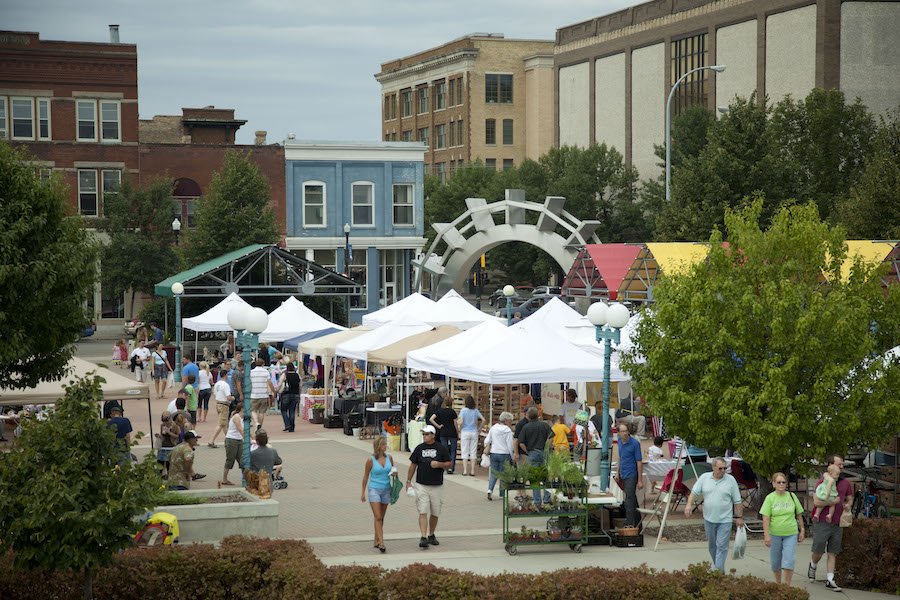
Along with active recreation, the Greenway is also a convenient way for residents to get to restaurants and shopping. Rygg said one of her favorite outings on the Greenway is to ride her bike from her home in south Grand Forks to the farmers market that takes place in the downtown area. Others regularly bike to dining spots that make up East Grand Forks’ popular “restaurant row,” where they dine on patios and seating areas that overlook the Red River.
For Huttunen and other regular users, the easy access provided to a natural area within the city is one of the Greenway’s greatest attributes. “Instead of a metropolitan area, you’re out in the wilderness—in some cases, within two or three blocks of your house.”
“I think it’s the best thing we’ve done in 25 years,” enthused Greendahl. It’s raised the bar in what people expect in outdoor spaces.”
Related: Book Review: Exploring Chuck Flink’s “The Greenway Imperative”
Related: Top 10 Trails in North Dakota


Donate
Everyone deserves access to safe ways to walk, bike, and be active outdoors.


