Arizona’s Santa Cruz River Park Trail
Trail of the Month: April 2021
“The idea that these paths came from flooding—it was a remarkable bit of city planning. The people with the county had a vision.”
—Dan Gibson, Senior Director of Communications, Visit Tucson
Trails in Tucson are having a moment in the national spotlight right now, and in the midst of it all is a 41.8-mile ribbon of blacktop that cuts a path through the colorful heart of the southern Arizona city.
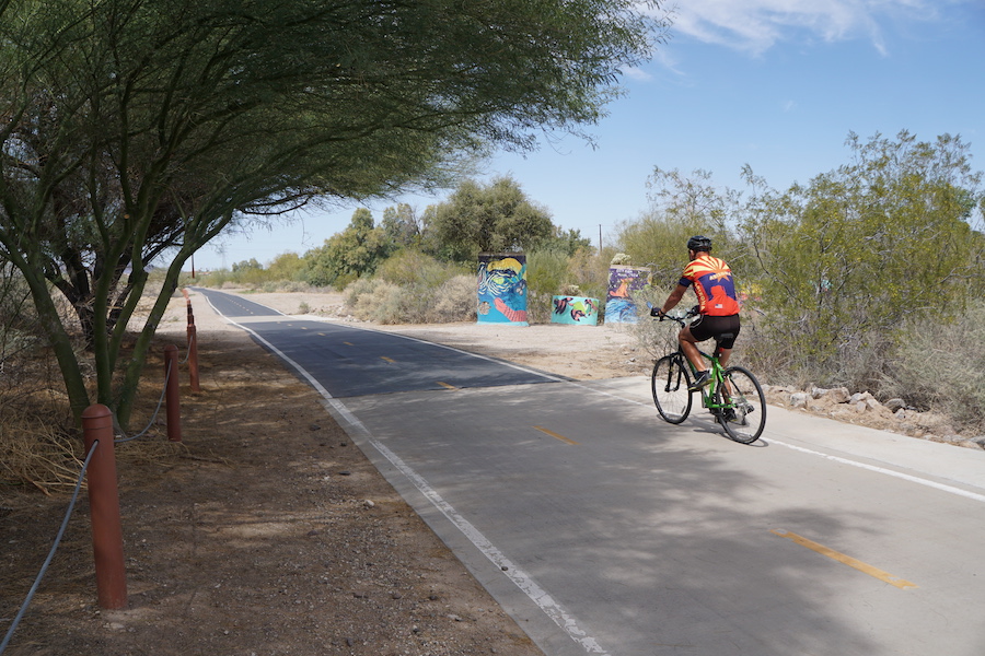
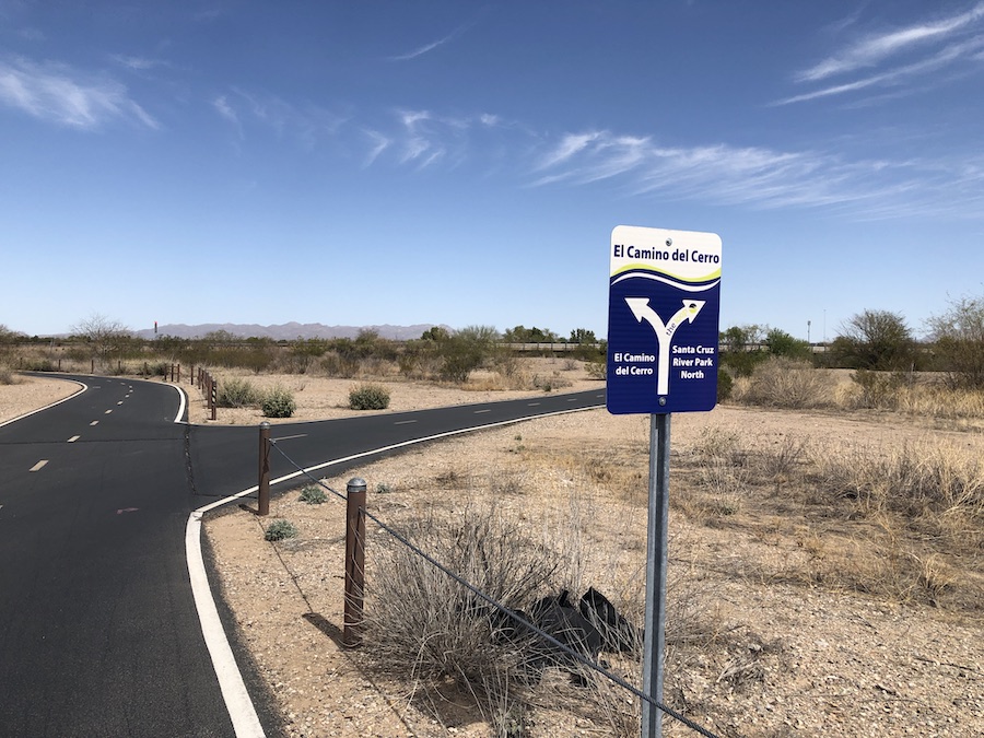
Starting in the centuries-old birthplace of Tucson in the south, the Santa Cruz River Park Trail follows the sandy and mostly dry riverbed, passing nearby murals and taquerias in neighborhoods like Midvale Park and Santa Cruz Southwest, lively shops and hotels of the downtown area, and busy parks and ballfields of the El Camino Del Cerro area in the northwest.
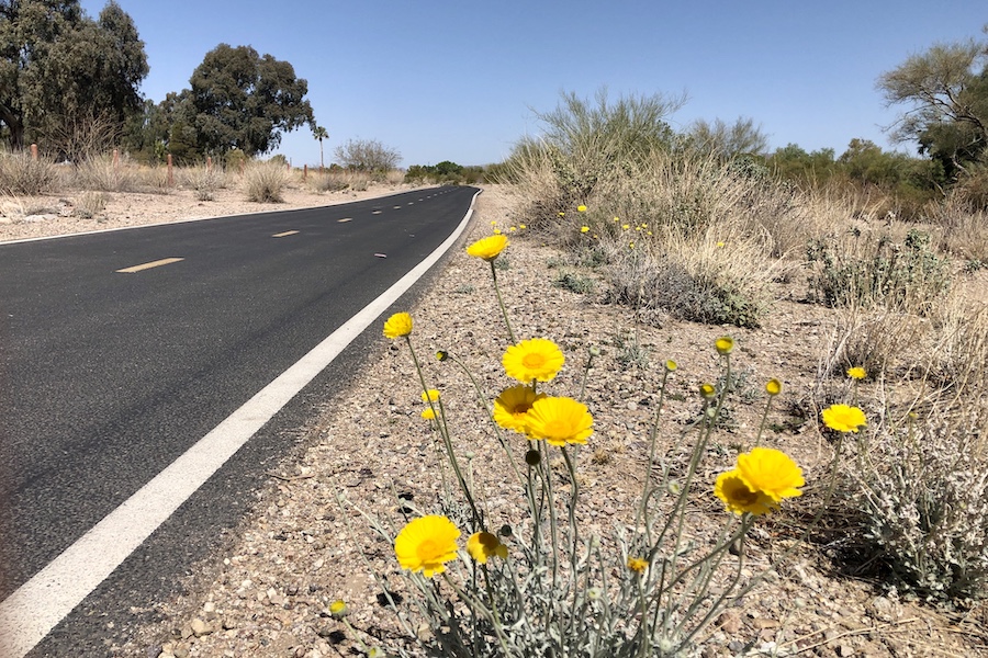
Along the way, the Santa Cruz River Park Trail captures the unique desert vibe of Arizona’s second-largest city.
On any given day, a walk or ride along the trail could feature sightings of cheery yellow wildflowers, speedy roadrunners scampering from one side of the trail to the other and spiny mesquite trees offering a bit of spotty shade—all with jagged mountain ranges as a distant backdrop.
“There’s so much variety,” Dan Gibson, senior director of communications of Visit Tucson, said of the Santa Cruz River Park Trail. “You have the urban environments of downtown and the traditional birthplace of what we call Tucson. Mission San Xavier is accessible, and there’s birdwatching up by the Sweetwater Wetlands. You just get to see so much of Tucson.”
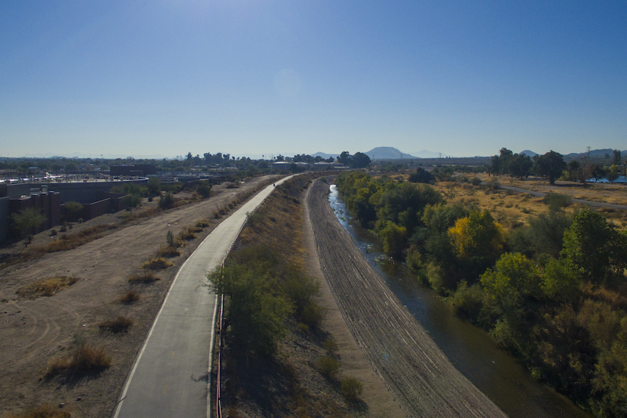
The River Park Trail runs through Tucson south-to-north from the neighborhoods west of Interstate 19 in the Valencia Road area in the south to the Interstate 10 community of Marana, located northwest of Tucson.
The riverside trail is just one section of the 136-mile Chuck Huckelberry Loop that circles Tucson and was recently voted the Best Recreational Trail in the nation in USA Today’s Readers’ Choice 2021 poll.
A Biking Destination
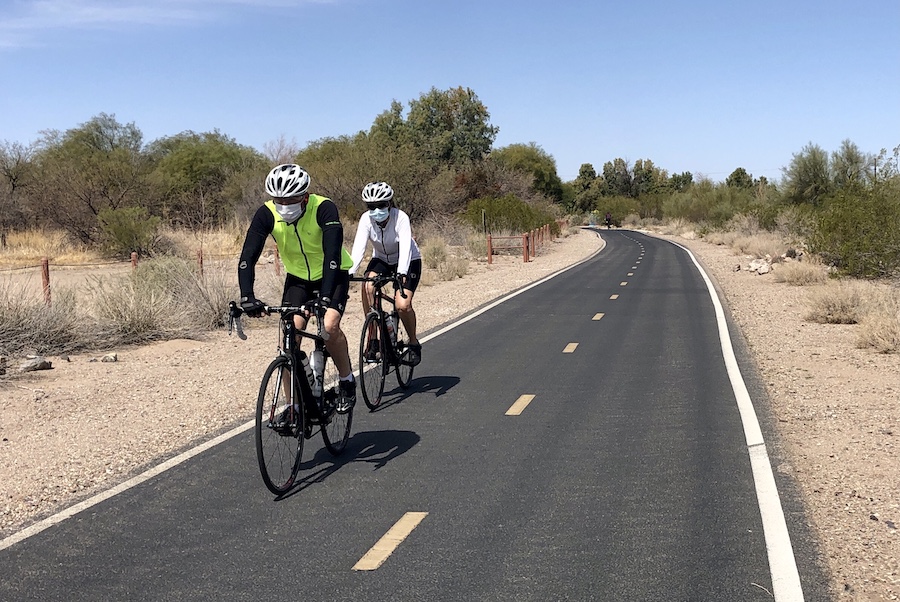
Locals are understandably proud of their trail system. Tucson is sometimes billed as the “Biking Capital of the World,” and the trails are used extensively by residents and visitors alike.
“Numerous people have said they moved to Pima County because of the Loop Trail,” said Robert Padilla, deputy director of the Pima County Natural Resources, Parks and Recreation Department.
The Loop is also viewed as a major asset by the community’s tourism department. “Tucson is a destination where people want to be outside,” Gibson said. “They want to walk, to hike, to bike. It’s a huge asset. People want to get around without driving, and you can basically connect with all the places in the city on the trails.”
Diego Martinez Barrera of Beyond Tucson, an organization dedicated to improving the health and well-being of the community, sees the Loop as a critical link for locals as well.
“It is definitely important, given the fact that here in Tucson, we do have a lack of public transportation,” he said. “The Loop in itself is very, very helpful for our community. People walk and bike to get from place to place.”
In the Midst of a Colorful History
The Santa Cruz River Park Trail starts in the river valley that is widely recognized as Tucson’s birthplace. Before Europeans arrived in the area in the late 1600s, Native American peoples were already living along the Santa Cruz and Rillito rivers near the base of Sentinel Peak, commonly referred to as “A” Mountain.
“When the Spanish Jesuit missionary Father Eusebio Kino first visited this area in the early 1690s, he was met here by the Tohono O’odham, or ‘Desert People,’ who were peacefully living, foraging and farming,” says the Visit Tucson website.
A relic of the missionary era remains just a few miles south of the Santa Cruz River Park Trail’s southern terminus. The beautifully preserved white walls of the San Xavier del Bac Mission, a Spanish Colonial church located in the Tohono O’odham Nation, can be seen for miles around.
Heading north, the trail passes through the center of Tucson’s Latino heritage near Valencia Road. Gibson noted that the South 12th Avenue area, the home of some of Tucson’s best Mexican restaurants, is located not far from the trail (south of Irvington Road and east of Interstate 19).
Rooted in Flood Control
The story of the trail itself is also compelling. Andy Dinauer, deputy director of Pima County Flood Control, said the idea for the system sprang from devastating flooding in the 1980s.
“A lot of the system came along after the 1983 floods,” he said, referring to largescale flooding that occurred in Arizona during the tropical storm Octave that year. After the region’s rivers flooded several of the nearby towns, Dinauer said the county began “soil cementing” channels to protect against flooding.
Ultimately, trails were built on the structures, often on both sides of the river.
“It’s Flood Control dollars that buy the land and construct the trail,” Dinauer said. “The Loop provides us maintenance access where we can fight floods and do maintenance. It’s a huge advantage to have [the trail] on both sides.”
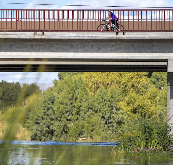
The natural flow of the Santa Cruz River began diminishing during extensive mining operations in the 1940s and 1950s, and today, the river is dry for much of the year. In an effort to get water flowing in parts of the riverbed, the Tucson Water Department currently releases reclaimed (treated) wastewater into it. The city’s water department notes that the released water is permitted by the state as Class A reclaimed water, which means it is rated as safe for recreational uses such as wading, but not for drinking or swimming.
Along sections of the trail, the reclaimed water helps keep the river banks lush, and a blue sliver of water can be seen from the overpasses above. The greenways have been “a huge amenity,” Dinauer said. “And [they bring] in a lot of tourism.”
A Truly Multiuse Trail
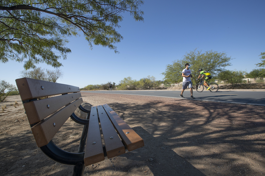
Along with the focus on recreation, the Loop is popular as a commuter bicycle route.
Counters have been installed at a number of points on the Loop, showing high usage numbers. For February 2021, all counters totaled 84,223, with a daily average of 3,008.
Padilla noted that in some cases, the high numbers and multiple uses have led to trail conflicts between recreational users and those using the trail for transportation.
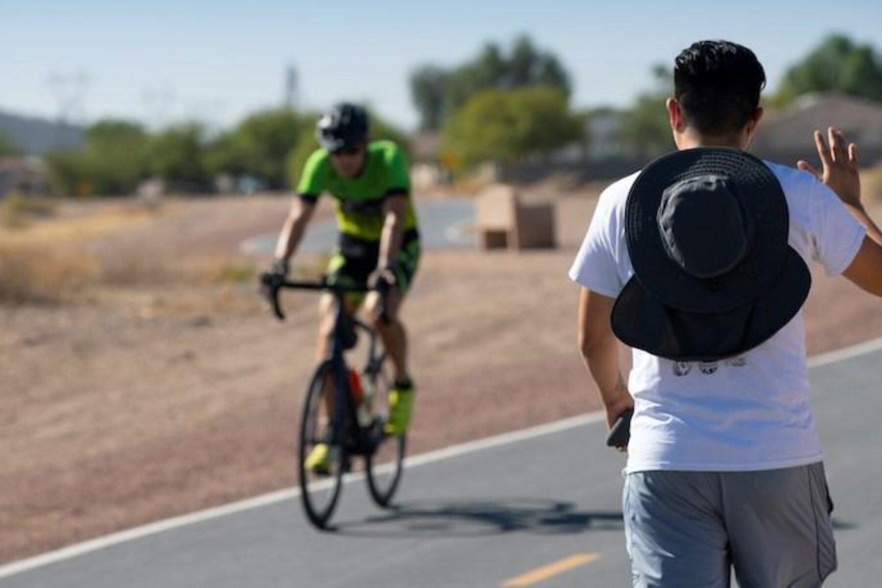
Still, on a recent sunny Sunday morning in March, a variety of users—walkers, cyclists, runners, parents pushing strollers and people walking dogs—appeared to be coexisting peacefully on the trail, which is divided by a centerline.
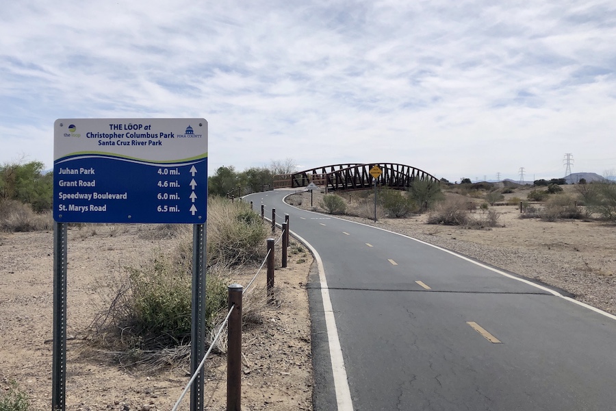
Retiree Joe Padias, who was out for a bike ride with his family, said he rides the Loop at least once a week, and usually more often. “We’ve been averaging 20 miles,” he said during a break at a scenic trailhead at the Christopher Columbus Park. “It’s been great.”
A Benefit to Health
The Loop trail system also plays an important role in promoting exercise and healthy living. The Pima County Health Department sponsors the Racial and Ethnic Approaches to Community Health Program (REACH), which aims to reduce chronic diseases such as hypertension, heart disease, Type 2 diabetes and obesity. The program is particularly focused on at-risk populations, including the Native American and Hispanic communities, says the REACH website. To reach out to those communities, program proponents formed a community-based coalition that includes parents, business owners and community leaders from the south and southwest areas of Tucson.
One of the REACH program’s main efforts has been to improve access to the Loop trails—an initiative that Martinez Barrera, a Tucson native, said has been effective. “The whole idea of REACH was to get more minority groups onto the Loop,” he said. “I feel like it was a very large success, honestly.”
As a part of its efforts, the program launched a successful social media campaign called #ReachTheLoop, which was intended to raise awareness about its existence.
“Truth be told,” Barrera said, “there is still a lot of work to be done. But they have recognized areas that needed improvements. Through the REACH grant, they were able to make various improvements.”
With the help of grant funding, Pima County Natural Resources, Parks and Recreation installed benches, bike racks and new paved paths connecting neighborhoods directly to the Loop. Through those efforts, they’ve encouraged residents and visitors to stay in touch.
Barrera noted, “People know that if they see anything that needs improvements or needs to be safer, they could reach out to Pima County.”
Gibson sees the multi-purposing of the flood control improvements for recreational and health uses as an example of visionary thinking. “The idea that these paths came from flooding—it was a remarkable bit of city planning,” he said. “The people with the county had a vision.”
Padilla with the County Parks and Recreation Department says that although about 70% of the Loop is within the City of Tucson, the county committed to maintaining it. “From our perspective, it’s a recreational corridor, and people absolutely love it,” he said.

Donate
Everyone deserves access to safe ways to walk, bike, and be active outdoors.