The Secretary of Transportation’s New Proposal Sends the Country Back to the 1950s
Article Summary:
- The secretary of the U.S. Department of Transportation, Sean Duffy, released a proposal on July 22, 2026, outlining priorities for the next surface transportation bill.
- The current surface transportation law is set to expire on Sept. 30, and Congress is continuing its work to define the investments, policies and programs that will be prioritized and determine America’s transportation future.
- RTC’s analysis of the proposal finds it to be an unmitigated attack on walking and biking that will hurt the country, putting Americans’ lives at risk and cause long-term damage to towns and cities.
- This proposal from Secretary Duffy does not represent the interests of the American people to make it safer and easier to walk and bike. It erases multimodal investment that has fueled decades of progress towards walkable and bikeable communities.
For months, Congress has been working to write the country’s next surface transportation law, defining priorities for how Americans move around their communities for the next five years and beyond. While the current law expires on Sept. 30, all indicators point to an extension to give lawmakers more time to hammer out the details.
To date, these discussions have largely happened without input from the administration, but that all changed last week when Transportation Secretary Sean Duffy released a proposal that would catapult the country back to the 1950s—an era defined by a monolithic focus on building interstate highways at all costs.
Duffy’s proposal is best interpreted as an unmitigated attack on walking and biking that will hurt the country, putting Americans’ lives at risk and causing long-term damage to American towns and cities. At a time when 20 people die while walking every single day, the secretary wants Congress to eviscerate investment in traffic-separated walking and biking routes—proven strategies to make it safer for everyone to navigate their communities while delivering new economic opportunities and quality of life.
With this proposal, Secretary Duffy and the administration seek to dramatically increase funding for highway and roadway expansion, while cutting funding for active transportation, public transit and passenger rail. The proposal eliminates support for existing and proven approaches that keep people safe whether or not they’re driving, while prioritizing investment in automated vehicles (AVs), an unproven technology that holds both promise and peril for future bicycle and pedestrian safety. It consolidates or eliminates multiple other grant programs that have been proven to accelerate progress for communities in every single state trying to make it safer and easier for people to walk and bike.
RTC’s Policy Agenda
RTC has outlined a bold agenda for the country’s next transportation law that builds on progress and begins to deliver the active transportation infrastructure that Americans deserve. Read the agenda and urge your member of Congress to support it.
The Implications of the Administration’s Proposal
Should Congress take this proposal seriously the implications would be far-reaching and deeply damaging to American towns and cities. Duffy’s proposal is a radical departure from Congress’s responsiveness to the American people’s desire for a multimodal transportation system, dating back to the passage of ISTEA in the early 1990s. While people and leaders across the country are calling on Congress to do more for transit and active transportation, this proposal asks Congress to adopt the view that driving is the only legitimate way to get around.
The following summarizes specific provisions in the secretary’s proposal that impact the ability of states and local governments to develop the multimodal transportation system that their constituents want.
Ending most federal funding for biking … which affects walking investments, too.
The proposal calls on Congress to “restrict competitive and formula grant funding for bicycle lanes and other bicycle infrastructure that reduce travel throughput for motor vehicles and support removal of existing bike lanes that contribute to congestion”—a claim that has been disproven time and again. Transportation Alternatives (TA), the nation’s oldest and largest source of dedicated funding for trails, walking and biking, and its companion the Recreational Trails Program (RTP), are structured as set-asides within formula programs and would likely be eliminated under this proposal. The implications of this cut cannot be understated. Essential infrastructure projects in every state would be in jeopardy. Further, many state and local communities rely on formula and discretionary funding to supplement TA and RTP and catalyze or complete projects, and this proposal would leave local communities at a dead end.
Eliminating the Active Transportation Infrastructure Investment Program (ATIIP) … making it harder for places to create traffic-separated walking and biking routes.
This new program was authorized in the most recent surface transportation law, creating the first and only program dedicated to the larger grants necessary to build complete and connected active-transportation networks. Unlike roadways and railways, the nature of federal funding programs for trails, walking and biking has created a patchwork of active transportation infrastructure that is disconnected. ATIIP complements TA and RTP by providing the funding necessary to strategically address gaps in developing active transportation networks. By eliminating ATIIP, the administration would end the only dedicated source of funding for complete and connected active-transportation networks, undermining communities’ safety, economic development and quality of life goals.
Erasing the Reconnecting Communities Pilot Program (RCP) … further diverting funding away from trails and other walking and biking projects that create transportation connections across communities.
RCP was designed to reconnect places that had been divided previously when transportation infrastructure, like highways, major roadways and railroads had been built. Active transportation infrastructure is proven to improve neighborhood connectivity in impactful and cost-effective ways and has received significant investment through this program. Eliminating RCP would make it more difficult for places to reconnect neighborhoods, and reduce further investment in trails and other walking and biking infrastructure.
Removing dedicated funding for Complete Streets … which will make it harder for places to do the necessary planning for bicycle and pedestrian projects.
The administration proposes to eliminate a policy created in the current transportation law that requires a 2.5% planning set-aside for Complete Streets activities because it supports “planning and prioritizing active transportation facilities including sidewalks and bikeways.” The administration describes it as counter to administration priorities. This funding is already making a difference in communities across the country, helping places plan and design projects so they are eligible for funding, creating a pipeline of qualified projects. Ending this policy will make it harder for places to plan, and as a result, fewer bike and pedestrian projects will get built.
Eliminating the Carbon Reduction Program … getting rid of an entire program that supports low-carbon-emission transportation projects.
The administration proposes to end this program that was created in the current law, providing states with guaranteed annual funding for low carbon projects, including trails biking and walking. Eliminating this program will make fewer resources available for this essential infrastructure.
Redirecting Safe Streets and Roads For All (SS4A) funding to the states … undermining local safety strategies at the heart of the program.
This program was created by the current law to provide $1 billion directly to local communities for roadway safety planning and projects each year. This program has delivered meaningful investment in traffic-separated active-transportation infrastructure, including trails, which are identified by local communities as priority safety investments, while also funding local safety plans to create a project pipeline. The program directly addressed a real need as these local safety projects are often not prioritized by state departments of transportation, creating a funding gap that puts American lives at risk. The administration proposes to transition the program into a formula program administered by state departments of transportation, undermining the ability of local communities to improve safety while providing states with additional resources despite their overall record of disinvestment in this essential infrastructure.
This proposal is the latest in a series of attacks against walking and biking from the U.S. Department of Transportation (USDOT), despite the demand from local leaders, states and voters for more investment in this infrastructure. The attacks began in January 2025 when the USDOT paused thousands of grants previously awarded to states and municipalities for review to ensure alignment with administration priorities. Ultimately, many of the projects that were canceled were trail, walking and biking projects, and others were modified to remove trails and bike infrastructure, dramatically delaying progress in meeting state and regional demand for safe walking and biking routes.
Should Congress act on the recommendations that the administration has outlined, American towns and cities will become increasingly hostile to people trying to navigate their communities without a car. The proposal prioritizes high-speed automobile travel over all other transportation investments, despite the soaring demand for safe, convenient walking and biking routes in every single state.
This proposal comes at a time when America is experiencing the intersecting transportation crises of roadway safety, affordability, congestion and pollution. Trails and other active transportation infrastructure serve to address these issues by providing safe, affordable, zero-emission travel that is accessible to all, while simultaneously reducing roadway congestion. The administration’s proposal calls on Congress to eliminate virtually all federal funding and policy, naming biking as the offensive mode of transportation. In reality, these cuts will make it harder for everyone to move around their communities—whether you’re walking to and from a parking garage to your destination, bicycling to work or helping your children safely walk to school—and especially the nearly 1/3 of Americans who do not drive.
It’s on all of us to ensure that Congress opposes Secretary Duffy’s proposal.
Tell Congress Trails Are Essential
As your members of congress work to define the priorities in the next surface transportation bill, make sure they understand why trails and connected walking and biking infrastructure matters to you. The decisions made today will shape our transportation future for years to come, and it’s vital that trails are part of the agenda.

Donate
Everyone deserves access to safe ways to walk, bike, and be active outdoors.
Related
View All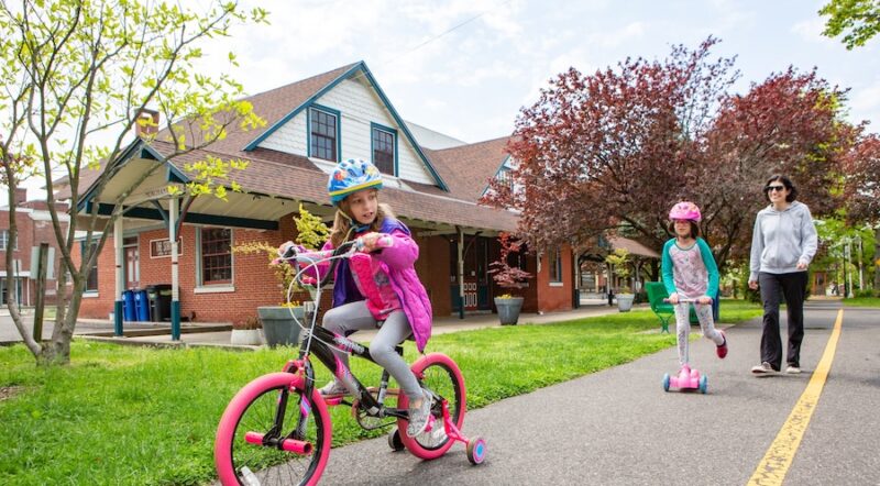
Safe by Design: Examining the Impact of Trails and Bike-Ped Infrastructure on Safety in America
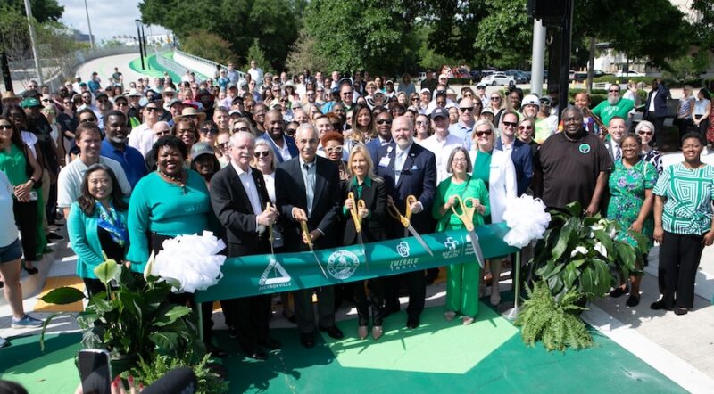
Florida’s Emerald Trail: June 2026 Trail of the Month
